Name/Title
BookEntry/Object ID
0000.5.305Scope and Content
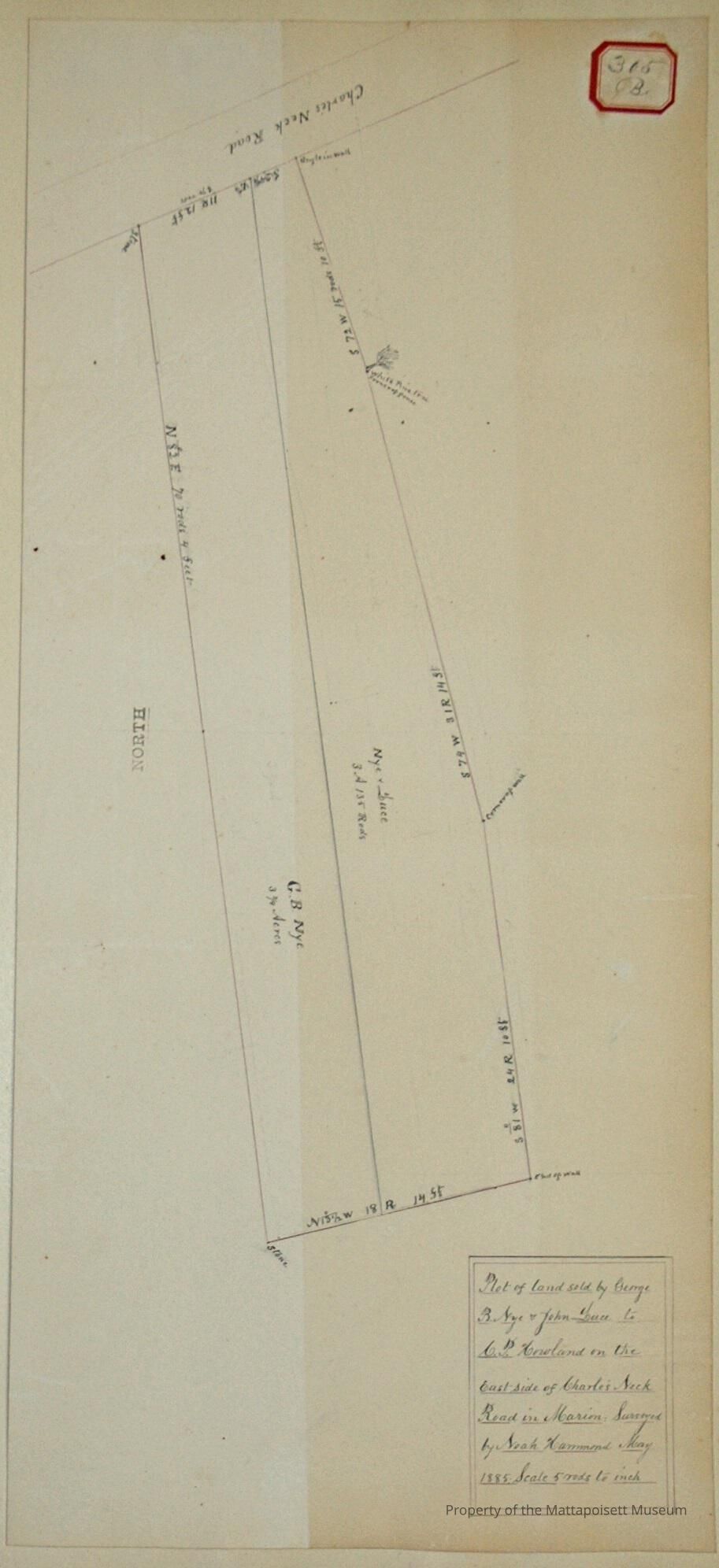
Plot of land sold by George B. Nye and John Luce to C. P. Howland on the east side of Charle’s Neck Road in Marion. Surveyed by Noah Hammond May 1885. Scale 5 rods to the inch. Nye and Luce plot at 3 acres and 135 rods. C. B. Nye plot at 3 ¼ acres.Acquisition
Accession
0000.5Acquisition Method
GiftLexicon
Nomenclature 4.0
Nomenclature Primary Object Term
BookNomenclature Sub-Class
Other DocumentsNomenclature Class
Documentary ObjectsNomenclature Category
Category 08: Communication ObjectsLOC Thesaurus for Graphic Materials
LandSearch Terms
Real Estate, Noah Hammond surveyor, Charles Neck, Marion, MAArchive Details
Date(s) of Creation
1885Archive Notes
Publication Notes: 1885Other Names and Numbers
Other Numbers
Number Type
Other NumberOther Number
305bRelationships
Related Person or Organization
Person or Organization
LucePerson or Organization
NyePerson or Organization
HowlandGeneral Notes
Note
Notes: Notecard:
1. Nye, George P. (305B)
Land on east side of Charles Neck - Marion
1885
2. Nye, George P. and John Luce (305B)
Land on east side of Charles Neck Road - Marion
Sold to C. P. Howland
1885
Status: OKCreated By
admin@catalogit.appCreate Date
December 17, 2014Updated By
admin@catalogit.appUpdate Date
August 28, 2021