Name/Title
BookEntry/Object ID
0000.5.322Scope and Content
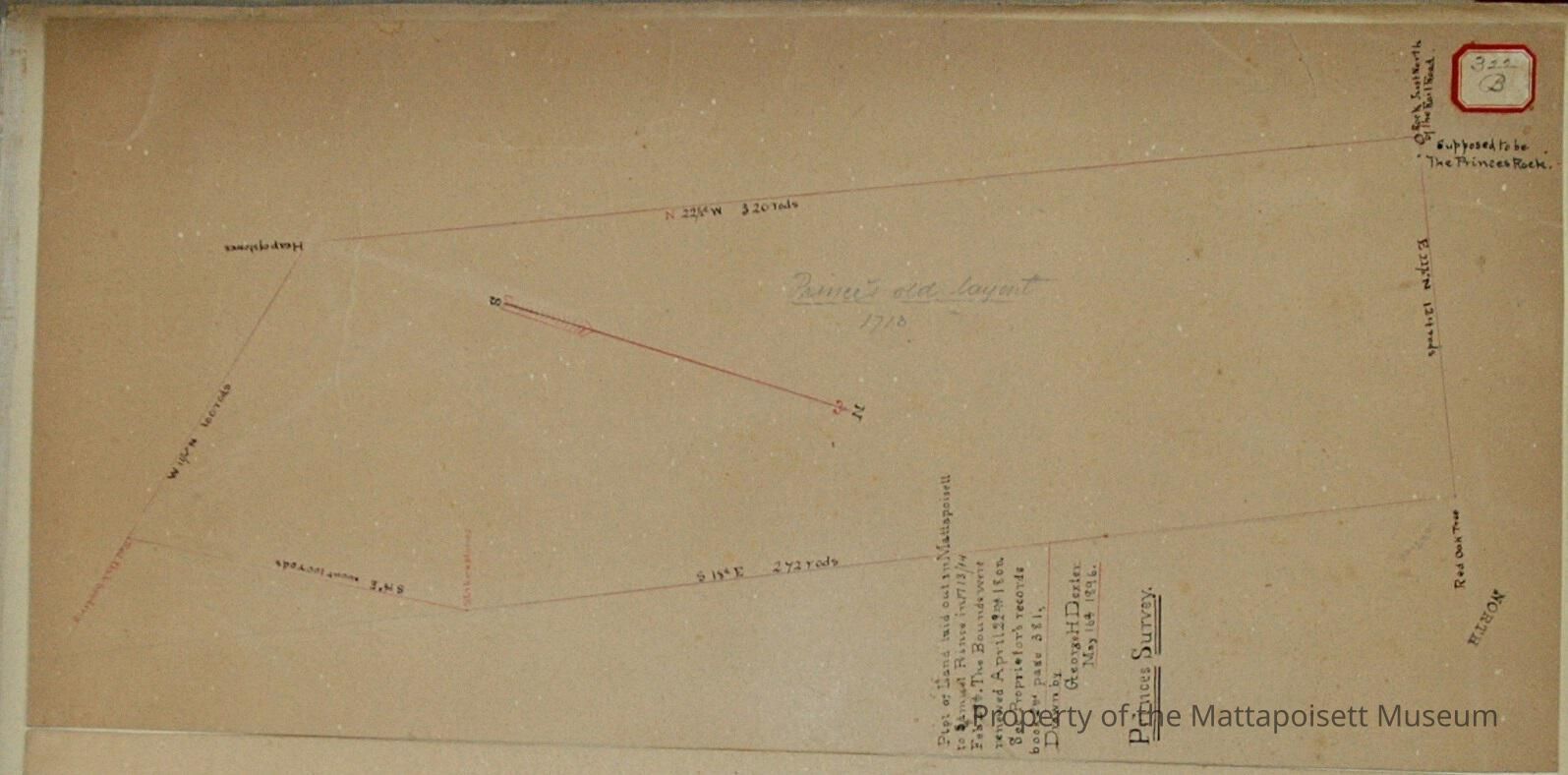
Plot of land laid out in Mattapoisett to Samuel Prince in 1713/1714 February 28th. The bounds were renewed April 22nd 1800. See Proprietor’s records book 2nd page 381. Drawn by George H. Dexter, May 16th 1896.Acquisition
Accession
0000.5Acquisition Method
GiftLexicon
Nomenclature 4.0
Nomenclature Primary Object Term
BookNomenclature Sub-Class
Other DocumentsNomenclature Class
Documentary ObjectsNomenclature Category
Category 08: Communication ObjectsLOC Thesaurus for Graphic Materials
LandSearch Terms
George H. Dexter surveyor, Mattapoisett, MAOther Names and Numbers
Other Numbers
Number Type
Other NumberOther Number
322bRelationships
Related Person or Organization
Person or Organization
PrinceGeneral Notes
Note
Notes: Notecard:
1. Prince, Samuel (322B)
Land laid out to Prince in 1713 & 1714
West line of survey "Prince's Line"
Northwest corner bound by "Prince's Rock"
For location see Prince's Rock
2. Prince's Line (322B)
Old boundry line dating back to 1713
Terminating at north end in Prince's Rock
For location see Prince's Rock
3. Prince's Rock (322B)
Old boundry.
North end of Prince's Line
Town Plot 400N by 50W
Status: OKCreated By
admin@catalogit.appCreate Date
December 17, 2014Updated By
admin@catalogit.appUpdate Date
August 28, 2021