Name/Title
BookEntry/Object ID
0000.5.329Scope and Content
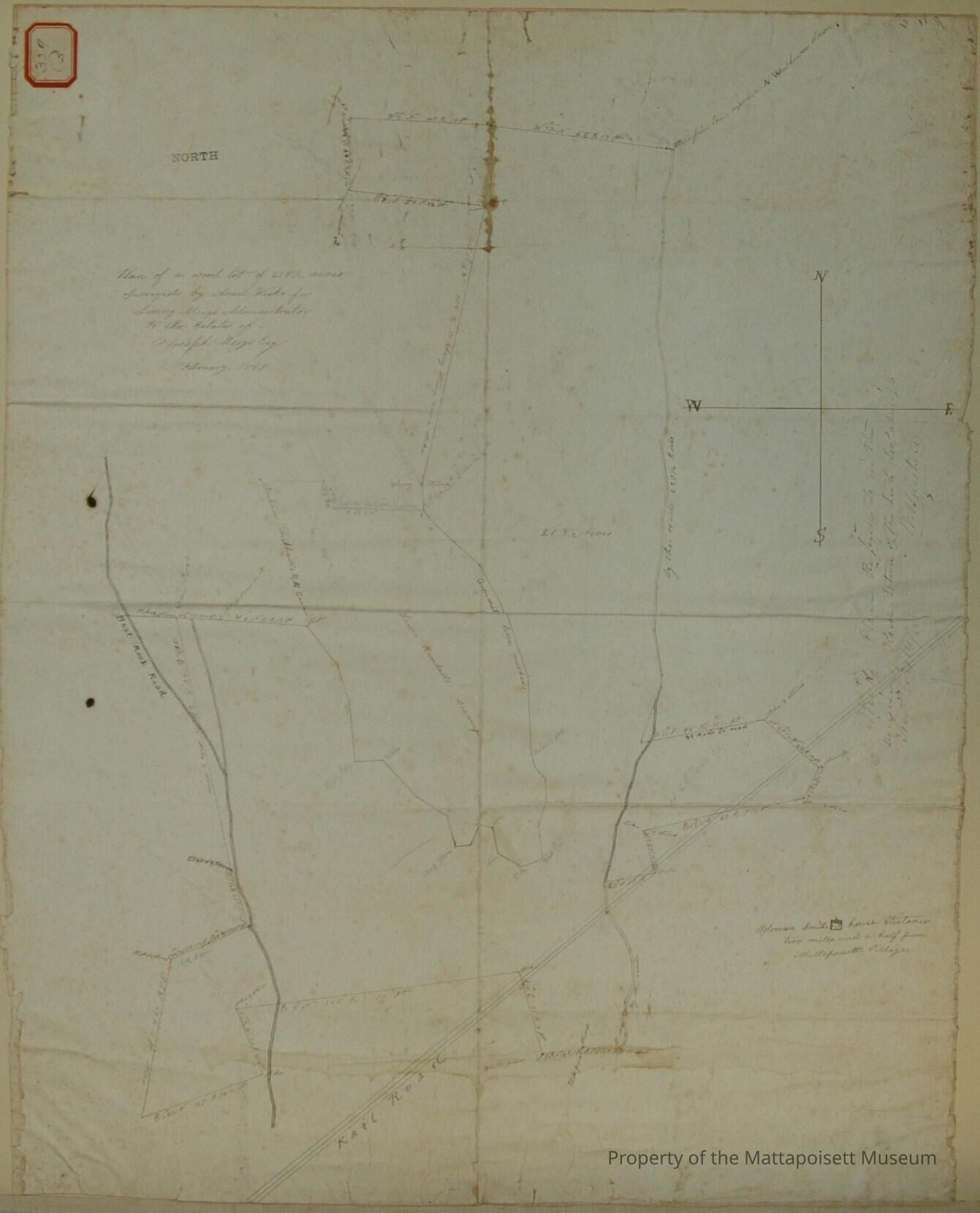
Plan of a wood lot of 218 1/2 acres surveyed by Ansel Weeks for Loring Meigs Administrator to the estate of Joseph Meigs, Esq. February 1847. Solomon Smith's house distance two miles and a half from Mattapoisett Village. Boat-rock Road and Railroad runs through. Lewis Randall's swamp in the middle.Acquisition
Accession
0000.5Acquisition Method
GiftLexicon
Nomenclature 4.0
Nomenclature Primary Object Term
BookNomenclature Sub-Class
Other DocumentsNomenclature Class
Documentary ObjectsNomenclature Category
Category 08: Communication ObjectsLOC Thesaurus for Graphic Materials
LandSearch Terms
Real Estate, Boat-Rock, Fairhaven Branch Railroad, Mattapoisett, MA, Ansel Weeks surveyorArchive Details
Archive Notes
Date(s): 1847 & 1885
Publication Notes: 1847 & 1885Other Names and Numbers
Other Numbers
Number Type
Other NumberOther Number
329bRelationships
Related Person or Organization
Person or Organization
MeigsPerson or Organization
RandallGeneral Notes
Note
Notes: Notecard:
1. Durfee, Edward (154B & 329B)
Part of Meigs 200 acre wood lot
Bought of L. hall
Town Plot 650N by 200E
1847 & 1885
2. Hall, L. Jr (154B & 329B)
Part of Meigs 200 acre wood lot
Crossed by Railroad
Later owned by Edward Durfee
Town Plot 650N by 200E
1847 & 1885
3. Meigs, Joseph (154B & 329B)
200 Acre Wood Lot
Crossed by Boat-Rock Road
Town Plot 700N by 125E
1847 & 1885
Status: OKCreated By
admin@catalogit.appCreate Date
December 10, 2014Updated By
admin@catalogit.appUpdate Date
August 28, 2021