Name/Title
BlueprintEntry/Object ID
0200.1.28Scope and Content
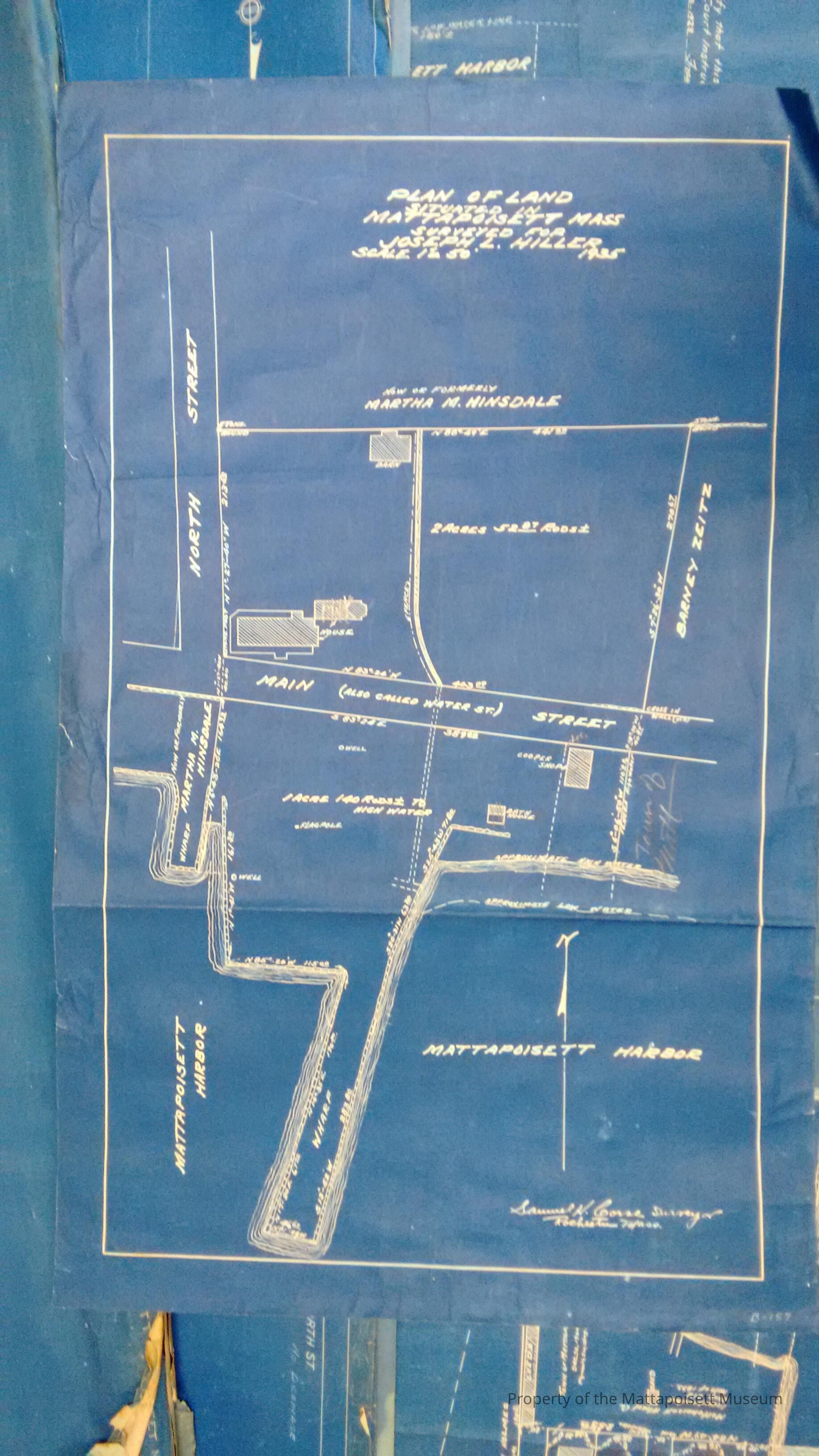
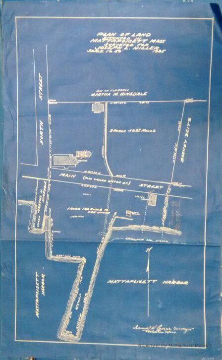
Plan of land situated in Mattapoisett, Mass. surveyed for Joseph L. Hiller. 1935. Scale 1"=50'. Samuel H. Corse, surveyor. Between Main Street , North Street and Mattapoisett Harbor. One page.Collection
Maps/Surveys/Blueprints (MP)Acquisition
Accession
0200.1Acquisition Method
GiftLexicon
Nomenclature 4.0
Nomenclature Secondary Object Term
BlueprintNomenclature Primary Object Term
Copy, ReprographicNomenclature Sub-Class
Other DocumentsNomenclature Class
Documentary ObjectsNomenclature Category
Category 08: Communication ObjectsArchive Details
Date(s) of Creation
1935 - 1935Archive Notes
Date(s): 1935General Notes
Note
Status: OK
Status By: Lenora Robinson
Status Date: 2016-07-01Created By
admin@catalogit.appCreate Date
July 1, 2016Updated By
admin@catalogit.appUpdate Date
August 28, 2021