Name/Title
MapEntry/Object ID
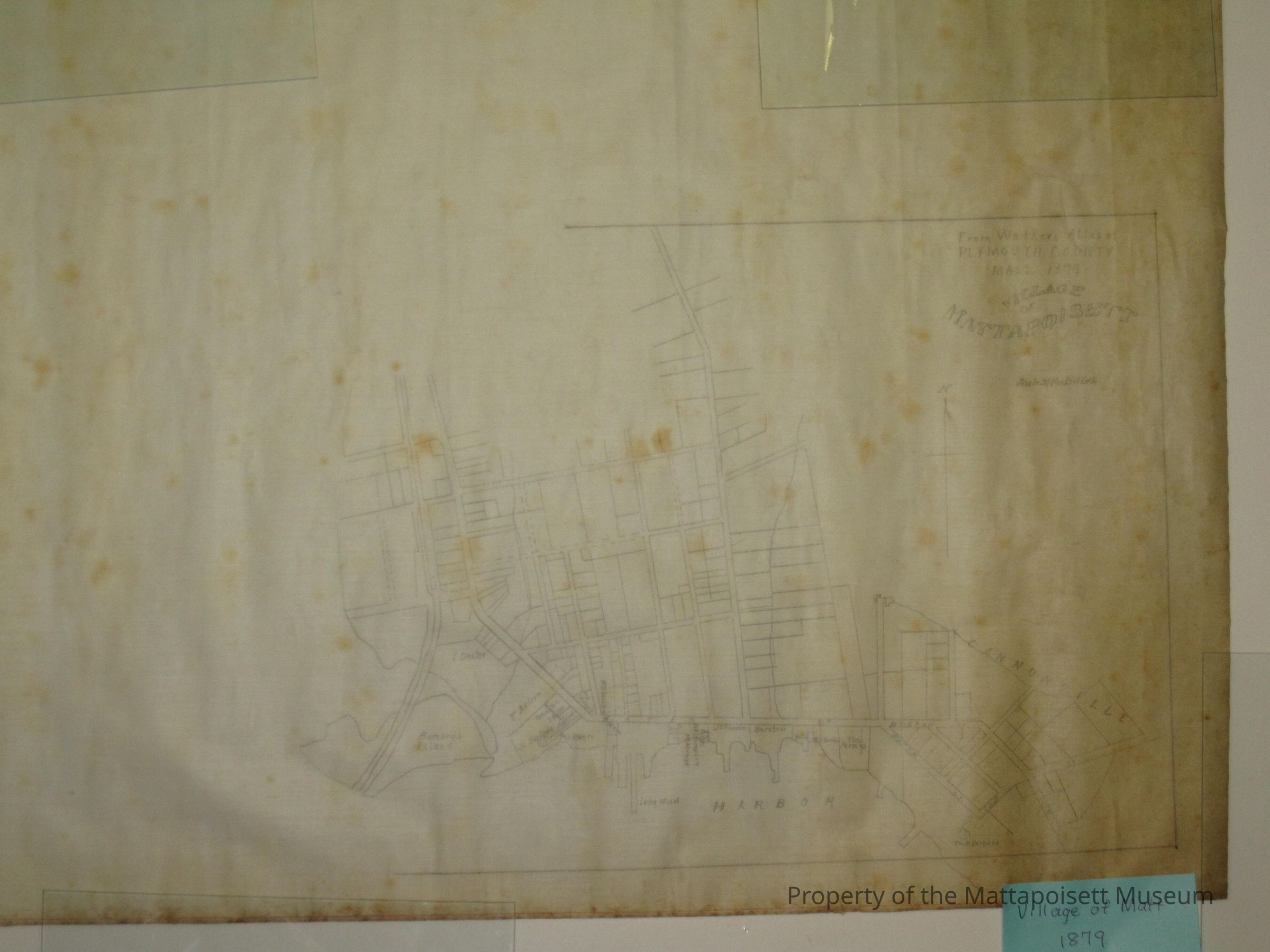
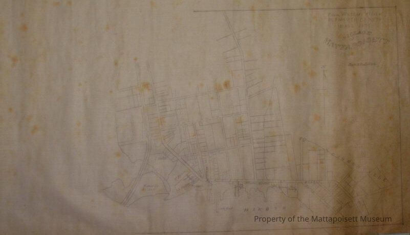
0110.1.1Description
Handdrawn technical street map from Walker's Atlas of Plymouth County, Massachusetts 1879. Village of Mattapoisett. Scale 30 rods to the inch. Cannonville, Mattapoisett Harbor and Barnard's Island noted. Beacon, Water and Ship Streets marked. E. Dexter, T. Nelson, Barstow, Stackpole, Bolles and Parsons properties recorded.Collection
Maps/Surveys/Blueprints (MP)Acquisition
Accession
0110.1Acquisition Method
GiftLexicon
Nomenclature 4.0
Nomenclature Secondary Object Term
MapNomenclature Primary Object Term
CartographNomenclature Sub-Class
Graphic DocumentsNomenclature Class
Documentary ObjectsNomenclature Category
Category 08: Communication ObjectsLOC Thesaurus for Graphic Materials
Streets, MapsSearch Terms
Maps, Beacon Street, Water Street, Ship Street, Cannonville, Mattapoisett Harbor, Barnard's IslandRelationships
Related Person or Organization
Person or Organization
NelsonPerson or Organization
DexterPerson or Organization
BarstowPerson or Organization
StackpolePerson or Organization
BollesPerson or Organization
ParsonsCreated By
admin@catalogit.appCreate Date
January 21, 2015Updated By
admin@catalogit.appUpdate Date
August 28, 2021