Name/Title
MapEntry/Object ID
0110.1.2Description
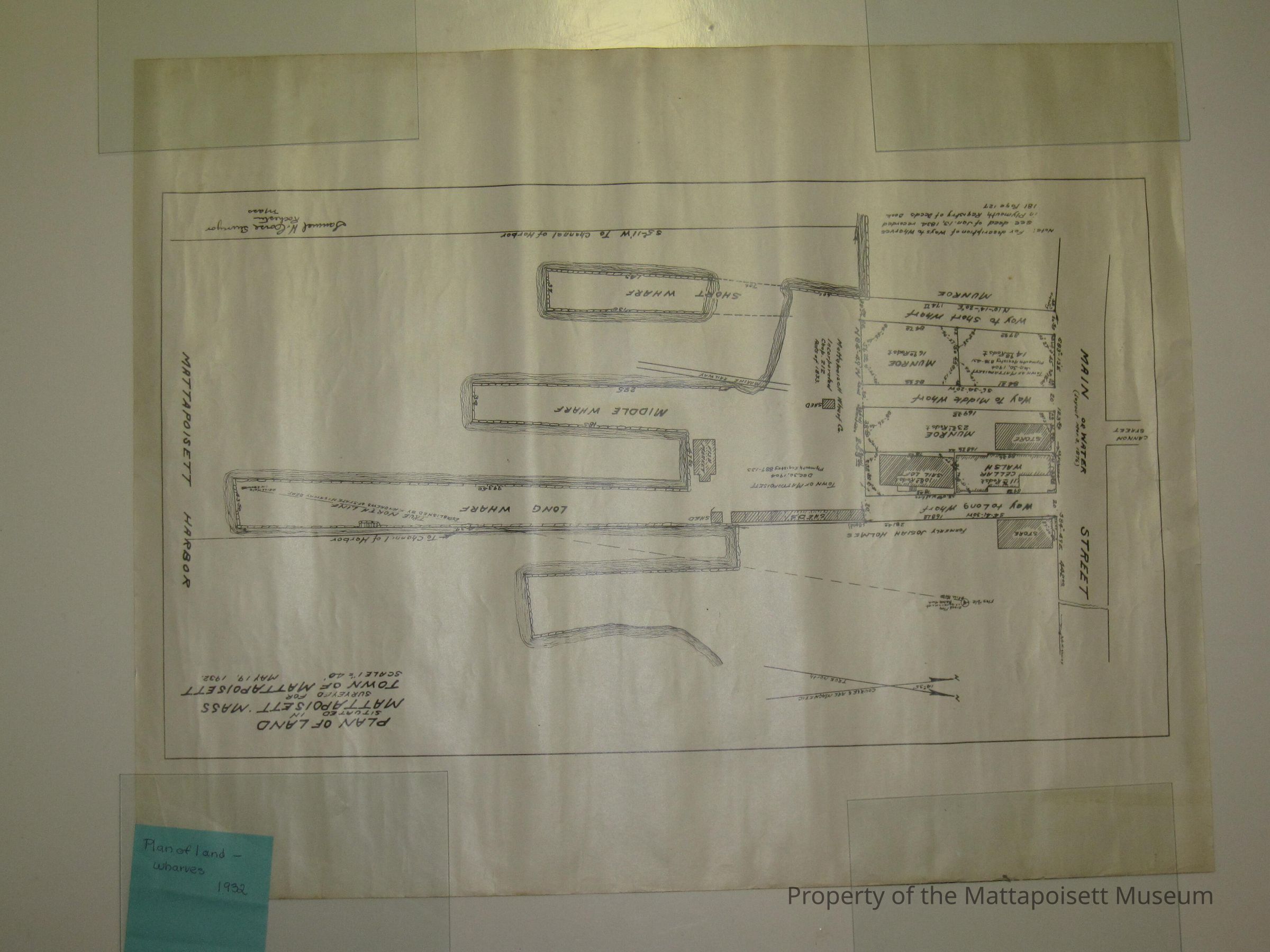
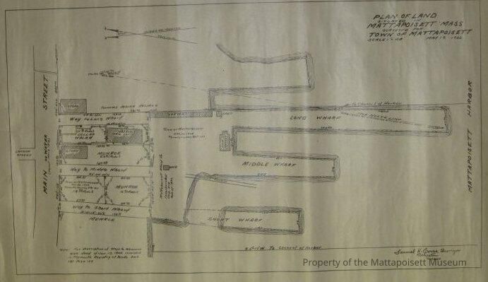
Mattapoisett Town Wharves May 19, 1932 and adjoining property. Cannon, Main and Water streets (from layout of 1876). "Plan of land situated in Mattapoisett, Mass. Surveyed for the Town of Mattapoisett May 19, 1932". Scale 1" = 40'. Samuel H. Corse, Surveyor (Rochester, Mass).Collection
Maps/Surveys/Blueprints (MP)Acquisition
Accession
0110.1Acquisition Method
GiftLexicon
Nomenclature 4.0
Nomenclature Secondary Object Term
MapNomenclature Primary Object Term
CartographNomenclature Sub-Class
Graphic DocumentsNomenclature Class
Documentary ObjectsNomenclature Category
Category 08: Communication ObjectsLOC Thesaurus for Graphic Materials
WaterfrontsSearch Terms
Maps, Mattapoisett Harbor, Cannon Street, Main Street (Mattapoisett), Water Street, Samuel H. Corse surveyorCreated By
admin@catalogit.appCreate Date
January 21, 2015Updated By
admin@catalogit.appUpdate Date
August 28, 2021