Name/Title
MapEntry/Object ID
0110.1.7Description
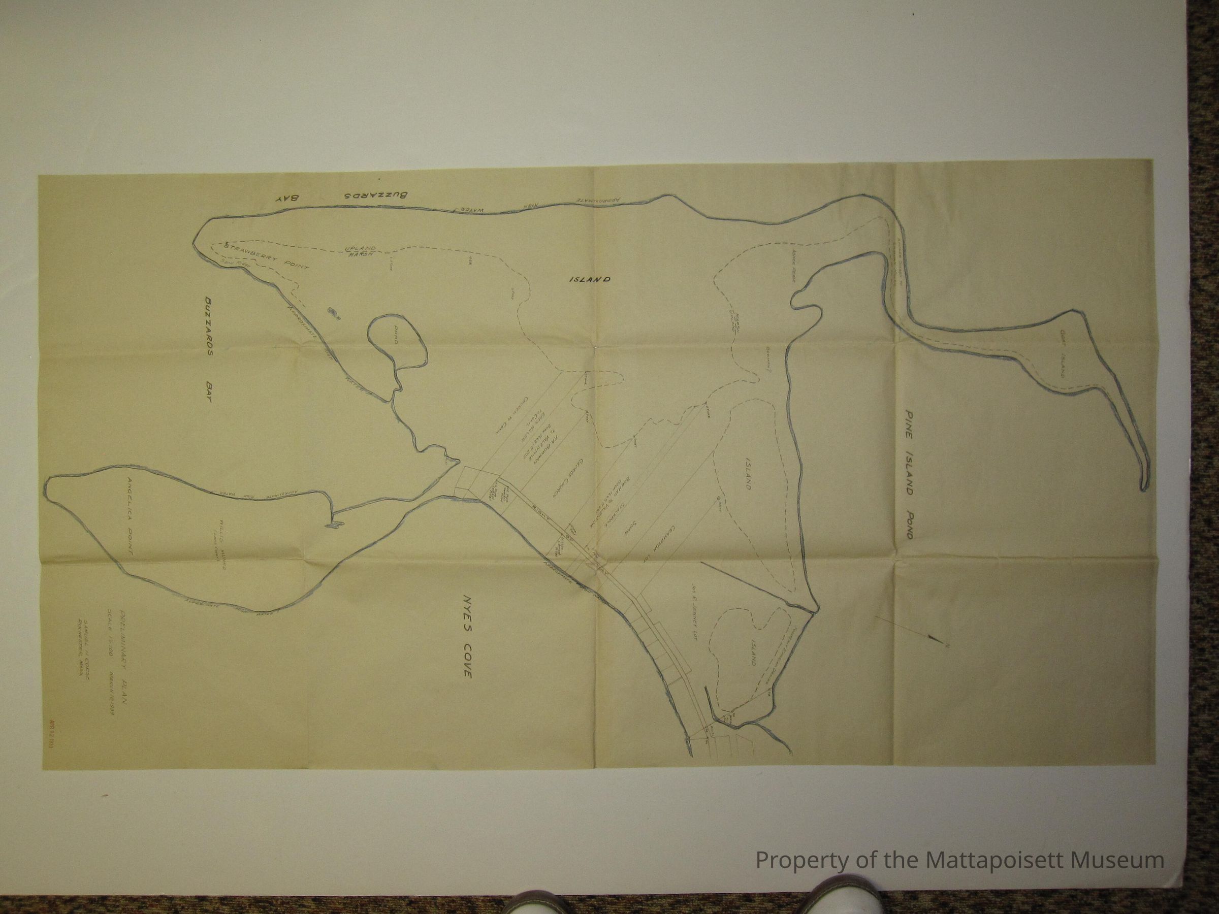
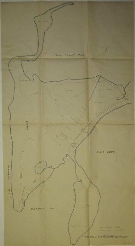
Preliminary plan March 10, 1939 (stamped April 12, 1939). Includes Goat Island, Strawberry Pond, Angelica Point, and Nyes Cove. Scale 1"=100'. Samuel H. Corse, surveyor. Owners' notes: Andrew Sisson to Lilburn Hiller, Abner Pease, Joseph R. Jenney, Ephraim Dexter, Crampton Lot, Shaw, Stackpole, Bowman to Valentine (Book 1668, Page 205), George Church, Ellen Hiller to Covil, Church to Covil. Marked with Old# MP-6Collection
Maps/Surveys/Blueprints (MP)Acquisition
Accession
0110.1Acquisition Method
GiftMade/Created
Date made
1939 - 1939Notes
Date: 03/10/1939Lexicon
Nomenclature 4.0
Nomenclature Secondary Object Term
MapNomenclature Primary Object Term
CartographNomenclature Sub-Class
Graphic DocumentsNomenclature Class
Documentary ObjectsNomenclature Category
Category 08: Communication ObjectsSearch Terms
Goat Island, Samuel H. Corse surveyor, Strawberry Pond, Angelica Point, Nye's CoveOther Names and Numbers
Other Numbers
Number Type
Old NumberOther Number
MP6Relationships
Related Person or Organization
Person or Organization
PeasePerson or Organization
HillerPerson or Organization
SissonPerson or Organization
DexterPerson or Organization
CramptonPerson or Organization
BowmanPerson or Organization
JenneyPerson or Organization
StackpolePerson or Organization
ShawPerson or Organization
ValentinePerson or Organization
ChurchPerson or Organization
CovilGeneral Notes
Note
Notes: Plan of Goat Island, Strawberry Point, Angelica Pond and Nyes Cove, 1939.
Status: OKCreated By
admin@catalogit.appCreate Date
January 26, 2015Updated By
admin@catalogit.appUpdate Date
August 28, 2021