Name/Title
MapEntry/Object ID
0110.1.11Description
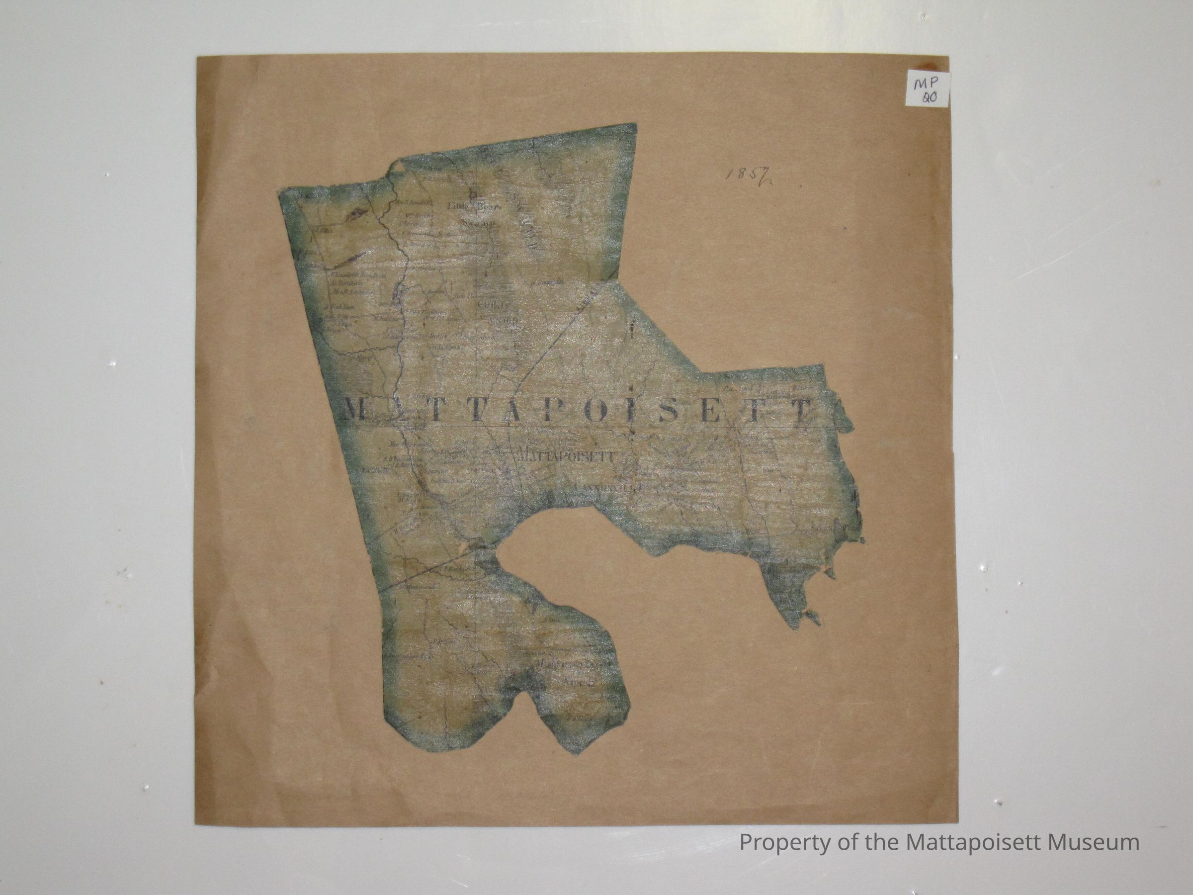
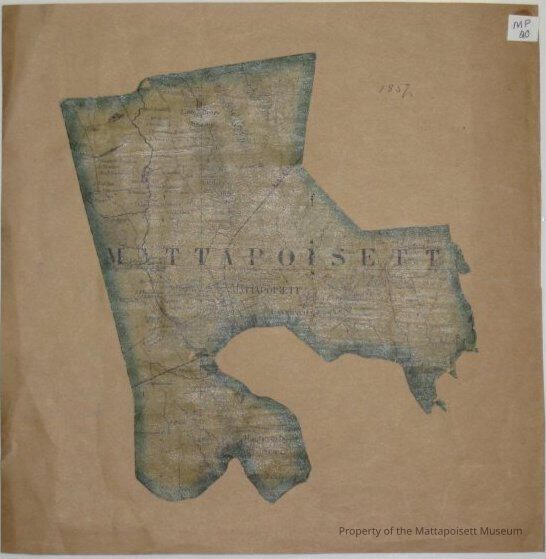
1857 cut out map of Mattapoisett. The back reads: Mattapoisett, Mass. From map of Plymouth County by Henry F. Walling. Supt. of the state map.Collection
Maps/Surveys/Blueprints (MP)Acquisition
Accession
0110.1Acquisition Method
GiftLexicon
Nomenclature 4.0
Nomenclature Secondary Object Term
MapNomenclature Primary Object Term
CartographNomenclature Sub-Class
Graphic DocumentsNomenclature Class
Documentary ObjectsNomenclature Category
Category 08: Communication ObjectsOther Names and Numbers
Other Numbers
Number Type
Old NumberOther Number
MP20General Notes
Note
Notes: Notecard: Cut out portion of Walling Map - Mattapoisett.
Status: OKCreated By
admin@catalogit.appCreate Date
January 29, 2015Updated By
admin@catalogit.appUpdate Date
August 28, 2021