Name/Title
MapEntry/Object ID
0110.1.13Description
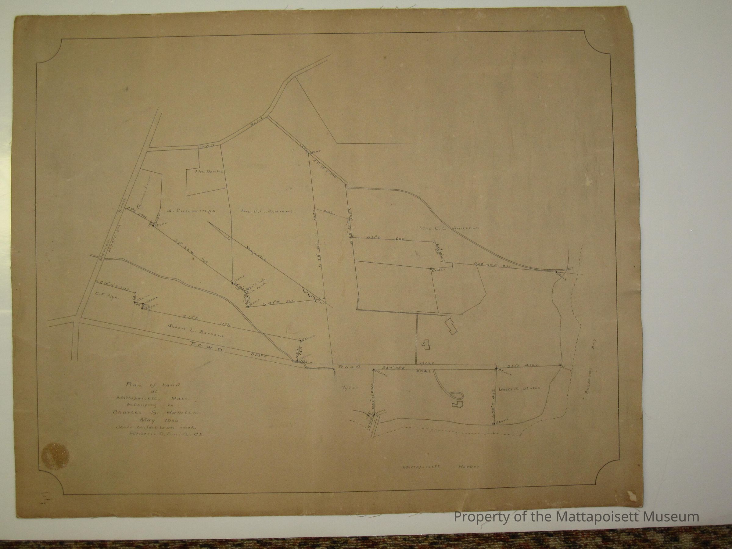
Plan of land at Mattapoisett, Mass belonging to Charles S. Hamlin May 1900. Scale 200 feet to an inch. Frederic O. Smith C. E. On Mattapoisett Harbor, Town Road and Marion Road.Collection
Maps/Surveys/Blueprints (MP)Acquisition
Accession
0110.1Acquisition Method
GiftLexicon
Nomenclature 4.0
Nomenclature Secondary Object Term
MapNomenclature Primary Object Term
CartographNomenclature Sub-Class
Graphic DocumentsNomenclature Class
Documentary ObjectsNomenclature Category
Category 08: Communication ObjectsSearch Terms
Marion Road (Road to Marion)Other Names and Numbers
Other Numbers
Number Type
Old NumberOther Number
MP30Relationships
Related Person or Organization
Person or Organization
HamlinGeneral Notes
Note
Notes: Notecard: Plan of Chas. S. Hamlin land by Frederick O. Smith.
Status: OKCreated By
admin@catalogit.appCreate Date
January 31, 2015Updated By
admin@catalogit.appUpdate Date
August 28, 2021