Name/Title
MapEntry/Object ID
0110.1.14Description
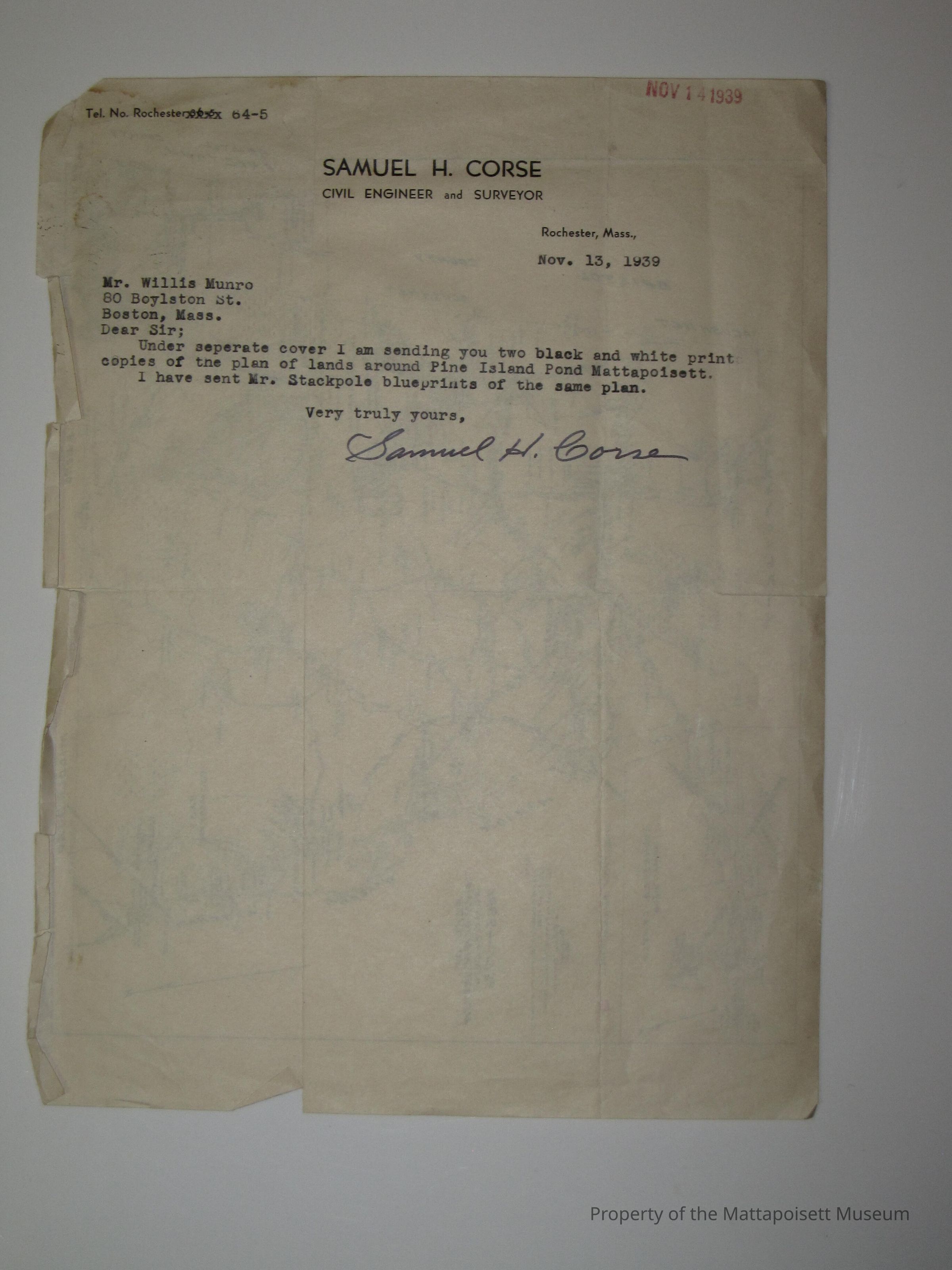
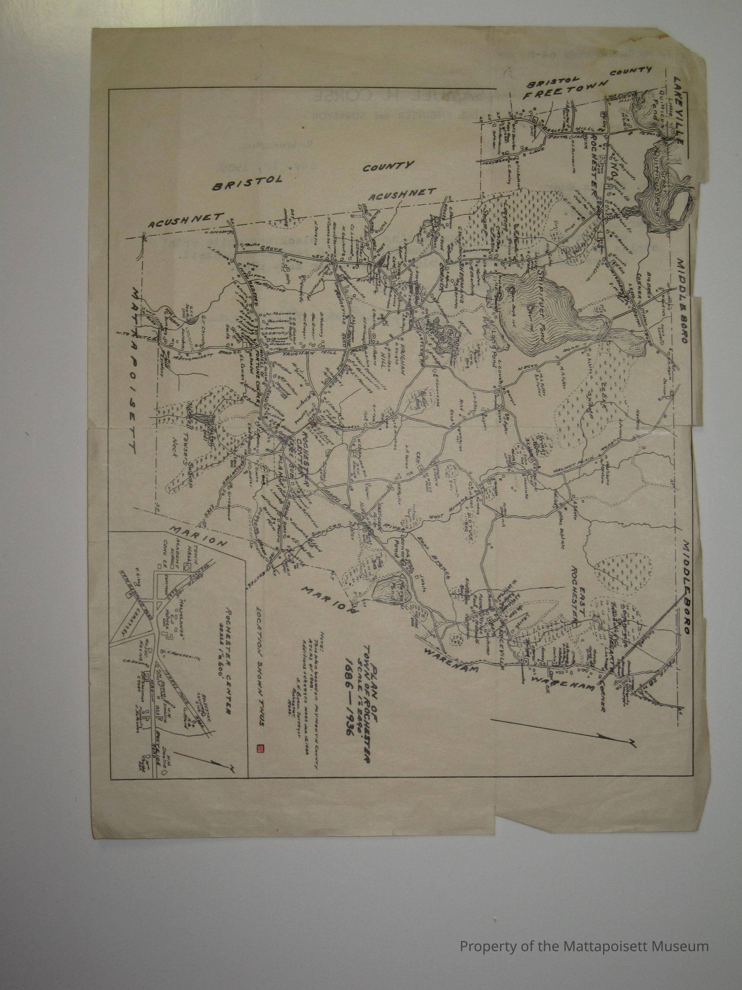
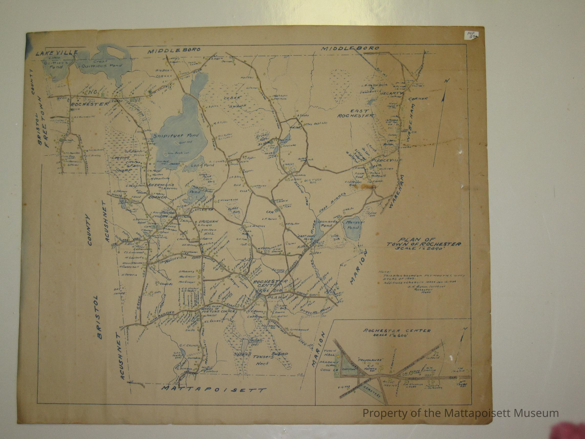
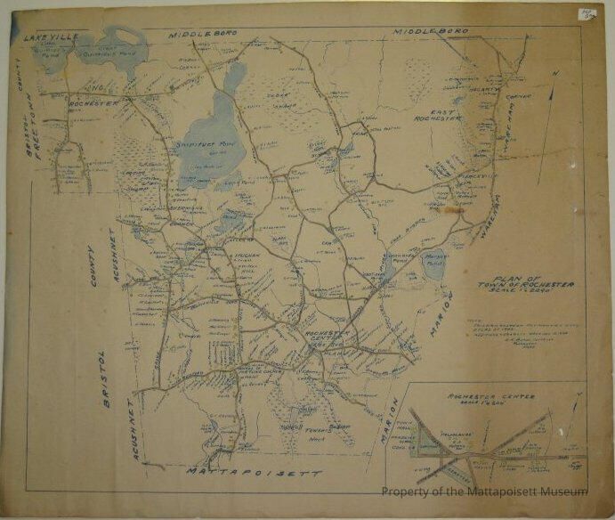
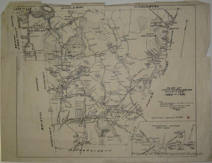
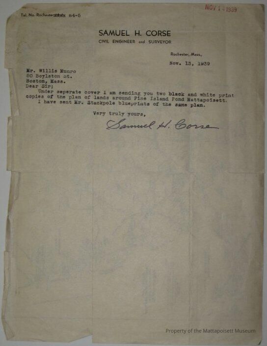
Plan of Town of Rochester. Scale 1"=2490'. 1686-1936. Note: This plan based on Plymouth County Atlast of 1903. Additions and changes made January 15, 1934. S. H. Corse, Surveyor, Rochester, Mass. Inset of Rochester Center. 3 maps total. One is large (17x20) and two are small (8x10). Two are marked with MP-23. The third (a small) has a letter from Samuel H. Corse to Mr. Willis Munro on the back. Dear Sir; Under separate cover I am sending you two black and white print copies of the plan of lands around Pine Island Pond, Mattapiosett. I have sent Mr. Stackpole blueprints of the same plan. Very truly yours. Dated November 13, 1939.Collection
Maps/Surveys/Blueprints (MP)Acquisition
Accession
0110.1Acquisition Method
GiftMade/Created
Date made
1934 - 1934Notes
Date: 01/15/1934Lexicon
Nomenclature 4.0
Nomenclature Secondary Object Term
MapNomenclature Primary Object Term
CartographNomenclature Sub-Class
Graphic DocumentsNomenclature Class
Documentary ObjectsNomenclature Category
Category 08: Communication ObjectsSearch Terms
Samuel H. Corse surveyor, Rochester, MAOther Names and Numbers
Other Numbers
Number Type
Old NumberOther Number
MP23Relationships
Related Person or Organization
Person or Organization
MunroGeneral Notes
Note
Notes: Notecard: Map of Town or Rochester based on Ply. Co. Atlas 1903.Created By
admin@catalogit.appCreate Date
January 31, 2015Updated By
admin@catalogit.appUpdate Date
August 28, 2021