Name/Title
MapEntry/Object ID
0110.1.15Description
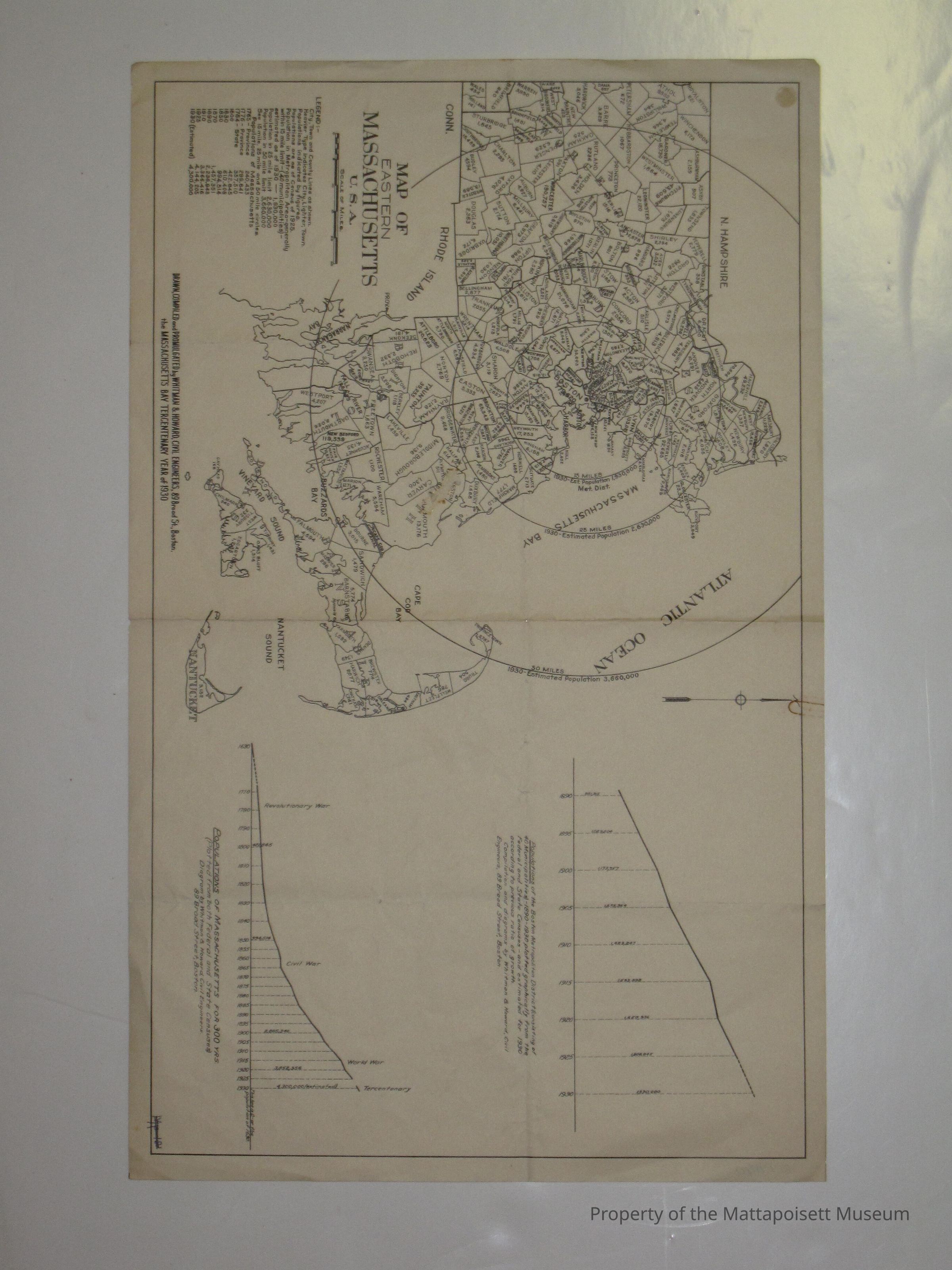
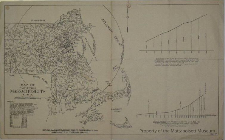
Map of Eastern Massachusetts. Drawn, Compiled and promulgated by Whitman & Howard, Civil Engineers, 89 Broad Street, Boston. The Massachusetts Bay Tercentenary Year of 1930. Includes graphs of the Populations of Boston Metropolitan District from 1890-1930 and Populations of Massachusetts for 300 years. Map was marked with MP-12, but matching card is MP-19.Collection
Maps/Surveys/Blueprints (MP)Acquisition
Accession
0110.1Acquisition Method
GiftLexicon
Nomenclature 4.0
Nomenclature Secondary Object Term
MapNomenclature Primary Object Term
CartographNomenclature Sub-Class
Graphic DocumentsNomenclature Class
Documentary ObjectsNomenclature Category
Category 08: Communication ObjectsOther Names and Numbers
Other Numbers
Number Type
Old NumberOther Number
MP19Created By
admin@catalogit.appCreate Date
January 31, 2015Updated By
admin@catalogit.appUpdate Date
August 28, 2021