Name/Title
MapEntry/Object ID
0110.1.19Description
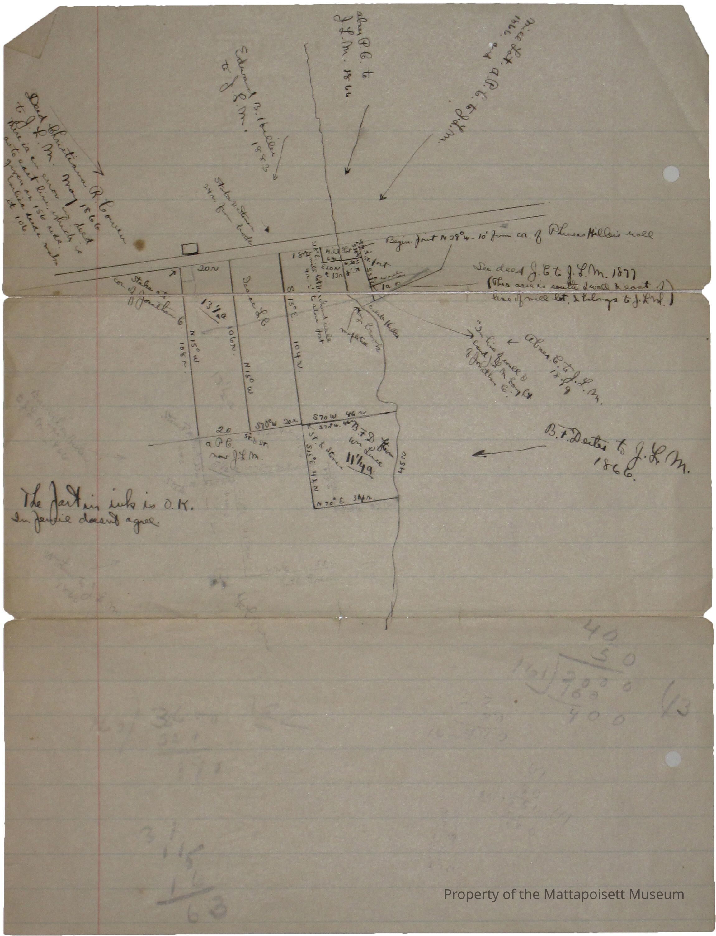
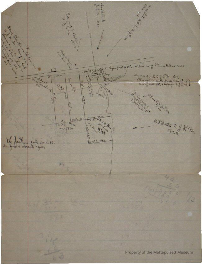
Hand drawn plan of land bought by J. L. M. around 1866. *Deed Christiana R. Cowen to J. L. M. May 1866. There is an error in deed as to east line with is given as 156 rods earlies deeds make it 106. *Edward B. Hiller to J. L. M. 1883. *Abner P. C. to J. L. M. 1866. *Mill Lot. A. P. C. to J. L. M 1866.The part in ink is OK, in pencil doesn't agree. *See deed J. C. to J. L. M. 1877 (This acre south of wall and east of line of Mill Lot & belongs to J. L. M.). *Abner C. to J. L. M. 1879. *In line of wall & land J. L. M. bought of Jonathan C. *B. F. Dexter to J. L. M. 1866.Collection
Maps/Surveys/Blueprints (MP)Acquisition
Accession
0110.1Acquisition Method
GiftLexicon
Nomenclature 4.0
Nomenclature Secondary Object Term
MapNomenclature Primary Object Term
CartographNomenclature Sub-Class
Graphic DocumentsNomenclature Class
Documentary ObjectsNomenclature Category
Category 08: Communication ObjectsRelationships
Related Person or Organization
Person or Organization
CowenPerson or Organization
DexterGeneral Notes
Note
Notes: Paper has come apart at folds, so is now in 3 pieces, 0110.1.19a - c
Status: OKCreated By
admin@catalogit.appCreate Date
January 31, 2015Updated By
admin@catalogit.appUpdate Date
August 28, 2021