Name/Title
MapEntry/Object ID
0110.1.25Description
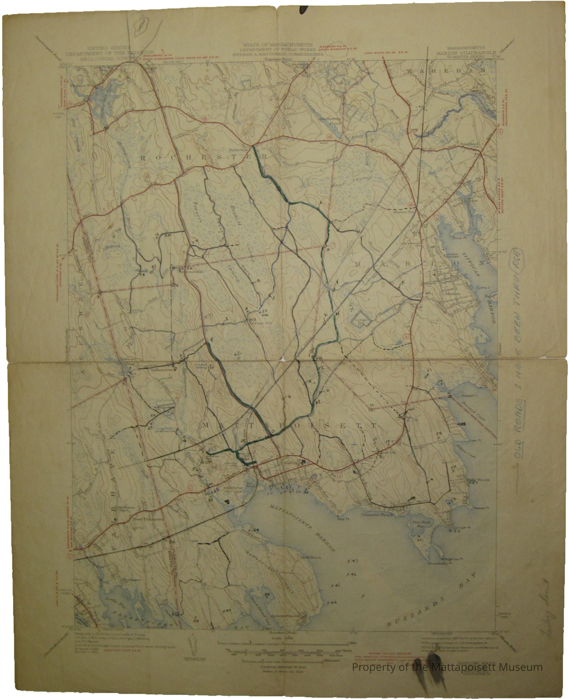
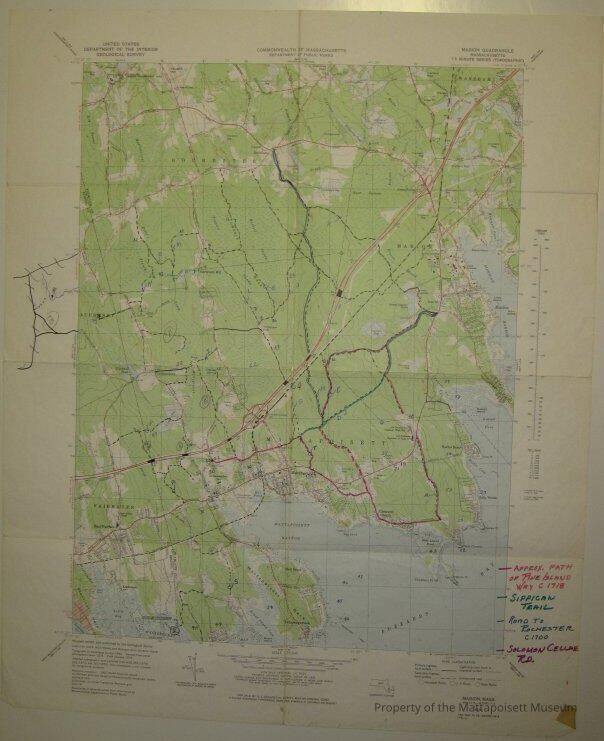
Marion Quadrangle, Massachusetts, 7.5 minute series (topographic). Commonwealth of Massachusetts, Department of Public Works. United States Department of the Interior Geological Survey. 1977. Hand marked with approximate path of Pine Island Way c. 1718, Sippican Trail, Road to Rochester c. 1700, Solomon Cellar Road. Second of the same map that says “Old Roads I have been thru (FGR)" poor quality.Collection
Maps/Surveys/Blueprints (MP)Acquisition
Accession
0110.1Acquisition Method
GiftMade/Created
Date made
1710 - 1720Notes
Date: 1718Lexicon
Nomenclature 4.0
Nomenclature Secondary Object Term
MapNomenclature Primary Object Term
CartographNomenclature Sub-Class
Graphic DocumentsNomenclature Class
Documentary ObjectsNomenclature Category
Category 08: Communication ObjectsSearch Terms
Marion, MACreated By
admin@catalogit.appCreate Date
February 3, 2015Updated By
admin@catalogit.appUpdate Date
August 28, 2021