Name/Title
MapEntry/Object ID
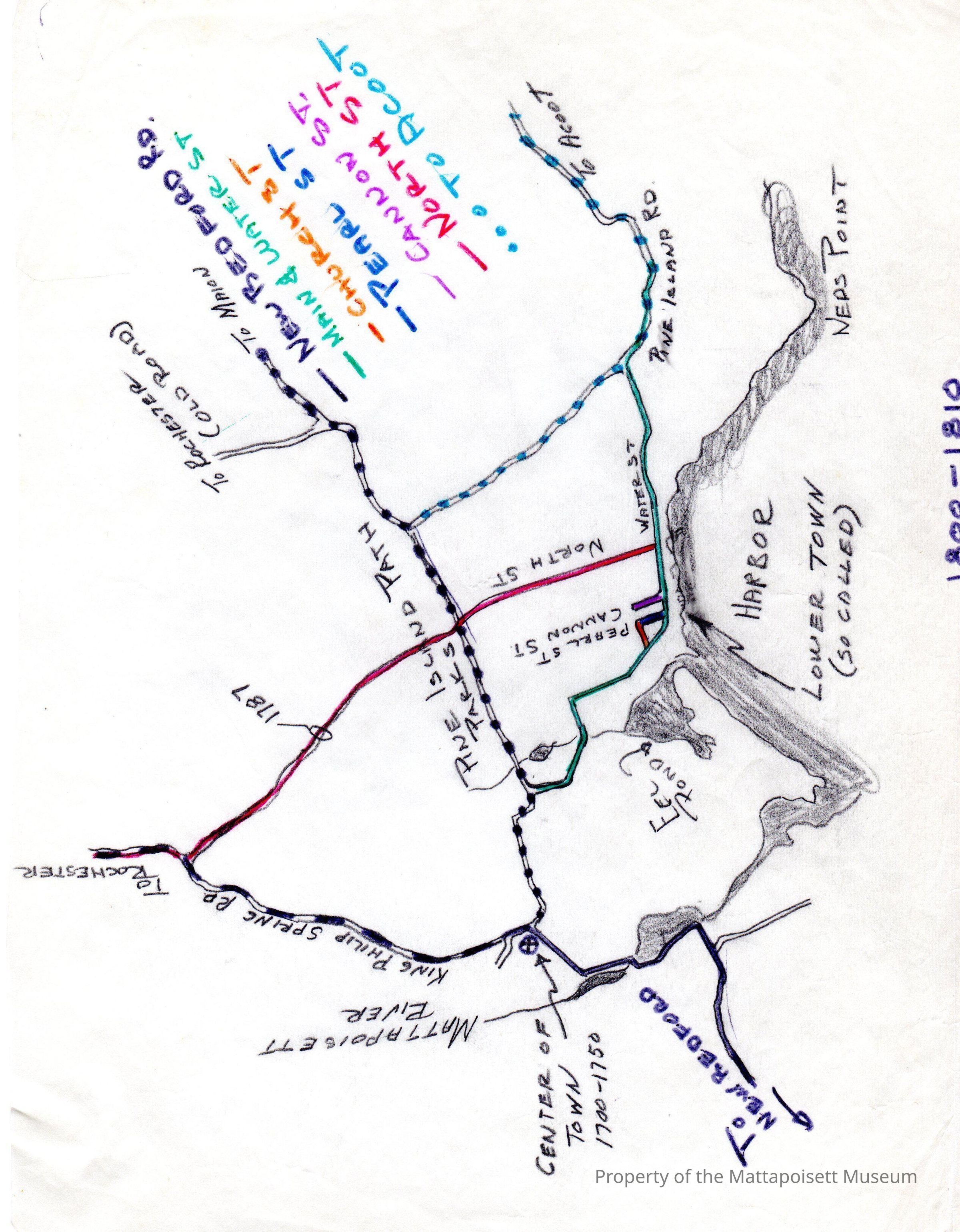
0100.1.10Description
Handdrawn map of Mattapoisett. Center of town, 1700-1750, Mattapoisett River, King Philip Spring Road (to Rochester), Pine Island Path, Eel Pond, Harbor, Lower Town (so called), Pine Island Road (to Aucoot), Ned's Point marked. Water, Pearl, Cannon, North Streets marked.Collection
Maps/Surveys/Blueprints (MP)Acquisition
Accession
0100.1Acquisition Method
GiftLexicon
Nomenclature 4.0
Nomenclature Secondary Object Term
MapNomenclature Primary Object Term
CartographNomenclature Sub-Class
Graphic DocumentsNomenclature Class
Documentary ObjectsNomenclature Category
Category 08: Communication ObjectsSearch Terms
Pearl Street, Cannon Street, North Street, Main Street (Mattapoisett), Water Street, Rochester Road (Old Road to Rochester), Mattapoisett River, Ned's Point, Mattapoisett HarborCreated By
admin@catalogit.appCreate Date
February 24, 2015Updated By
admin@catalogit.appUpdate Date
August 28, 2021