Property Deed #50
Name/Title
Property Deed #50Scope and Content
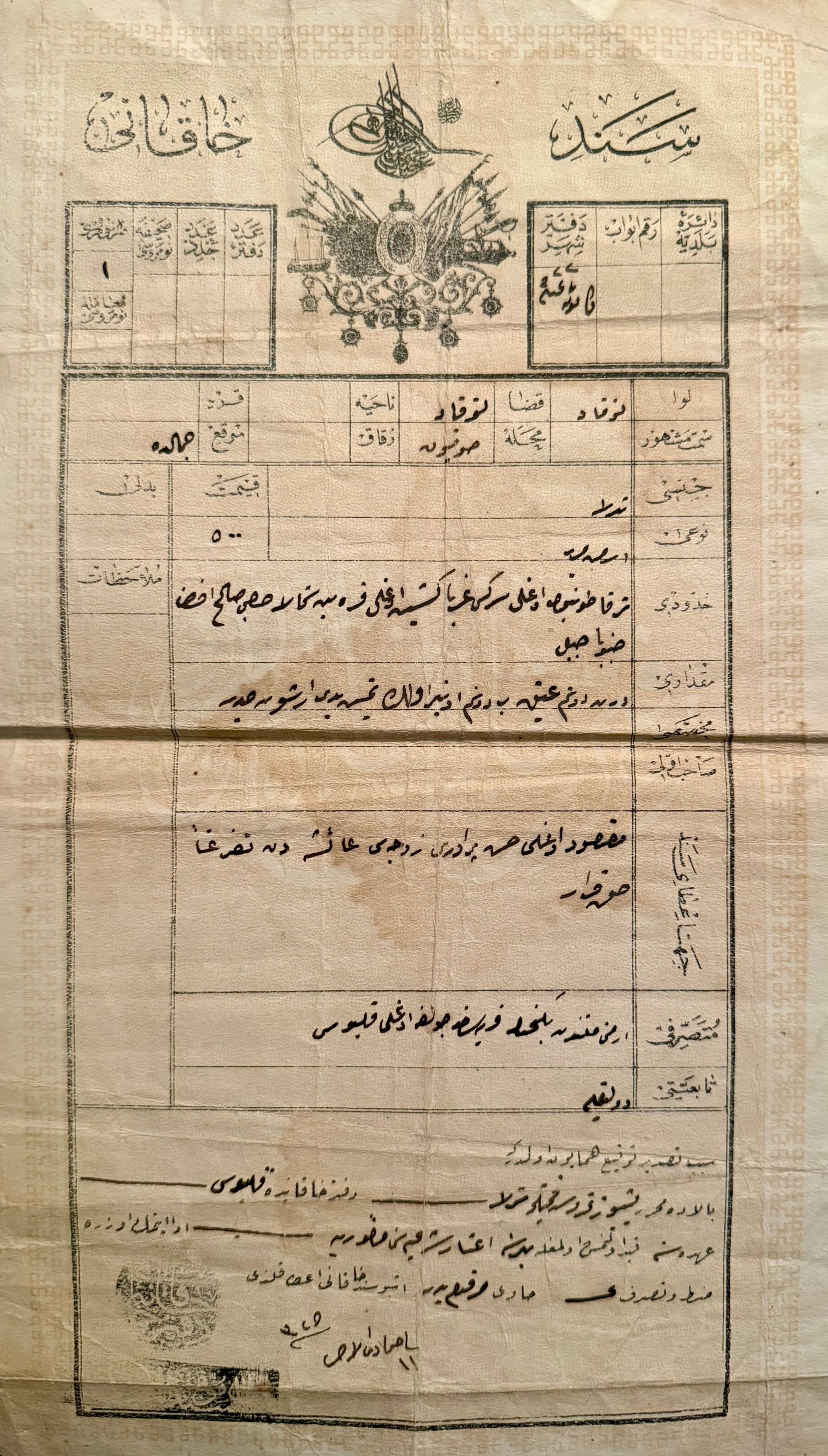
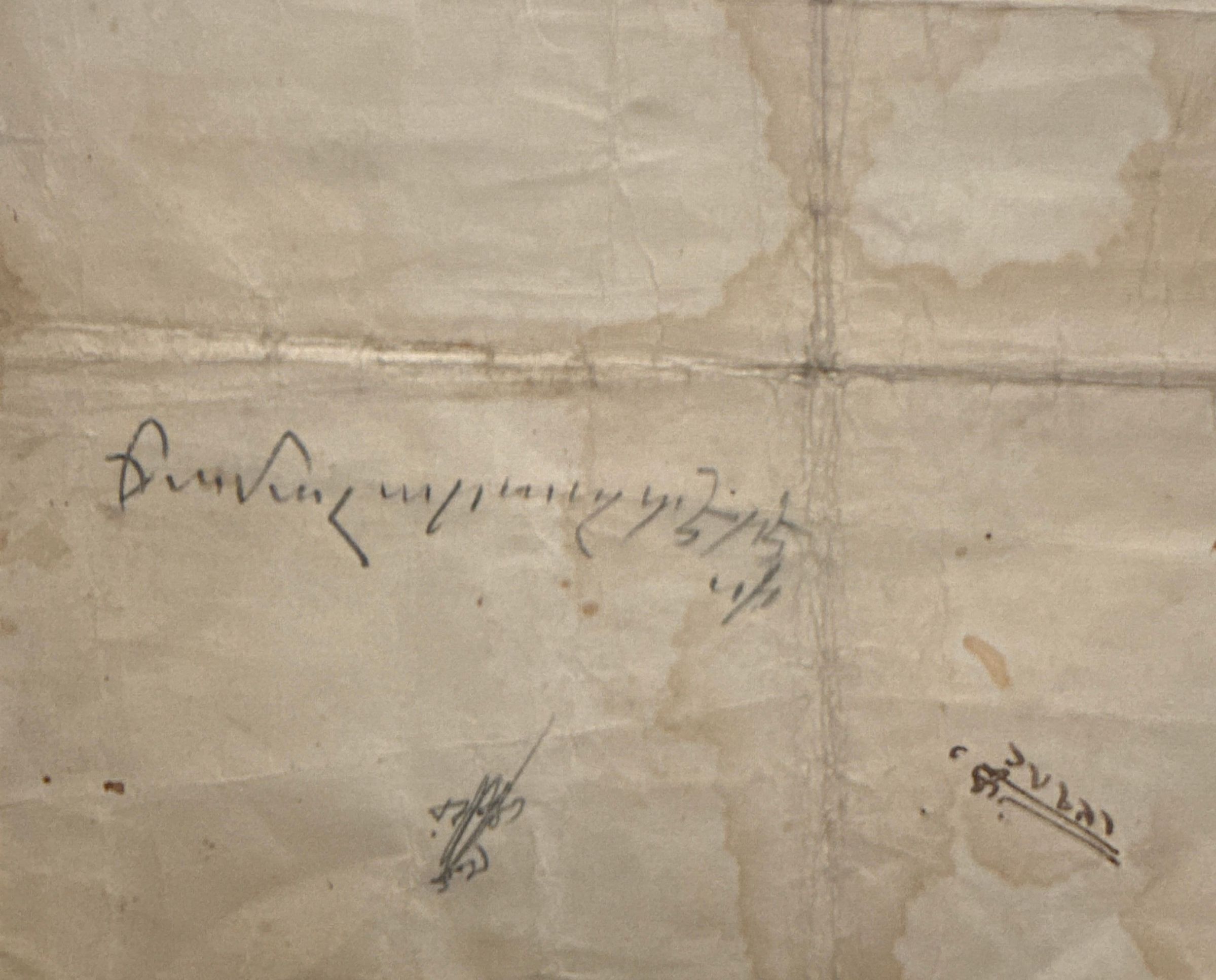
This is an original Ottoman Turkish land deed (tapu) documenting a field property located in the Sofyon neighborhood (40.3168419, 36.5511948) of Tokat, in an area recorded in the document as Cemaldere. This designation may correspond to present-day Cemalettin Neighborhood which is next to Sofyon, while the referenced Dere Street may preserve the memory of an older stream or ravine (dere). Supporting this possibility, an Armenian note written on the reverse side of the deed appears to read “Cemal(??) deresi” (“Cemal stream”). The document is dated 11 Cemaziyelahir 1325 (22 July 1907) and is written in Ottoman Turkish using Arabic script. It records detailed boundary descriptions and precise land measurements, listed as 4 dönüm atik, 2 dönüm 11 evlek, and 77 arşın-ı cedid, reflecting the coexistence of traditional and standardized systems of land measurement during the late Ottoman period. The document records a transfer of usage rights (hakk-ı karar) involving property previously associated with Maksud oğlu Hasan’s household. According to the deed, Ayşe Hanım transferred her usage rights over the property to Culfa oğlu Kalbus, an Armenian individual from Teknecik village. The recorded value of the transaction is 500 kuruş. The boundary descriptions include both Armenian and Muslim names, including Serkis and Karabet to the east, Keşiş oğlu Karabet to the west, Hacı Salih Efendi to the north, and a mountain boundary to the south. Key details: • Type: Ottoman land deed (tapu) • Location: Tokat, Sofyon neighborhood (Cemal area) • Date: 11 Cemaziyel Ahir 1325 / 22 July 1907 • Property type: Agricultural field • Size: 4 dönüm atik, 2 dönüm 11 evlek, 77 arşın-ı cedid • Transaction: Transfer of usage rights (hakk-ı karar) • Transferor: Ayşe Hanım • Recipient: Culfa oğlu Kalbus (Armenian, Teknecik village) • Value: 500 kuruş • Boundaries: East—Tonbul oğlu Serkis; West—Keşiş oğlu Karabet; North—Hacı Salih Efendi; South—mountainCategory
Property Deeds