Name/Title
Various MapsScope and Content
Various maps in a folder titled "Maps of roads, streets, railroads."
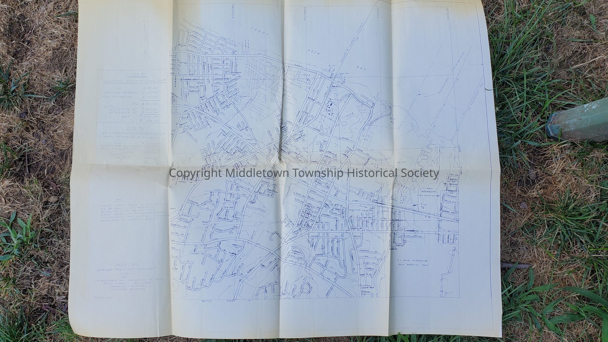
Proposed Sewage Treatment Plants (1964)
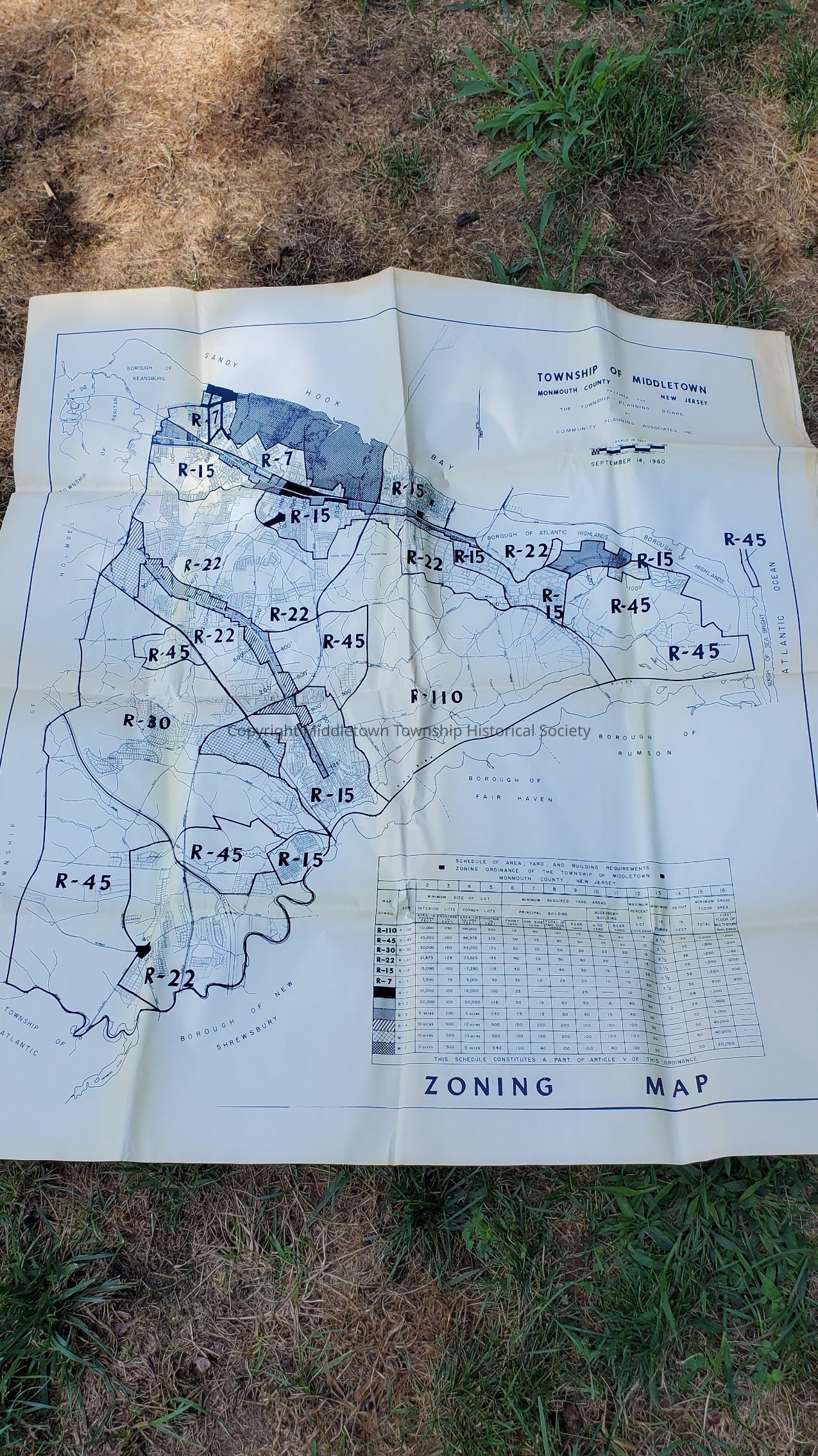
Zoning (1960)
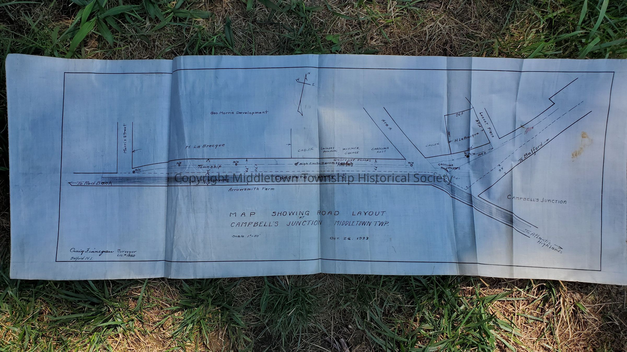
Campbell's Junction Road Layout (1933)
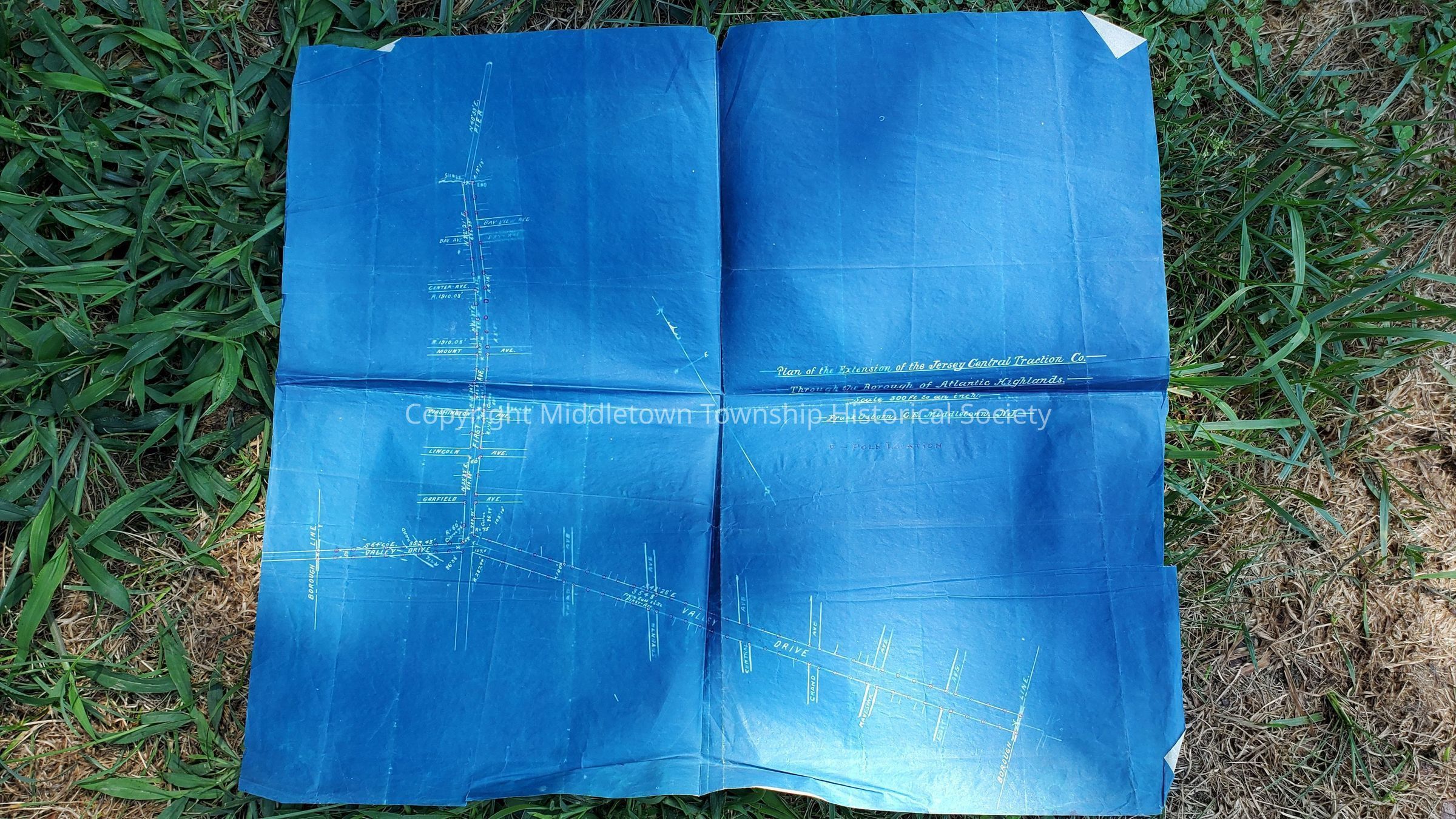
Plan of the Extension of Jersey Central Traction Company through Atlantic Highlands (First Ave and Route 36)
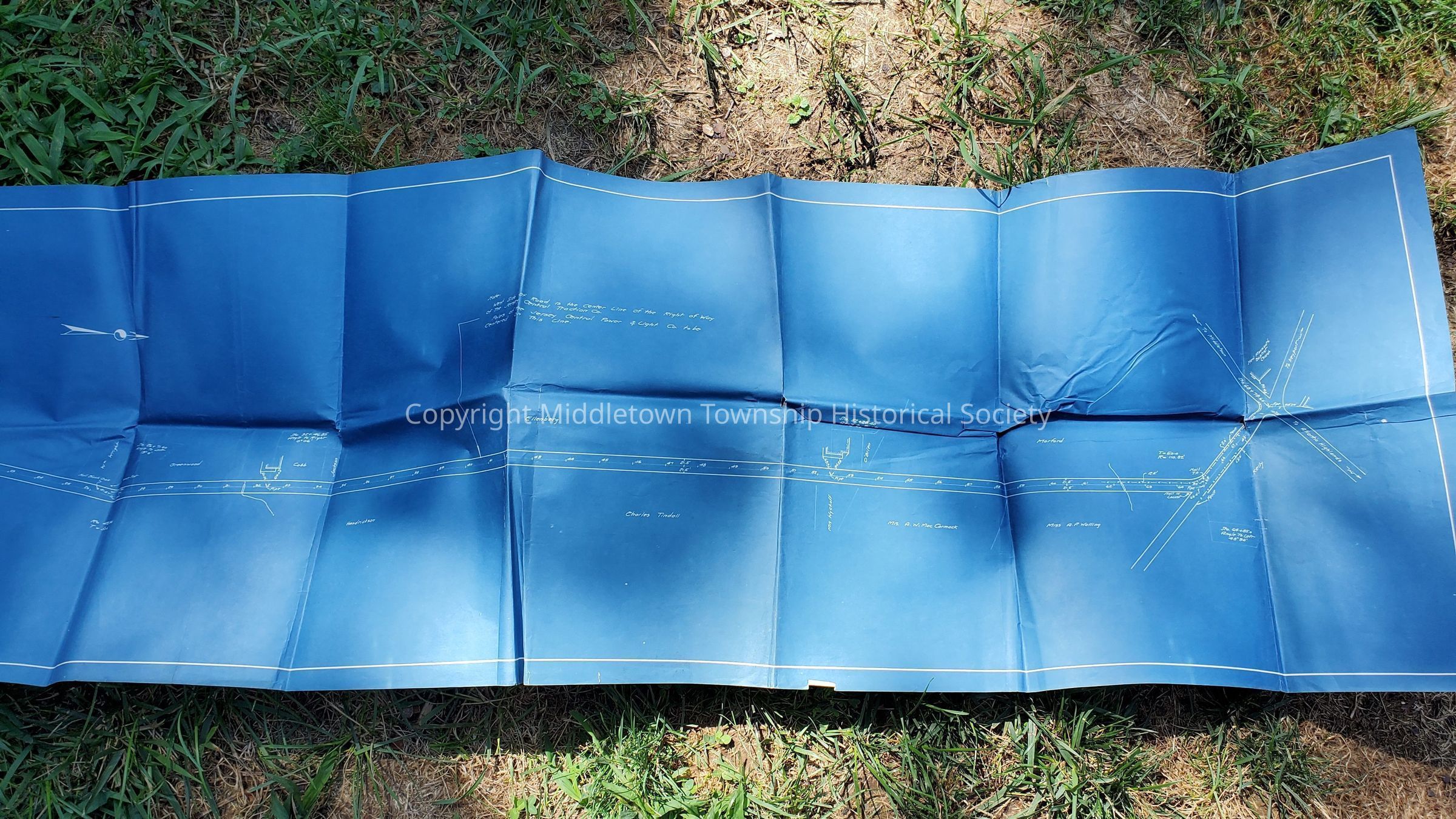
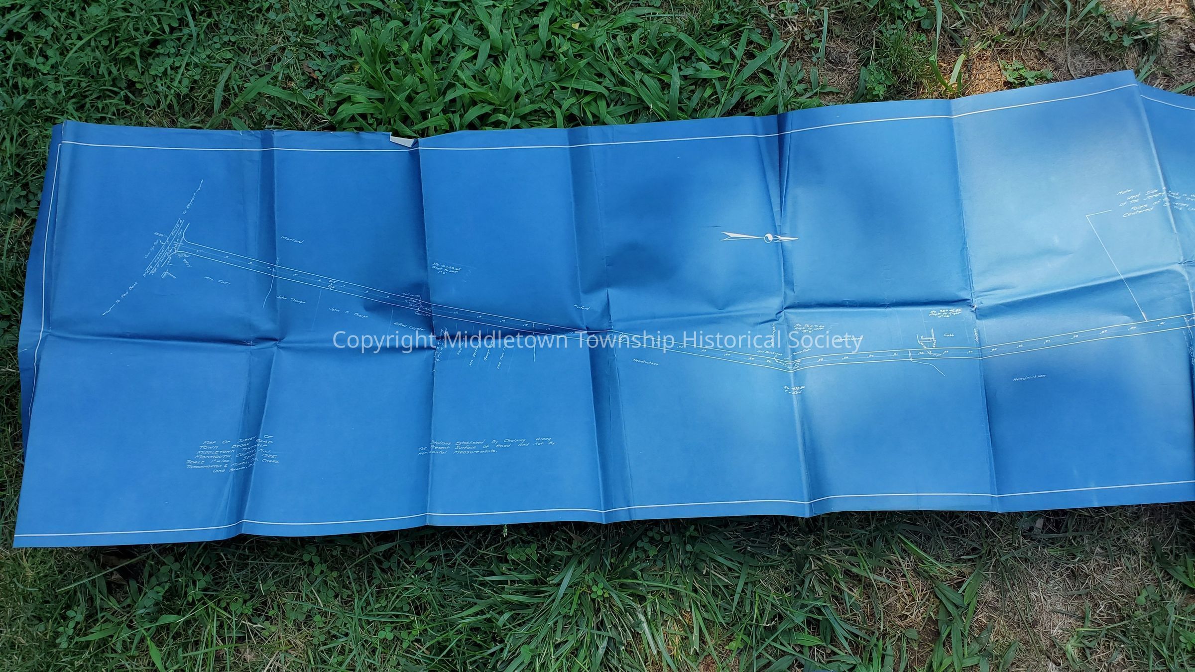
Survey of Town Brook Road (AKA Tindall Road, 1935)
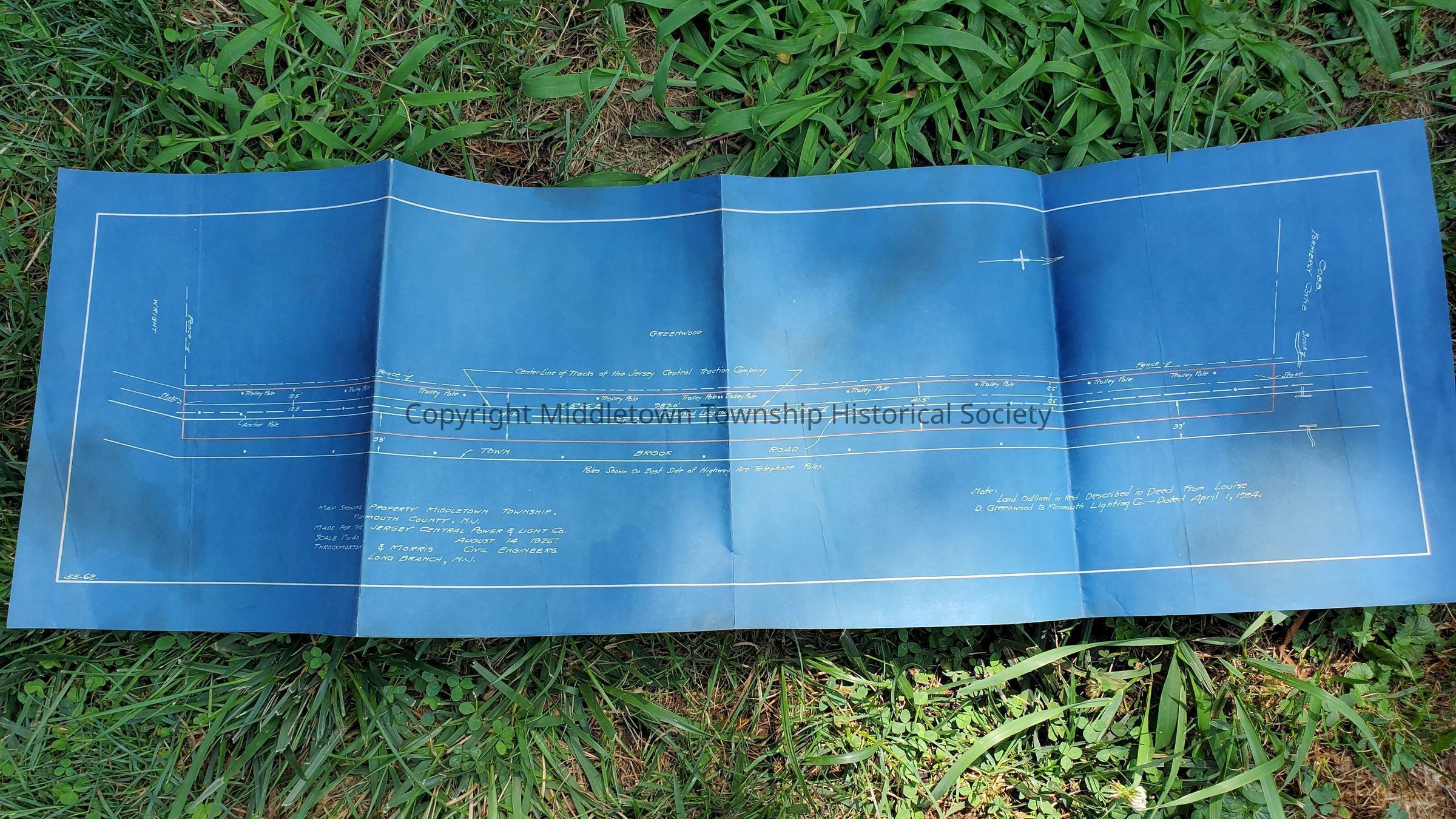
Property Map for JCP&L (Tindall Road, 1925)
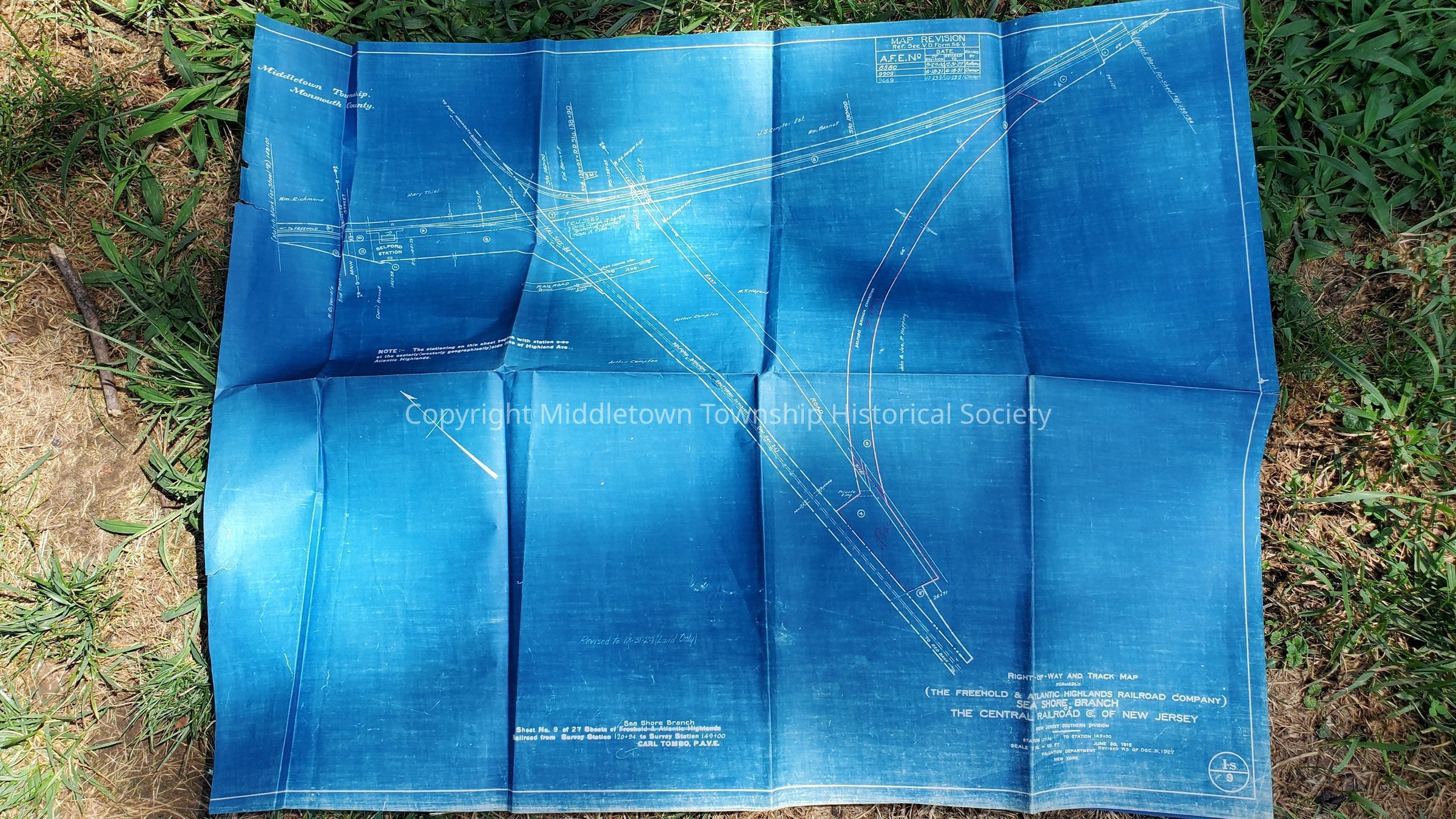
Right of Way and Track Map for Sea Shore Branch of the Central Railroad of New Jersey (shows Belford Branch Connection, Main st, East Road and Railroad Ave, 1927)
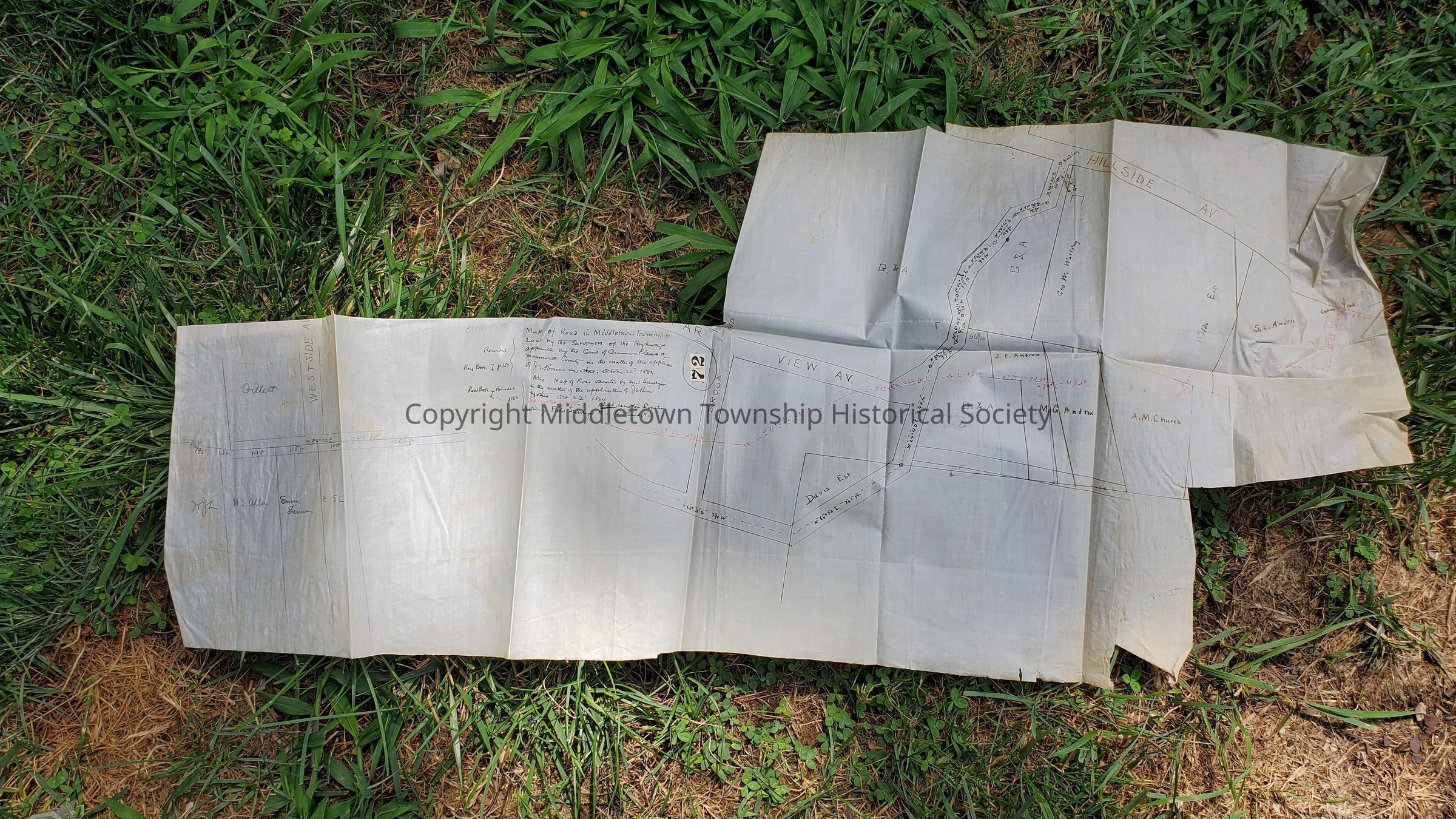
Map of Hillside section of Navesink (Hillside Ave, Far View Ave, 1884)
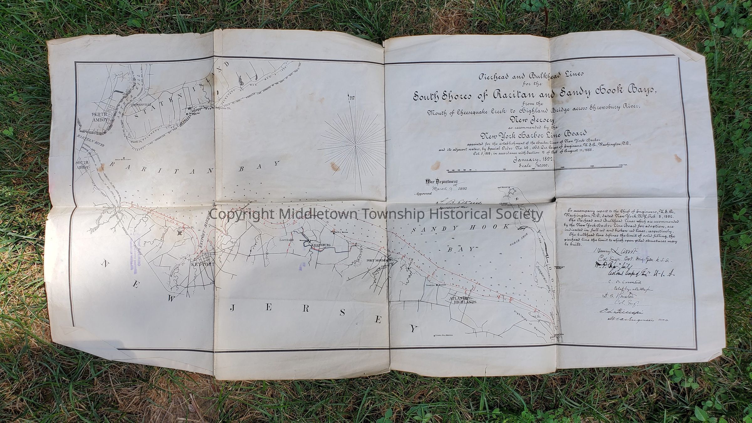
South Shores of Raritan and Sandy Hooks Bays (1892)
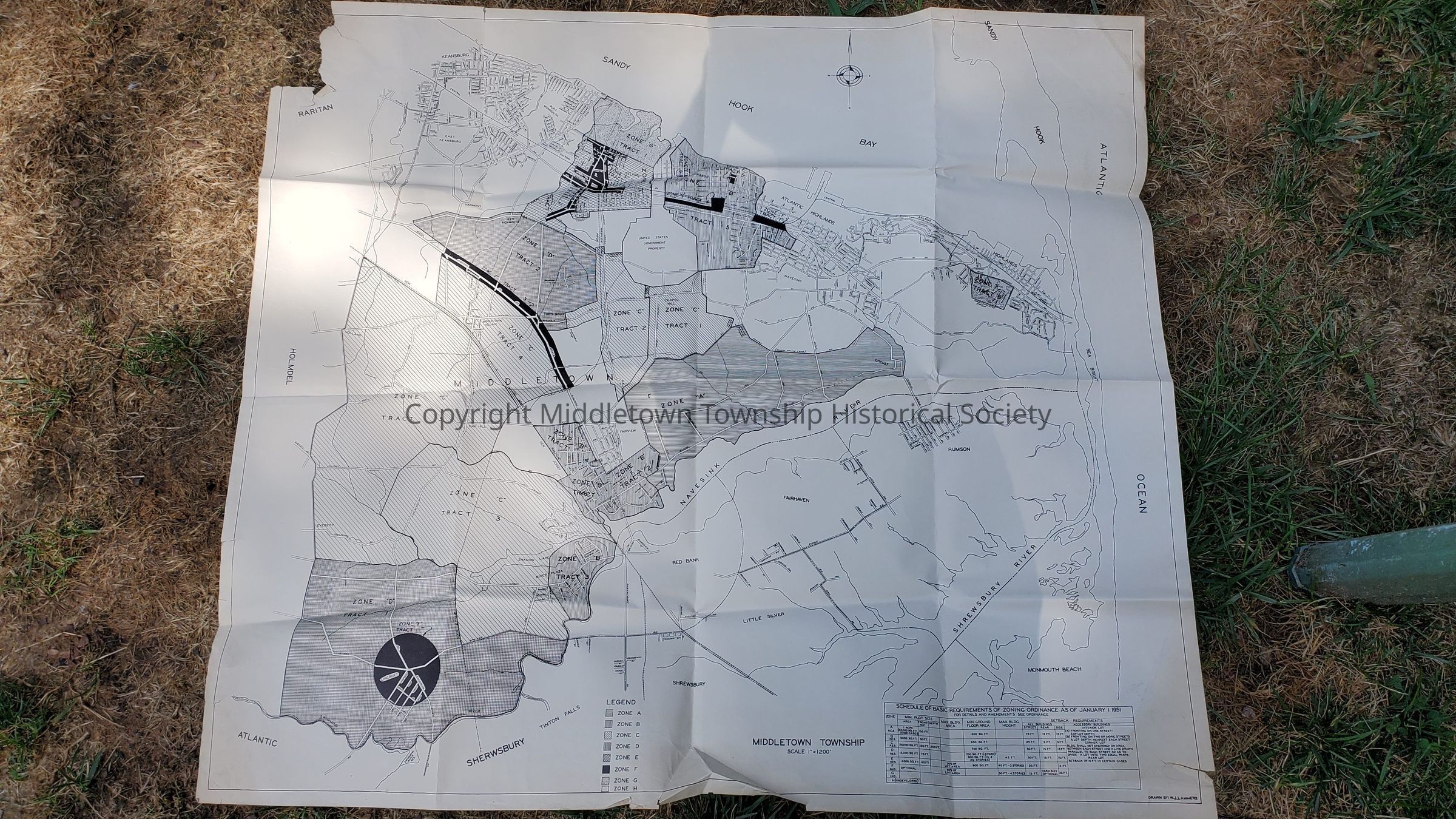
Zoning (1951)
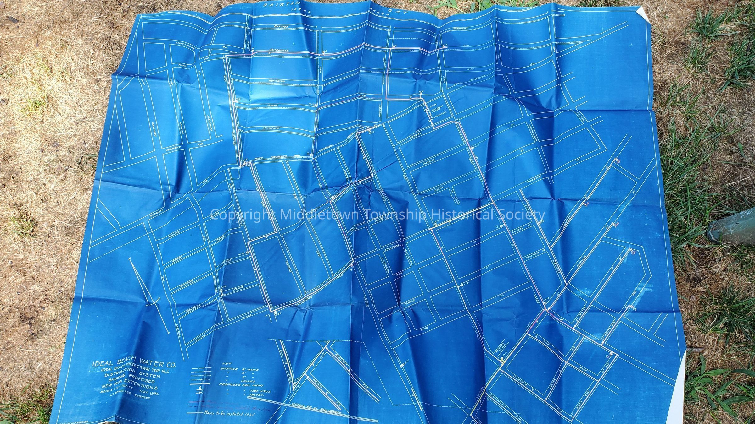
Ideal Beach Water Company (shows new mains and extensions, 1932)
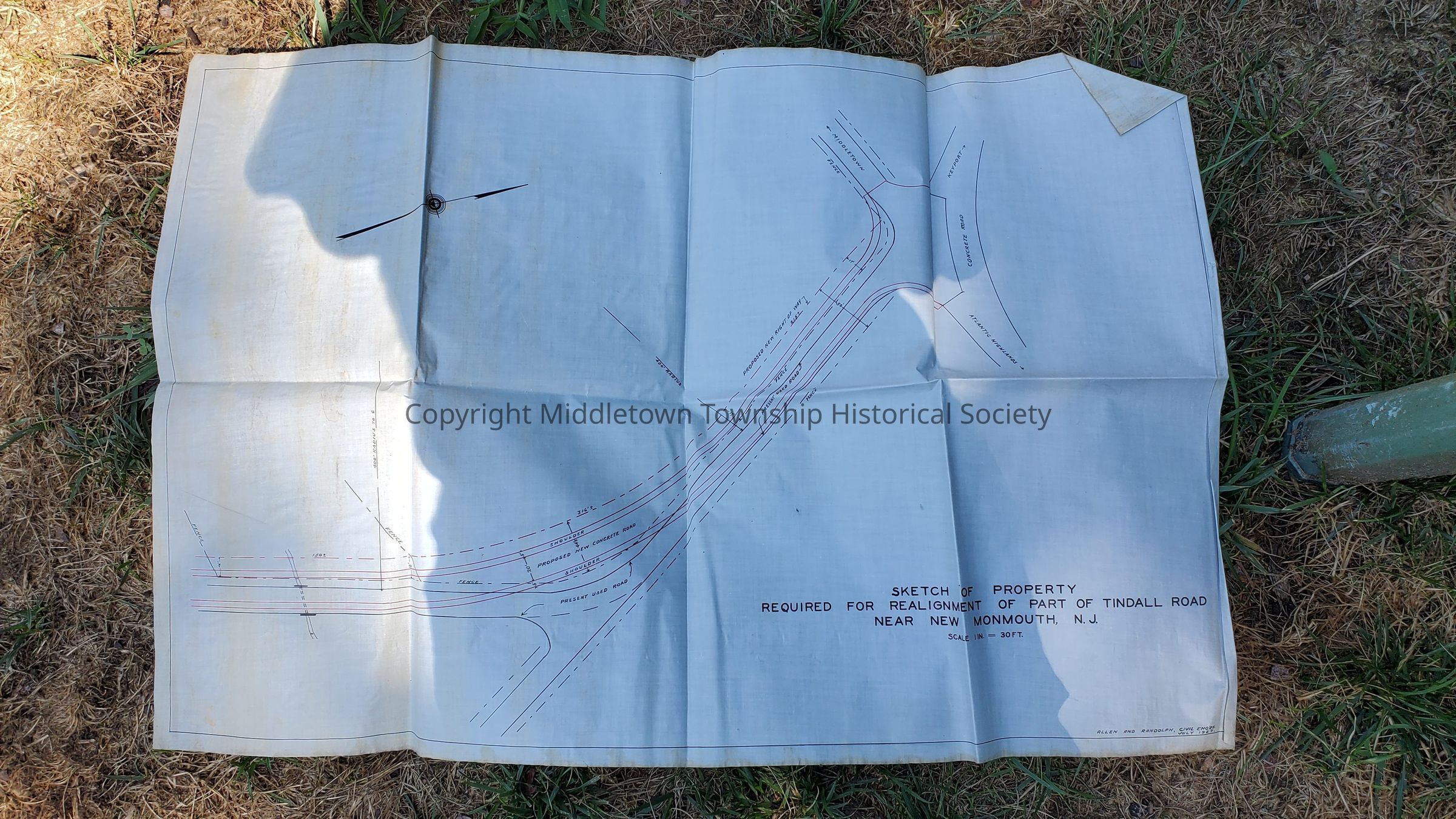
Sketch of Property for Realignment of Tindall Road (1927)
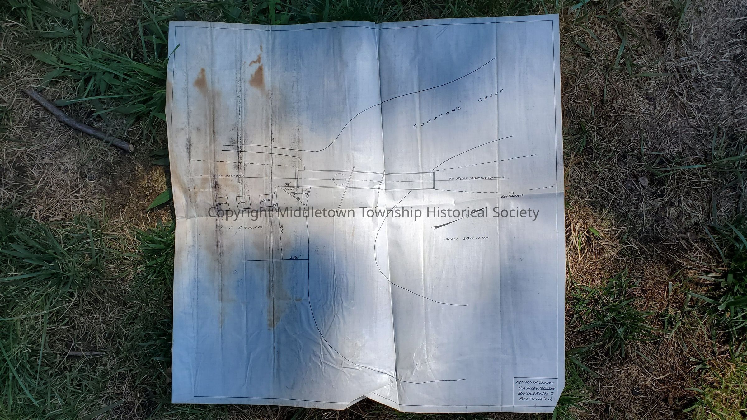
Bridge over Compton's Creek (unknown)
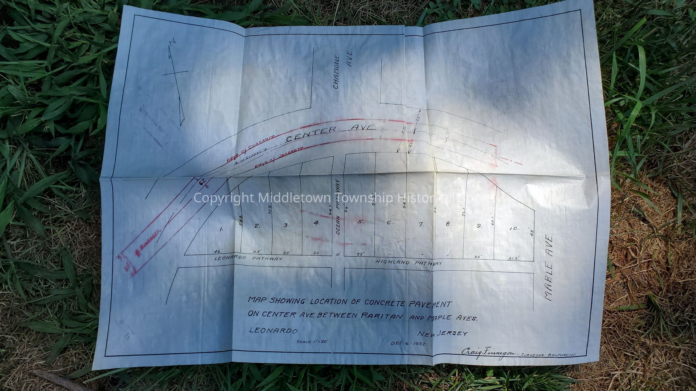
Center Ave between Raritan and Mable Avenues (Chamone Ave, 1932)
Right of Way on Tindall Road for Jersey Central Traction Company (unknown)
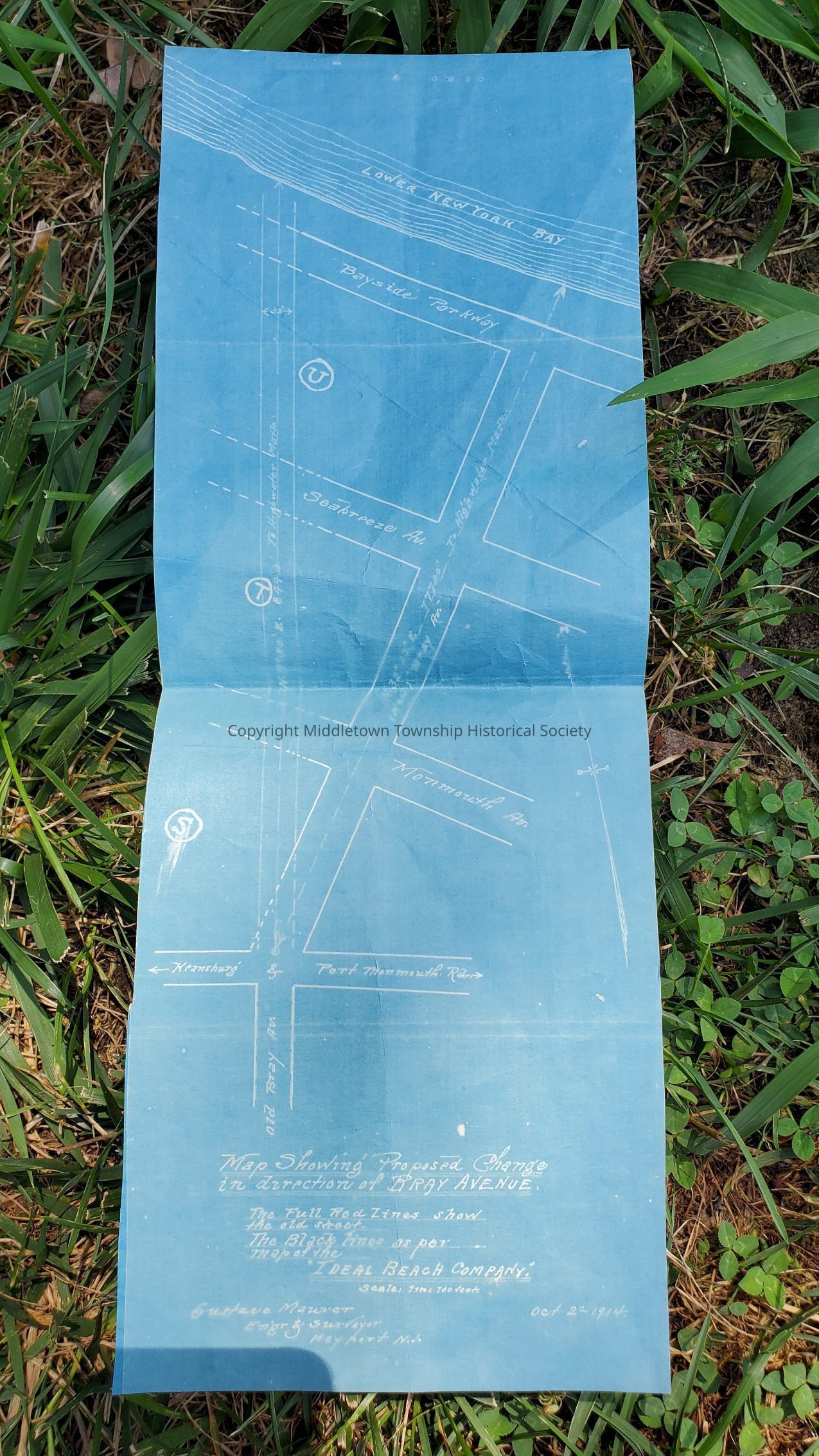
Proposed Change of Direction on Bray Ave (1914)
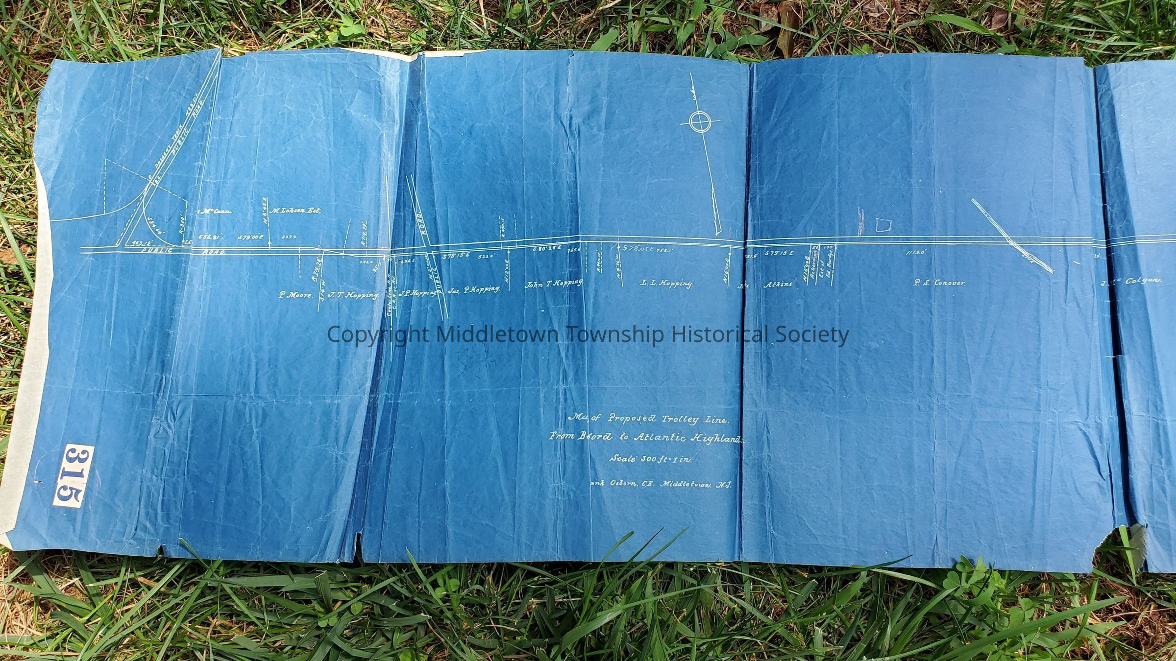
Proposed Trolley Line from Belford to Atlantic Highlands (Leonardville Road, unknown)Acquisition
Acquisition Method
GiftAcquired From
Howard W. Roberts/Law Office of Roberts, Pillsbury, & Carton