Name/Title
Charles Morford FarmScope and Content
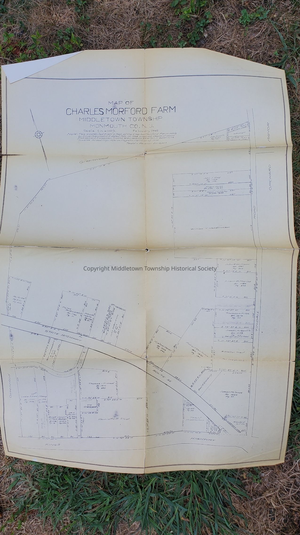
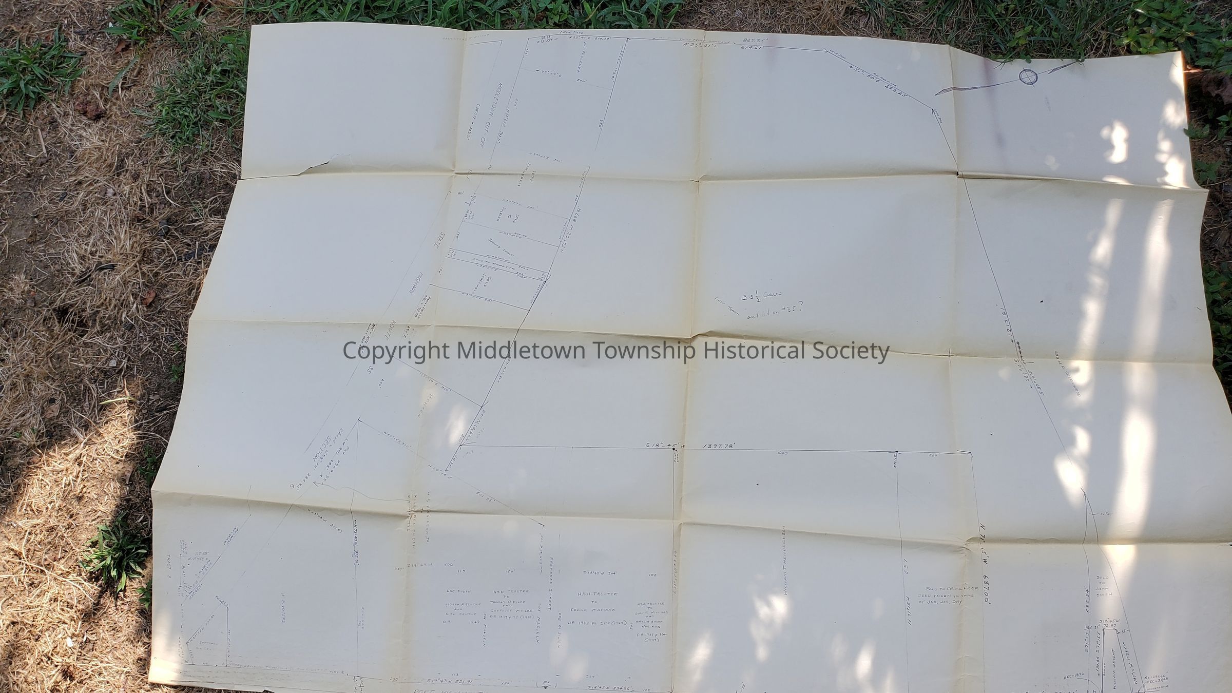
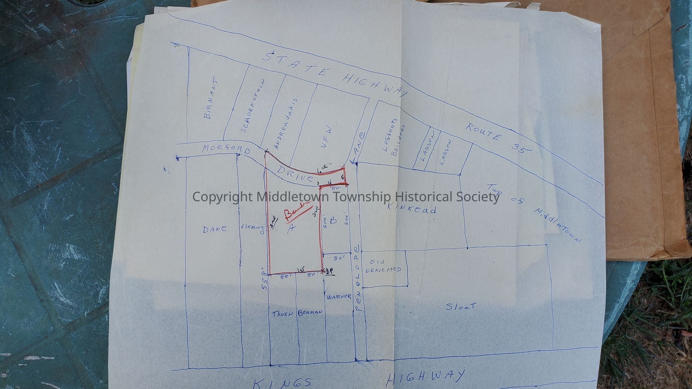
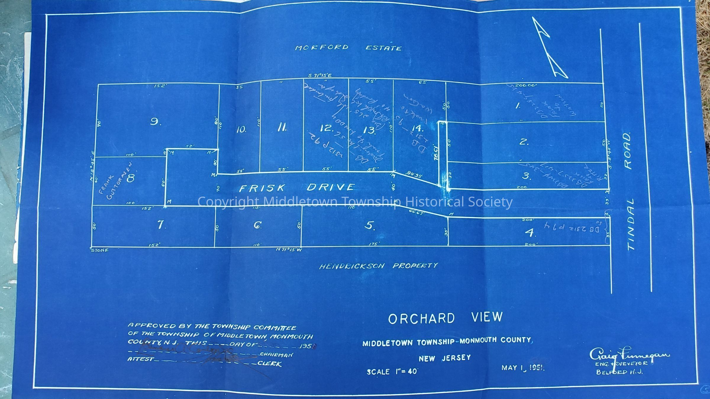
Maps from 1948 (35" x 24", 48" x 34") showing the Charles Morford Farm and Orchard View (Frisk Drive) along Tindall Road (also referred to as Port Monmouth Road), Route 35, and Kings Highway. Contains correspondence about title clean up in the 1950s and 1960s.Archive Details
Date(s) of Creation
circa 1950 - circa 1960Acquisition
Acquisition Method
GiftAcquired From
Howard W. Roberts/Law Office of Roberts, Pillsbury, & Carton