Name/Title
Lightfoot MapDescription
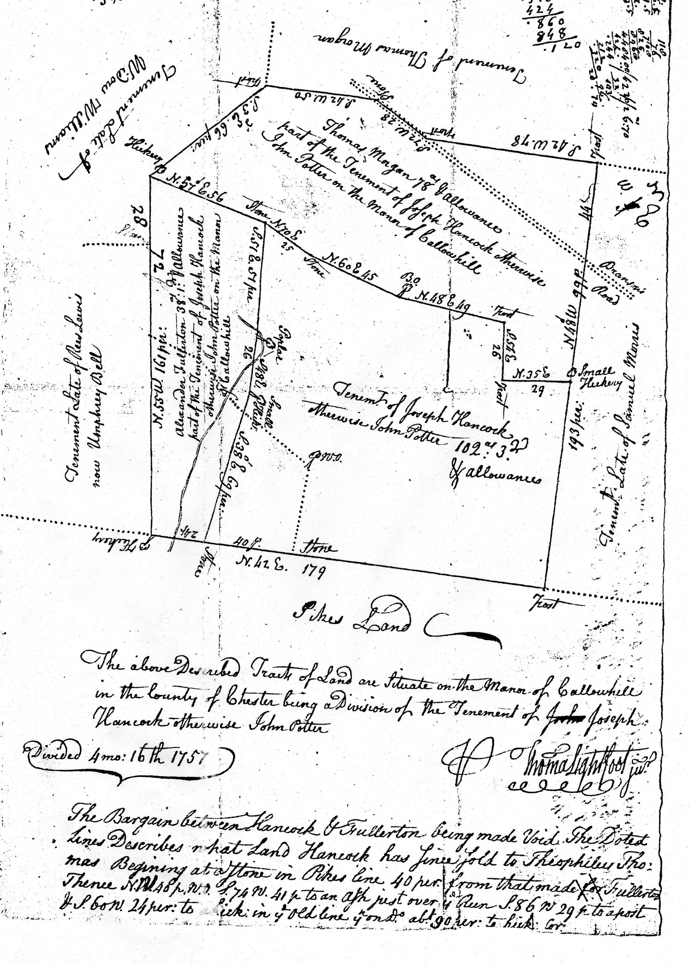
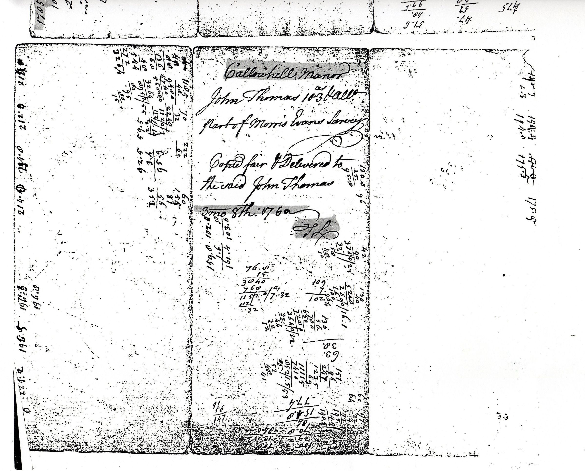
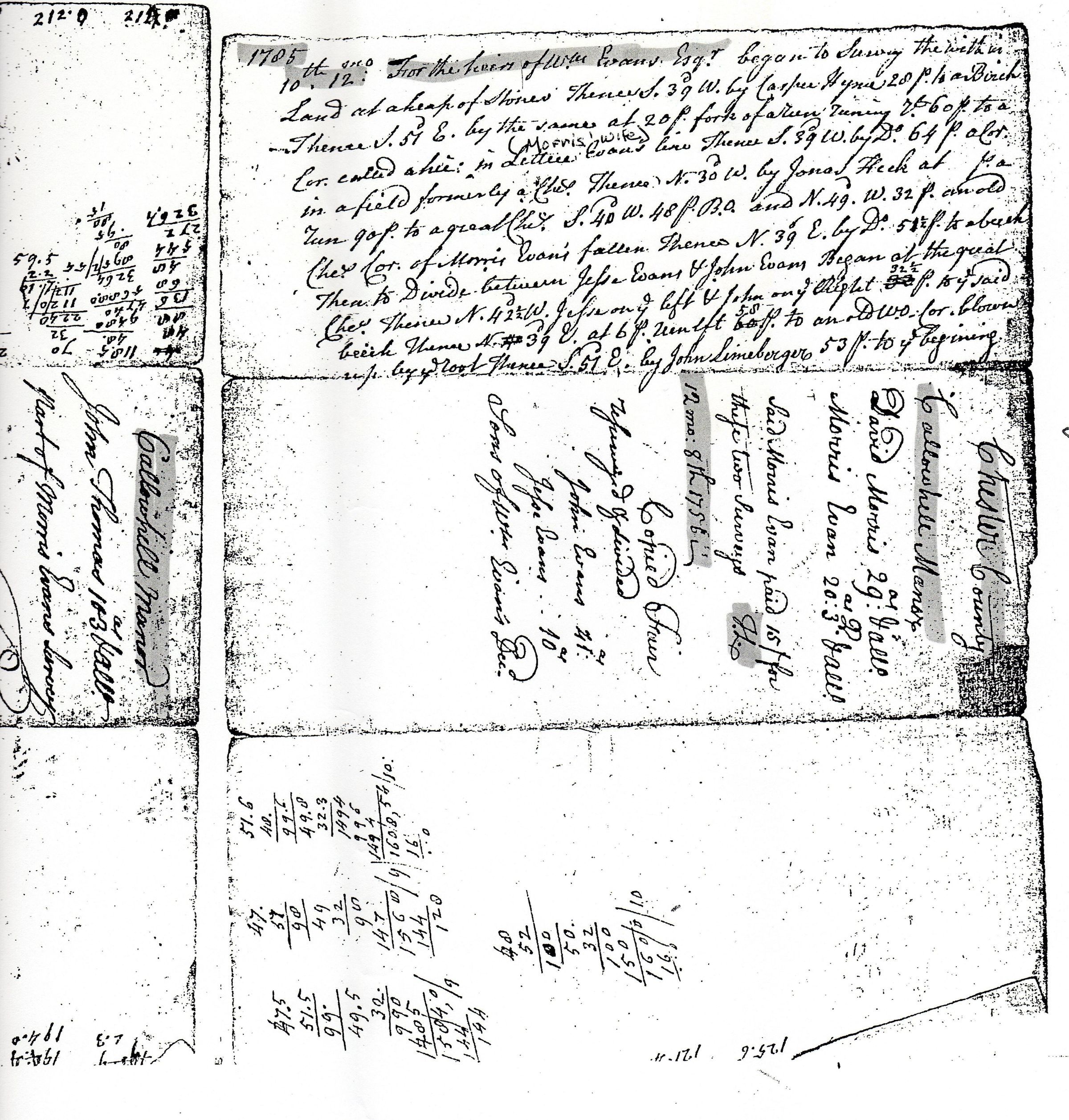
“Samuel Lightfoot was, first and foremost, an excellent surveyor. From his field books we know the he engaged in surveying from 1734 to 1771, if not earlier.
In 1737, Samuel was appointed deputy surveyor to the surveyor general of the Land Office for Lancaster County. In 1741, he was appointed deputy surveyor for both Lancaster and Chester Counties.
In 1738, Samuel was called upon by the Penn family to participated in a survey of the boundary line separating Maryland and Pennsylvania.” (D. Rollenhagen, Feb. 2016).
Samuel taught his sons Thomas and Benjamin how to survey land. Their surveys remain and were sought after and held in high regard due to the Callowhill decision which kept landowners from holding a deed. Thousands of acres were surveyed by the Lightfoot family which gave landowners credence for their property until the Penn descendants could come to an agreement. This was a process that took generations to achieve the family's rightful land title.