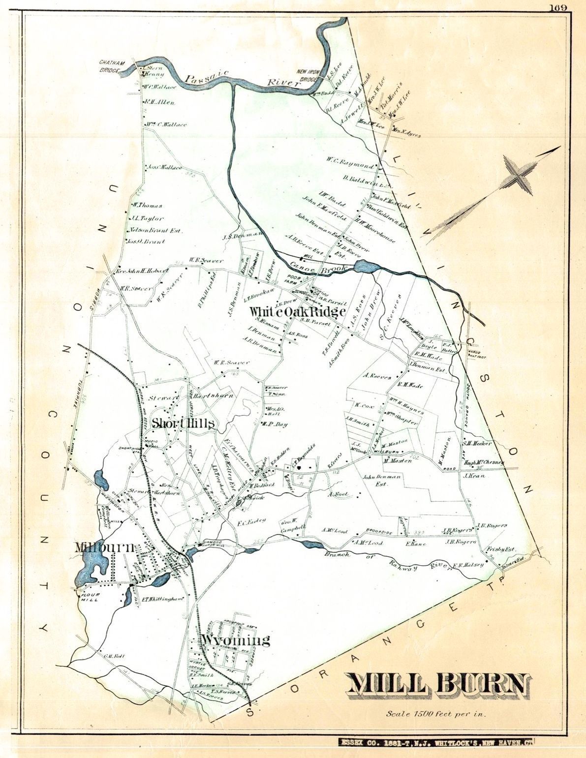
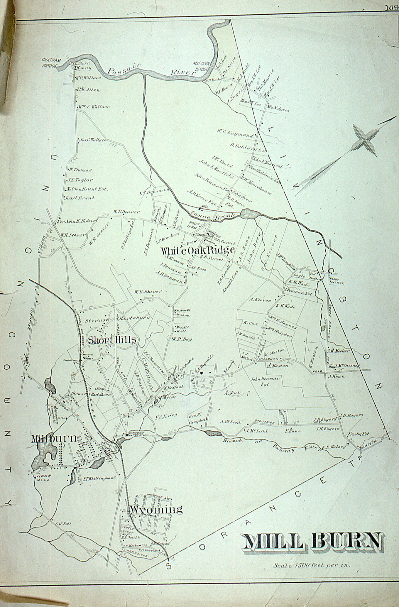
Name/Title
Map: Robinson's Atlas of Essex County, Millburn, 1881Entry/Object ID
2024.026.187Description
Photograph of an 1881 map of Millburn (incl. Short Hills, Wyoming, White Oak Ridge areas), from the 1881 Robinson Atlas of Essex County. The map is sometimes referred to as the Whitlock map, in reference to the antique map dealer from which the map was purchased.Collection
Owen Lampe SlidesAcquisition
Accession
2024.026Source or Donor
Owen LampeAcquisition Method
GiftDimensions
Height
15-1/2 inWidth
20 in