Name/Title
Map: Millburn Mills/Hat Factories Map, 1957Entry/Object ID
1976.015.003Description
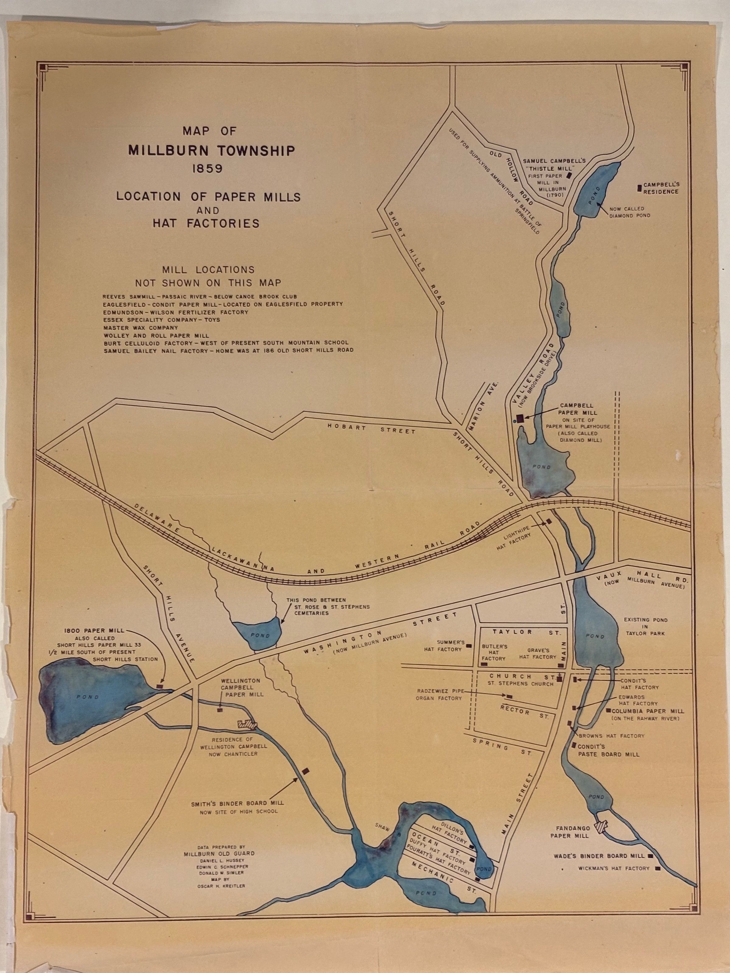
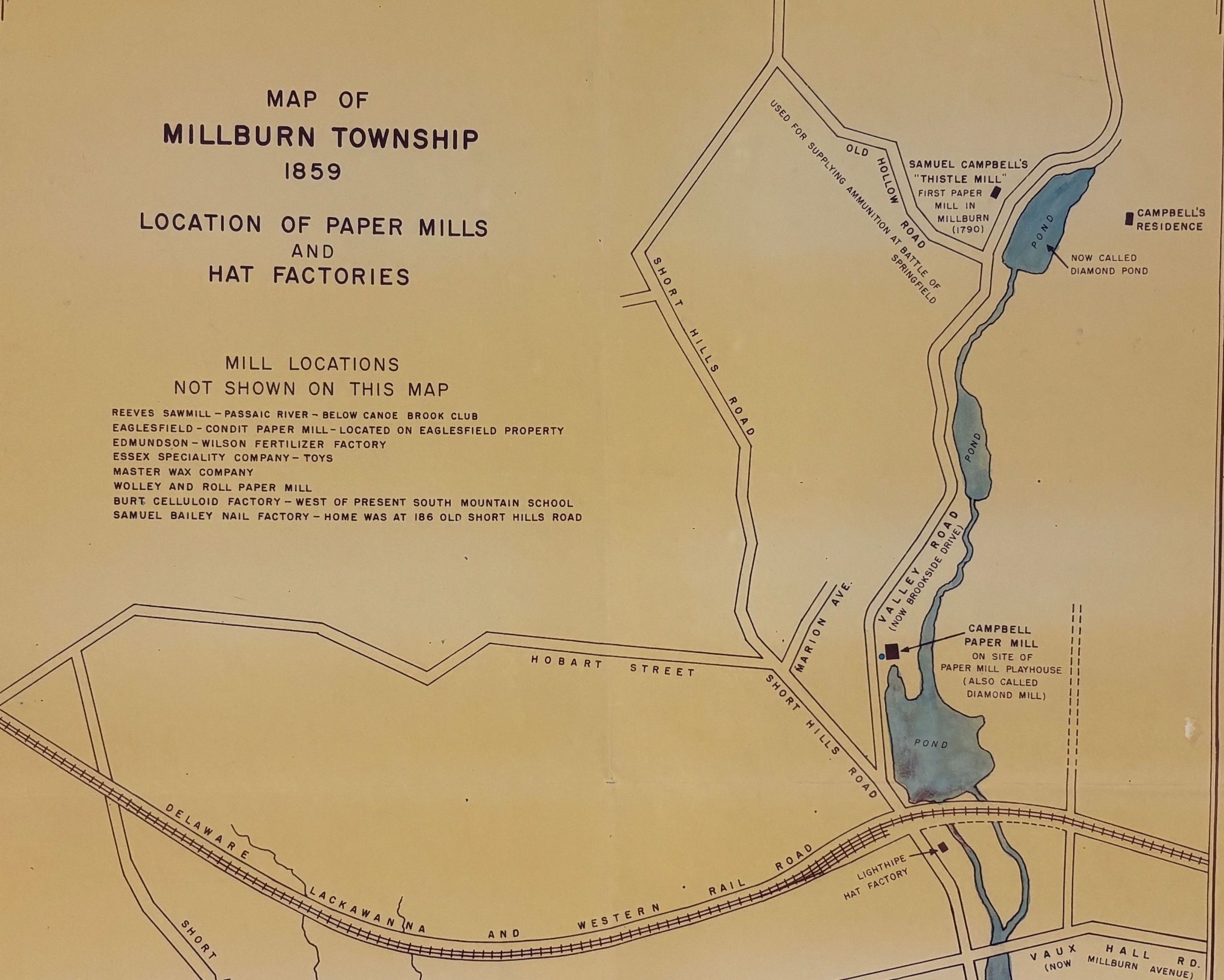
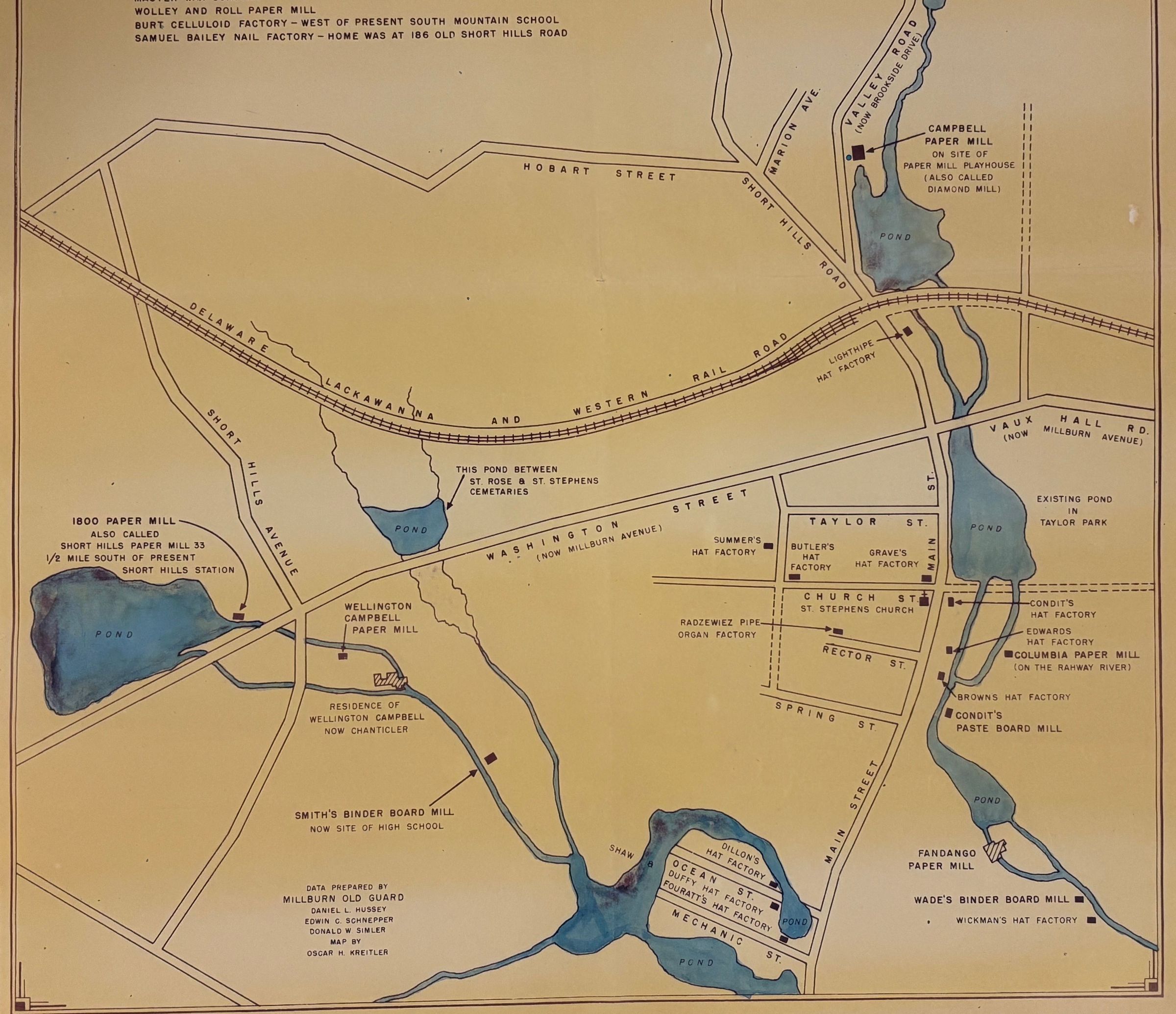
Two of these four maps (maps 1976.15.3c and 1976.15.3d) are labeled "Map of Millburn Township; 1859; Location of Paper Mills and Hat Factories." Beneath the heading is a list of eight mills or factories, labeled "Mill Locations Not Shown on This Map." At the bottom of the map is "Data Prepared by Millburn Old Guard; Daniel L. Hussey; Edwin C. Schnepper; Donald W. Simler; Map by Oscar H. Kreitler." Map 1976.15.3a has only the streets and natural resources, such as rivers and ponds -- as appear on all four maps -- but no mills or factories. Map 1976.15.3b has only the streets, etc. and penciled notations of the same information that appears on the printed mills and hat factories maps. The maps are printed in purple ink on lesser-quality paper that has yellowed considerably. Map 1976.15.3a has yellowed unevely and shows bands of darker yellowing in places. All maps have worn edges, most with minor tears (most less than 1/2") along the edges. The presumption is that the maps were prepared for an anniversay celebration, such as the town's 1957 centennial celebration or the nation's bicentennial celebration in 1976.Acquisition
Accession
1976.015Source or Donor
UnknownDimensions
Height
36-1/4 inWidth
48 in