Name/Title
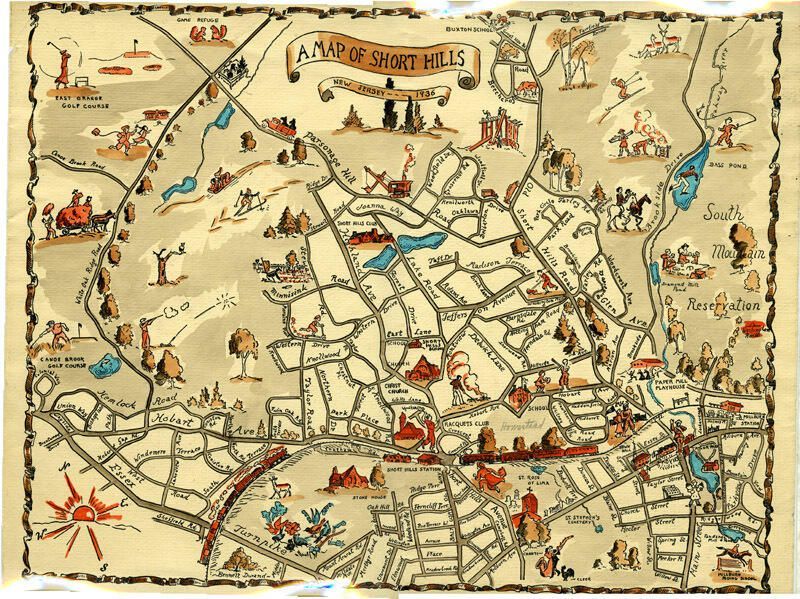
Map: 1936 Colored Map of Short HillsEntry/Object ID
2015.013.016Description
Colored (hand-colored?) print of 1936 map of Short Hills drawn by Bennett Durand. Map features figural representations of town features, such as clubs, houses of worship, schools, recreational activities, etc.. Map has edge wear, yellowing on all edges, ca. 1/4" tears along edges, vertical crease top to bottom in the center of the map, bluish color in the center back of the map, and a ca. 1" tear at the center top of the map. The lower right hand corner of the back has "Carolyn" written in pencil.Dimensions
Height
15-1/2 inWidth
12-1/4 in