Name/Title
Roselle Quadrangle Topo MapEntry/Object ID
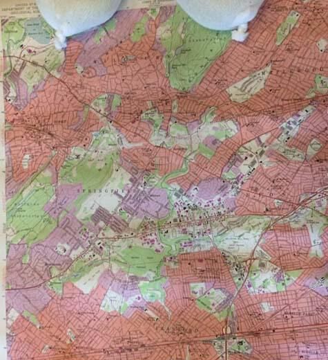
2019.025.001Description
Colored map labeled: "United States; Department of the Army; Corps of Engineers" and "United States; Department of the Interior; Geological Survey." and "Roselle Quadrangle; New Jersey; 7.5 minute series (Topographic)" and "Mapped by the Army Map Service; Edited and published by the Geological Survey; Control by USC&GS, USCE, and New Jersey Geodetic Survey; Topography from aerial photographs by photogrammetric methods; Aerial photographs taken 1942-1943. Field check 1943; Culture revised by the Geological Survey 1955; Polyconic projection. 1927 North American datum; 10,000-foot grid based on New Jersey coordinate system; 1,000-meter Universal Transverse Mercator grid ticks; zone 18, shown in blue; Red tint indicates areas in which only landmark buildings are shown; Revisions shown in purple compiled by the Geological Survey from; aerial photographs taken 1970. This information not field checked. ; Purple tint indicates extension of urban areas." and "195; Photorevised 1970" in addition to a scale reference, Road Classification, UTM grid and 1970 magnetic north declination at center of sheet. The map is clean and undamaged,Acquisition
Accession
2019.025Source or Donor
Juli TowellDimensions
Height
21-1/2 inWidth
26-3/4 in