Name/Title
Province of New Jersey Repro MapEntry/Object ID
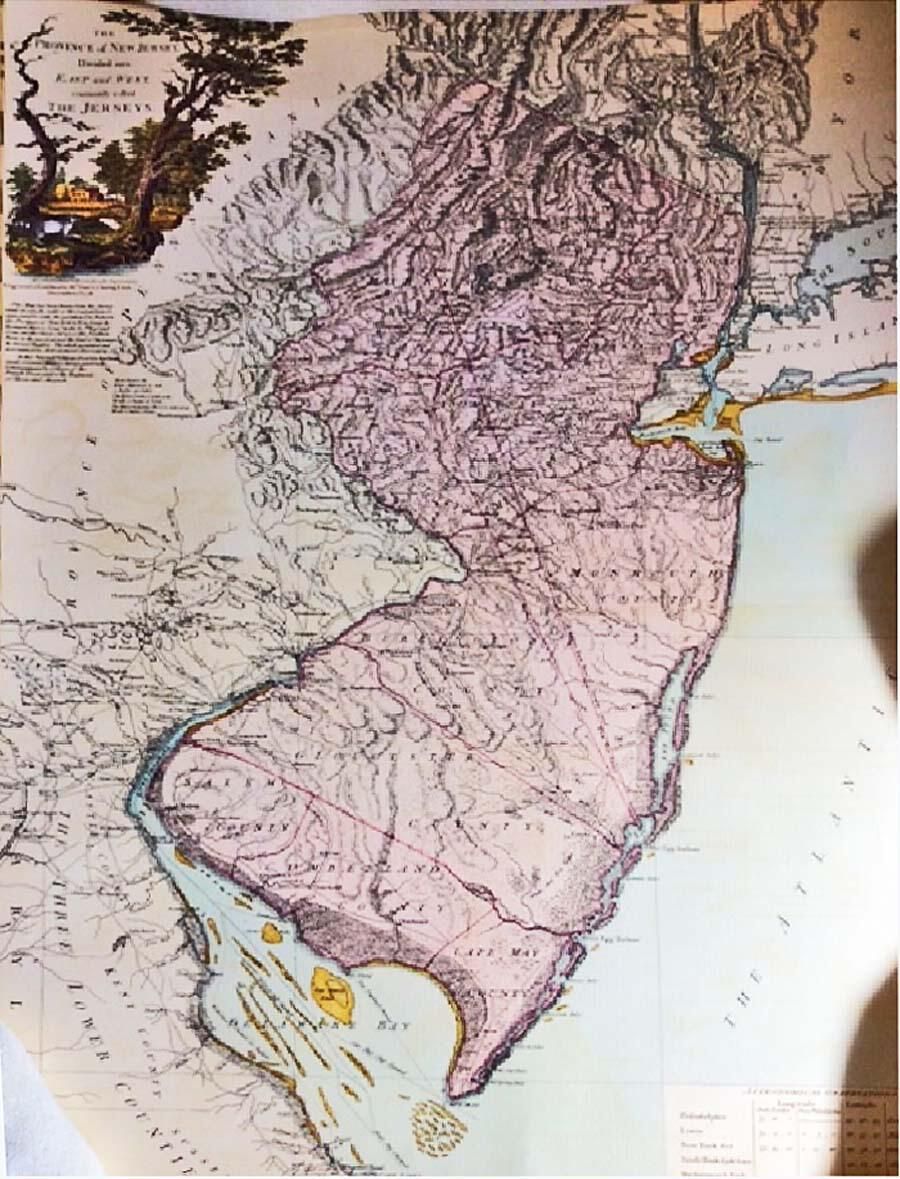
2019.025.004Description
Undated colored map labeled: "The PROVINCE of NEW JERSEY; Divided into; EAST and WEST; commonly called; THE JERSEYS." Below the title and graphic on the upper left corner is printed: "SECOND EDITION with considerable Improvements; Engraved and Publithed (sic) by Wm. FADEN, Charing Cross; December 1st, 1778" and "This map has been drawn from the Survey made in 1769 by the order of the Commissioners appointed to settle the partition Line between the Provinces of New York & New Jersey by Bernard Ratzer, Lieut. in the 60th Regt. and from another large Survey of the Northern Parts in the possession of the Earl of Dunmore by Gerard Banker. The whole regulated and ascertained by Astronomical observations. In this Second Edition Great use has been made of several Military Surveys generously Communicated by Officers of the British Troops and the Regiments of Hesse and Anspach." In the bottom right corner is a box labeled Astronomical Observations. The map is clean and undamaged, except for moderate edgewear and small creases sprinkled along the edges..Acquisition
Accession
2019.025Source or Donor
Juli TowellDimensions
Height
23-1/4 inWidth
31-3/4 in