Name/Title
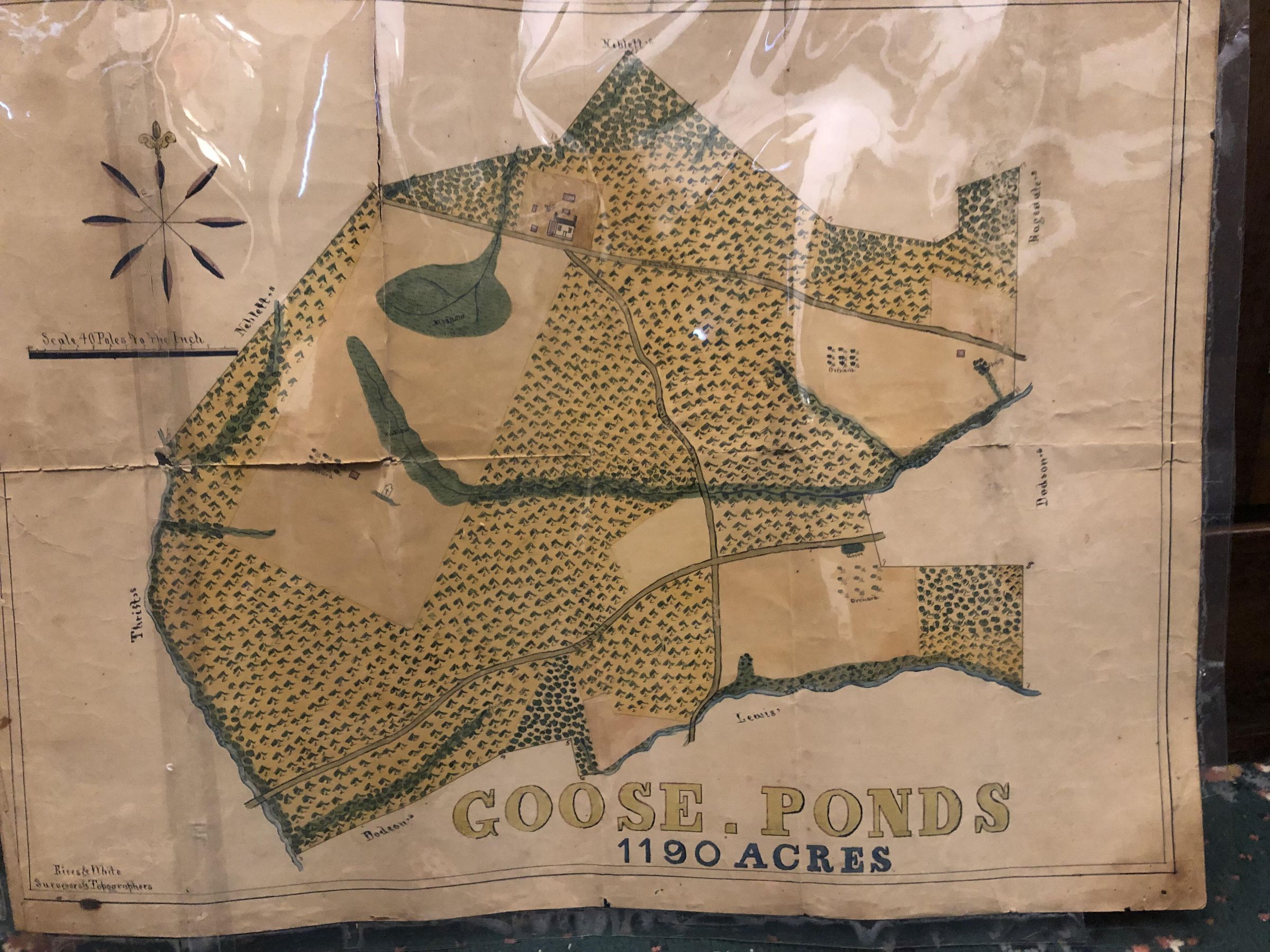
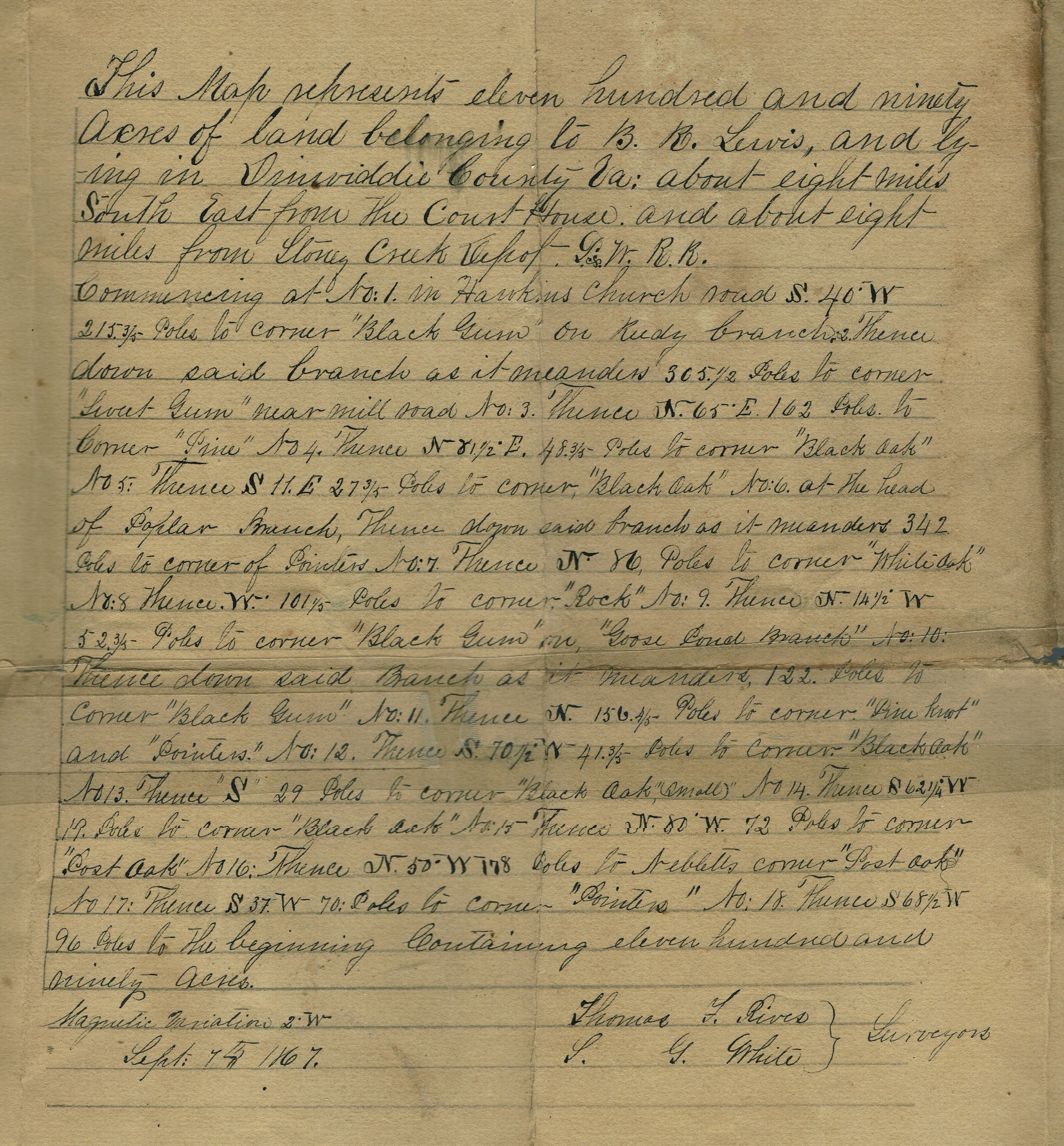
Map: Brison Map of Goose Ponds, Virginia 1867Entry/Object ID
2021.276.020Description
May of "Goose Ponds" dated September 4, 1867 from the Brison Collection. The map shows 1,190 Acres of land belonging to B.R. Lewis in Dinwiddie County, Virginia. A full description of the property and is handwritten on the back of the map and signed by the surveyors.Collection
Brison Collection