Name/Title
Battle of Springfield: Sesquicentennial Celebration Map, 1930Entry/Object ID
2010.082.001Description
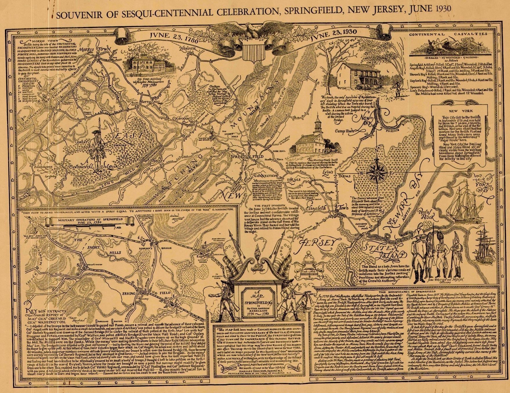
Commemorative map produced for the Sesquicentennial Celebration marking the 150th Anniversary of the Battle of Springfield in June 1930 . According to the text: the map aims to show the public the strategic position of this town and the importance of this famous battle. Be it known that authentic histories and documents have been consulted that this map may be a true record of this memorable affair. This map shows the country as it was in the year 1780 and is based on maps prepared for His Excellency General Washington which are now in the library of the New York Historical Society. Mister A.W. Hicks of Millington, with his knowledge of history of these parts has been a most valuable aid in compiling this. Designed, published and copyrighted in June 1930 by Harold C. Thomson, Summit, N.J.. Printed at the Press of the "Item" at Millburn, N.J.
The map shows New Ark, Staten Island, Morristown, Sprinfield, The Short Hills, Elizabeth Town, Connecticut Farms, Camptown, New York. It includes extracts from the report of Major General Greene to General Washington, a description of the Significance of Springfield, a listing of Continental Casualties, and illustrations of key landmarks from the period.Acquisition
Accession
2010.082Source or Donor
John MurrayAcquisition Method
Gift