HUB
Collections
Classifications
About
App
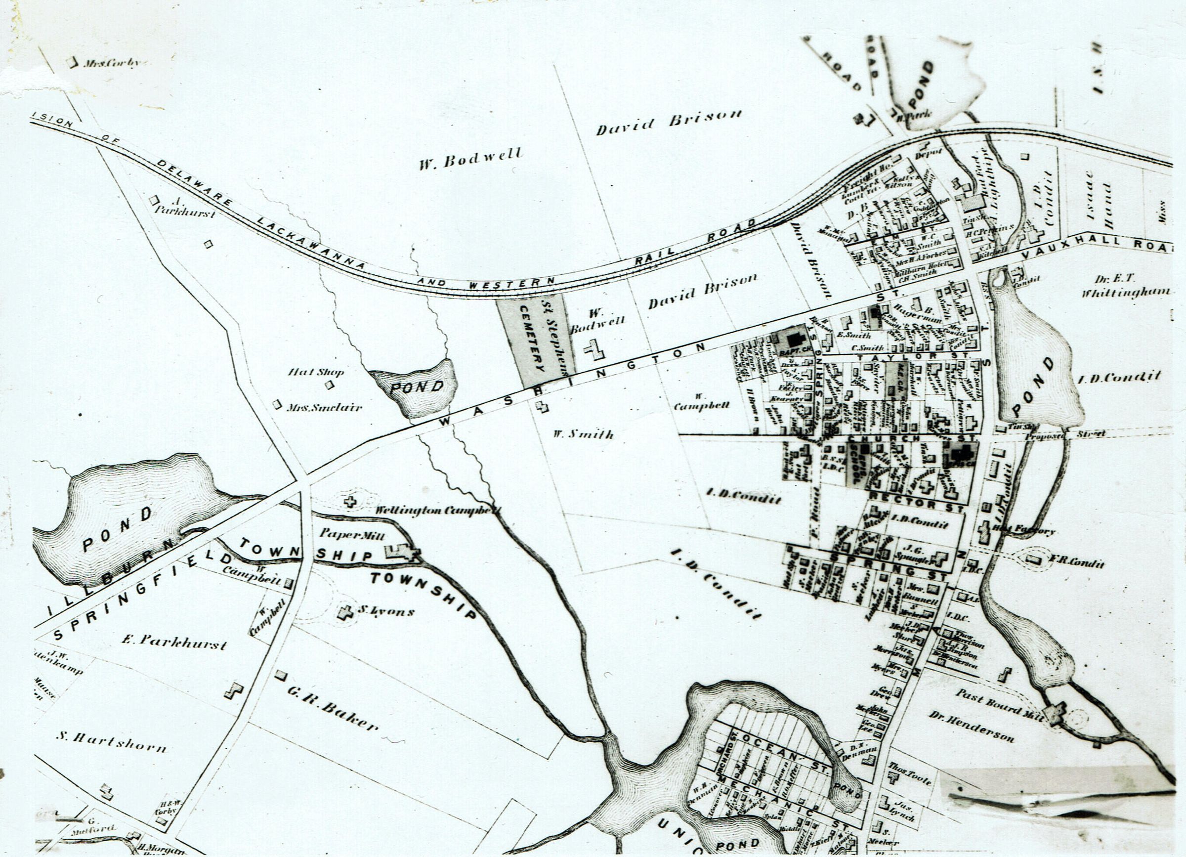
F.W. Beers State Atlas of New Jersey, 1872
Map
-
Millburn-Short Hills Historical Society
Image Id # 335
Name/Title
F.W. Beers State Atlas of New Jersey, 1872
Description
Map Covering Millburn Center from north of the railroad tracks, south to Springfield and from Morris Turnpike on the west to near present day Holm Street on the east.
Collection
Centennial Collection
Dimensions
Dimension Description
3 1/8 x 4 3/8" print, 3 1/8 x 4 3/8" negative