Name/Title
1938 Crabapple Aerial PhotoEntry/Object ID
2022.3.1Description
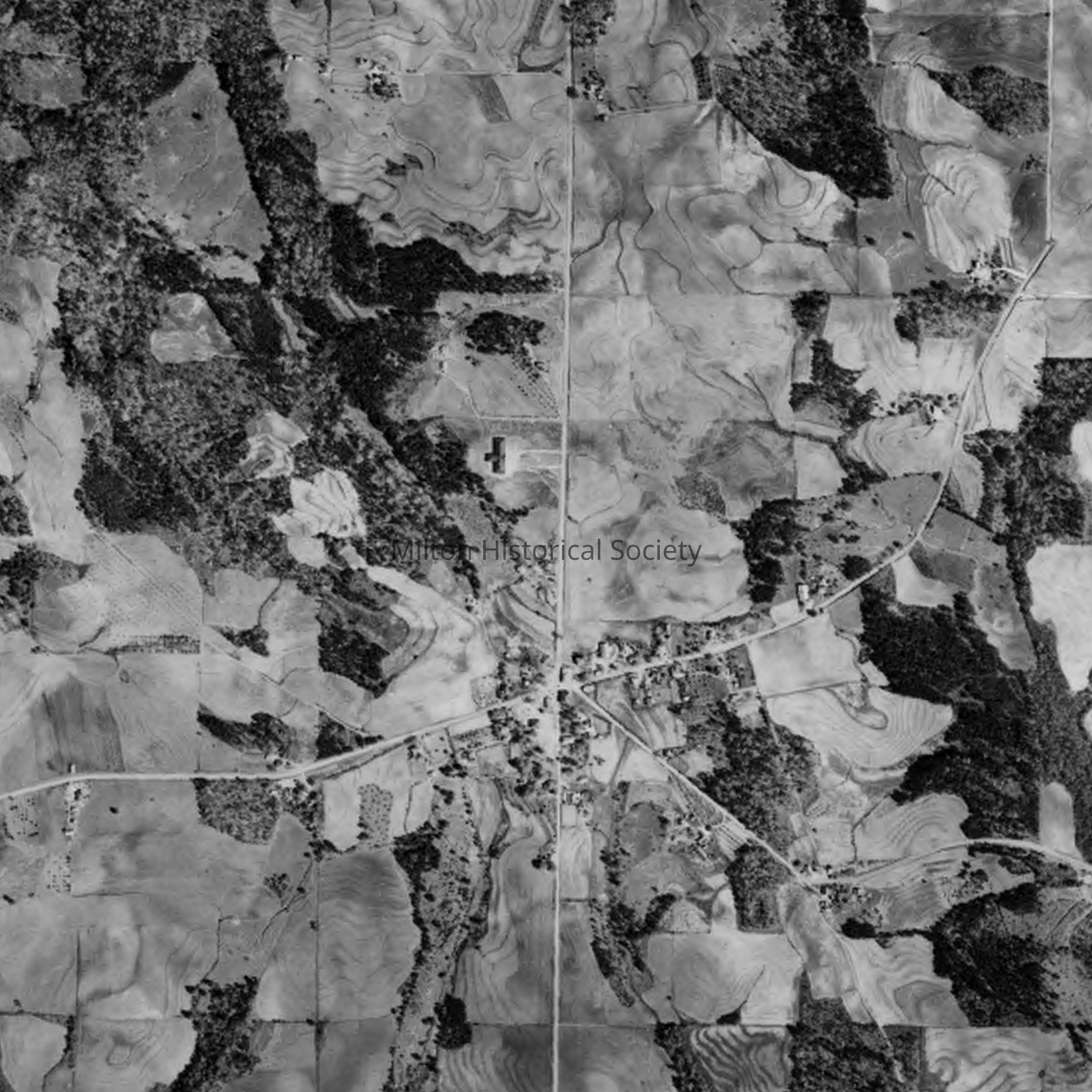
Black and white digital aerial photograph of the main intersection of roads in Crabapple in 1938.Context
Milton's agricultural past is on full display as there are primarily fields and few structures in the frame. The few buildings present are mostly center frame at the intersection of Mayfield, Broadwell, Mid Broadwell and Crabapple Roads forming historic Crabapple. Broadwell runs due north/south. Mayfield from center to the northeast. Mid Broadwell from center to the southeast. Crabapple from the center to the west. Some of the roofs of historic buildings that can be seen are the Reese House (c1912), the John B. Broadwell House (remodeled in 1913), Rucker Cotton Gin (c1930), Broadwell building (c1837, Crabapple Baptist Church (1892). The photo is copyrighted. The right to use/view only via the Society site has been granted by Historical Aerial Photos / NETRonline.comCollection
Kathy and Philip BeckAcquisition
Accession
2022.3Source or Donor
Kathy BeckAcquisition Method
Digital Donation