Name/Title
MapEntry/Object ID
2012.09.18Scope and Content
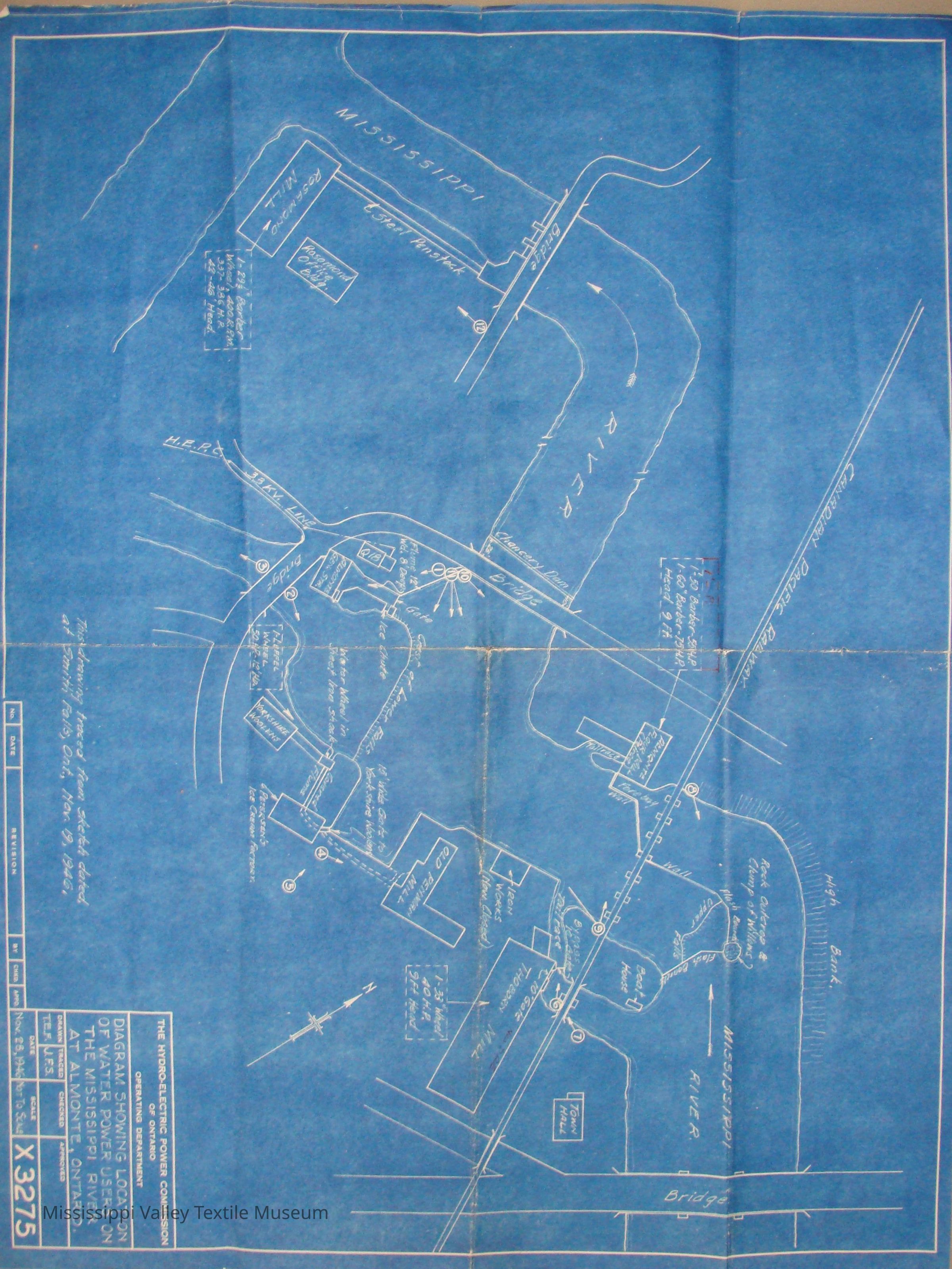
Diagram showing location of water power users on the Mississippi River at Almonte, ON. Prepared by Hydro-Electric Commision of Ontario. Created on November 25, 1946..Collection
AlmonteCataloged By
Moxley, MatthewLexicon
Nomenclature 4.0
Nomenclature Secondary Object Term
MapNomenclature Primary Object Term
CartographNomenclature Sub-Class
Graphic DocumentsNomenclature Class
Documentary ObjectsNomenclature Category
Category 08: Communication ObjectsLOC Thesaurus for Graphic Materials
Maps, Water powerSearch Terms
AlmonteArchive Details
Date(s) of Creation
Nov 25, 1946Archive Notes
Date(s): 1946Location
Location
Container
Protective Plastic SheetingShelf
Shelf 107Room
Collections RoomBuilding
M.V.T.M.Category
PermanentDate
November 7, 2023Location
Container
Protective Plastic SheetingShelf
Shelf 8, Shelf 8Room
Collections RoomBuilding
M.V.T.M.Category
PermanentMoved By
Whit, ElizabethDate
June 29, 2016Location
Shelf
II-3, II-3Room
Collections RoomBuilding
M.V.T.M.Category
PermanentMoved By
Moxley, MatthewDate
September 20, 2012General Notes
Note
Status: OK
Status By: Moxley, Matthew
Status Date: 2012-09-20Created By
admin@catalogit.appCreate Date
September 20, 2012Updated By
admin@catalogit.appUpdate Date
November 12, 2023