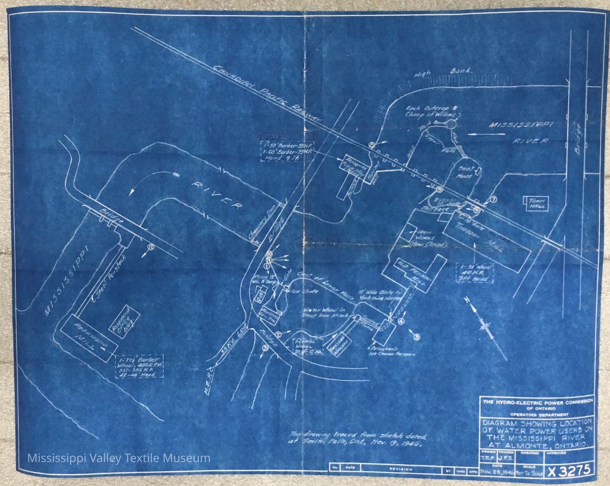
Name/Title
Diagram showing location of water power users on the Mississippi River at Almonte Ontario.Entry/Object ID
2021.11.04Description
Copy of accessioned blueprint 2012.09.18 created by the Hydro-Electric Power Commission showing the diagram of water power users on the Mississippi River.Collection
DocumentCataloged By
Deanna FosterMade/Created
Artist
The Hydro-Electric Power Commission of OntarioLexicon
Nomenclature 4.0
Nomenclature Secondary Object Term
BlueprintNomenclature Primary Object Term
Copy, ReprographicNomenclature Sub-Class
Other DocumentsNomenclature Class
Documentary ObjectsNomenclature Category
Category 08: Communication ObjectsDimensions
Dimension Notes
55.5 cm X 42.5 cmLocation
Location
Shelf
Shelf 126Room
Collections RoomBuilding
M.V.T.M.Category
PermanentDate
November 7, 2023Location
Building
Collections Room: Shelf 83Category
PermanentLocation
Shelf
Shelf 83, Shelf 83Room
Collections RoomBuilding
M.V.T.M.Category
PermanentGeneral Notes
Note
Notes: This blueprint is a copy of accessioned diagram 2012.09.18
Status: OK
Status By: Cotter, Ellen
Status Date: 2022-06-14Created By
admin@catalogit.appCreate Date
September 22, 2021Updated By
admin@catalogit.appUpdate Date
November 11, 2023