Name/Title
Mississippi River Valley Historical System Plan Study; by Graham MacDonald; July 1975; Study Conducted Under the Auspices of The Ministry of Culture and Recreation For The Ministry of Natural Resources Easternh Regional OfficeEntry/Object ID
2014.07.01Scope and Content
A 120 page document investigating the history of Lanark County's Mississippi River Valley systems. Pages labled 1 - 120
Transcription :
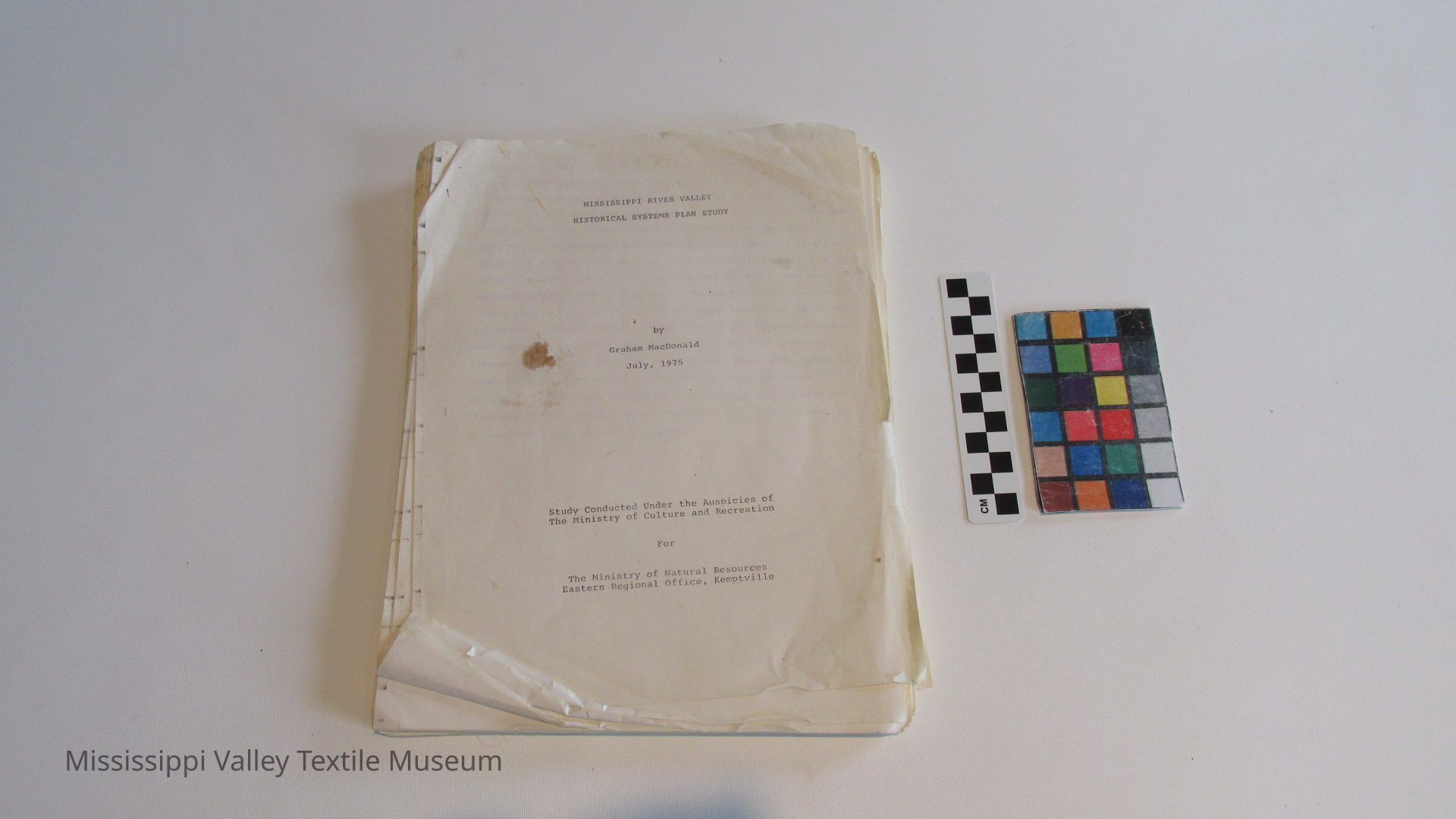
MISSISSIPPI RIVER VALLEY
HISTORICAL SYSTEMS PLAN STUDY
by
Graham MacDonald
July, 1975
Study Conducted Under the Auspicies of
The Ministry of Culture and Recreation
For
The Ministry of Natural Resources Eastern Regional Office, Kemptville
[2]
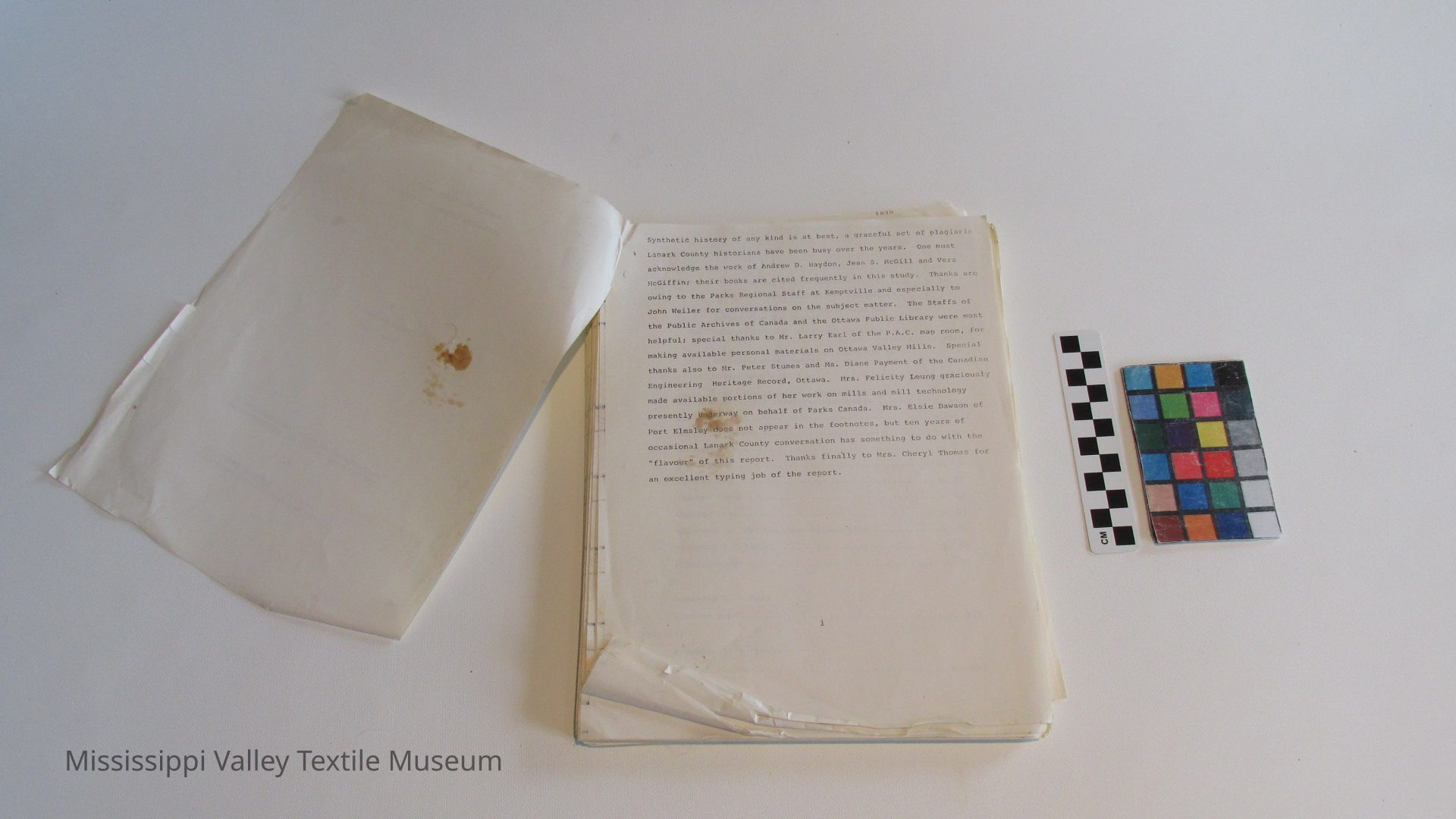
Synthetic history of any kind is at best, a graceful act of plagiaris Lanark County historians have been busy over the years. One must acknowledge the work of Andrew D. Haydon, Jean S. McGill and Vera McGiffin; their books are cited frequently in this study. Thanks arc owing to the Parks Regional Staff at Kemptville and especially to John Weiler for conversations on the subject matter. The Staffs of the Public Archives of Canada and the Ottawa Public Library were most helpful; special thanks to Mr. Larry Earl of the P.A.C. map room, for making available personal materials on Ottawa Valley Mills. Special thanks also to Mr. Peter Stumes and Ms. Diane Payment of the Canadian Engineering Heritage Record, Ottawa. Mrs. Felicity Leung graciously made available portions of her work on mills and mill technology presently underway on behalf of Parks Canada. Mrs. Elsie Dawson of Port Elmsley does not appear in the footnotes, but ten years of occasional Lanark County conversation has something to do with the "flavour" of this report. Thanks finally to Mrs. Cheryl Thomas for an e-xcellent typing job of the report.
[3]
Vol. I
Acknowledgements p. i
Contents p. ii
Section I: Planning Recommendations p. iv
(a) Results of Site Evaluation. Condensation... p. iv
(b) Sites and Zones to be considered for future site evaluation p. iv
(c) Related historic site work by other agencies p. viii
(d) Important related recreation zones in the Mississippi Valley p. ix
(e) Planning Proposals : p. xi
Section II: The Mississippi River Valley: A Nineteenth Century Industrial Landscape p. xii
Abstract p. xiii
Maps and Figures p. xiv
Section III: p. 1
Chapter 1 e p. 12
Chapter 2 o p. 33
Chapter 3 ree p. 45
Chapter 4 ur p. 63
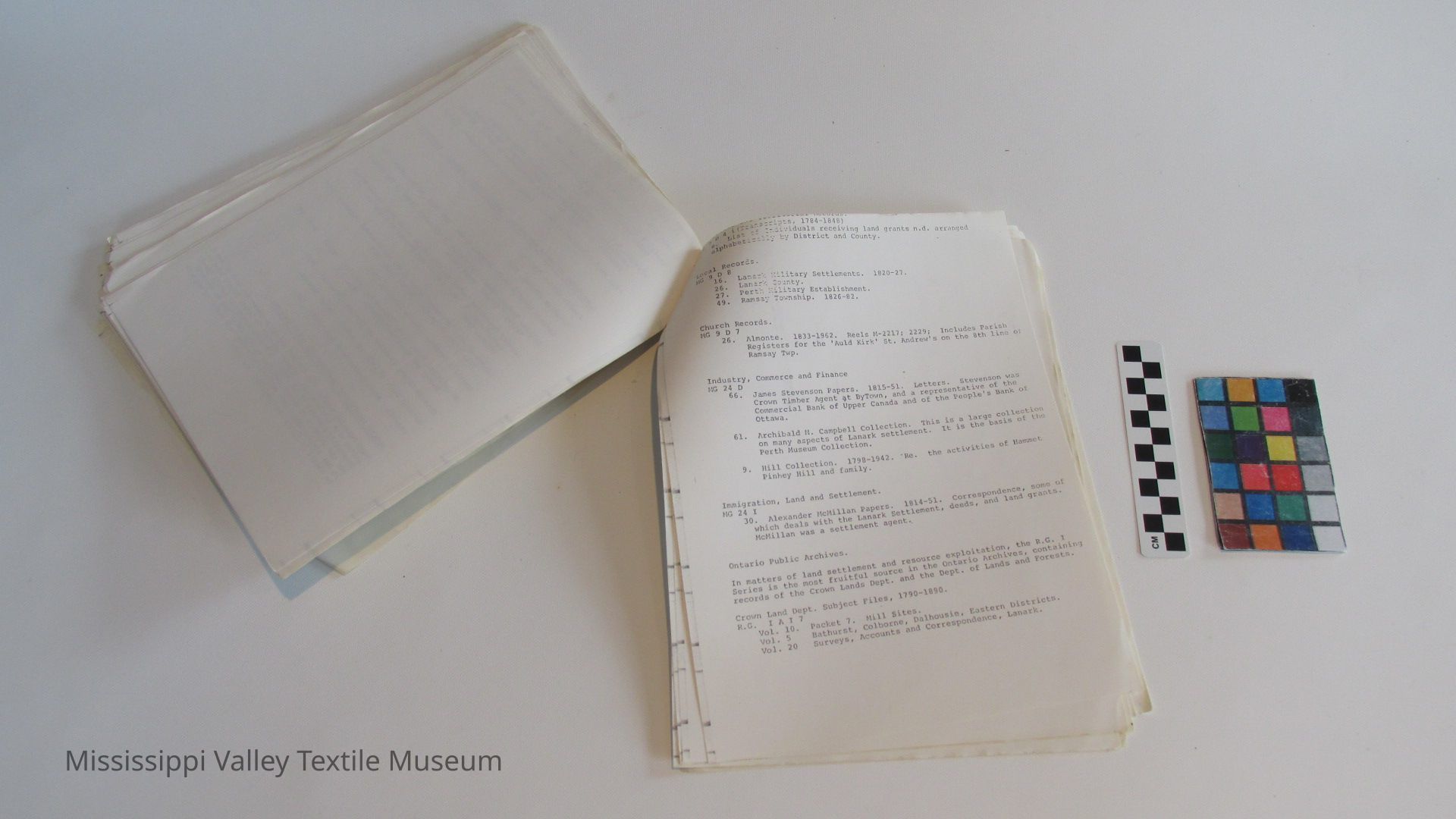
Appendix 1. The Gillies- Herron Site p. 70
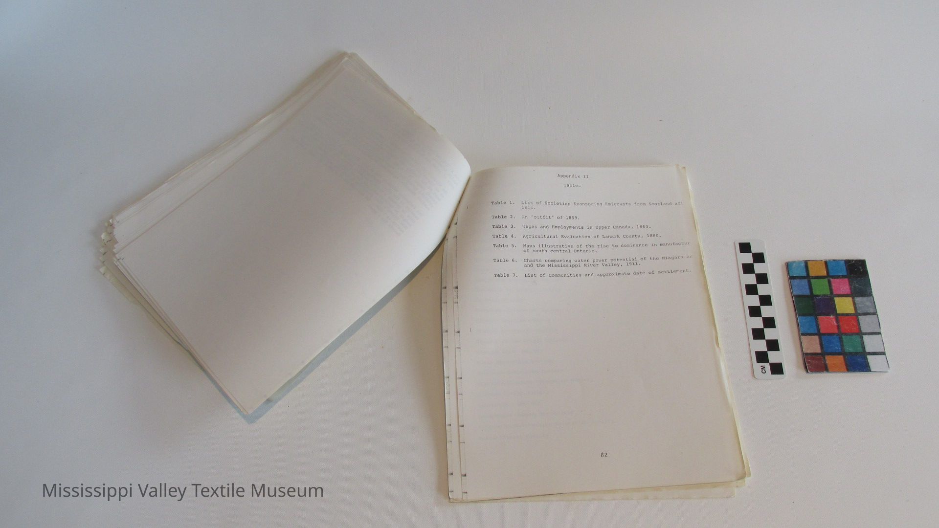
Appendix 2. Tables p. $2
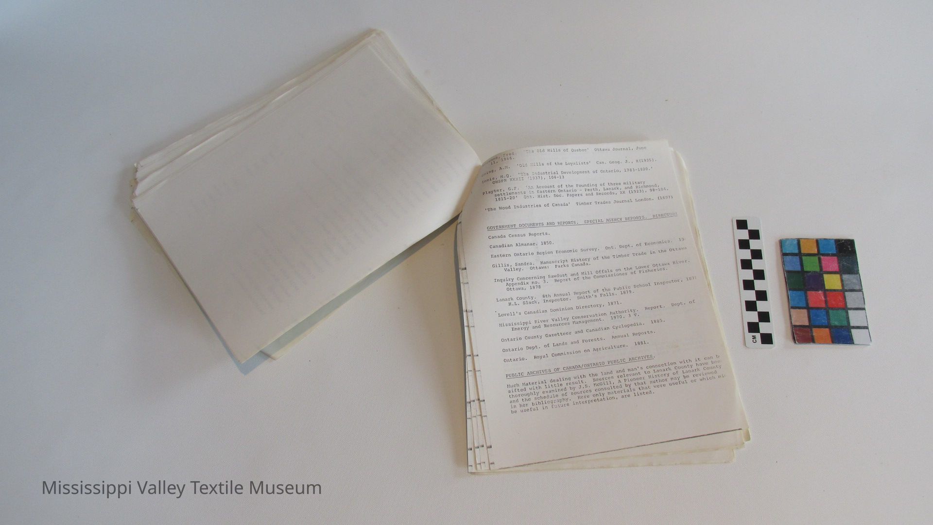
Bibliography p. 97
Vol. II
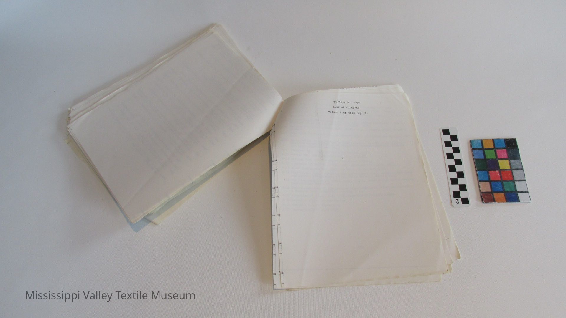
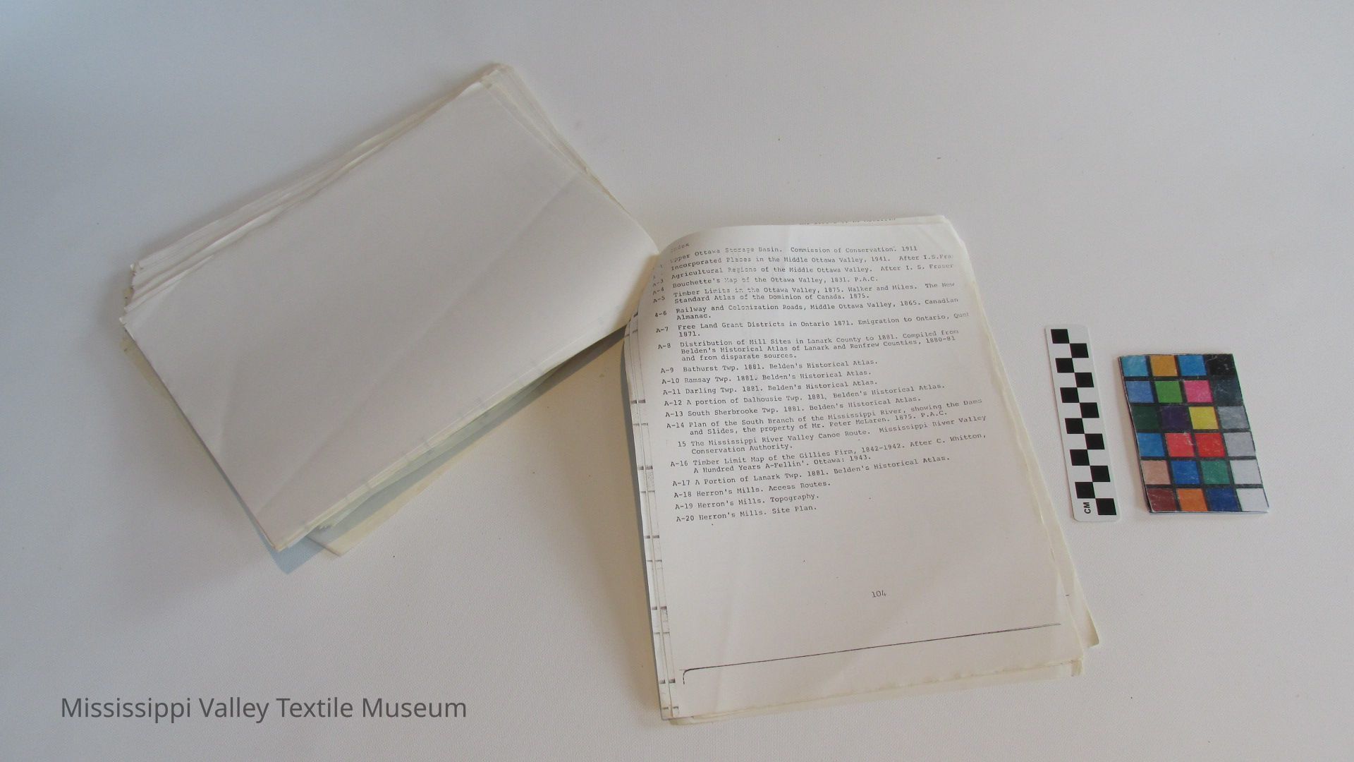
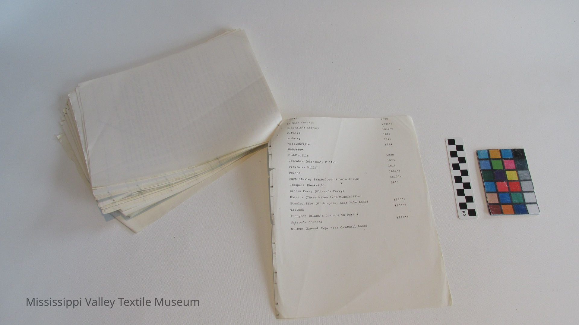
Appendix A. - Maps
List of maps p. 103
Vol. Ill
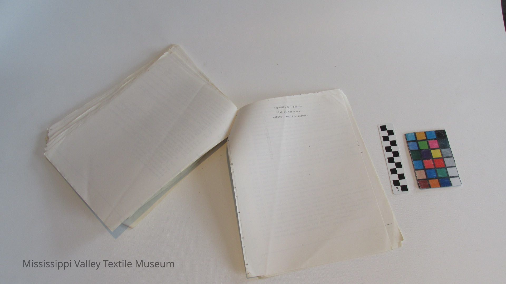
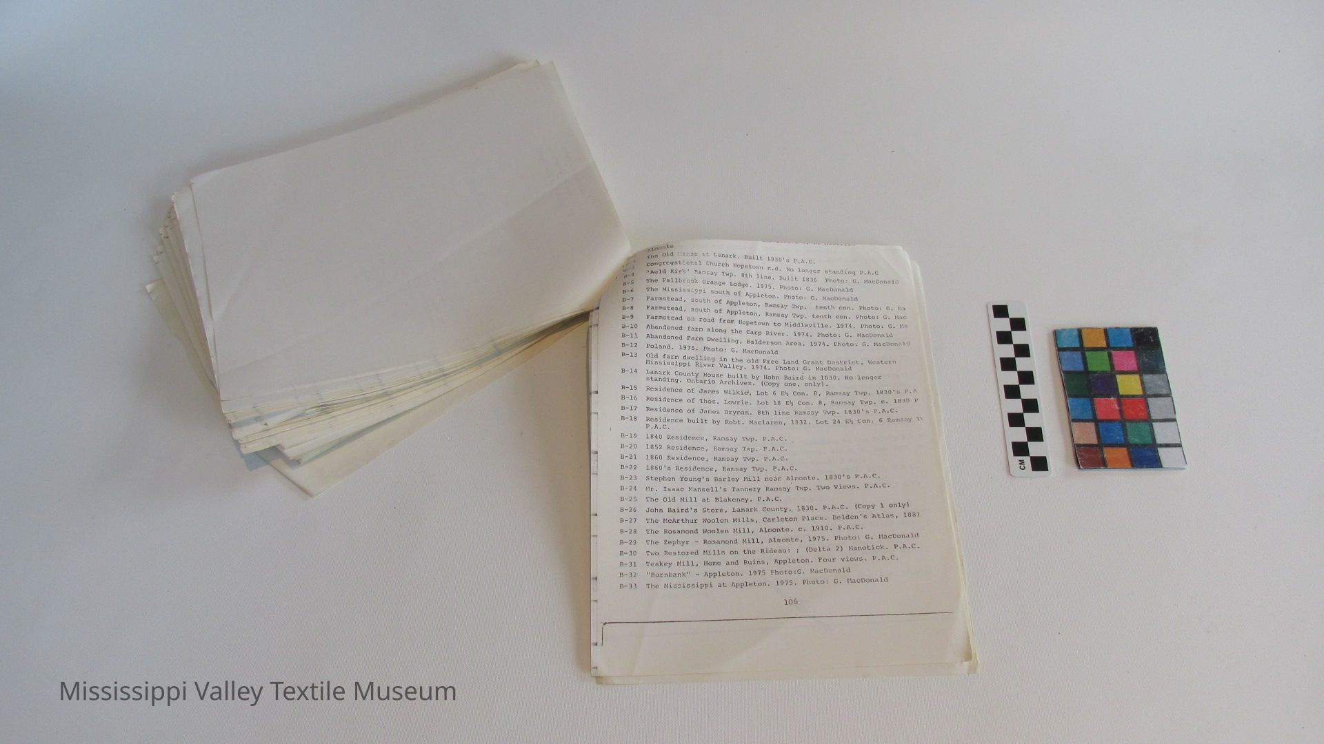
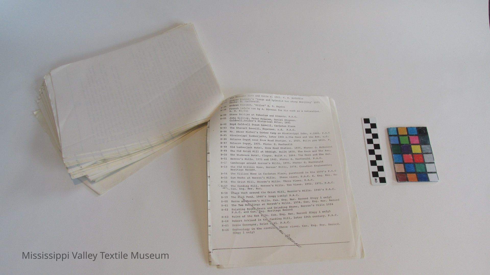
Appendix B. - Photos
I.ist of Photos p. 105
[4]
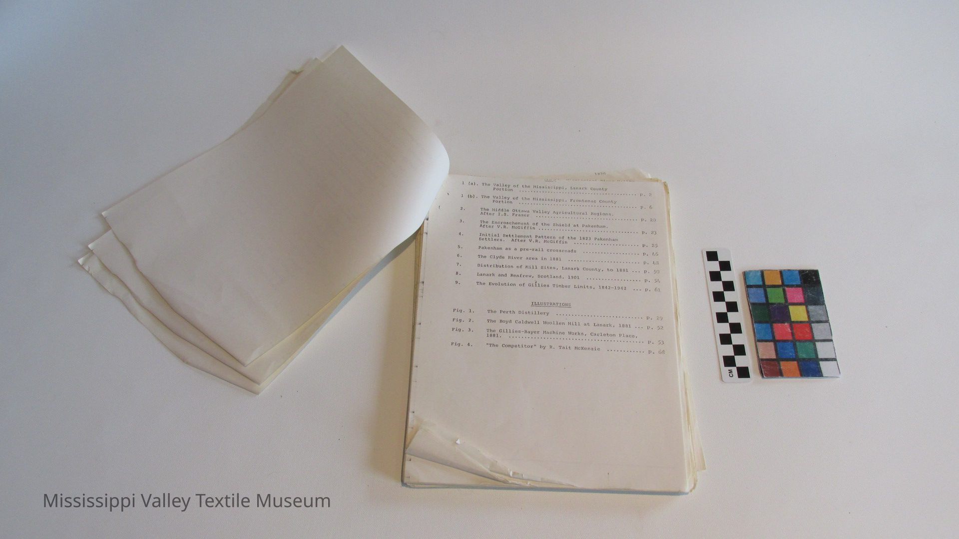
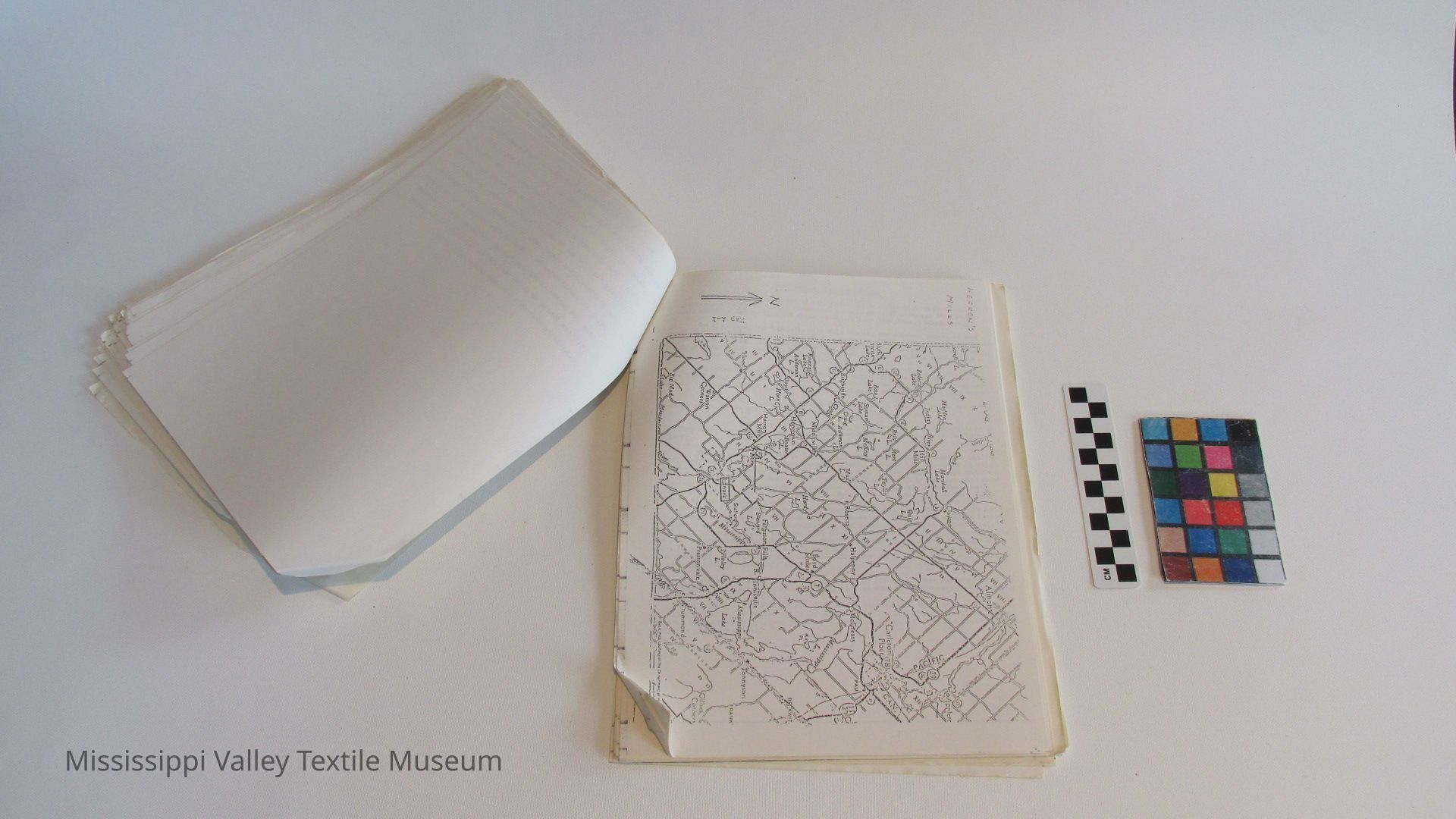
1. (a). The Valley of the Mississippi, Lanark County Portion
2. (b). The Valley of the Mississippi, Frontenac County Portion
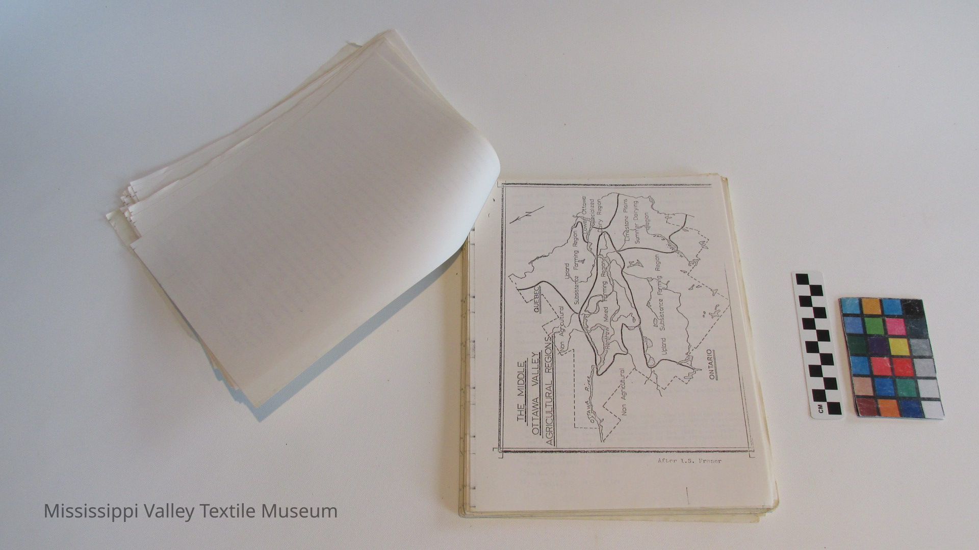
3. The Middle Ottawa Valley Agricultural Regions. After I.S. Fraser
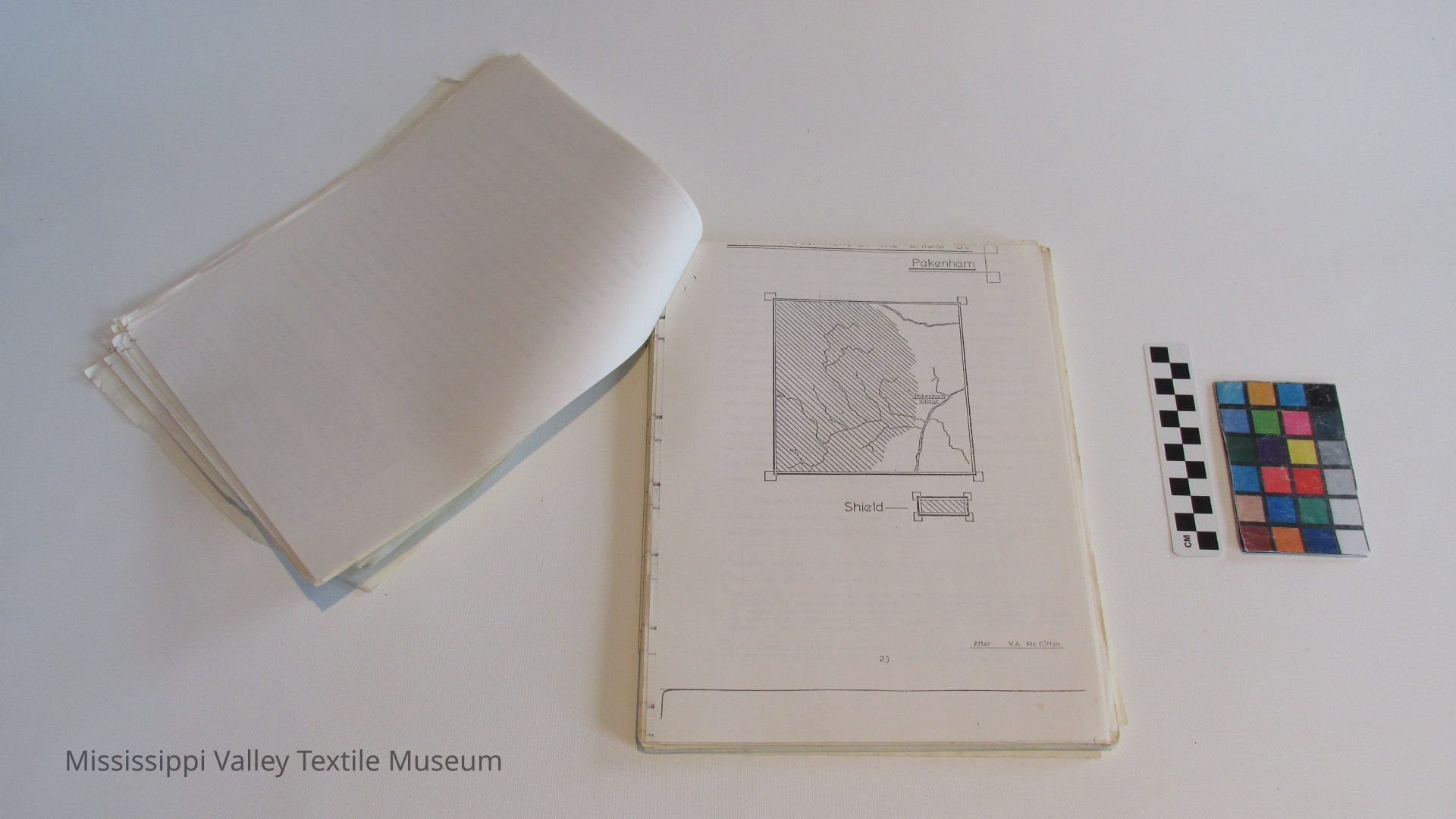
4. The Encroachement of the Shield at Pakenham.
After V.R. McGiffin
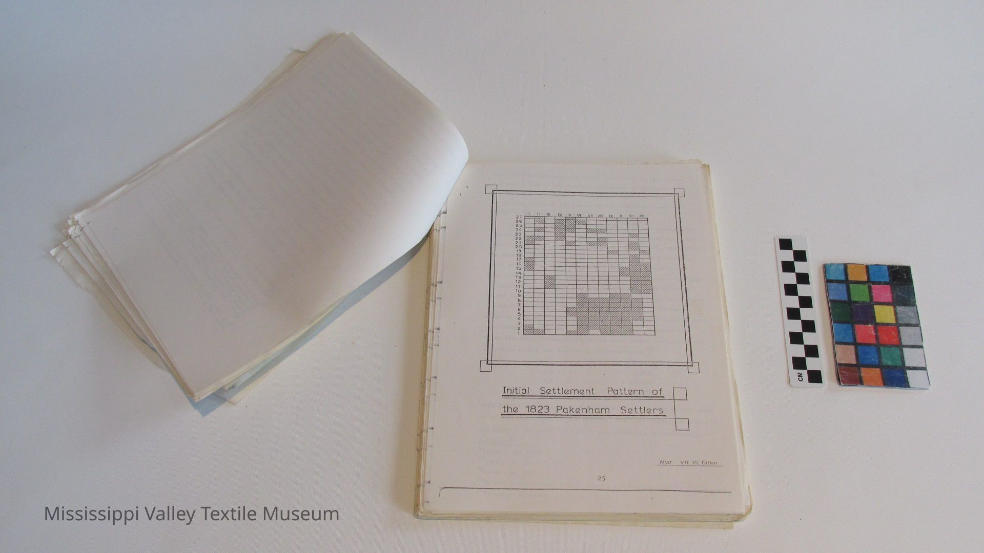
5. Initial Settlement Pattern of the 1823 Pakenham Settlers. After V.R. McGiffin
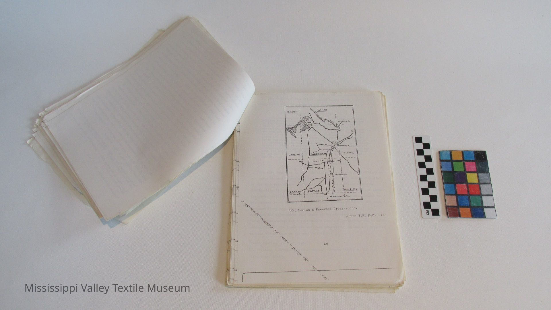
6. Pakenham as a pre-rail crossroads
7. The Clyde River area in 1881
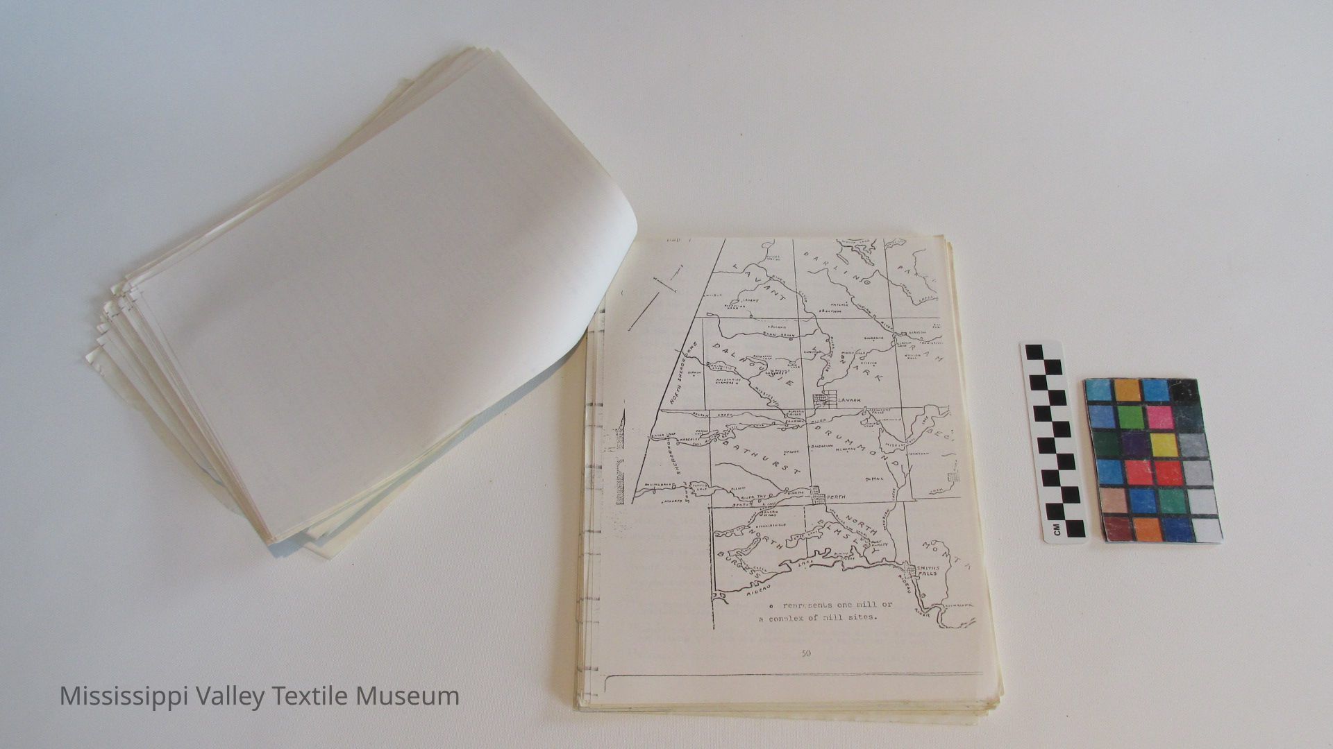
8. Distribution of Mill Sites, Lanark County, to 1881 ...
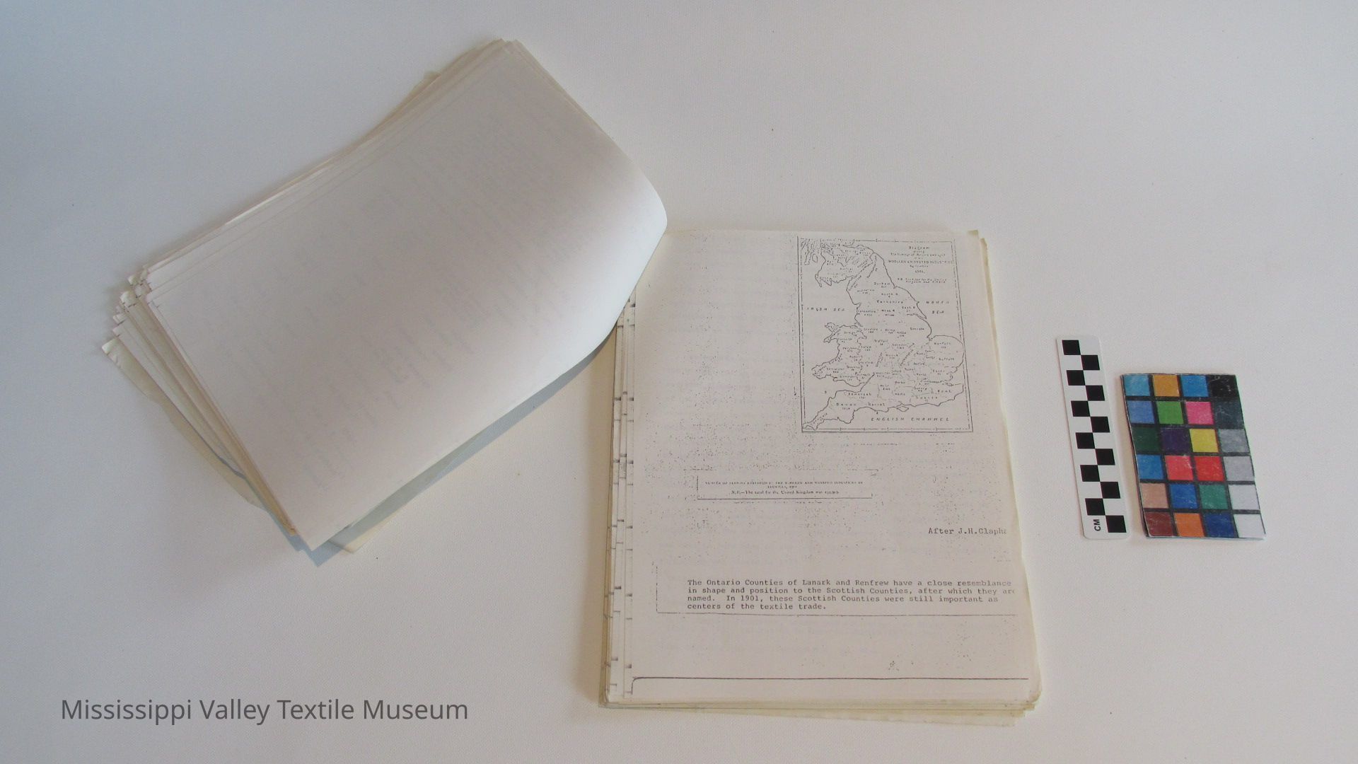
9. Lanark and Renfrew, Scotland. 1901
'j
10. The Evolution of Gillies Timber Limits, 1842-1942 ...
ILLUSTRATIONS
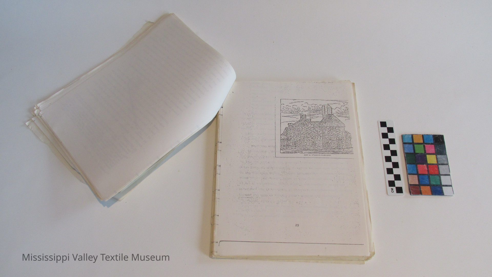
Fig. 1. The Perth Distillery
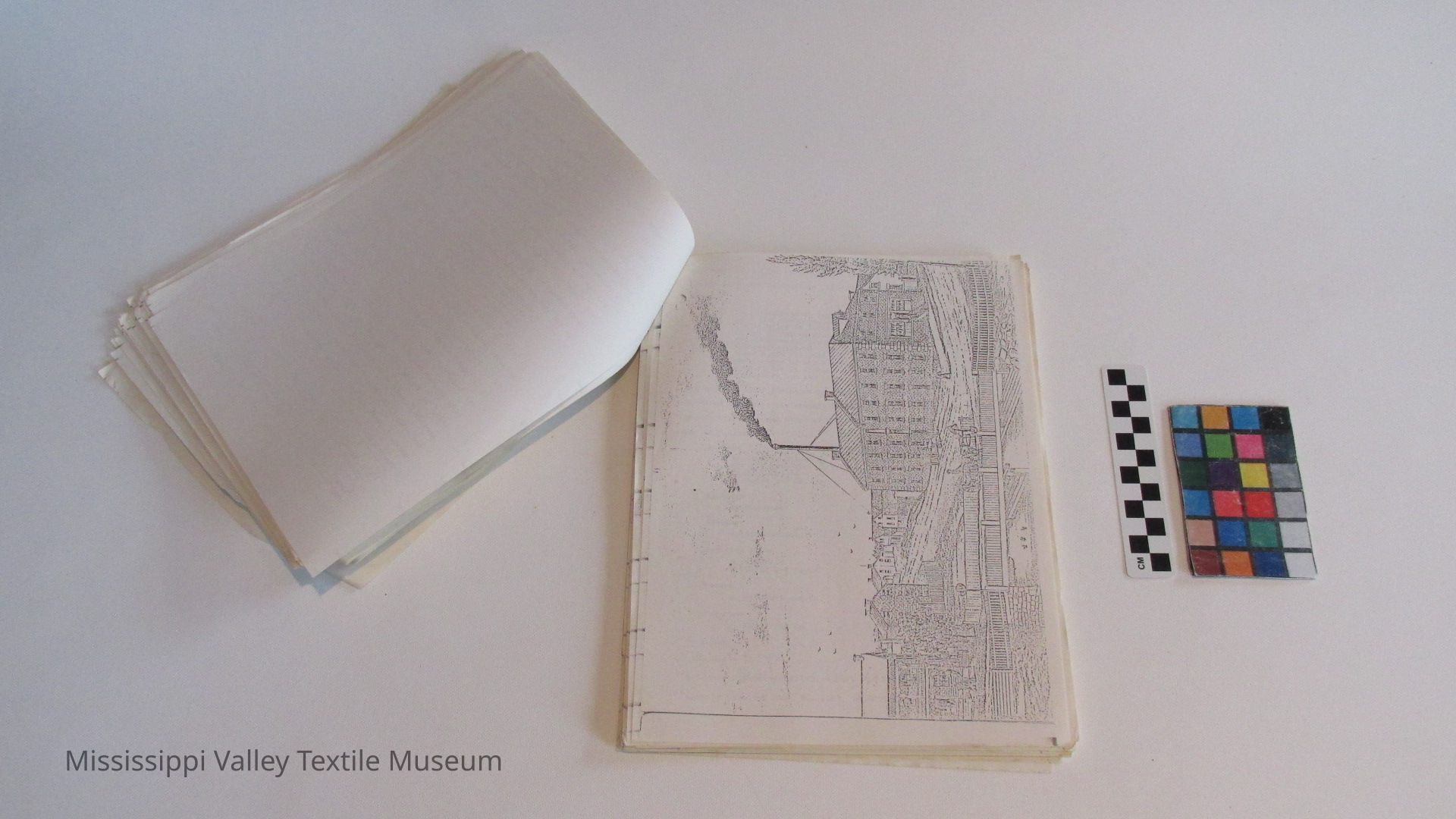
Fig. 2. The Boyd Caldwell Woollen Mill at Lanark, 1881 ...
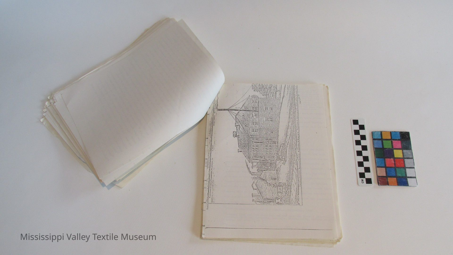
Fig. 3. The Gillies-Bayer Machine Works, Carleton Place,
1881
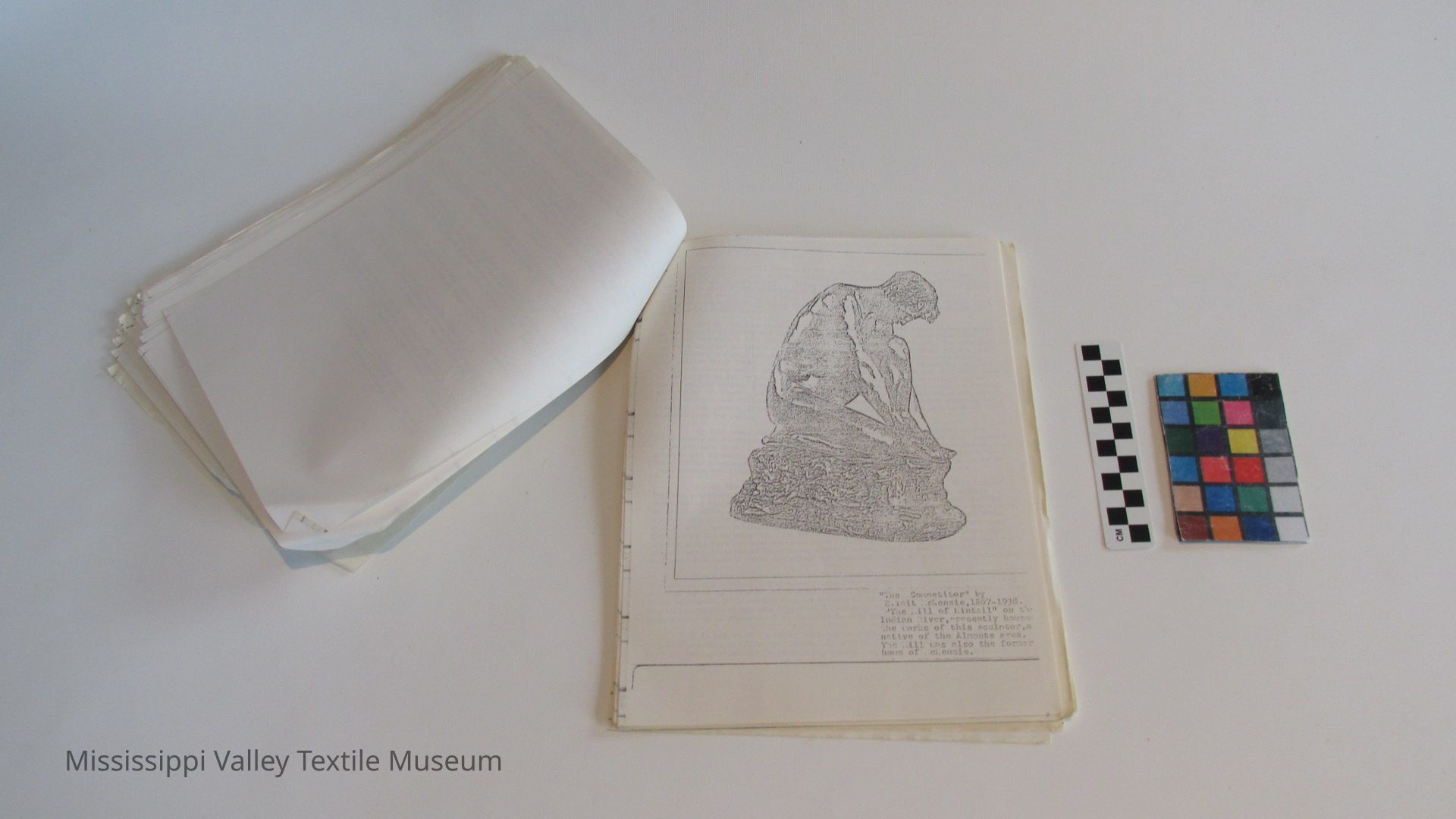
Fig. 4. "The Competitor" by R. Tait McKenzie
[5]
Planning Directions
[6]
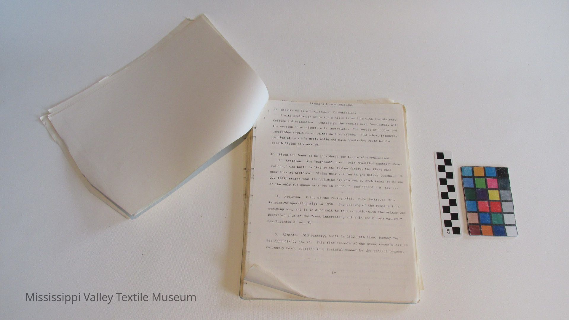
Planning Recommendations
a) Results of Site Evaluation. Condensation.
A site evaluation of Herron's Mills is on file with the Ministry- Culture and Recreation. Generally, the results were favourable, alLh the section on architecture is incomplete. The Report of Weiler and Garscadden should be consulted on that aspect. Historical integrity is high at Herron's Mills while the main constraint would be the possibilities of over-use.
b) Sites and Zones to be considered for future site evaluation.
1. Appleton. The "Burnbank" home. This "modified Scottish-George dwelling" was built in 1843 by the Teskey family, the first mill operators at Appleton. Gladys Mair writing in the Ottawa Journal, (De 27, 1969) stated that the building "is claimed by architects to be one of the only two known examples in Canada." See Appendix B. no. 32.
2. Appleton. Ruins of the Teskey Mill. Fire destroyed this impressive operating mill in 1950. The setting of the remains is a striking one, and it is difficult to take exception with the writer who described them as the "most interesting ruins in the Ottawa Valley." See Appendix B. no. 31
3. Almonte. Old Tannery, built in 1832, 8th line, Ramsay Twp.
See Appendix B. no. 24. This fine example of the stone mason's art is currently being restored in a tasteful manner by the present owners.
[7]
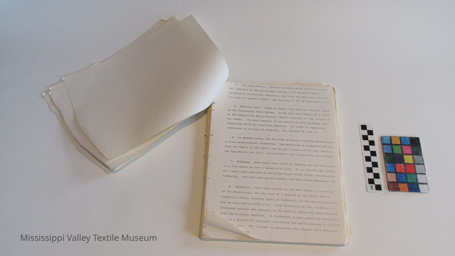
4. Snow Road Station. Private residence which served as a hote for lumbermen on the Mississippi putting in at McLaren1s Depot.
Building is in excellent condition, and faces the Lett farm which ho: the site of McLaren's Depot. See Appendix B. no. 48 Frontenac Count}
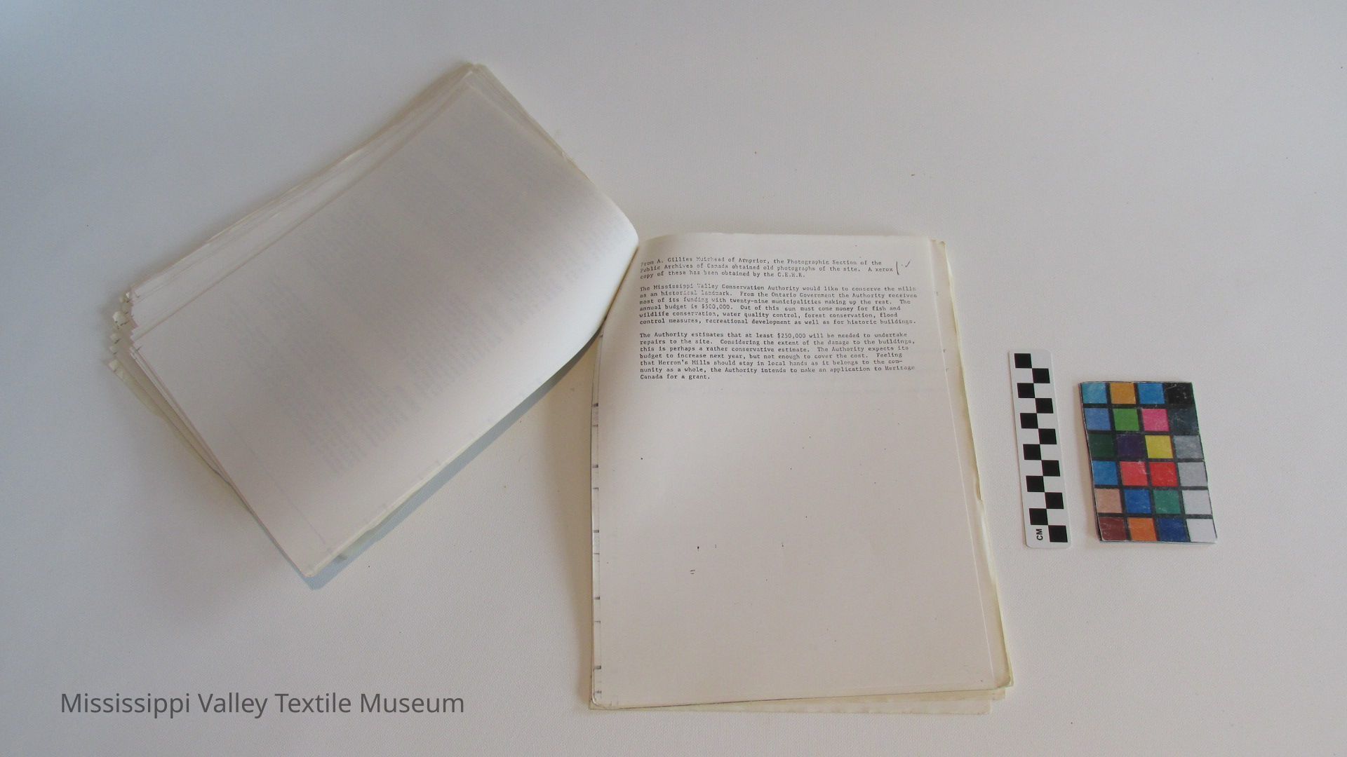
5. Balaclava Mill. North of Dacre, this site is slightly outsic of the Mississippi River Valley. It has been the subject of a study by the Engineering Record Society (Report Appended to this section of the study). Its main interest is the amount of mill machinery and technology which the owner has gathered. The owner is apparently interested in selling the property. See Appendix B. Vol. 2.
6. In general terms, the 8th line of Ramsay township should race a close architectural inspection. The evolution of architectural sty from the 1830's to the 1860's can be well documented in this section. See Appendix B. no. 14 f. Concessions. 6 and 7 could also be surveyed
7. Blakeney. This small town north of Almonte, on the Mississip; is a fine place to view a former mill site. It is already the settinc of a small park operated by the Mississippi River Valley Conservation Authority. Cultural remains are sparse, and the values primarily seer
8. Fallbrook. This small hamlet on the Fall River, a tributary of the Mississippi, was the seat of a sawmill in the early 1820's. Playfair's Mills, directly north of Fallbrook, on the nearby Mississir was an even earlier mill site, first developed by Col. Playfair, a disbanded soldier who returned to the British Isles and then returned with the Military settlers. In Fallbrook, a well preserved Blacksmith shop is a feature of interest, reflecting the early working of a nearb source of iron. The "Smithy" is presently the subject of a National Film Board feature.
[8]
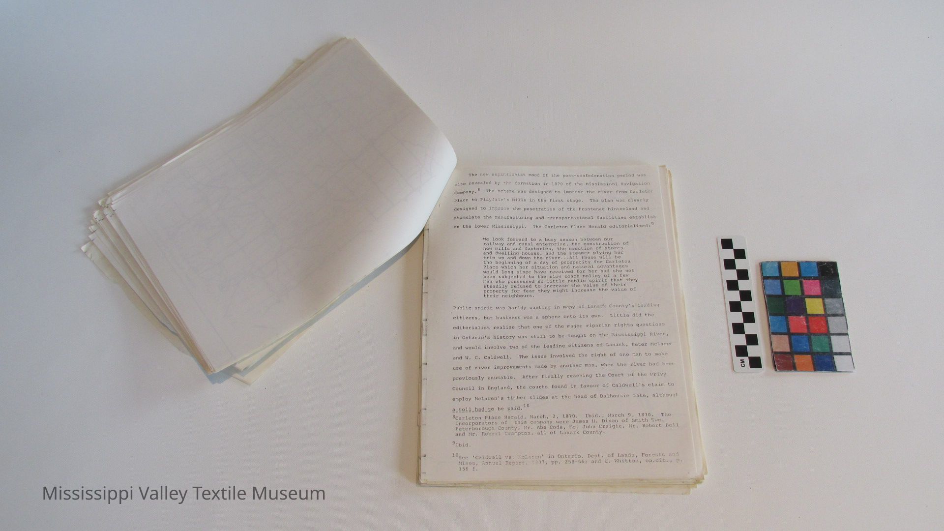
9. Clyde Forks. This area is upper Lavant Twp. is the setting much of the lumbering and milling operation of the Caldwells, a prominent family of Lanark Village. The Clyde Forks area is describe! in J. Fraser's Shanty, Forest and River Life (1883). The same Caldwell's were involved in the Riparian Rights dispute with Peter McLaren, that was a feature of Ontario Politics in the 1880's. For a description of the Clyde Fork's operation see Section II, Ch. 2.
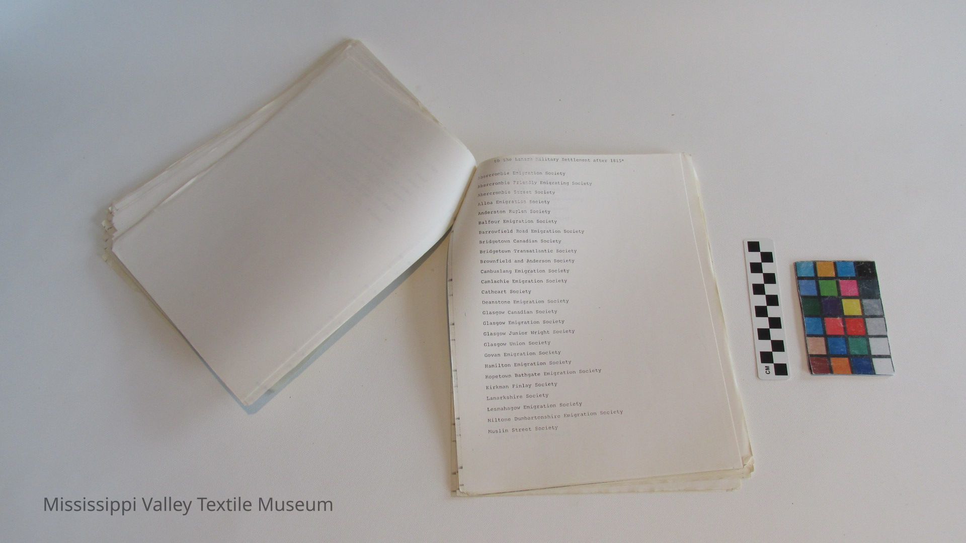
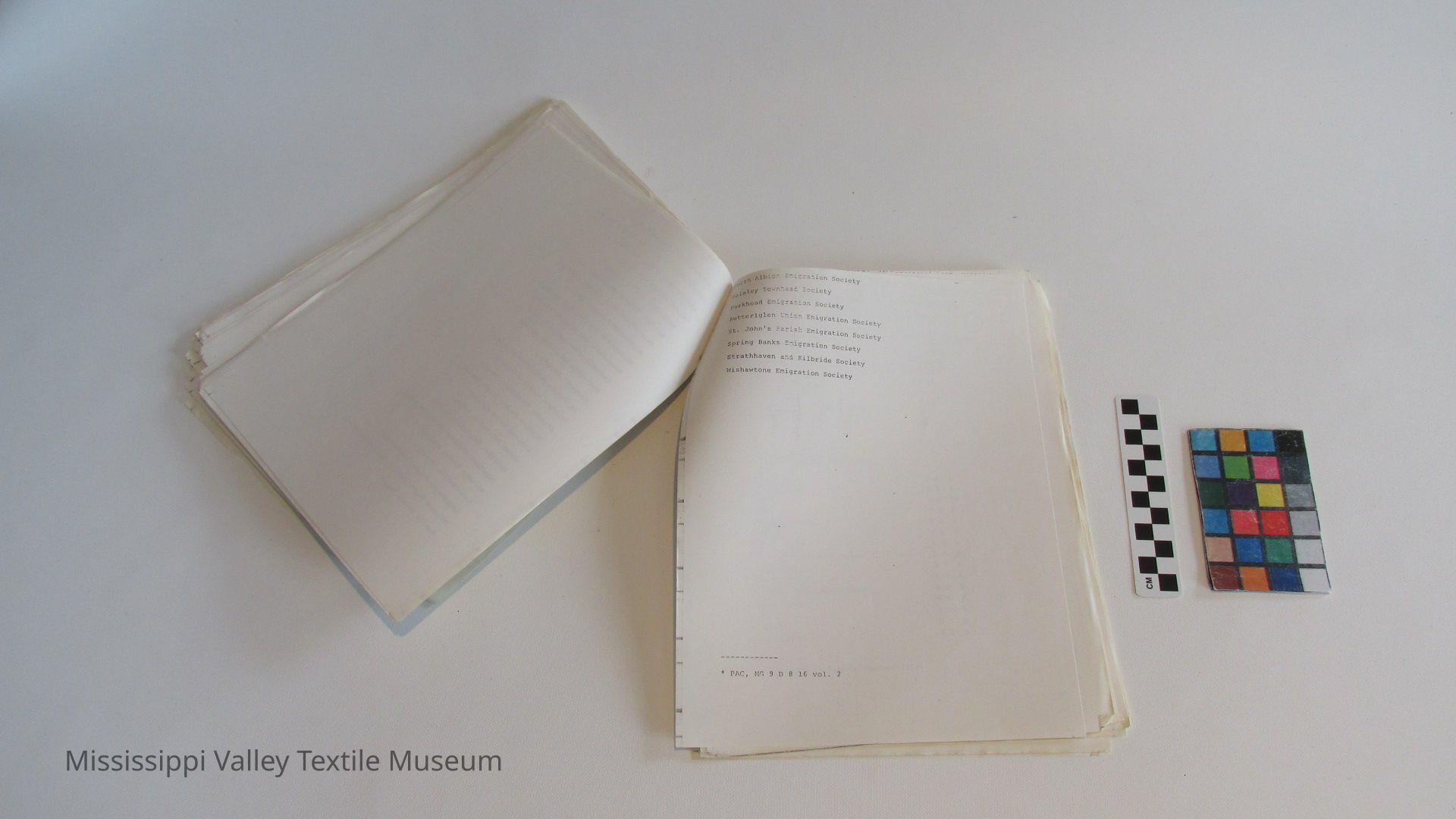
10. Lanark County Road no. 16. Almonte to Middleville and Hopetown. This corridor takes one through one of the earliest settled zones in Lanark, and many structures and farms dating from the 1830's are still to be observed. Hopetown, as a name, is derived from one of the Emigration Societies that functioned after 1816 when the Military Settlers were coming from Scotland. (Hopetown Emigration Society.)
11. Tatlock-Marble Bluff. Indian River country via Lanark County Road no. 9 or Hwy. 511. Darling Twp. Blue and white marble of a good quality exists in the quarries of this area, operated by a simple open-pit method.
12. Clayton. Ramsay Twp. This early mill site was active by 1824, known at that time as Bellamy's Mills, after Edmund Bellany of Vermont.
13. Ferguson's Falls-Innisville. These sites were both first settled by retired military men prior to 1820. James Ennis had establi[shed] a mill (grist) by 1825 at the latter site. Drummond Twp. Mississippi River prior to its entrance into Mississippi Lake, and on Hwy. no. 7.
[9]
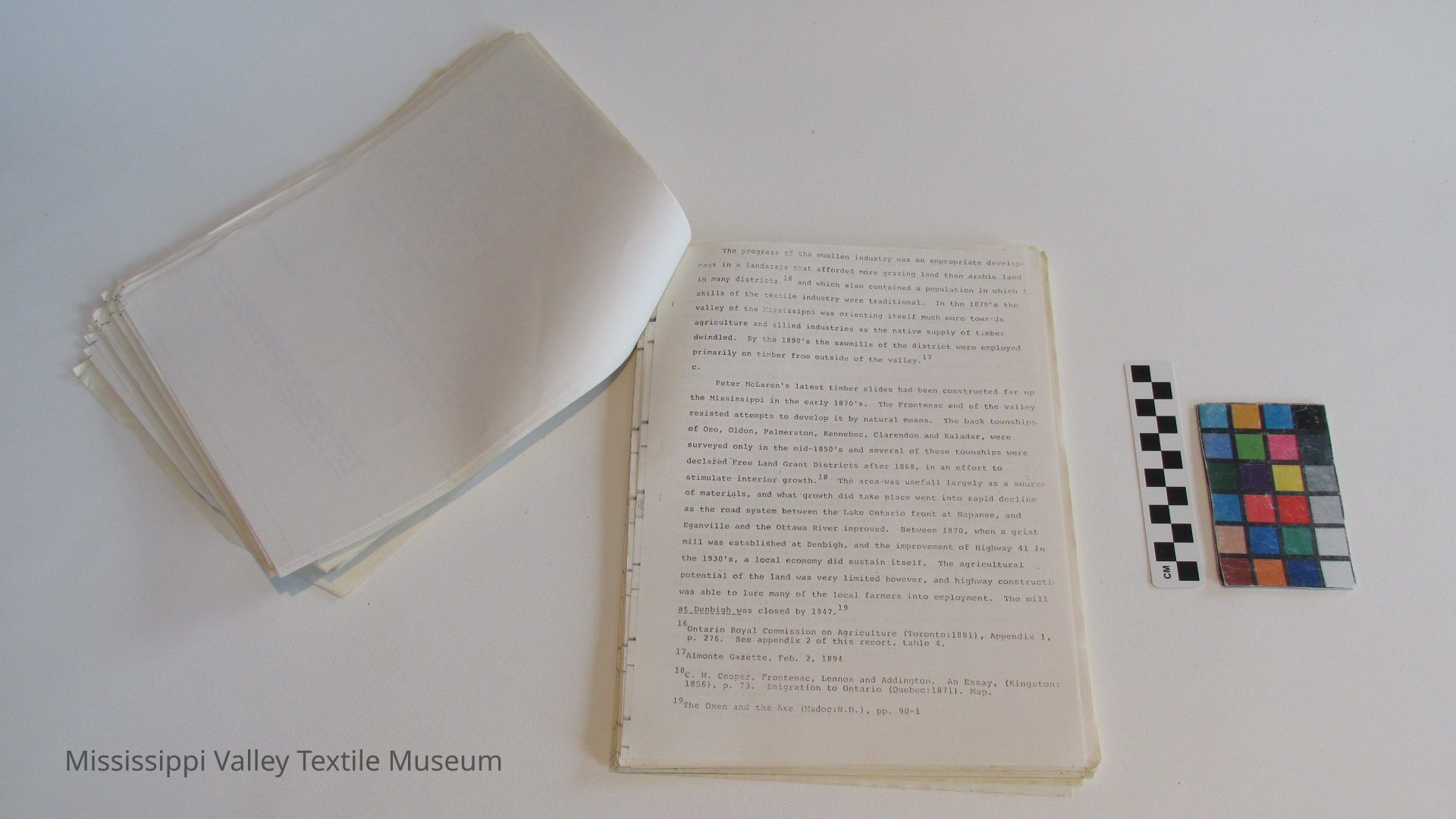
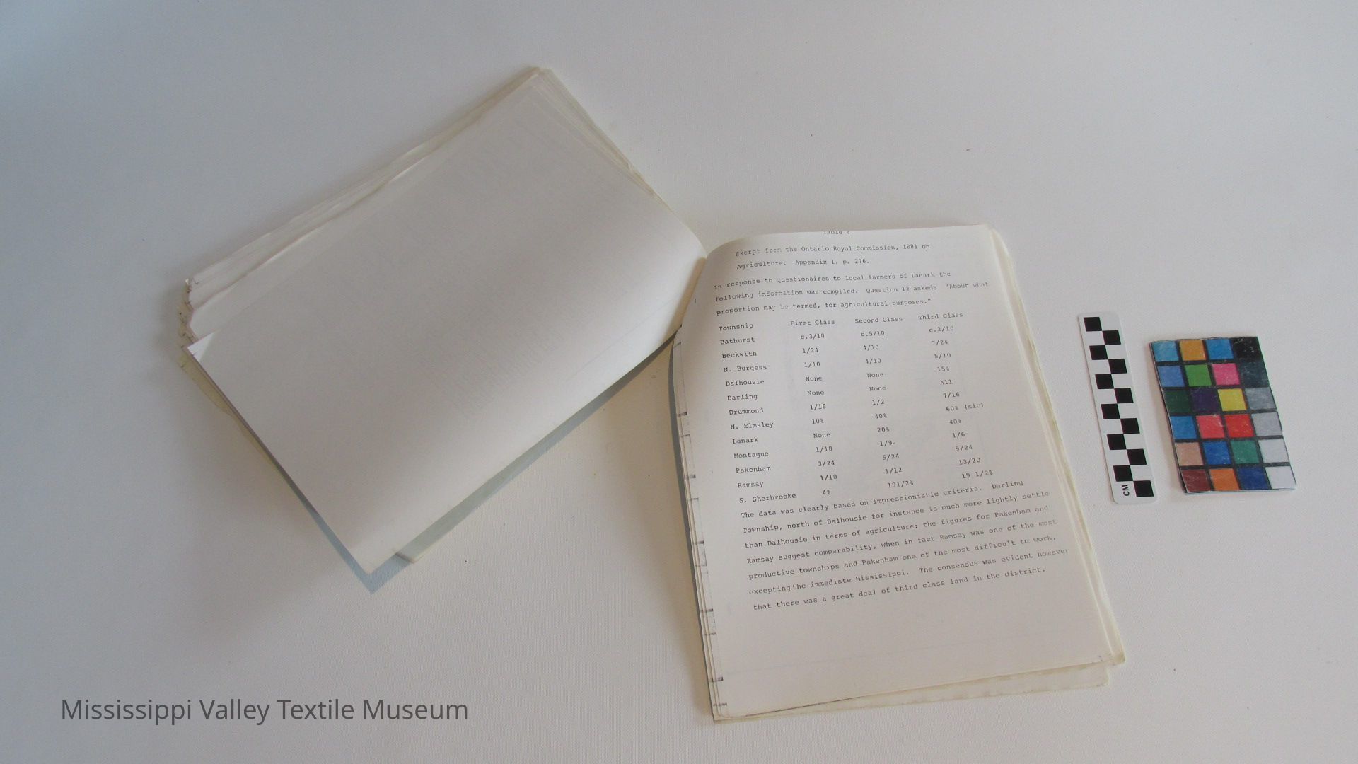
Lennox and Addington. The land west of North Sherbrooke Twp. is progressively inhospitable, but was the setting of colonization road experiments. A substantial number of abandoned farms are to be found in this landscape. The Mississippi canoe route that starts at Bon Echo Park and follows the river to Fitzroy harbor is undoubtedly the best way to view the western end of the valley due to the unfortunate way in which hydro towers follow the river valley, and roads such as Hwy. 506. The history of this section generally, is of a later perio than that which characterized the Lanark County section. The Denbigh Grist Mill for instance, was a structure of the 1870*s, an outgrowth < the Colonization Roads movement. See Appendix B. no. 49.
[10]
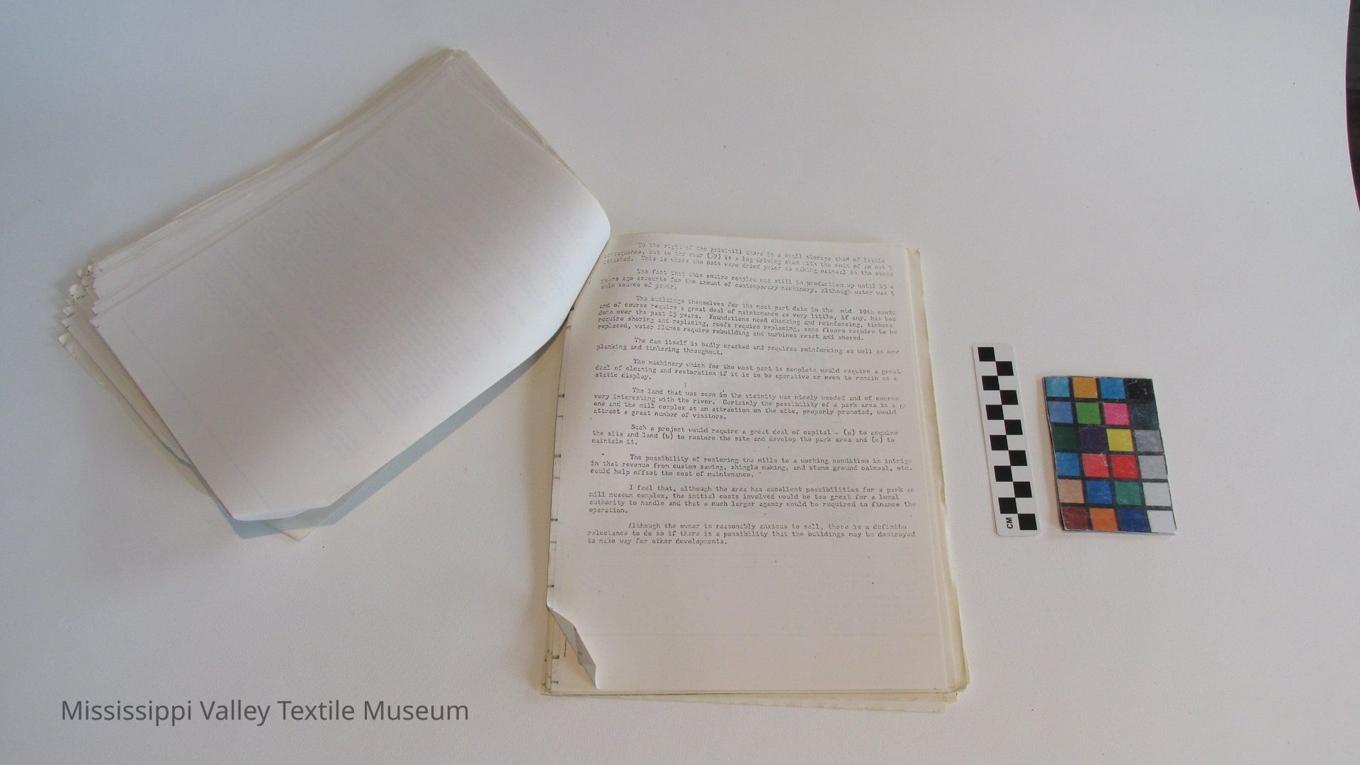
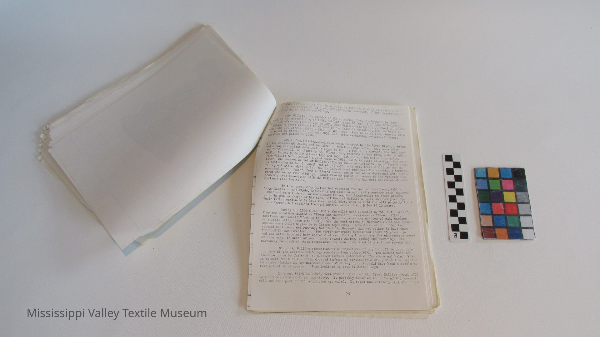
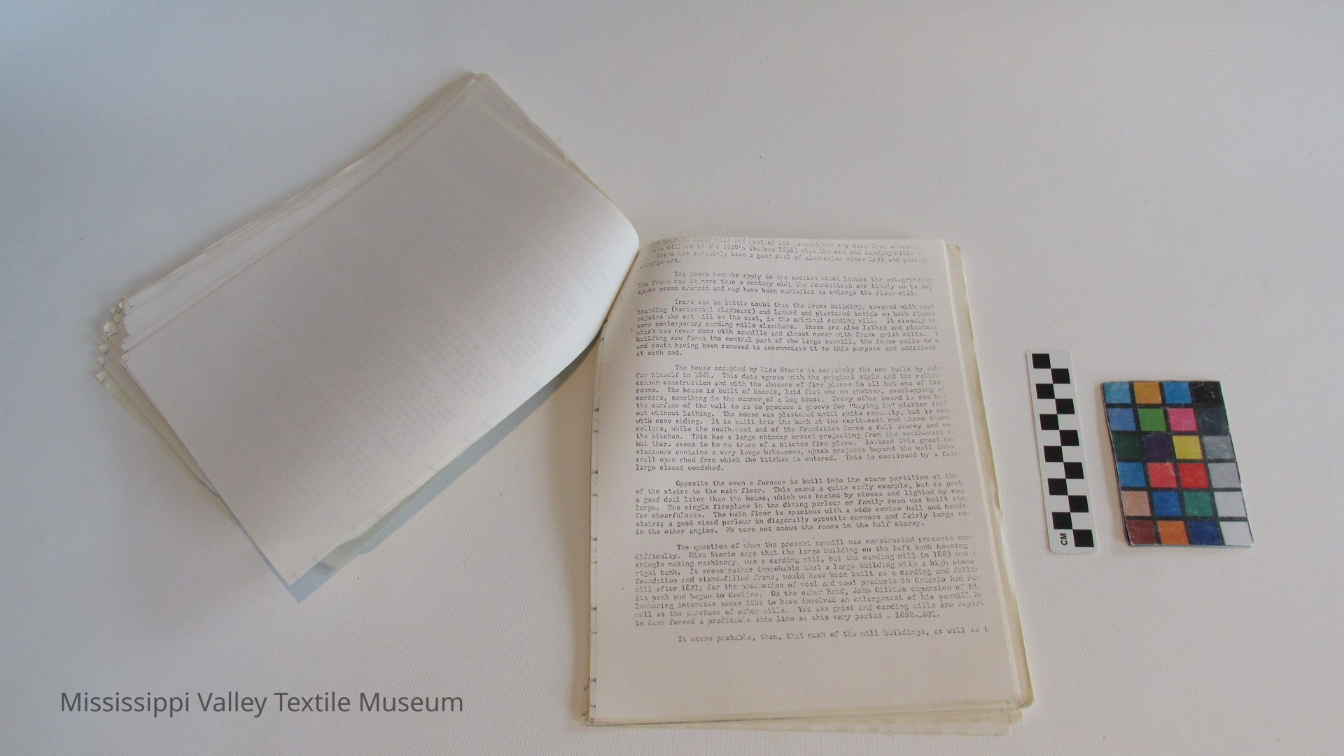
1. The main recommendations of this report have been concerned with the Gillies-Herron Mills site north of Lanark Village. The obvious role of this research at the present time, is probably that of a supporting document for the initiatives presently being taken by the Mississippi River Valley Conservation Authority, in connection with t site. The results of the site evaluation done according to M.N.R. Historic Sites Branch criteria, suggest that the Gillies-Herron site a highly representative mill site of the type which characterized [more] of the small hamlets along the Mississippi. It can be related to the major developments in the local economy, and has a number of biograph stories associated with it which are of general interest. In terms o a landscape setting, the site is also satisfactory. Its main virtue the completeness of the milling facilities still extant, illustrative of lumbering, gristing, and woollen processes. A substantial amount of technology is also present. Deterioration of some of the faciliti housing this machinery is a current problem, making a rapid decision the fate of this property desirable.
The technological component of this site is an important one, and a future management plan will want to consider the manuscript study now being completed by Ms. F. Lunge, of the National Historic Parks Service, which deals with the typology of mills in Canada with considerable emphasis on Ontario. (See Appendix 4).
While the Herron Mills site satisfies many of the criteria deemed significant by the Historic Sites Branch, in terms of what an historic park should be, the Ministry will also want to consider the number of mills already established as public site in Ontario, and in the Ottawa Valley in particular. In the Ottawa Valley, one might mention the
[11]
[cut off by scan]
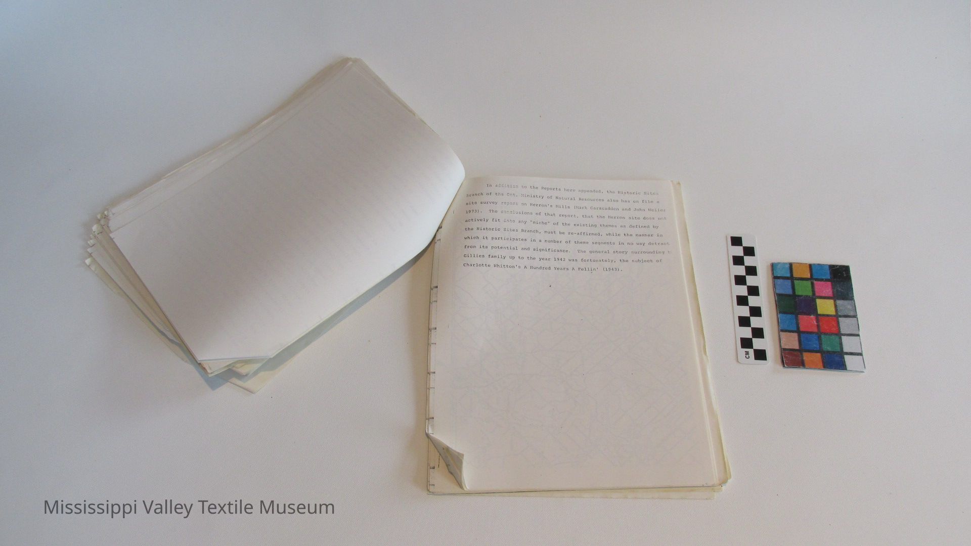
the Indian River; the National Capital Commission's Thompson-Perkin's Mill, Victoria Island, the oldest remaining structure in the Chaudier area; the Delta Mill Society's preservation of the 1802 mill at Delta the 1870 Flour Mill of Joshua Hazelton at Killaloe preserved by the town; the Rideau Valley Conservation Authority's Manotick Mill, Manot: Ont. It should be added however, that what the Herron site has to offer in comparison with these other sites, is substantially different
d). Important Related Recreation Zones in the Mississippi River Valley.
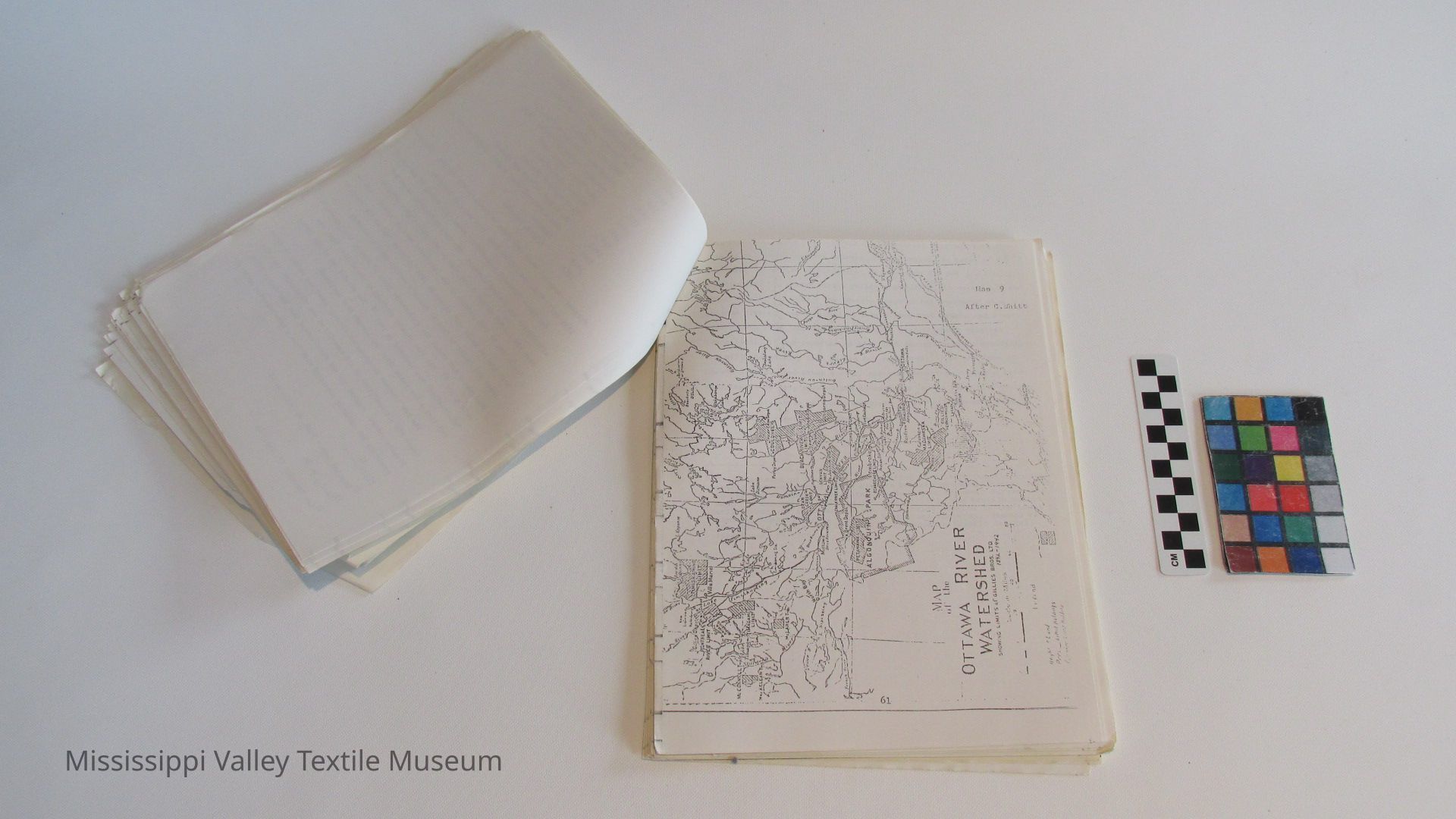
The Mississippi River Valley is already the focus of a number of recreation-based activities. In a general way the river divides a mor northerly zone of shield land from a southerly section of land that is more suitable for agriculture. The river itself constitutes a canoe route, while cottage and park development is considerable throught its length. (See Map A-15). Any development of an historic park would be compatible with established tendencies -in this river valley towards recreation development of several types. The larger parks are found all the extreme ends of the watershed, while the nearest major highway (no. runs some distance south of the watershed. In comparison with other recreation areas in the province, especially those served by the major parks, the Mississippi is only moderately used by tourists. The system of Lanark "By-Ways" suggests that those who do venture into the valley are genuine tourists, interested in "seeing" as much as getting from A to B. An historic park, such as might be developed at Herron's Mills, would have the advantage of providing further geographic balance to the M.N.R. park system in the valley, as well as providing a site that would probably only be used in a moderate way, a desirable situati when one is concerned with an historical resource of some fragility. I might also provide a good center from which to interpret the entire valley to the tourist about to venture into it by car.
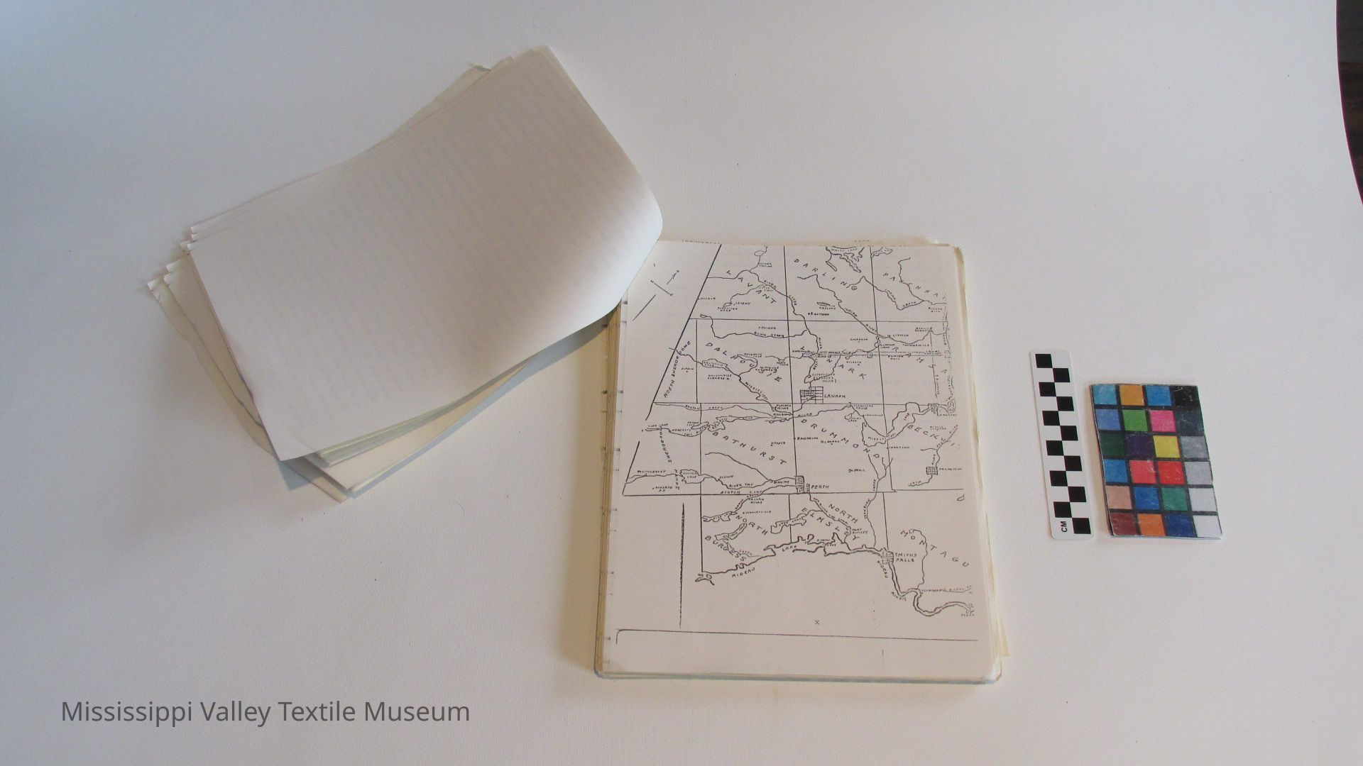
[12, map, not transcribed]
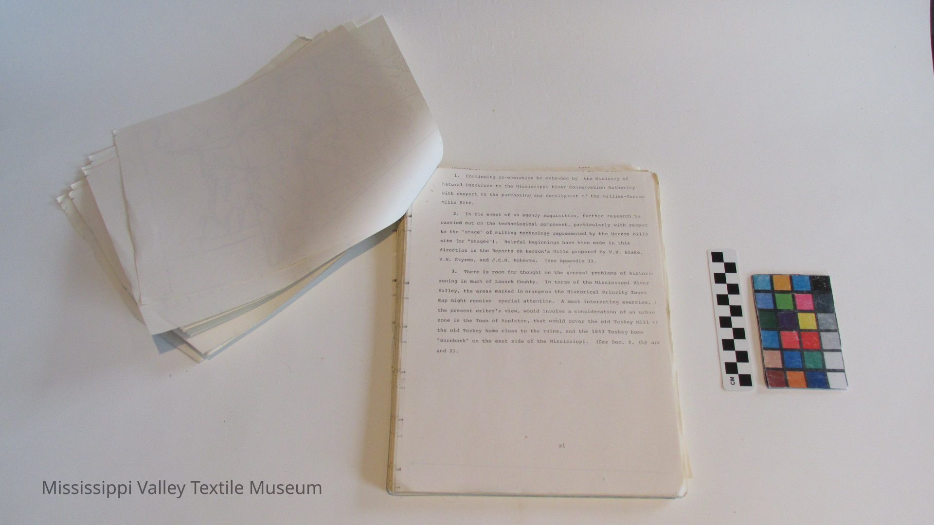
1. Continuing co-operation be extended by the Ministry of Natural Resources to the Mississippi River Conservation Authority with respect to the purchasing and development of the Gillies-Herron Mills Site.
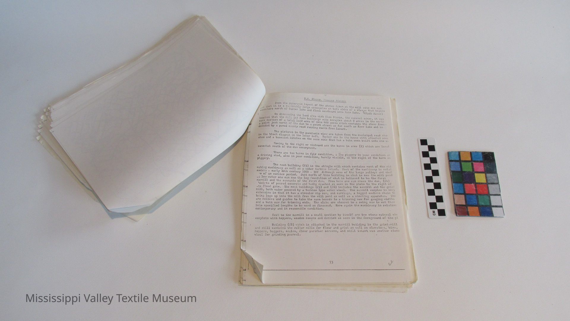
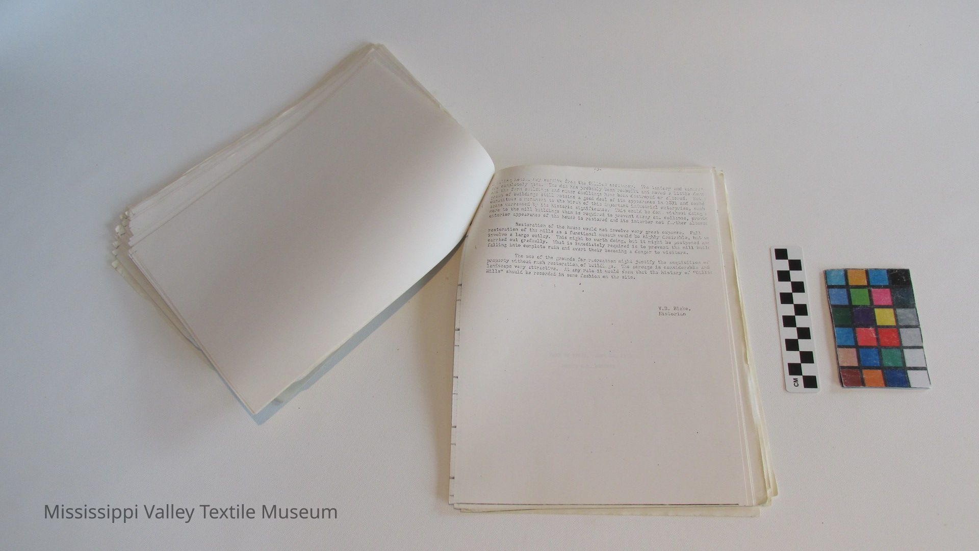
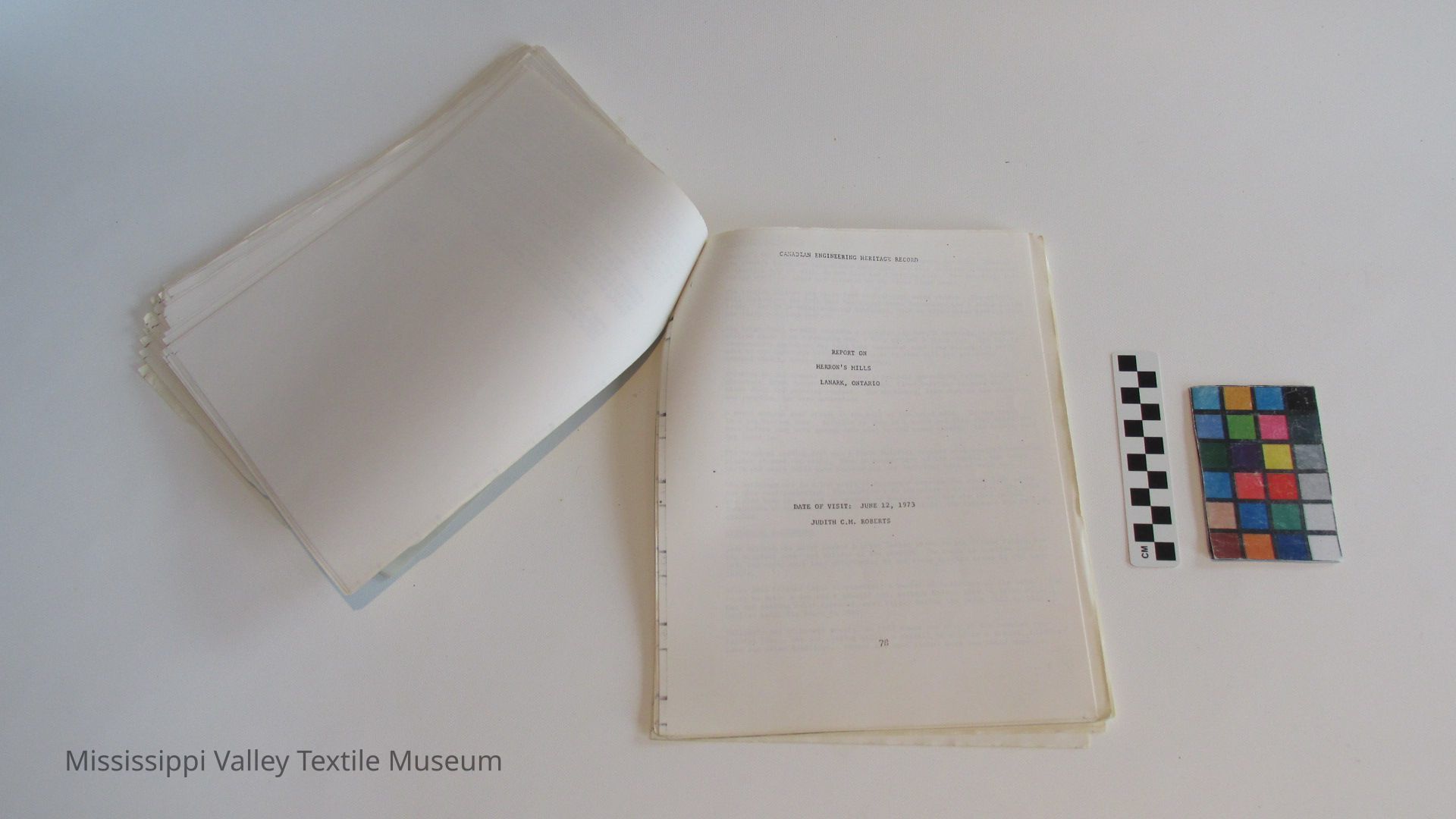
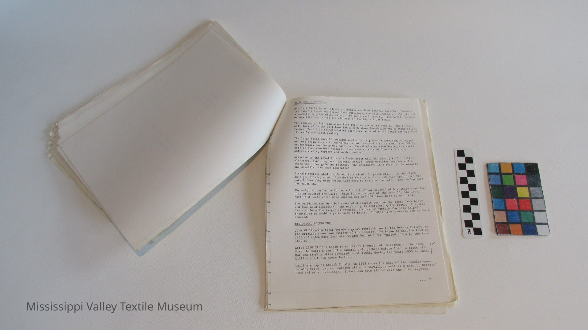
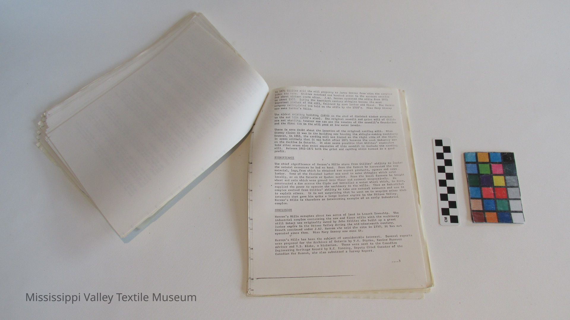
2. In the event of an agency acquisition, further research be carried out on the technological component, particularly with respect to the "stage" of milling technology represented by the Herron Mills site (or "Stages"). Helpful beginnings have been made in this direction in the Reports on Herron's Mills prepared by V.B. Blake, V.N. Styrmo, and J.C.N. Roberts. (See Appendix 1).
3. There is room for thought on the general problems of historic zoning in much of Lanark County. In terms of the Mississippi River Valley, the areas marked in orange on the Historical Priority Zones map might receive special attention. A most interesting exercise, I the present writer's view, would involve a consideration of an urban zone in the Town of Appleton, that would cover the old Teskey Mill rd the old Teskey home close to the ruins, and the 1843 Teskey home "Burnbank" on the east side of the Mississippi. (See Sec. I. (b) am and 21.
[13]
SECTION II
Historical Background Paper
The Mississippi Valley: A Nineteenth Century
Industrial Landscape in Ontario
[14]
ABSTRACT
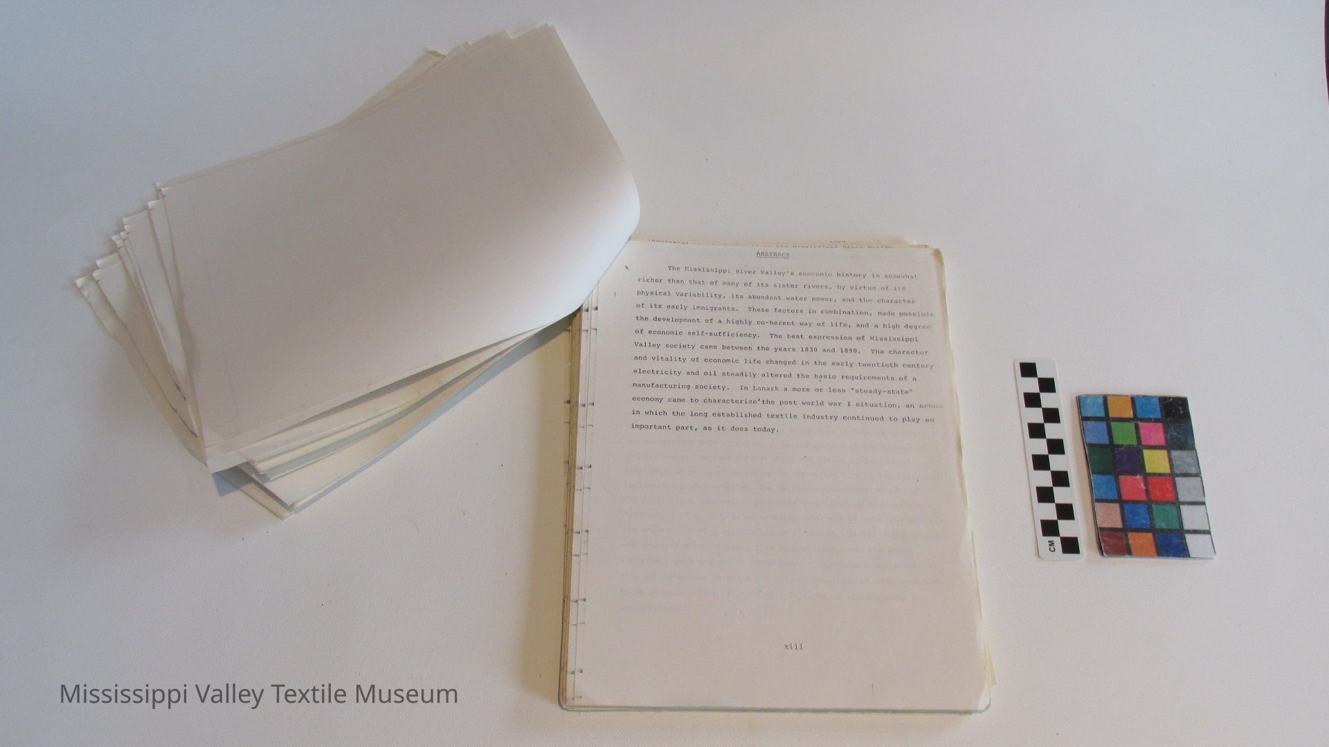
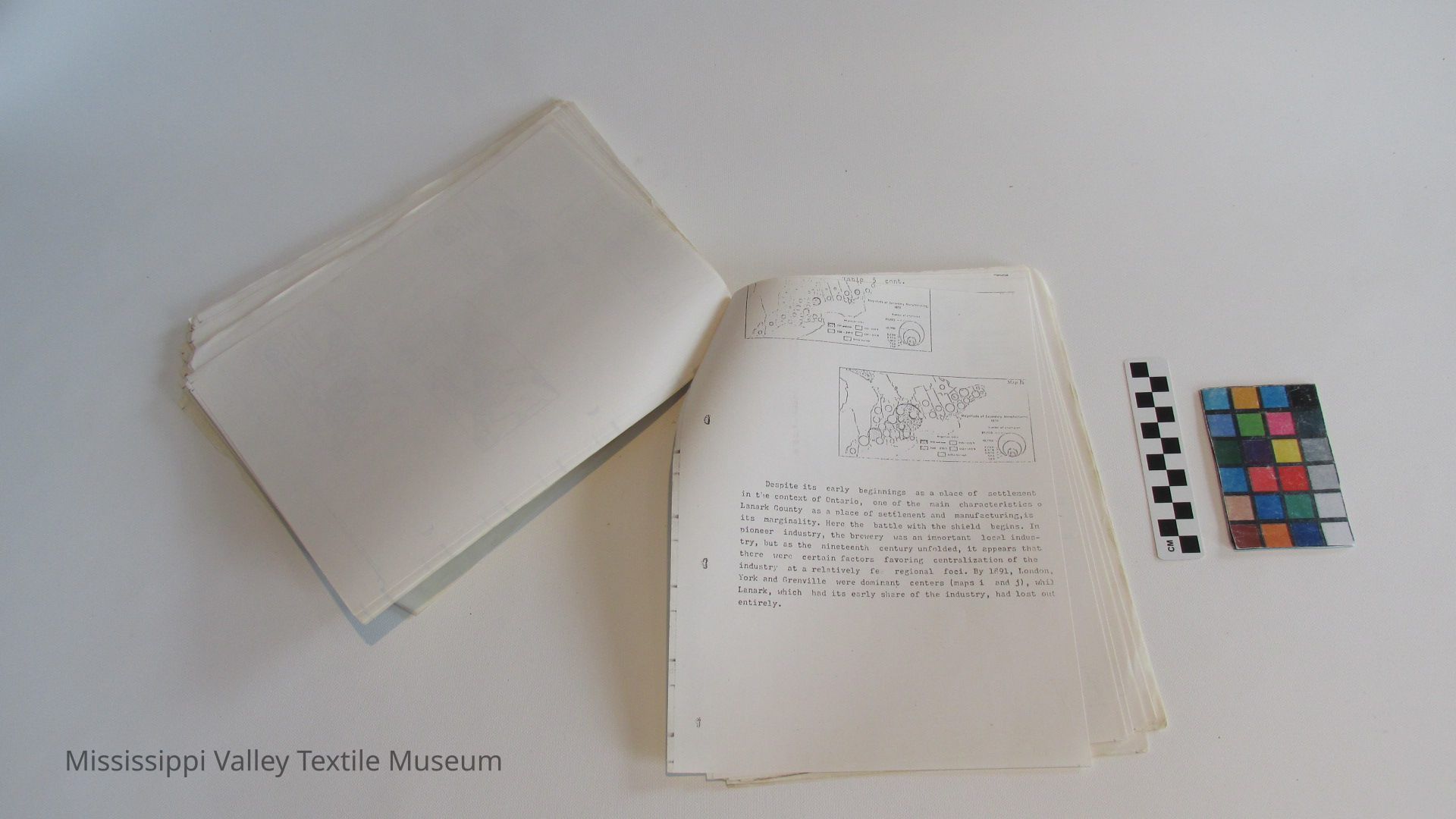
The Mississippi River Valley's economic history is somewhat richer than that of many of its sister rivers, by virtue of its physical variability, its abundant water power, and the character of its early immigrants. These factors in combination, made possible the development of a highly co-herent way of life, and a high degree of economic self-sufficiency. The best expression of Mississippi Valley society came between the years 1830 and 1890. The character and vitality of economic life changed in the early twentieth century electricity and oil steadily altered the basic requirements of a manufacturing society. In Lanark a more or less "steady-state" economy came to characterize the post world war I situation, an econo: in which the long established textile industry continued to play an important part, as it does today.
[15]
The Mississippi Valley: A Nineteenth Century Industrial
Landscape In Ontario
Of the several regions that comprise modern Ontario, the "Ottawa Valley" remains one of the most distinct in the public mind. Like Newfoundland, it is an area apart. Its character is conceded even by those who have not been there. The Ottawa Region has many subdivisions geographically speaking. One of these is the Mississippi River Valley, one of "the five rivers" that define the Middle Ottawa country on the Ontario side. From north to south one may count the Petawawa, the Bonnechere, the Madawasca, the Mississippi, and the Rideau. The first three participate more uniformly in a historical process of primary resource exploitation, while the Rideau is remembered first for its role in Upper Canadian military strategy. The Mississippi River runs through lands that are reminiscent both of the rough shield country of the Madawasca and the flater lowlands through which the Rideau winds. This compromise in terms of landscape is one of the keys to the historical understanding of the valley, for in the Lanark County section of the Mississippi especially, favorable conditions existed for the development of an industrial landscape that was at once self-sustaining and capable of a certain amount of growth. In the right amounts one could find here lumber, fish, agricultural land, and most important, good sources of water power. The present study details some of the manner in which a highly coherent way of life came into being in this valley, particularly in terms of its economic organization.
[16]
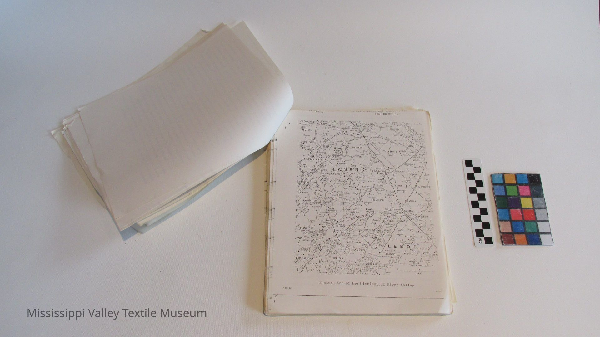
[17, map, not transcribed]
[cut off by scan]instinctive to recall the Ottawa Valley of the nineteenth century in terms of hoards of lumberjacks, or else in terms of their entrepreneurial godfathers, the "Lumber Barons". The very fruitful "staples approach" to Canadian history has encouraged this, and the notion that Canadians have been by and large, "hewers of wood and water" dies .hard. Yet, the facts often deny the view that Canadians have been little more than imperial lackeys. In the Mississippi River Valley from 1815 to 1904, it is possible to chronicle the efforts of an immigrant population to restructure the old world in the new, and to establish quickly an industrial environment capable of standing on its own and of competing in world markets. In Lanark County, the frontier experience was viewed as a temporary hardship, a prelude to the flowering of a culture similar, if improved, to that which had been abandoned. The practical beginnings of this effort are to be found in the history of the Rideau "Military Settlements" of Perth, Richmond and Lanark, between 1816 and 1821. These experiments in soldier settlement came about with the termination of the Napoleonic and American Wars in 1815. In conception they were irrelevant to the square timber trade already underway on the Ottawa. They were born with an eye to the defence of British North America, and in response to severe economic dislocations in the British Isles. The emigration was a planned effort which brought persons of like mind and skills together and deposited them in a wilderness. Within twenty years this pool of settlers provided the seed-bed from which many entrepreneurs sprang, a group which gradually fused their enterprise with larger economic undertakings, embracing the Ottawa Valley and the 19th century world of international trade. One of the central types encountered in this process was the miller.
[18]
the visible symbols of dissatisfaction among those of lesser consequence. In an earlier time when most economic dealings were carried on in face to face situations within small agriculturally based communities, the miller was the most conspicuous representative of the "middleman" class. "Grinding Capitalism" indeed, may be the appropriate transition phrase that expresses a certain shift of contempt away from the miller towards the "big businessman" of the twentieth century. At the end of the eighteenth century the slang of the time is revealing, for to be called a "miller" was synonomous with being called "a murderer"."To Mill" was "to rob", c "to beat or kill" while "to mill a ken" was "to rob a house". That such a seemingly innocent occupation as miller could conjur up such images, suggests the importance of this functionary in day to day life. We do know that in pre-conquest Quebec a miller caught, cheating his customers, stood to pay a high penalty at law. According to Bruemme, "the millers were kept honest by Draconic laws. If one short-measured his client, he ran the risk of being hanged from a gallows built especially for the occasion right beside 2 his mill."
The Quebec attitude towards the miller, and the miller's well defined role in the seigniurial system, were not features of Upper Canadian society. The French Regime had done its best to foster mill development, while in post - 1783 Canada, the problem of government monopoly of mill sites tended to retard such development until 1791. Following that date, mills developed with greater
1 1811 Dictionary of the Vulgar Tongue: A Dictionary of Buckish Slang, University Wit, and Pickpocket Eloquence, (London:Chappel , 18
2
Fred Bruemme, 'The Old Mills of Quebec' Ottawa Journal, June 11, 1966 (From the Imperial Oil Review).
[20]
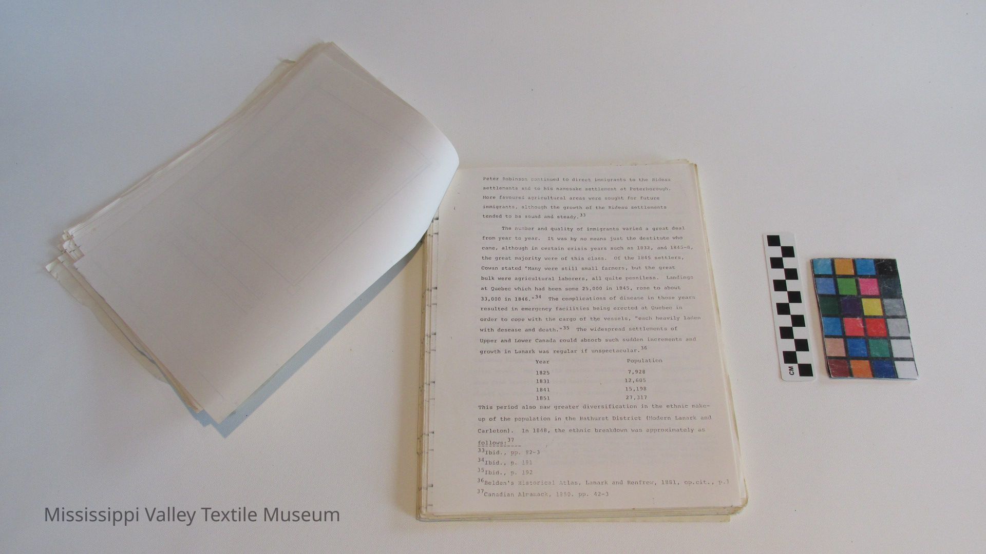
want of mills was a characteristic complaint of Loyalist settlers and of the settlers of the Rideau after 1816.4 If government did not undertake an overly active policy with respect to mill development it did see the virtue of an incentive for such development. The good site and land granted to the U.E.L. David Shepherd, at Almonte in 1819 was given on condition that he construct a mil]. From that date on, mill sites would proliferate in the Mississippi River Valley and become the characteristic sign of enterprise.
Of the several rivers that drain from the south into the Ottawa, the Mississippi affords some of the best mill sites. A steady and gradual decline from its headwaters north of Mazinaw Lake through a broad and wide valley distinguish the river from the more steepwalled Madawasca or from the swampier and more sluggish Rideau. It flows through a variety of woodland types, and receives a number of tributaries, themselves notable as lumbering streams, the Clyde and Indian Rivers particularly. The Fall River entering from the south near Lanark Village was particularly well suited for mill development in the early years of settlement. In the Frontenac end of the Valley agricultural development was slower in coming, being a result more of the Colonization Road Movement of the later 1850's. In the eastern end of the Valley much of the land on the wide flood plain was suitable for farming and was systematically worked by the military settlers and the steady stream of immigrants that entered Upper Canada from 1825 to 1850. This combination of farm
3 See M.Q. Innis, The Industrial Development of Ontario, 1783-1820 'Ont. Hist. Soc. Papers and Records, XXXII (1937), 104-13 and D.S.C. McKay, The Influence of Government Policy and Technological Change on Mill Development in the St. Lawrence Counties of Upper Canada, 1785-1846. (Carleton Univ. M.A. Thesis, 1974), Ch. 3-5
4 On specific mills in eastern Ontario after 1783 see also W. Caniff The Settlement of Upper Canada (Toronto:1869), p. 203 f. and A.M. Going, Old Mills of the Loyalists' Can. Geog. J. X no. 1. (1935), 43-50"
5Jean S. McGill, A pioneer History of Lanark County(Bewcdley, Ont.:
[21, map, not transcribed]
[22]
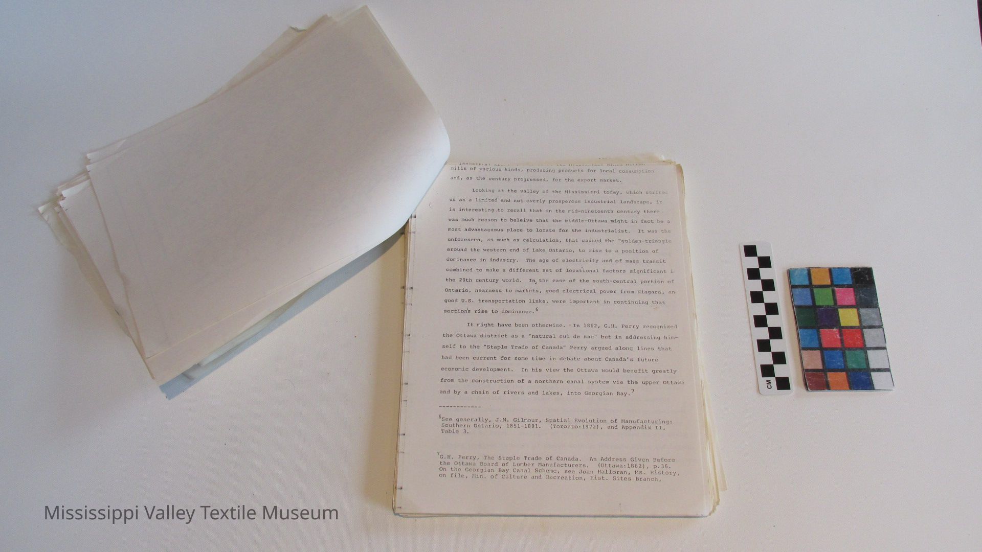
mills of various kinds, producing products for local consumption and, as the century progressed, for the export market.
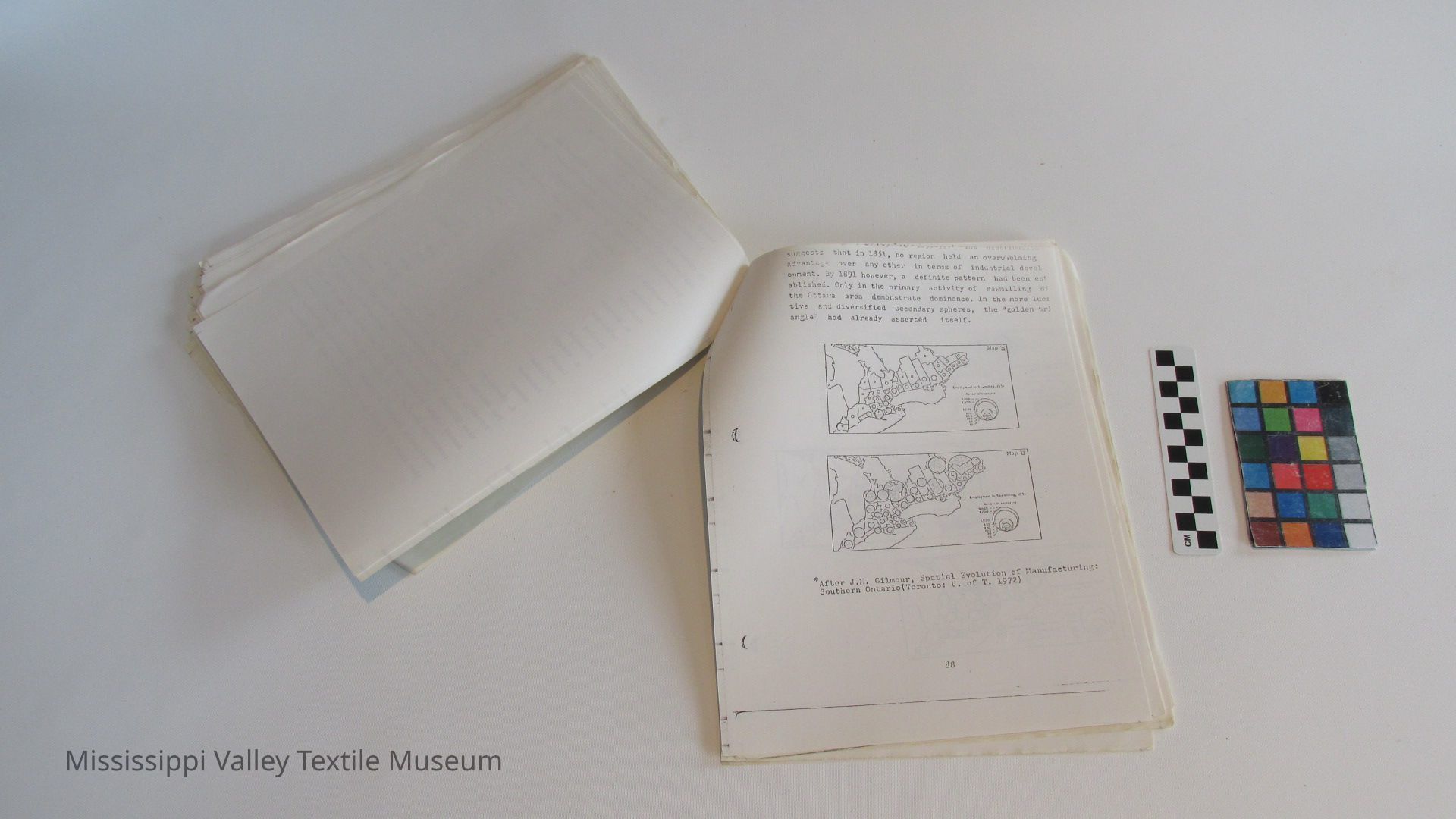
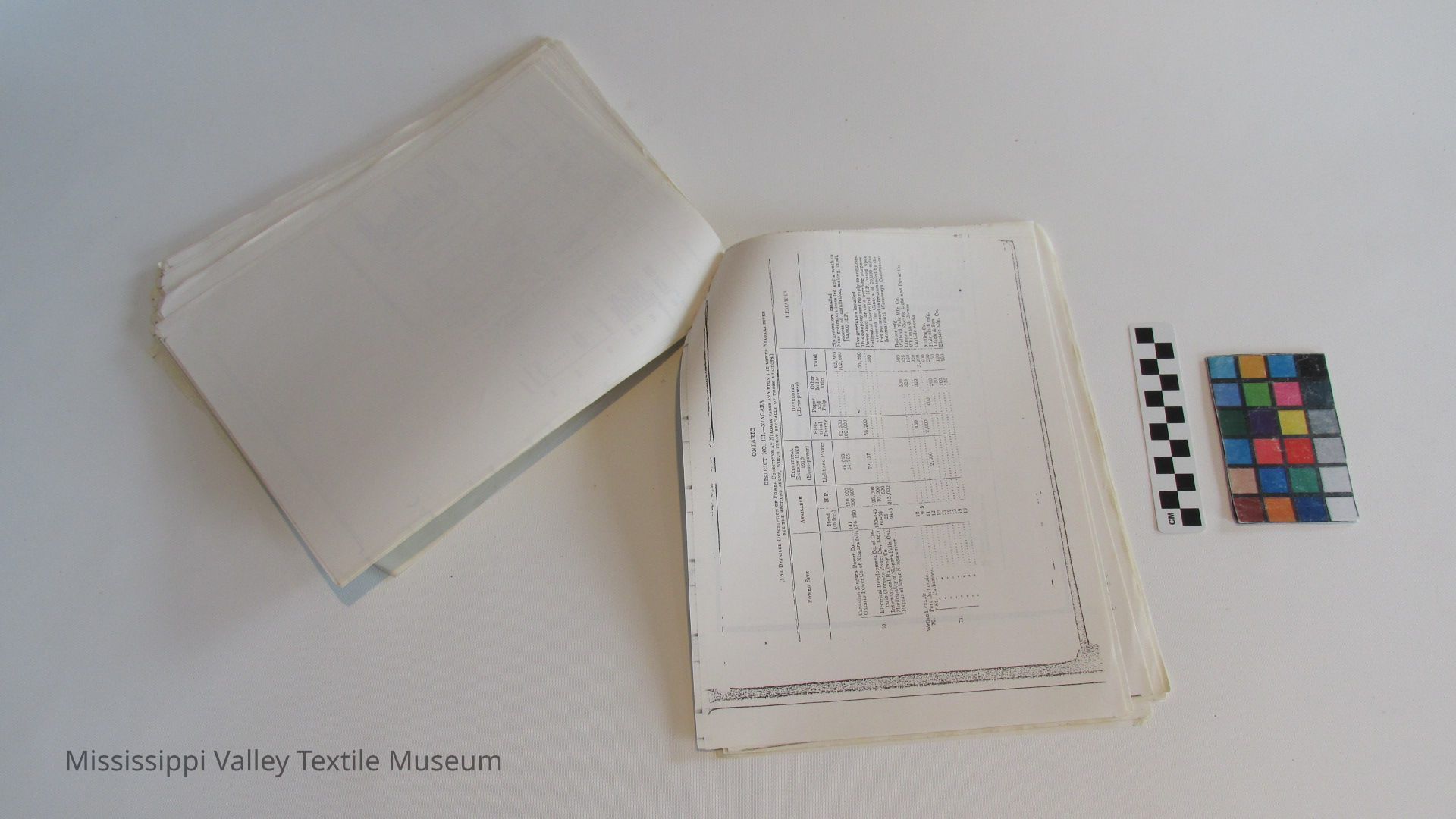
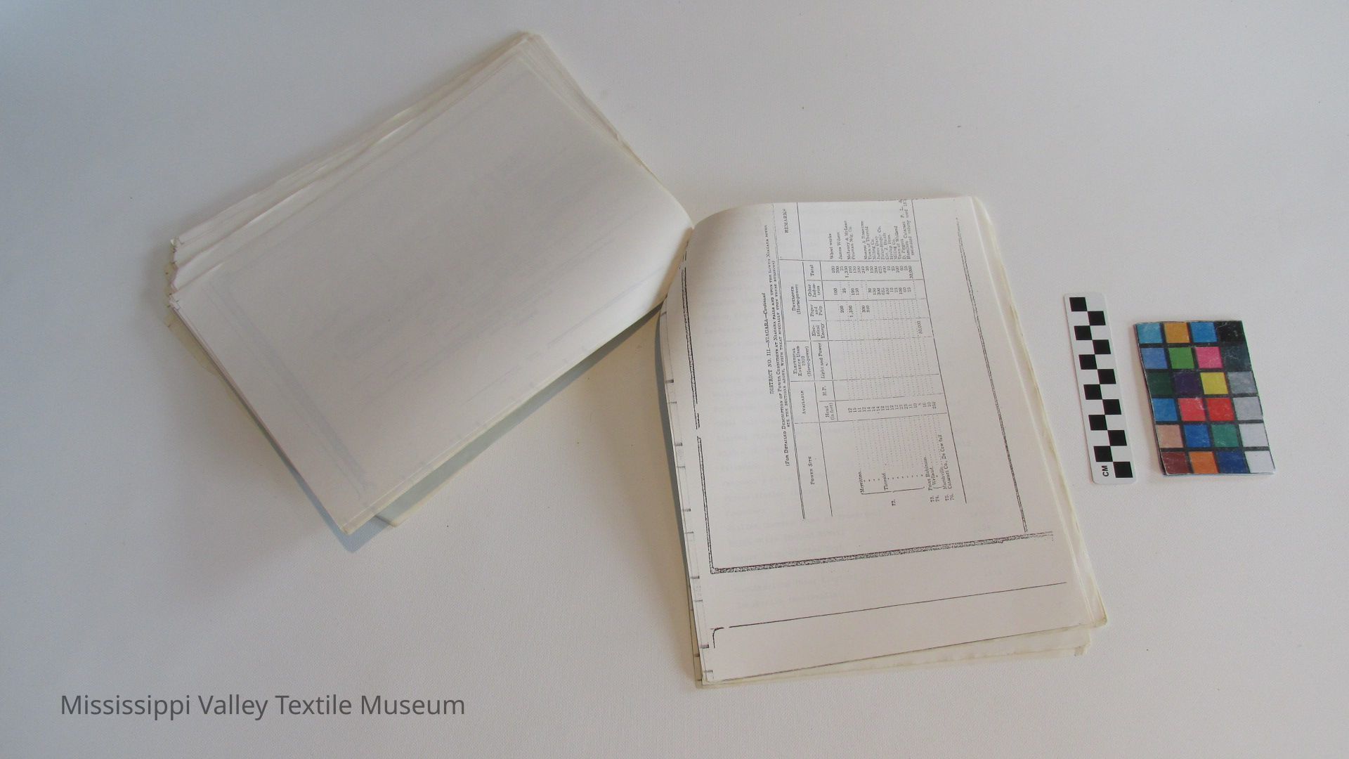
Looking at the valley of the Mississippi today, which strikes us as a limited and not overly prosperous industrial landscape, it is interesting to recall that in the mid-nineteenth century there was much reason to beleive that the middle-Ottawa might in fact be a most advantageous place to locate for the industrialist. It was the unforeseen, as much as calculation, that caused the "golden-triangle around the western end of Lake Ontario, to rise to a position of dominance in industry. The age of electricity and of mass transit combined to make a different set of locational factors significant in the 20th century world. In the case of the south-central portion of Ontario, nearness to markets, good electrical power from Niagara, an good U.S. transportation links, were important in continuing that section's rise to dominance.
It might have been otherwise. - In 1862, G.II. Perry recognized the Ottawa district as a "natural cul de sac" but in addressing himself to the "Staple Trade of Canada" Perry argued along lines that- had been current for some time in debate about Canada's future economic development. In his view the Ottawa would benefit greatly from the construction of a northern canal system via the upper Ottawa 7 and by a chain of rivers and lakes, into Georgian Bay.
6See generally, J.M. Gilmour, Southern Ontario, 1851-1891. Table 3.
7G.H. Perry, The Staple Trade of Canada. An Address Given Before the Ottawa Board of Lumber Manufacturers. (Ottawa:1862) , p.36. On the Georgian Bay Canal Scheme, see Joan Halloran, Ms. History, on file, Min. of Culture and Recreation, Hist. Sites Branch,
[23]
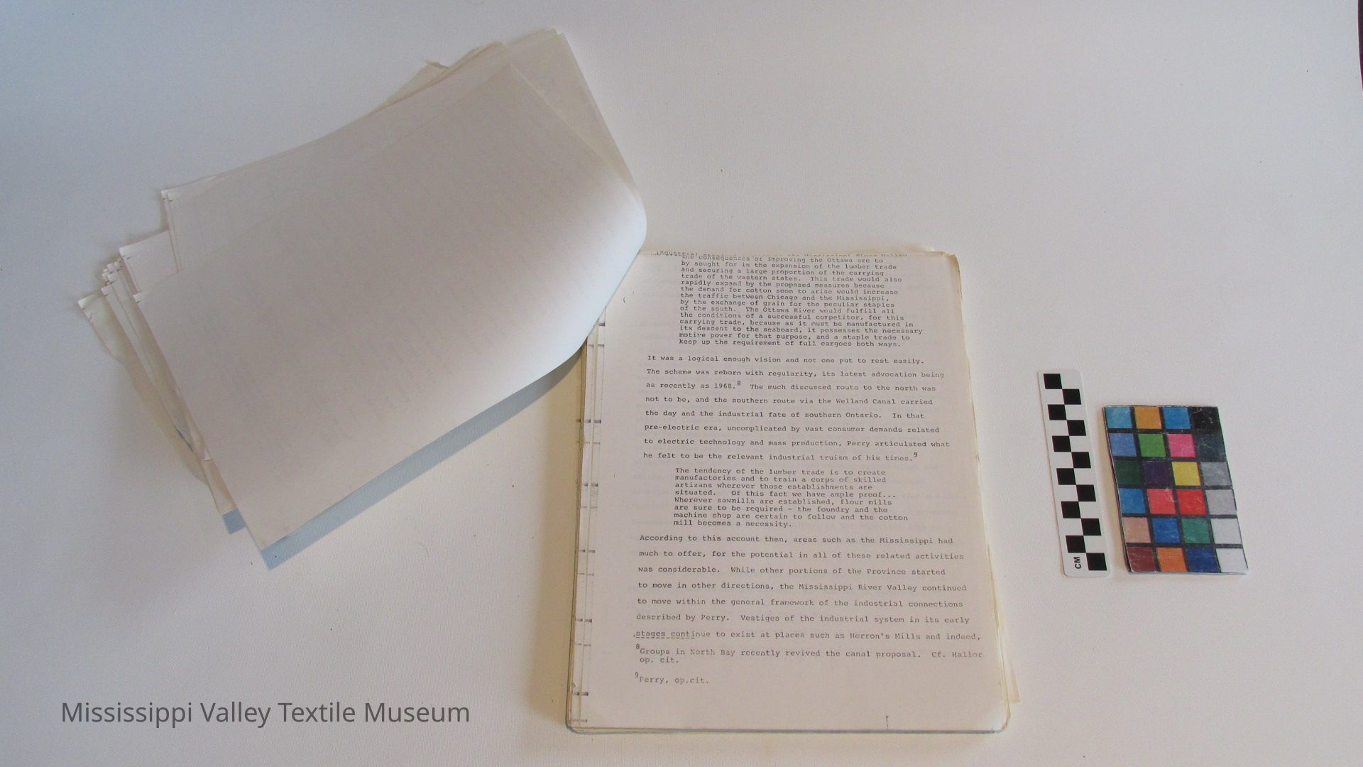
the- consequences or improving the Ottawa are to by sought for in the expansion of the lumber trade and securing a large proportion of the carrying trade of the western states. This trade would also rapidly expand by the proposed measures because the demand for cotton soon to arise would increase the traffic between Chicago and the Mississippi, by the exchange of grain for the peculiar staples of the south. The Ottawa River would fulfill all the conditions of a successful competitor, for this carrying trade, because as it must be manufactured in its descent to the seaboard, it possesses the necessary motive power for that purpose, and a staple trade to keep up the requirement of full cargoes both ways.
It was a logical enough vision and not one put to rest easily.
The scheme was reborn with regularity, its latest advocation being
as recently as 1968. The much discussed route to the north was
not to be, and the southern route via the Welland Canal carried
the day and the industrial fate of southern Ontario. In that pre-electric era, uncomplicated by vast consumer demands related to electric technology and mass production, Perry articulated what
. o . 9
he felt to be the relevant industrial truism of his times.
The tendency of the lumber trade is to create manufactories and to train a corps of skilled artizans wherever those establishments are situated. Of this fact we have ample proof... Wherever sawmills are established, flour mills are sure to be required - the foundry and the machine shop are certain to follow and the cotton mill becomes a necessity.
According to this account then, areas such as the Mississippi had much to offer, for the potential in all of these related activities was considerable. While other portions of the Province started to move in other directions, the Mississippi River Valley continued to move within the general framework of the industrial connections described by Perry. Vestiges of the industrial system in its early stages_continue to exist at places such as Herron's Mills and indeed,
8 Groups in North Bay recently revived the canal proposal. Cf. Bailor op. cit.
9
Perry, op.cit.
[24]
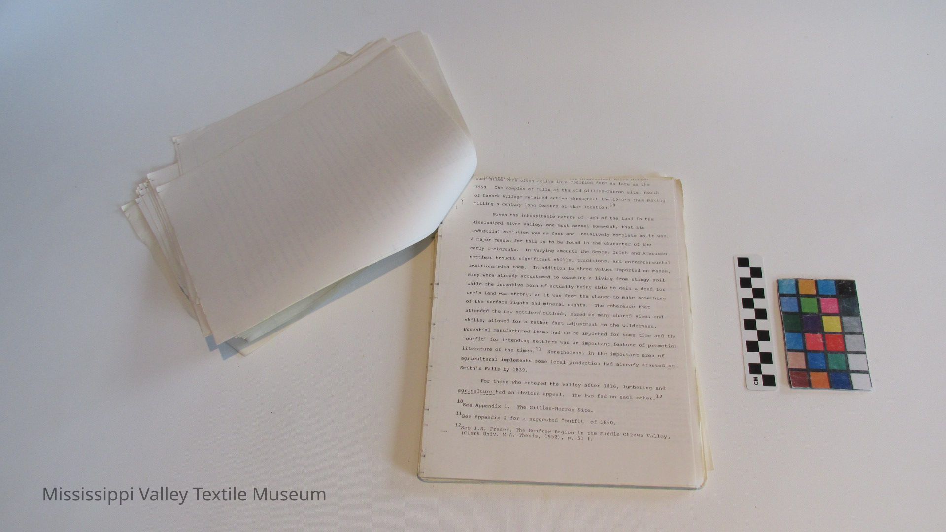
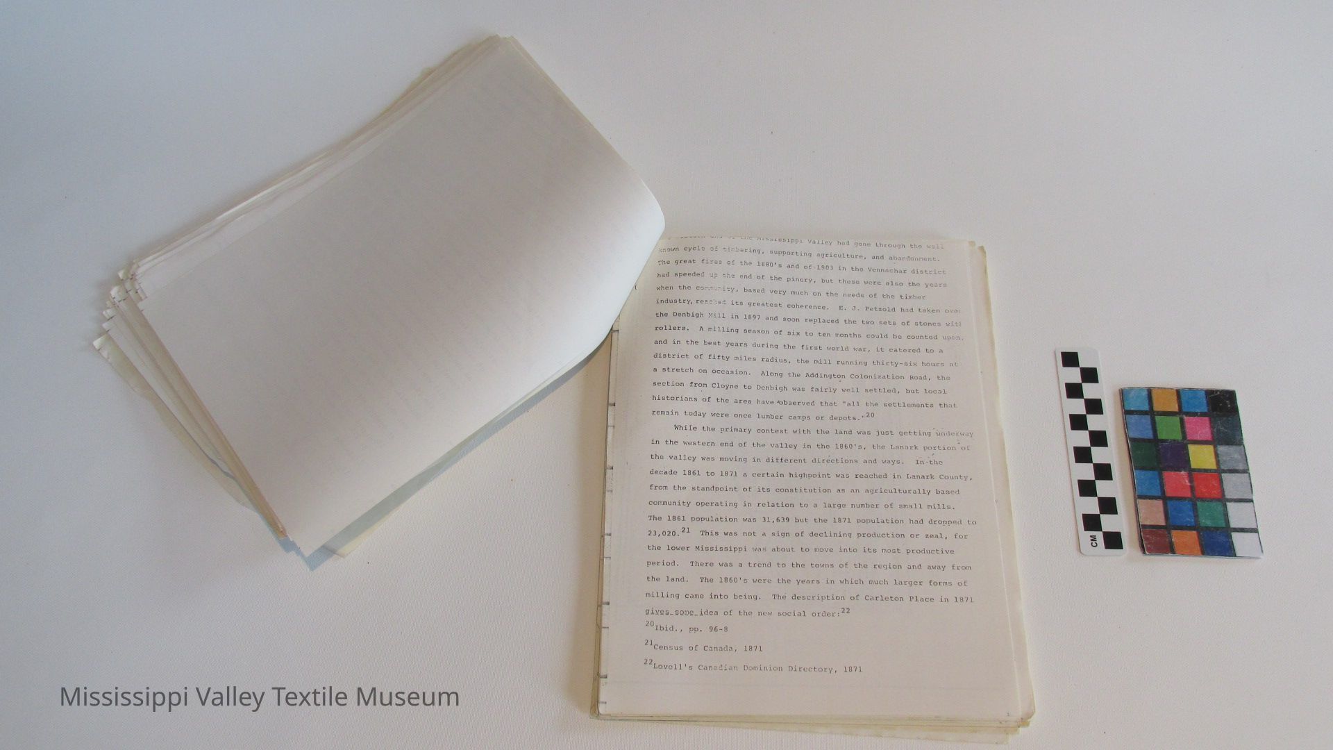
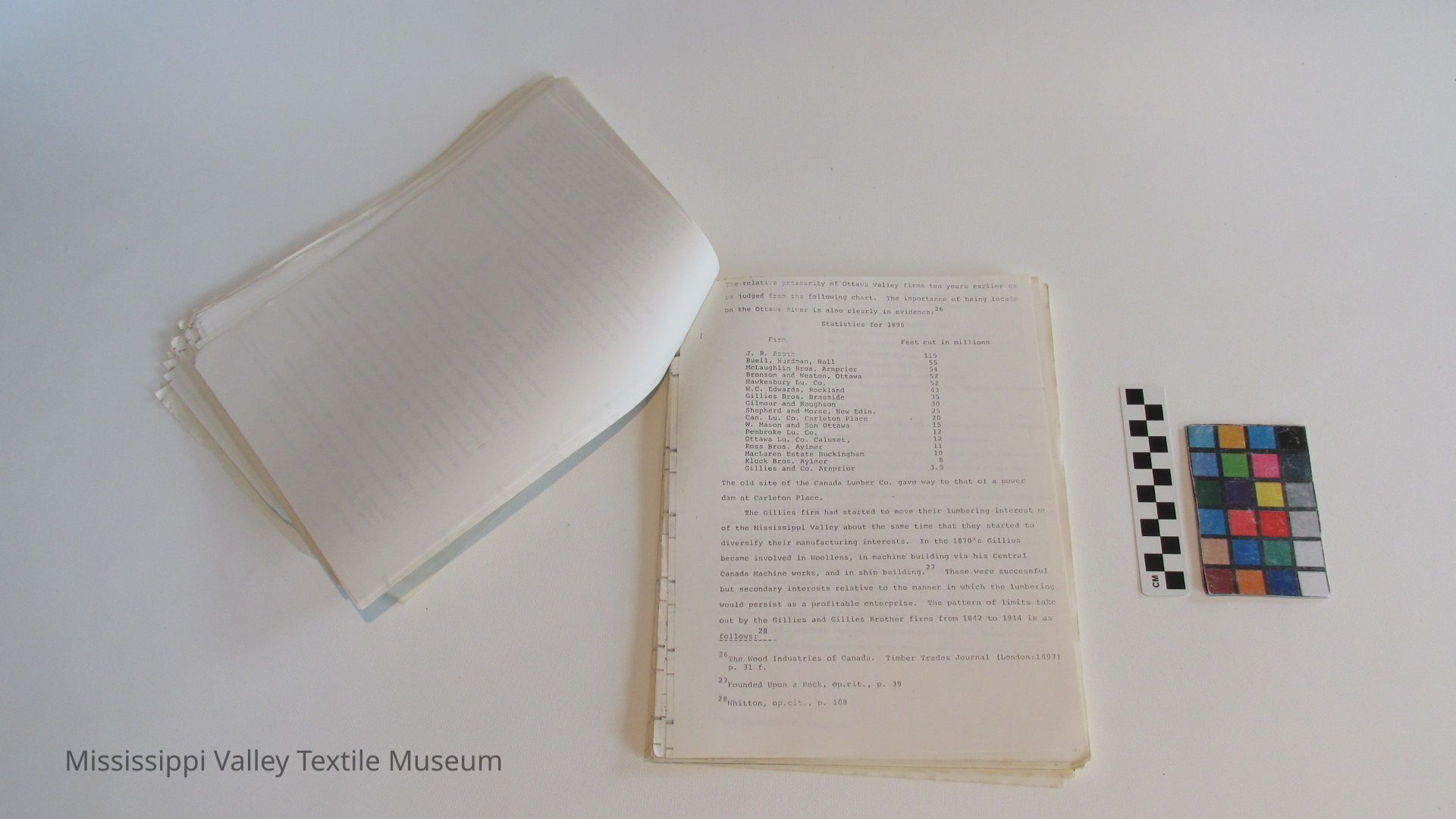
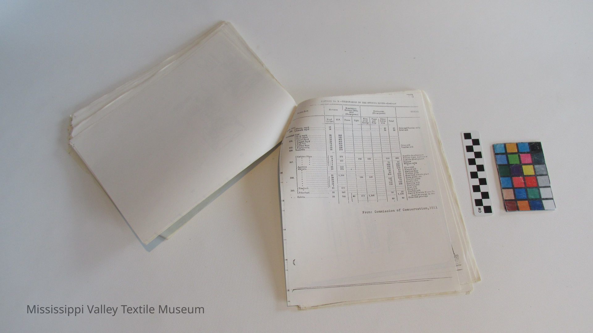
Such sites were often active in a modified form as late as the 1950 The complex of mills at the old Gillies-Herron site, north of Lanark Village remained active throughout the 1940's thus making milling a century long feature at that location.
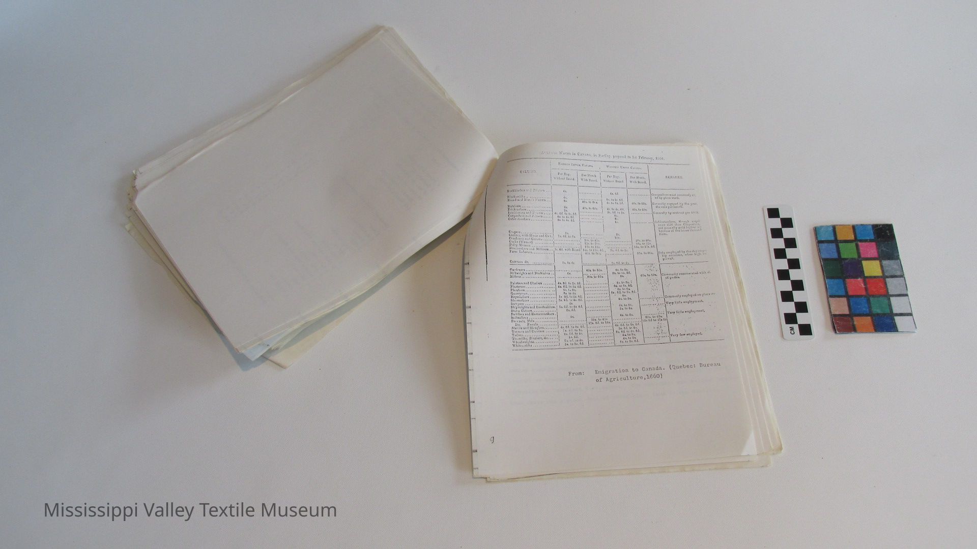
Given the inhospitable nature of much of the land in the Mississippi River Valley, one must marvel somewhat, that its industrial evolution was as fast and relatively complete as it was. A major reason for this is to be found in the character of the early immigrants. In varying amounts the Scots, Irish and American settlers brought significant skills, traditions, and entrepreneurial ambitions with then. In addition to these values imported en masse, many were already accustomed to exacting a living from stingy soil while the incentive born of actually being able to gain a deed for one's land was strong, as it was from the chance to make something of the surface rights and mineral rights. The coherence that attended the new settlers*outlook, based on many shared views and skills, allowed for a rather fast adjustment to the wilderness. Essential manufactured items had to be imported for some time and the "outfit" for intending settlers was an important feature of promotion literature of the times.11 Nonetheless, in the important area of agricultural implements some local production had already started at Smith's Falls by 1839.
For those who entered the valley after 1816, lumbering and . 12
agriculture had an obvious appeal. The two fed on each other.
10 See Appendix 1. The Gillies-Herron Site.
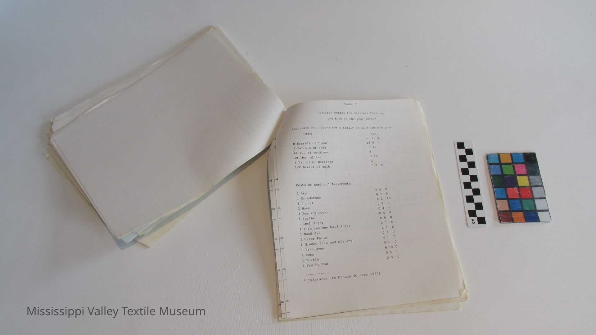
11 See Appendix 2 for a suggested "outfit of 1860.
12 See I.S. Fraser, The Renfrew Region in the Middle Ottawa Valley, (Clark Univ. M.A. Thesis, 1952), p. 51 f.
[25]
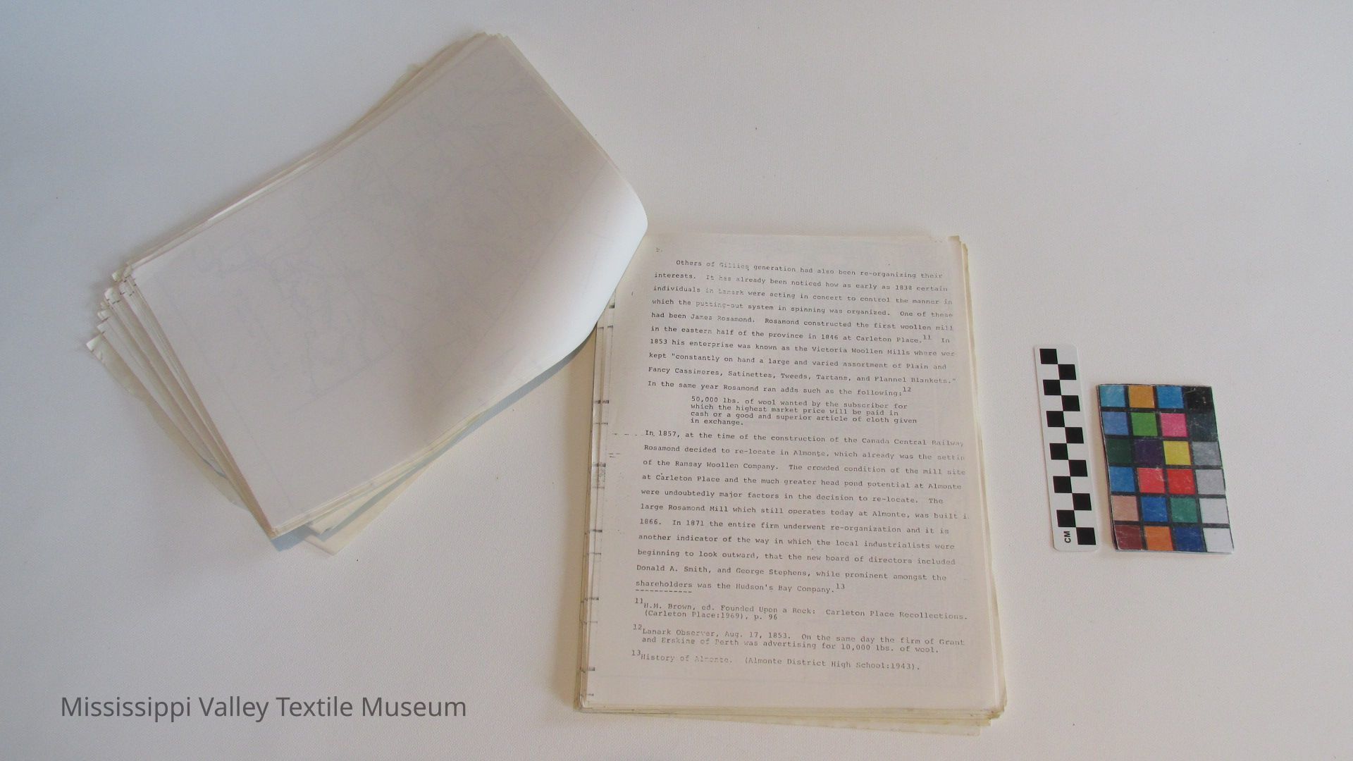
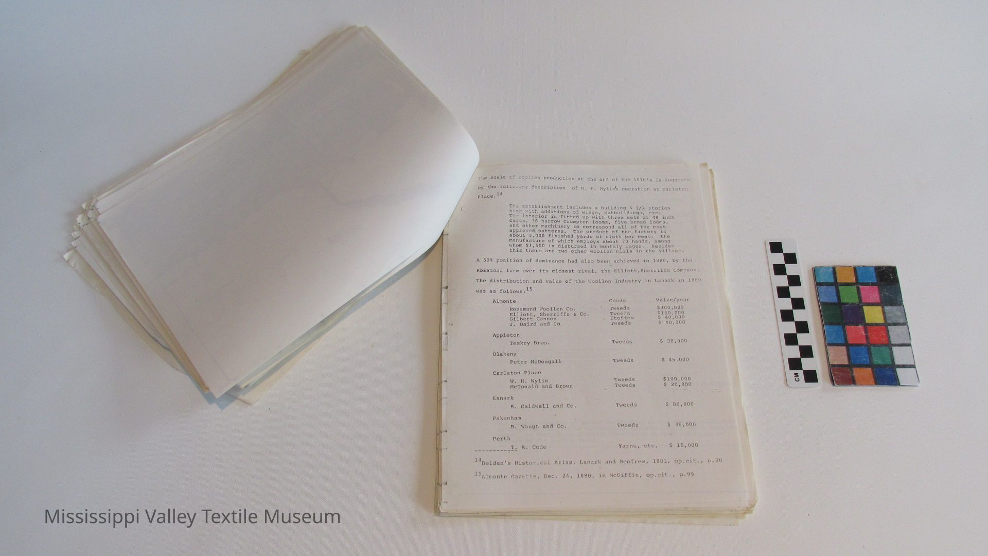
Capital accumulation was most easily achieved by participation in the staple lumber trade, and this was the approach favoured by John Gillies whose name will appear at many points throughout this study. Other routes were possible. The merchant class of Lanark was the cradle of many of Lanark's industrial elite of the future, and the names Mair, Baird, and Caldwell can be associated with such beginnings. Another route was the woollen trade, and this aspect of Lanark agriculture has been one of the longest and best develops features of the industrial life of the valley. The name of Rosamond is one of the oldest and most successful, still applying to the Mil1 at Almonte. In the 19th century Lanark the names Wylie, McArthur, Code and Caldwell, were all familiar in the trade. In the 1870's the woollen trade was so well established on the Mississippi that Almonte took on the name of "the little Manchester of Canada." The curcumstances which combined a high proportion of marginal farm lam suitable for grazing, good carding and fulling sites, and a population steeped in the skills of spinning and weaving, go far to explain the early and lasting development of the textile trade in Lanark.
In travelling along the Mississippi in 1975 there is little to remind one of the great stands of pine and Hardwoods that used to crowd in on the river. The claustrophobic effects of the forest that were earlier the subject of commentary by tourists, are difficult to credit. 3 By the 1880's lumbering was being viewed more from an
13
John McDonald, an 1822 traveller to the Rideau district was especi ly insistent on the unhealthy nature of the forest. He was impres with the amount of fever-prevelant in the settlements. "The reaso of this is clear and obvious to those who will be at the necessary pains to think and investigate, namely, the immensity and closenes. of the woods that surround them. Through these impervious forests no wind possibly can penetrate, and there is consequently no circulation." John McDonald, Emigration to Canada. Narrative of < Voyage to Quebec and Journey from thence to New Lanark (Glasgow:18: pp. 14-15.
[26]
industrial standpoint rather than from a supply ... [truncated due to length]Collection
DocumentCataloged By
Fournier, SarahArchive Details
Date(s) of Creation
Jul 1975Archive Size/Extent
120 pagesArchive Notes
Date(s): 1975
Level of Description: ItemLocation
Location
Container
Archive Box 2Shelf
1Cabinet
Archive CupboardRoom
Collections RoomBuilding
M.V.T.M.Category
PermanentDate
November 7, 2023Location
Container
Box 3Room
Collections RoomBuilding
M.V.T.M.Category
PermanentMoved By
Fournier, SarahDate
February 20, 2017Location
Shelf
37, 37Room
Collections RoomBuilding
M.V.T.M.Date
February 20, 2017Notes
Reason: Awaited storageGeneral Notes
Note
Status: OK
Status By: MacMillan, Lindsay
Status Date: 2020-11-26Created By
admin@catalogit.appCreate Date
February 20, 2017Updated By
admin@catalogit.appUpdate Date
November 11, 2023