Name/Title
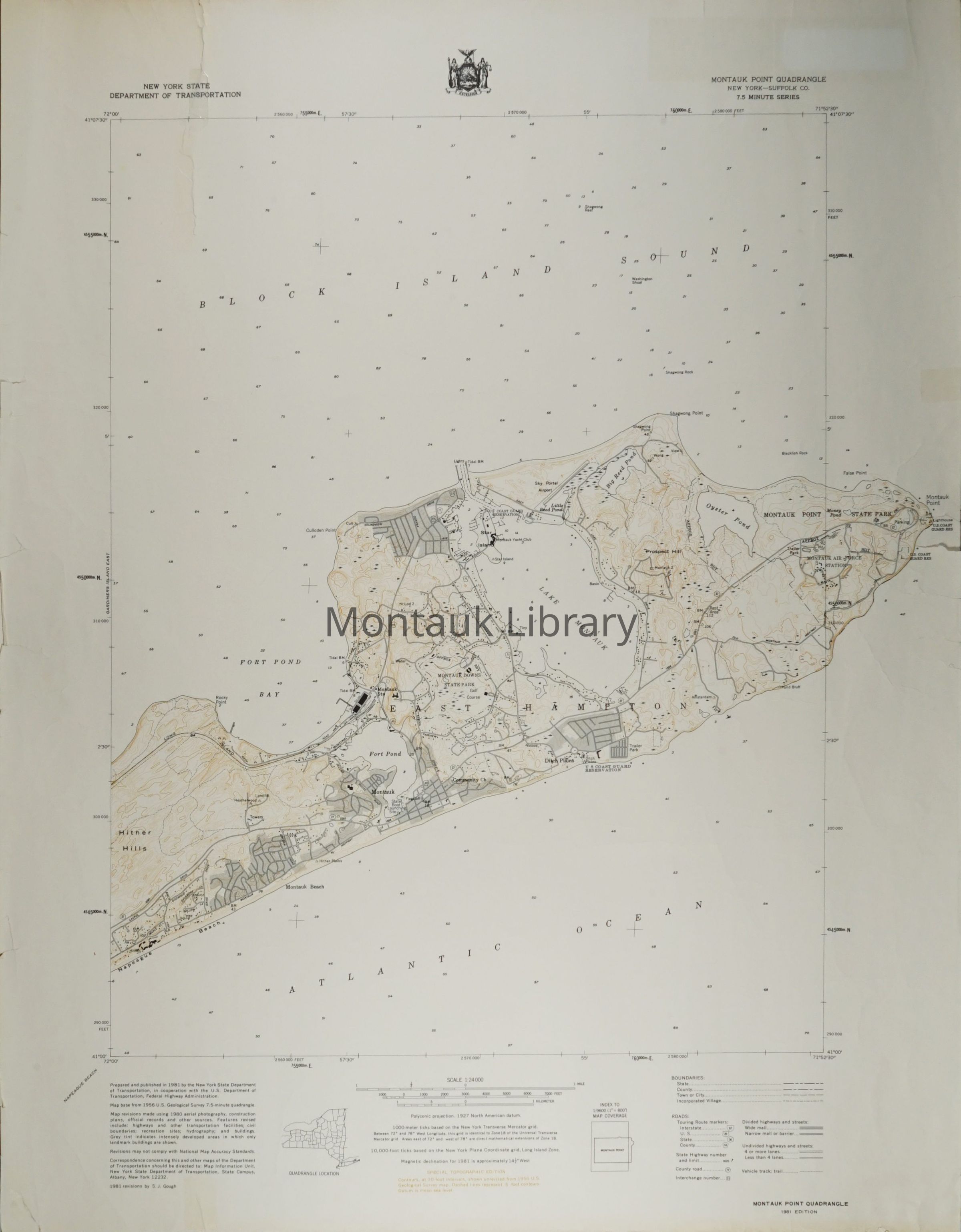
Montauk Point Quadrangle, 1981, New York State Department of TransportationEntry/Object ID
ARC.1122; ARC.610Description
Set of 2 maps produced by the New York State Department of Transportation, Montauk Point Quadrangle New York, Suffolk County, 7.5 minute series. Prepared and published by the NYSDOT in cooperation with the U.S. Department of Transportation, Federal Highway Administration. Map base from 1956 U.S. Geological Survey 7.5-minute quadrangle. Map revisions made using 1980 aerial photography, construction plans, official records and other sources.
1981 revisions by S.J. Gough.
Includes special topographical edition.Map Details
Maker or Creator
New York State Department of TransportationScale
1: 24000Area or Region
* Untyped Area or Region
Montauk, New YorkPublisher
New York State Department of TransportationDate Published
1981Publication Language
EnglishDimensions
Height
30 inWidth
23 inDimension Notes
Each.Copyright
Type of License
In copyright: http://rightsstatements.org/vocab/InC/1.0/Copyright Holder
New York State Department of TransportationCopyright Details
Researchers assume all responsibility for copyright questions. Fair use is permitted. For all other uses please contact archives@montauklibrary.org.