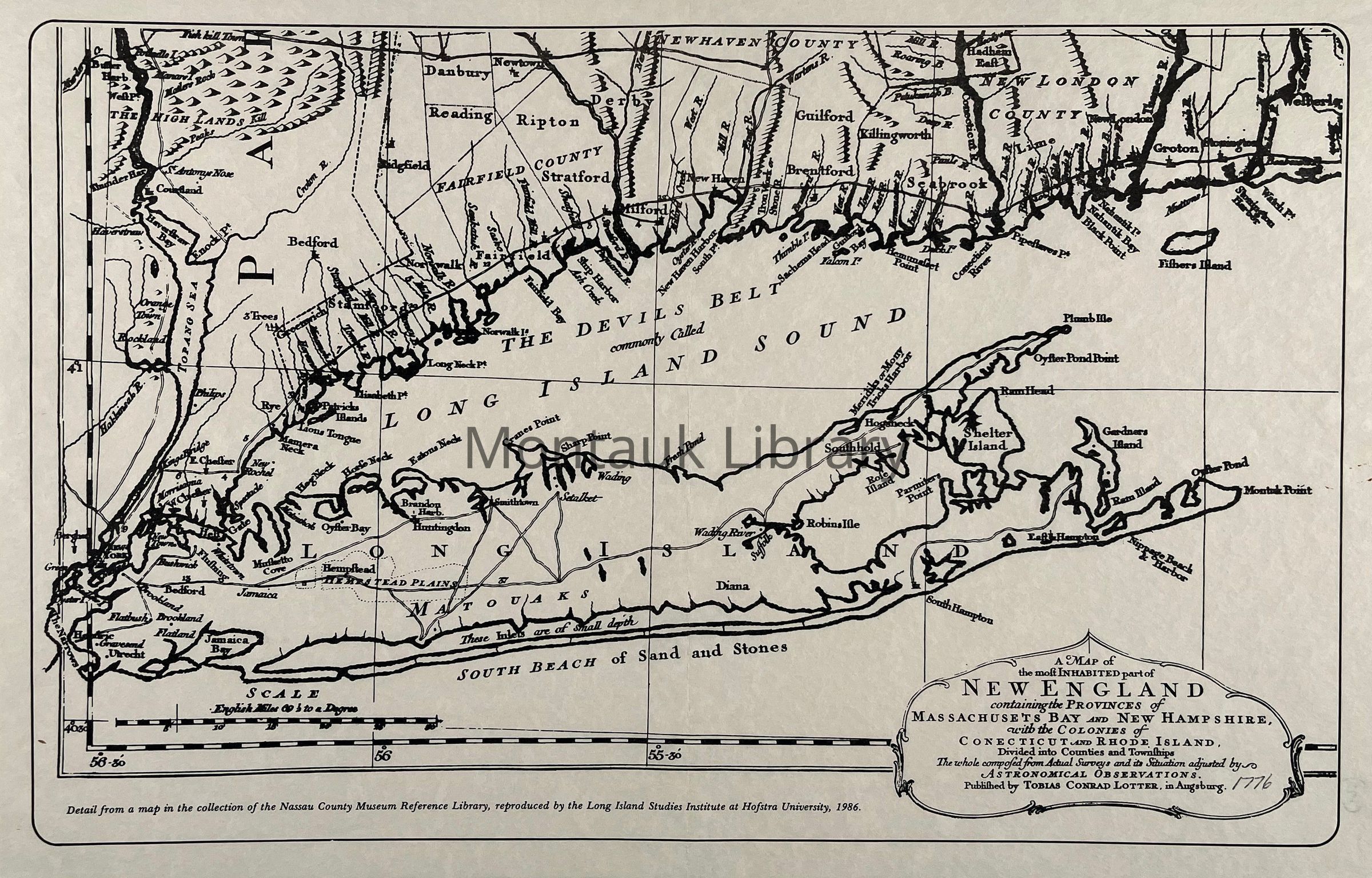
Name/Title
Map of the most inhabited part of New England, 1776. (1986 Reproduction)Entry/Object ID
ARC.0564Description
A map of the most inhabited part of New England containing the provinces of Massachusets Bay and New Hampshire, with the colonies of Conecticut and Rhode Island. Divided into counties and townships. the whole composed from actual surveys and its situation adjusted by astronomical observations. Detail from a map in the collection of the Nassau County Museum Reference Library, reprodued by the Long Island Studies Institute at Hofstra University, 1986.Map Details
Publisher
Tobias Conrad LotterDate Published
1776Printer
Long Island Studies Institute at Hofstra UniversityDate Printed
1986Publication Language
EnglishCopyright
Type of License
NoneCopyright Details
Public domain.