HUB
Collections
Classifications
About
App
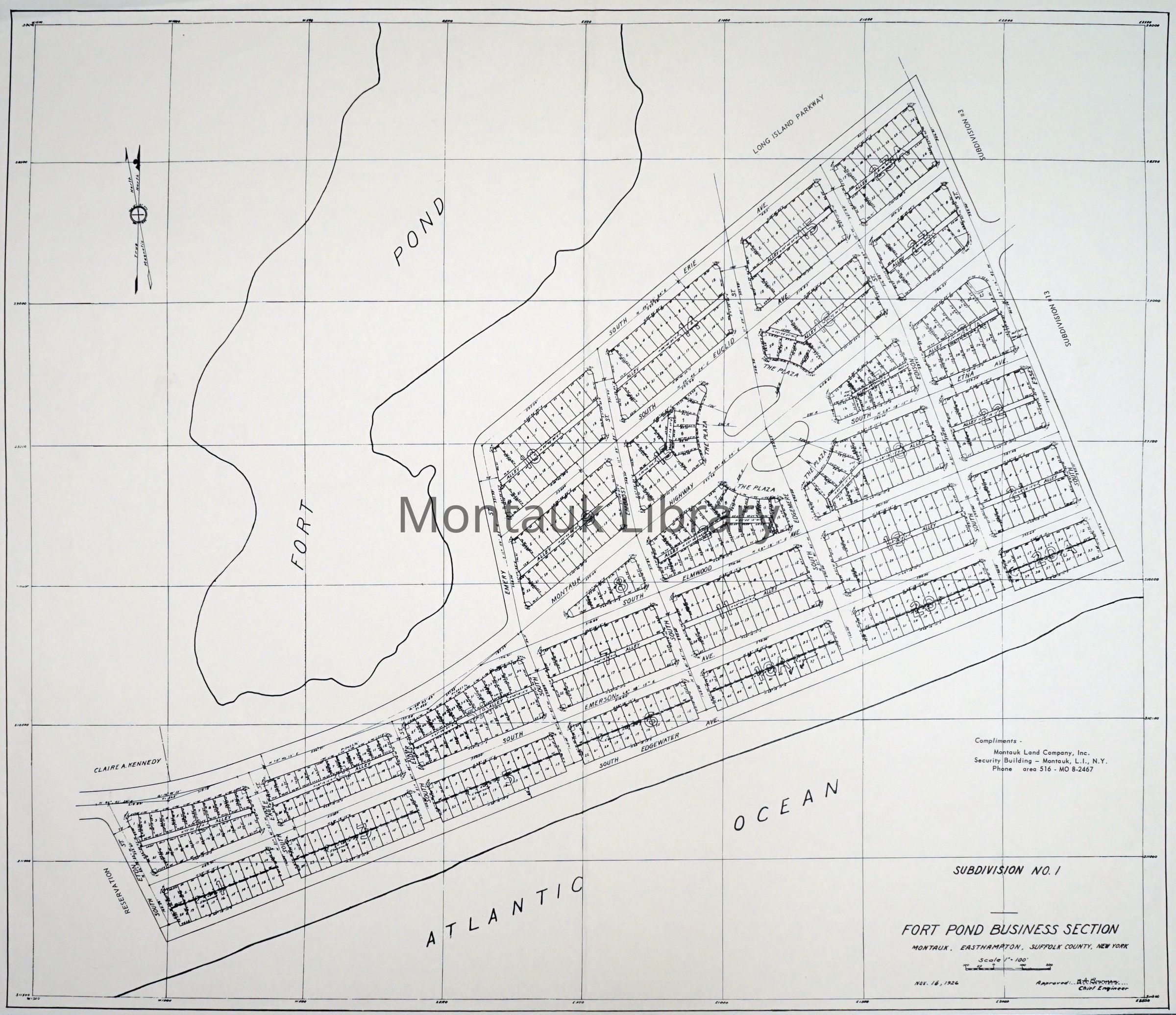
Map of Fort Pond Business Section, Montauk, NY, 1926
Map
•
Object ID: ARC.0566
•
Montauk Library Archives
Overview
Description
Subdivision No. 1. Showing Fort Pond and Atlantic Ocean
Map Details
Maker or Creator
B. A. Bowman
Scale
1" = 100'
Publisher
Montauk Land Company, Inc.
Date Published
Nov 16, 1926
Dimensions
Height
17 in
Width
22 in
Acquisition
Acquisition Method
Gift
Acquired From
Montauk Land Company, Inc.
Copyright
Type of License
None
Restrictions
Researchers assume all responsibility for copyright questions. Fair use is permitted. For all other uses please contact
[email protected]
.