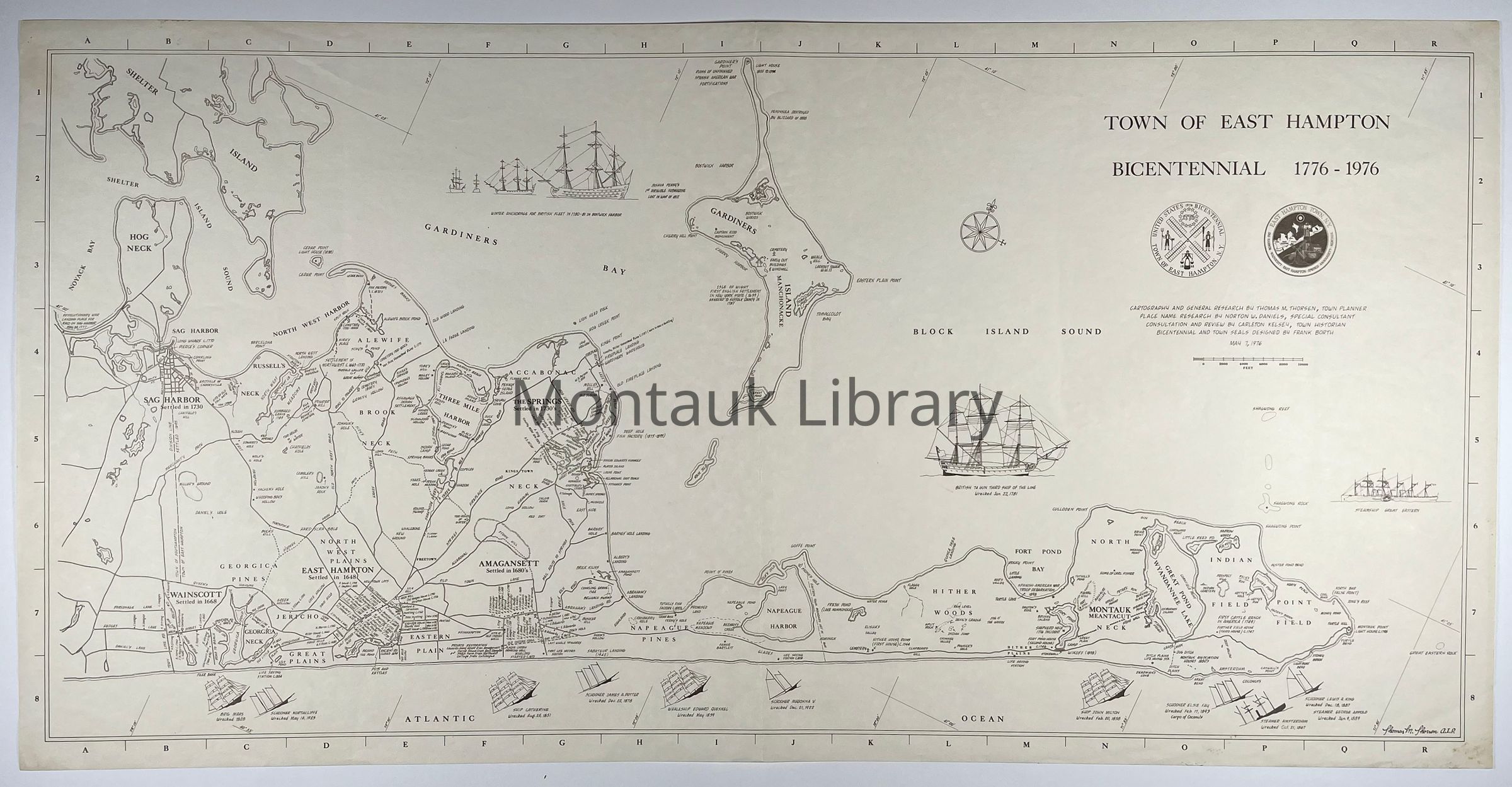
Map of East Hampton, including Sag Harbor, Wainscott, East Hampton, Springs, Amagansett, and Montauk created for the Town of East Hampton's Bicentennial celebration in 1976. Cartography and general research by Thomas M. Thorsen, Town Planner. Place name research by Norton W. Daniels, Special Consultant. Consultation and review by Carleton Kelsey, Town Historian. Bicentennial and town seals designed by Frank Borth. May 7, 1976
Map Details
Maker or Creator
Town of East Hampton
Illustrator
Thomas M. Thorsen
Publisher
Town of East Hampton
Date Published
May 7, 1976
Publication Language
English
Dimensions
Height
18-1/2 in
Width
37-1/2 in
Copyright
Type of License
In copyright: http://rightsstatements.org/vocab/InC/1.0/
Copyright Holder
Town of East Hampton
Copyright Details
Researchers assume all responsibility for copyright questions. Fair use is permitted. For all other uses please contact [email protected].