Historical Map of Wisconsin
Name/Title
Historical Map of WisconsinContext
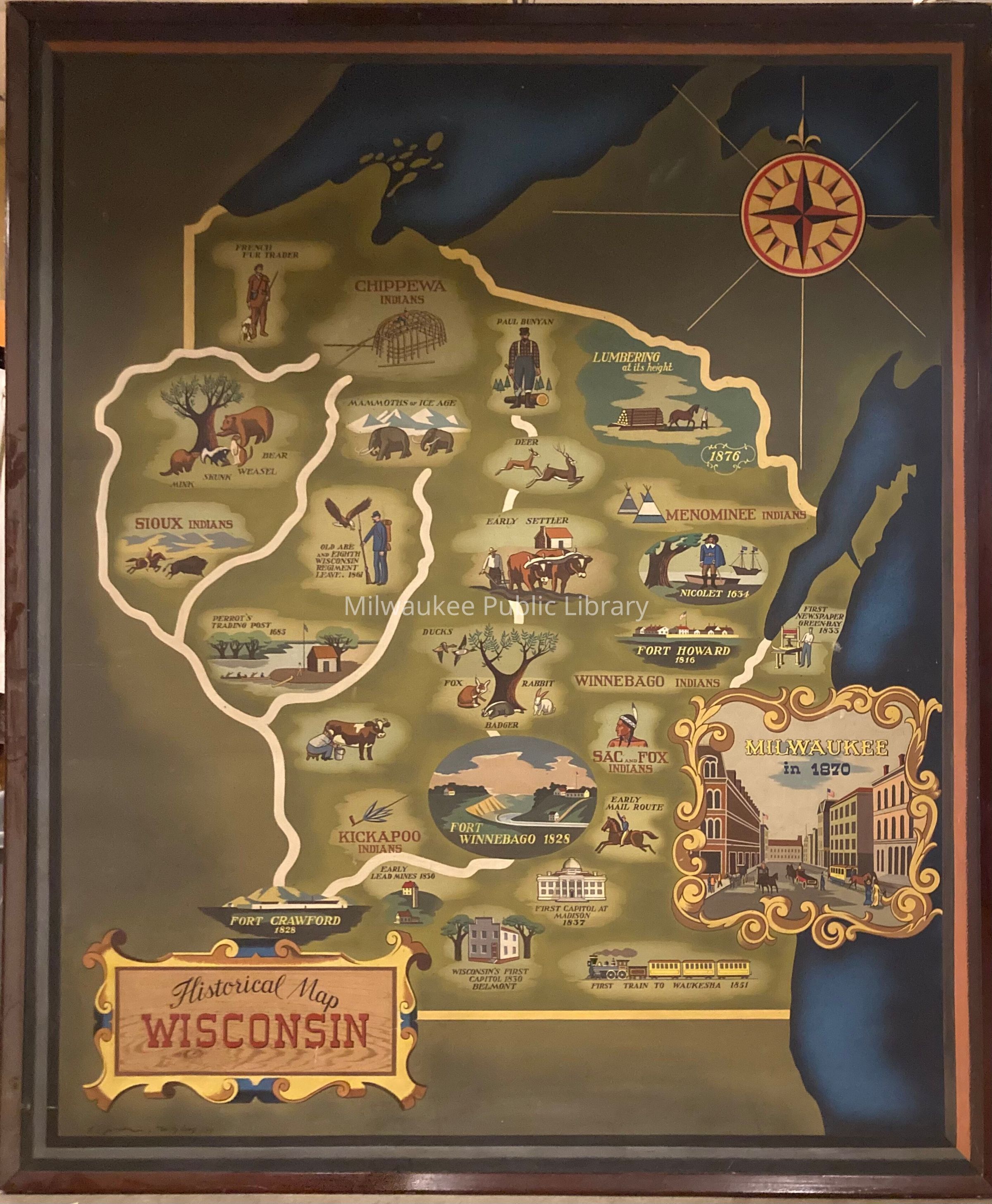
Illustrated map depicts local tribes, white settlement, and various 'firsts' in Wisconsin history. From top left corner proceeding from left to right and down, vignettes include: "French Fur Trader"; "Chippewa Indians" [sic]; "Paul Bunyan"; "Lumbering at its height" (1876); mink, skunk, weasel, and bear around a tree; "Mammoths of Ice Age"; "Deer"; "Menominee Indians"; "Sioux Indians" [sic]; "Old Abe and Eighth Wisconsin Regiment Leave. 1861"; "Early Settler"; "Nicolet 1634"; "Perrot's Trading Post 1685"; ducks, fox, badger, and rabbit around a tree; "Winnebago Indians"; "Fort Howard 1816"; "First Newspaper Green Bay 1833"; man milking cow; "Sac and Fox Indians"; "Kickapoo Indians"; "Fort Winnebago 1828"; "Early Mail Route"; "Milwaukee in 1870; "Fort Crawford 1828"; "Early Lead Mines 1836"; "First Capitol at Madison 1837"; Wisconsin's First Capitol 1830 Belmont"; "First Train to Waukesha 1851." The map depicts the "Chippewa Indians," "Menominee Indians," "Sioux Indians," "Winnebago Indians," "Sac and Fox Indians," and "Kickapoo Indians." The Sac and Fox called portions of the Midwest including now-Wisconsin home but were forcibly removed by the end of the 1800s. The Menominee, Ojibwe ("Chippewa"), and Ho-Chunk (Winnebago) remain present in Wisconsin as federally-recognized Native nations. The Kickapoo were pushed into Wisconsin by the mid-1600s and then gradually pushed out as a result of white settlement. The 'Sioux' prefer "Lakota" or "Dakota"; Dakota communities trace their roots back to northern Wisconsin. Despite intertribal warfare, white settlement, and land cessions via treaty which forced many Dakota out of Wisconsin, significant populations of Dakota remain in Wisconsin, though no Dakota in Wisconsin have federal recognition status.Collection
Wisconsin Art Collection, Artwork Collection, Federal Art CollectionAcquisition
Source (if not Accessioned)
Works Progress Adminstration Federal Art ProjectMade/Created
Artist Information
Richard L. Jansen
Works Progress Adminstration Federal Art Project
William Lang