Name/Title
Chart, NavigationalEntry/Object ID
2015.004.0001Scope and Content
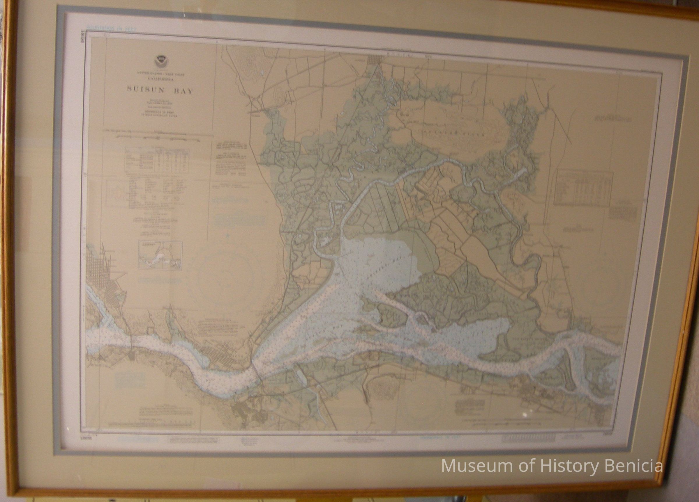
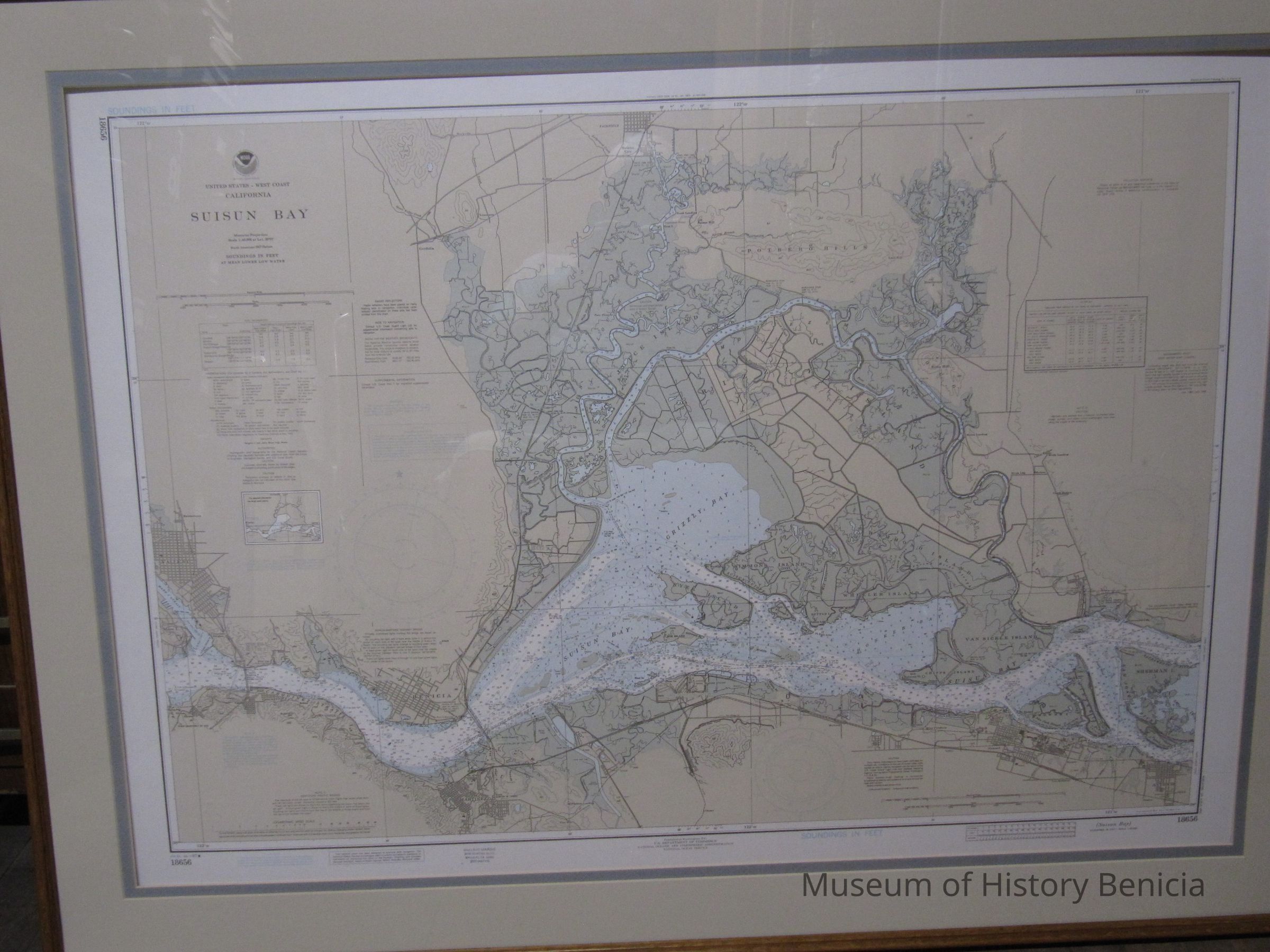
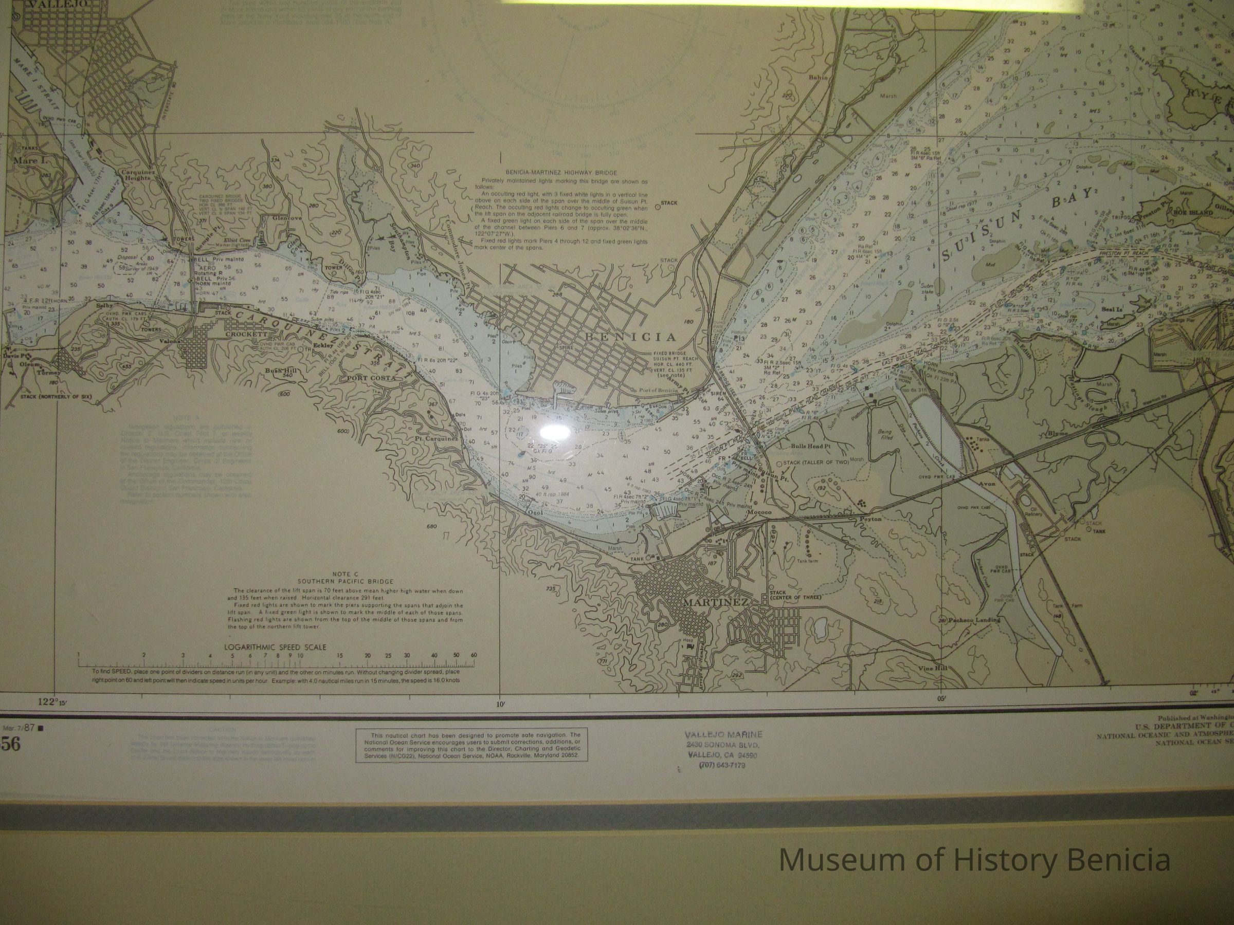
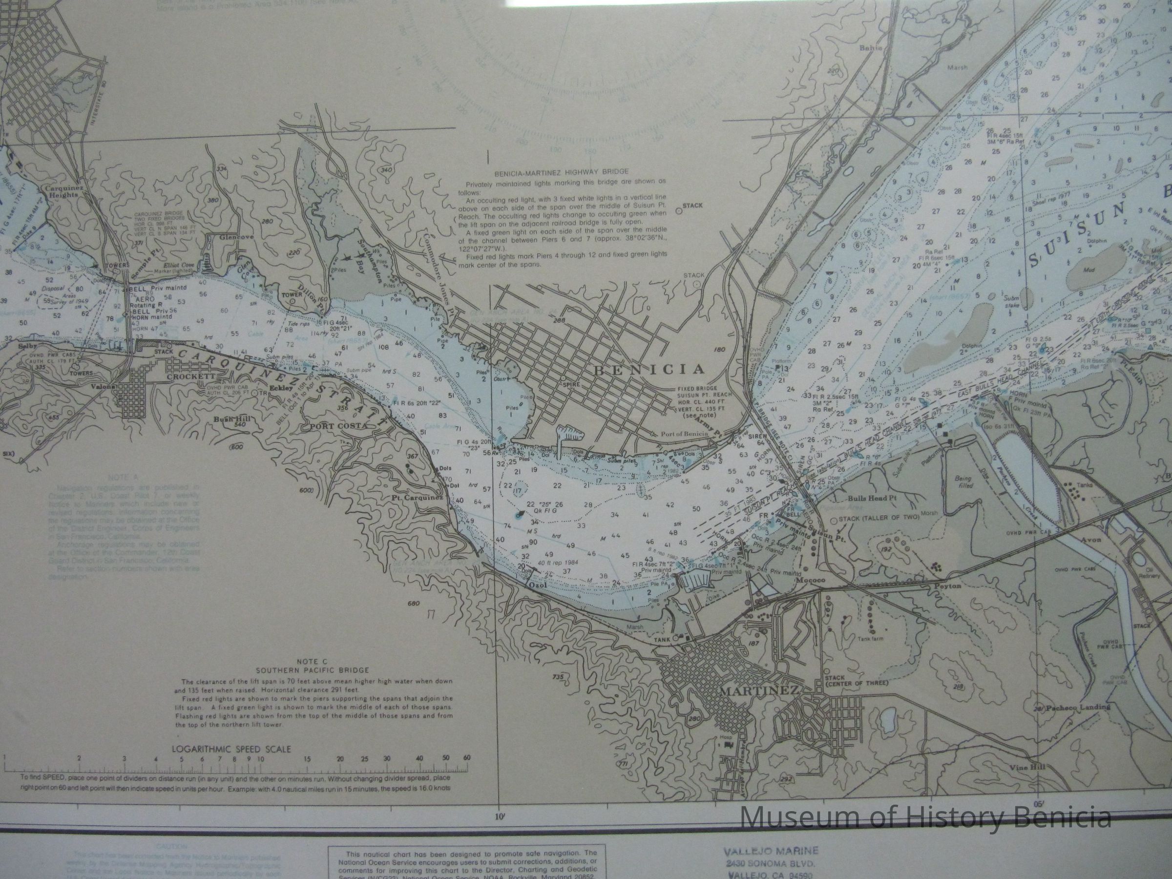
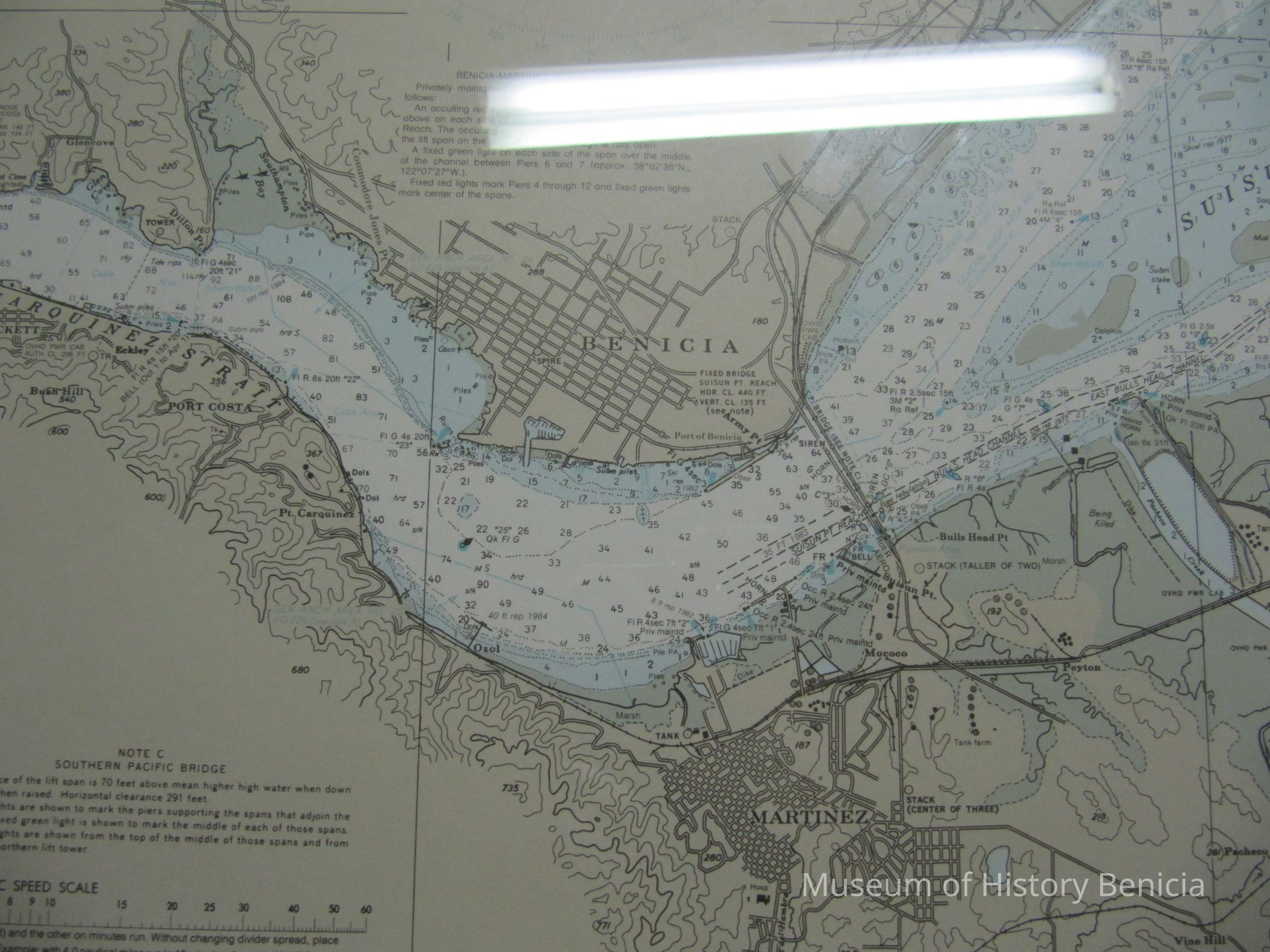
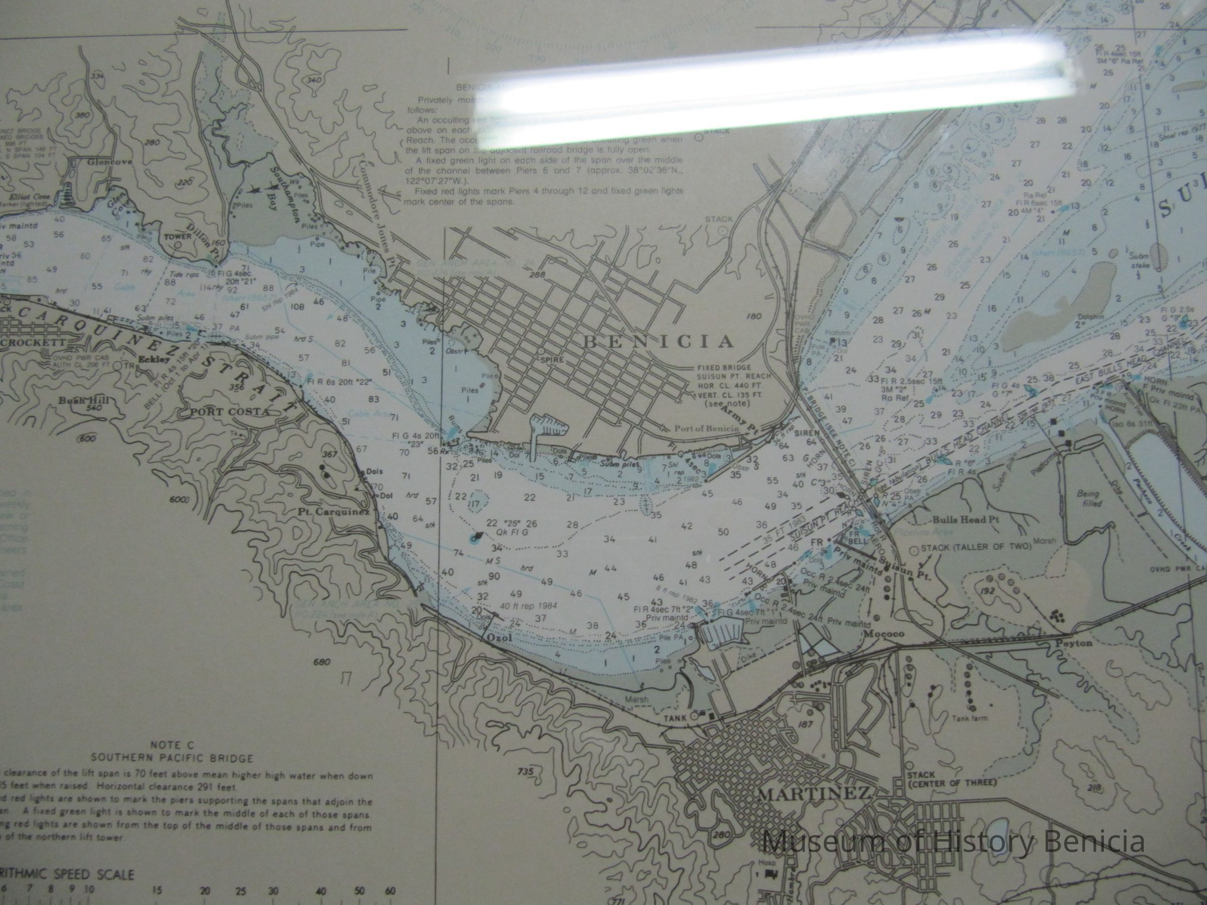
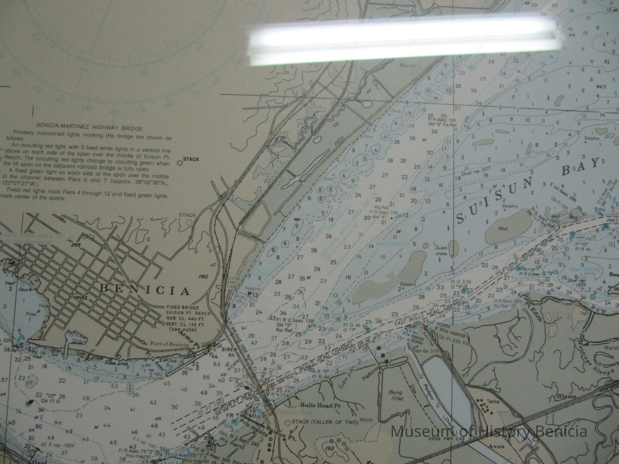
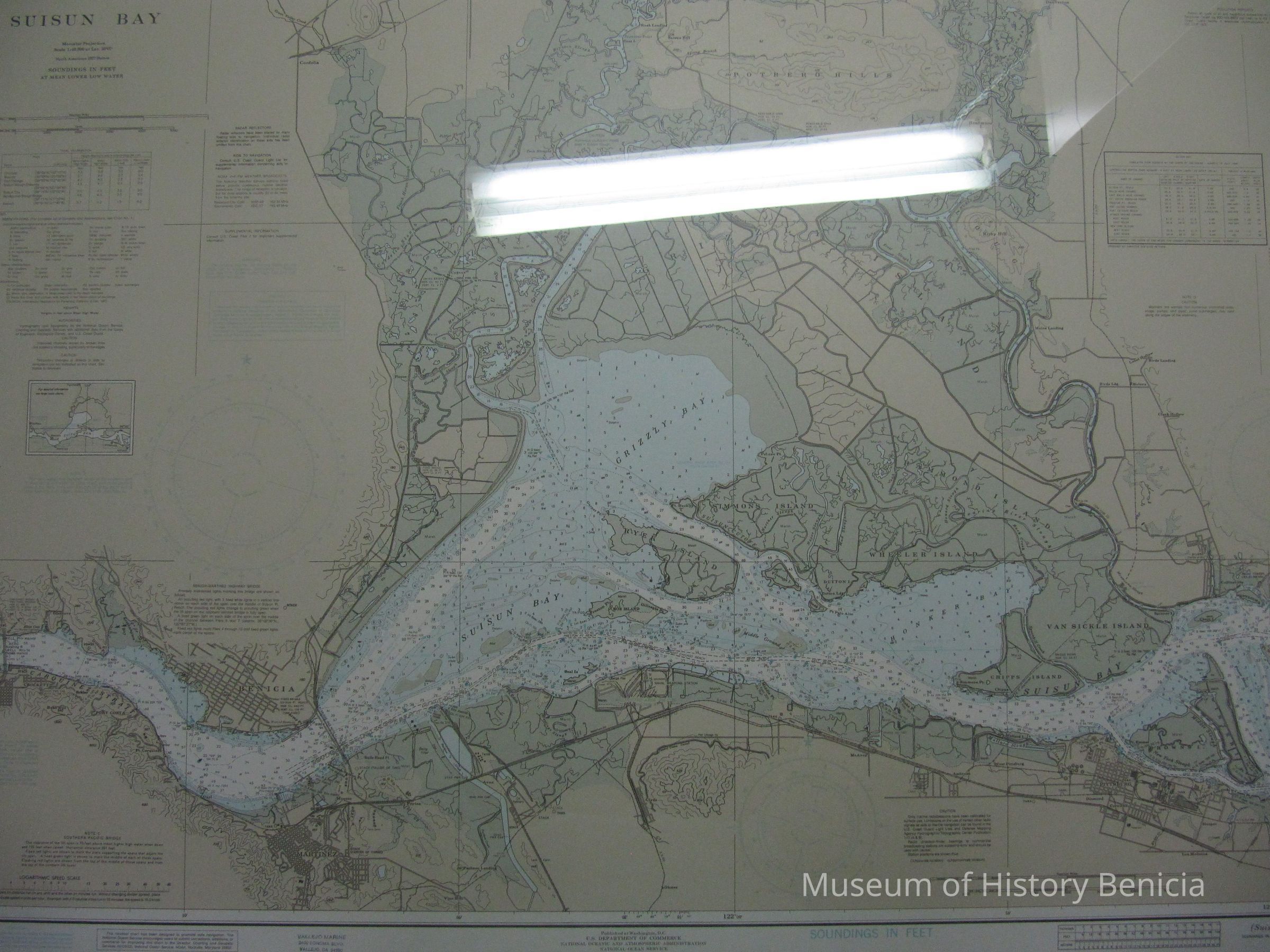
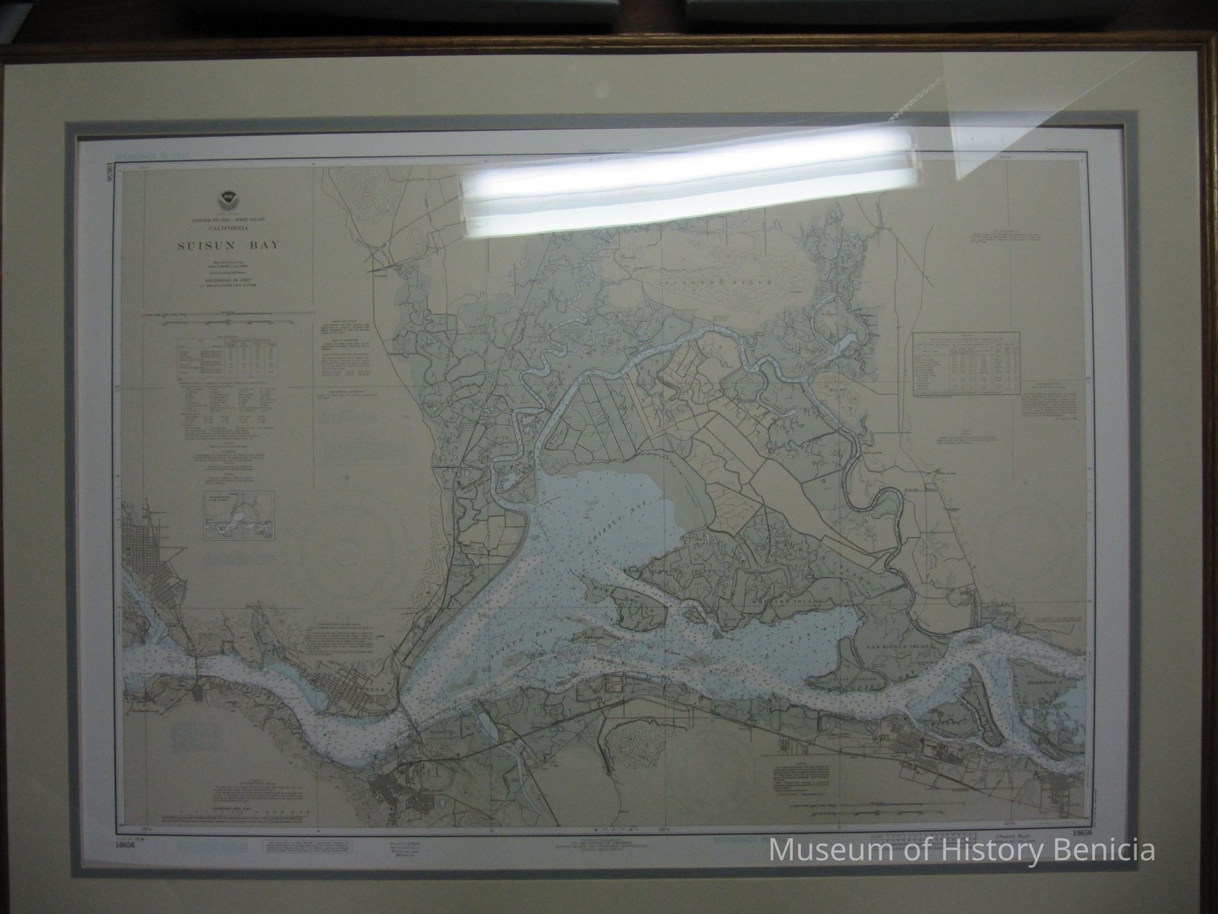
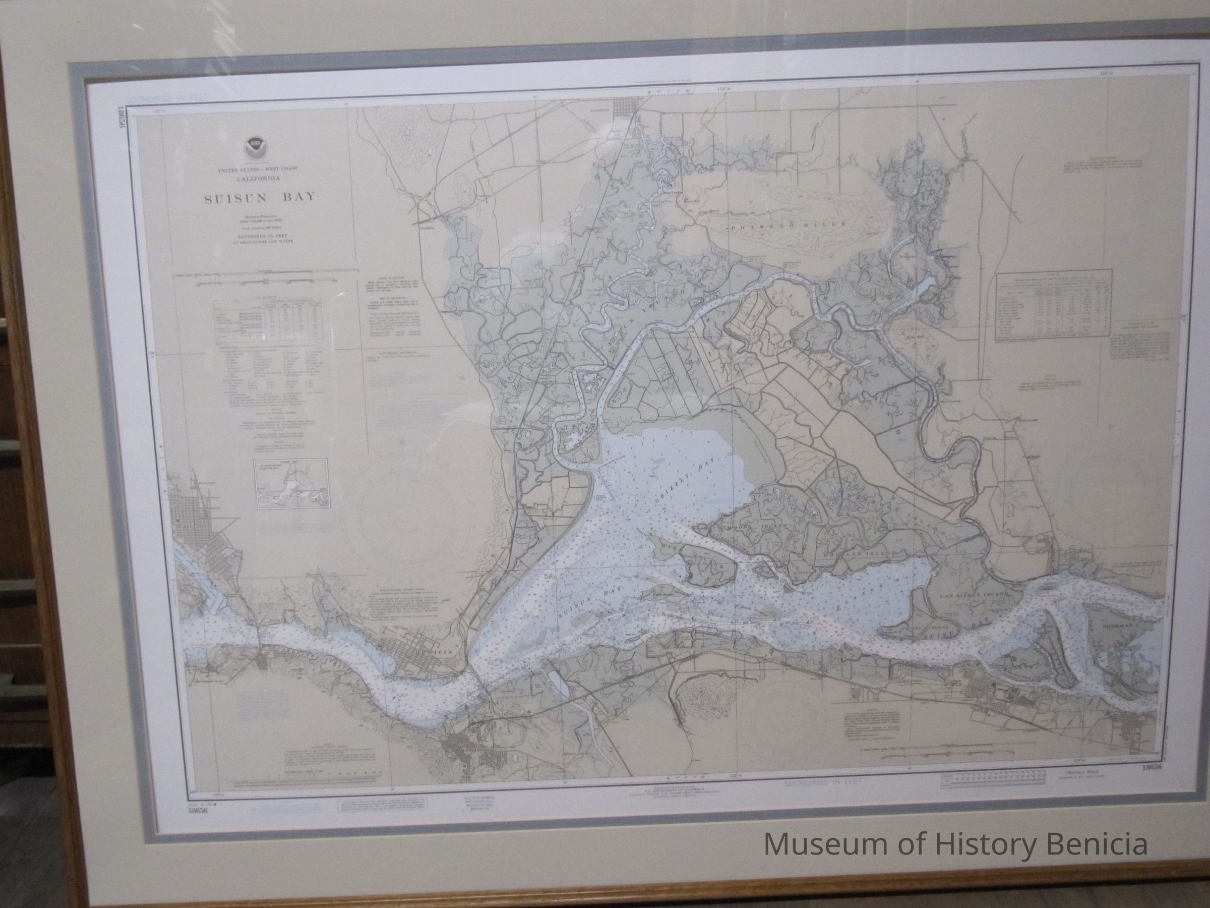
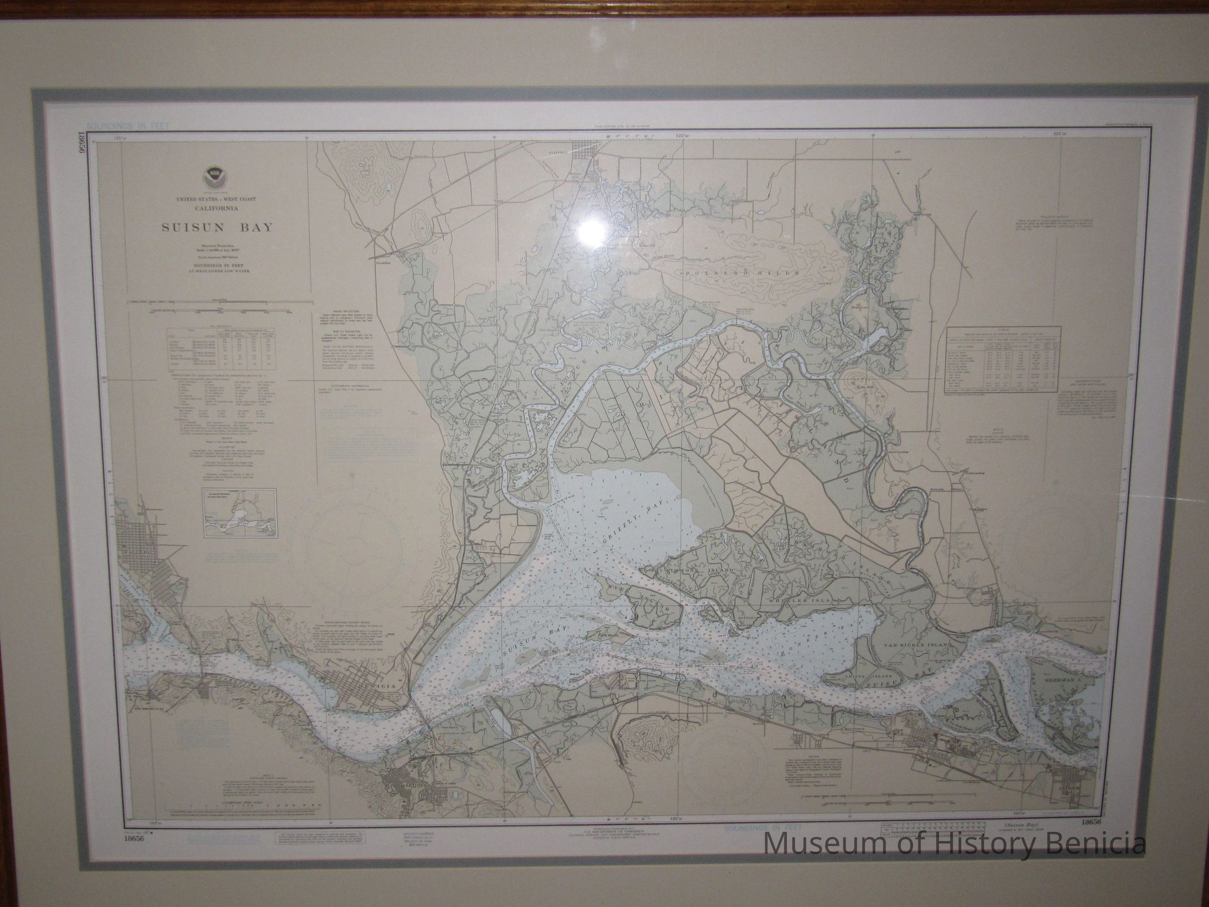
Navigational Chart, framed in oak with two color mat:
"National Oceanic and Atmospheric Administration, U.S. Department of Commerce [round logo w/NOAA in center], National Ocean Service, United States - West Coast, California, SUISUN BAY, Mercator Projection" Scale 1:40,000 at Lat. 38 degrees 7 feet, North American 1927 Datum, Soundings in Feet at Mean Lower Low Water"
47th Edition, March 7, 1987 number 18656
Published at Washington D.C.
colors: beige, blue, green, white
size: 38-1/2" x 51-1/2" overall
30" x 43-1/2" chart only
stamped w/Vallejo Marine / 2430 Sonoma Blvd. / Vallejo, CA 94590
/ (707) 643-7179
other points of interest: Vallejo and Mare Island Strait at left; Sherman Island at right; Martinez and Pittsburg at bottom; Fairfield at top;
Grizzly Bay, Honker Bay, Southampton Bay;
Carquinez Strait
North Latitude: 38.0-38-
West Longitude: 121-122Collection
Benicia Historical Museum Collection