Name/Title
Chart, PlottingEntry/Object ID
2012.099.0053Scope and Content
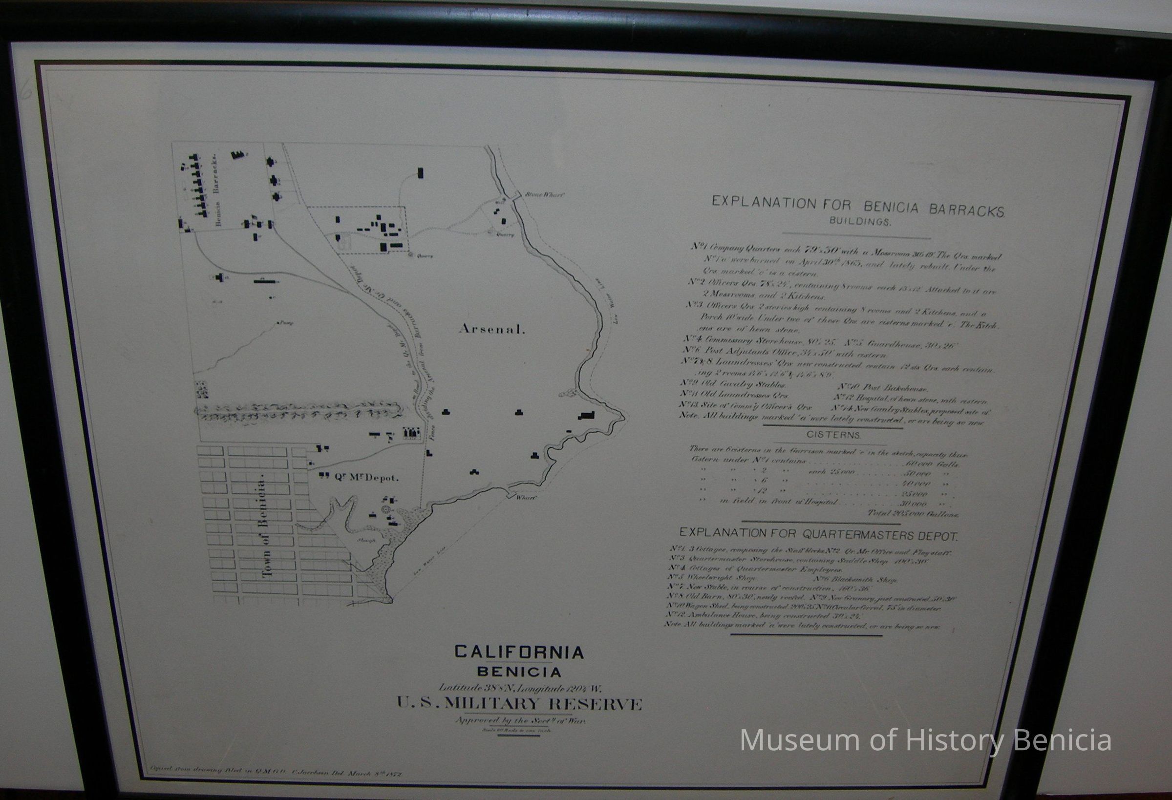
21-1/2" x 18-1/4" Black Framed Plotting Chart:
California
Benicia
Latitude 38 degrees 8'N
Longitude 120 degrees 4'W
U.S. MILITARY RESERVE
Scale: 60 rods to one inch
March 8th 1872
Explanation for Benicia Barracks
Buildings
Cisterns
Explanation For Quartermasters Depot
A map is to the left with landmarks plotted as identifiedCollection
Benicia Arsenal Collection