Name/Title
MapEntry/Object ID
2007.041.0086Scope and Content
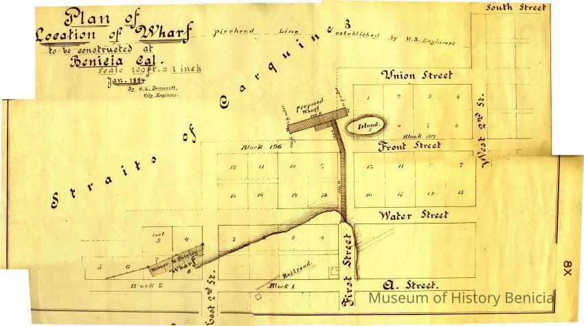
This is a map of a proposed wharf to be constructed at the foot of First Street in Benicia. The date of 01/1894 is shown on the map but this is obviously a copy of that map. It shows the blocks and lots that extend into the water past "A" street. The "streets" shown after A street are Water, Front, Union and South. The blocks that are partially in the water are blocks 1 and 2. The blocks totally in the water are 196 and 197. The island off the end of First street is in block 197 lot 5.Collection
Benicia Historical Museum Collection