Name/Title
MapEntry/Object ID
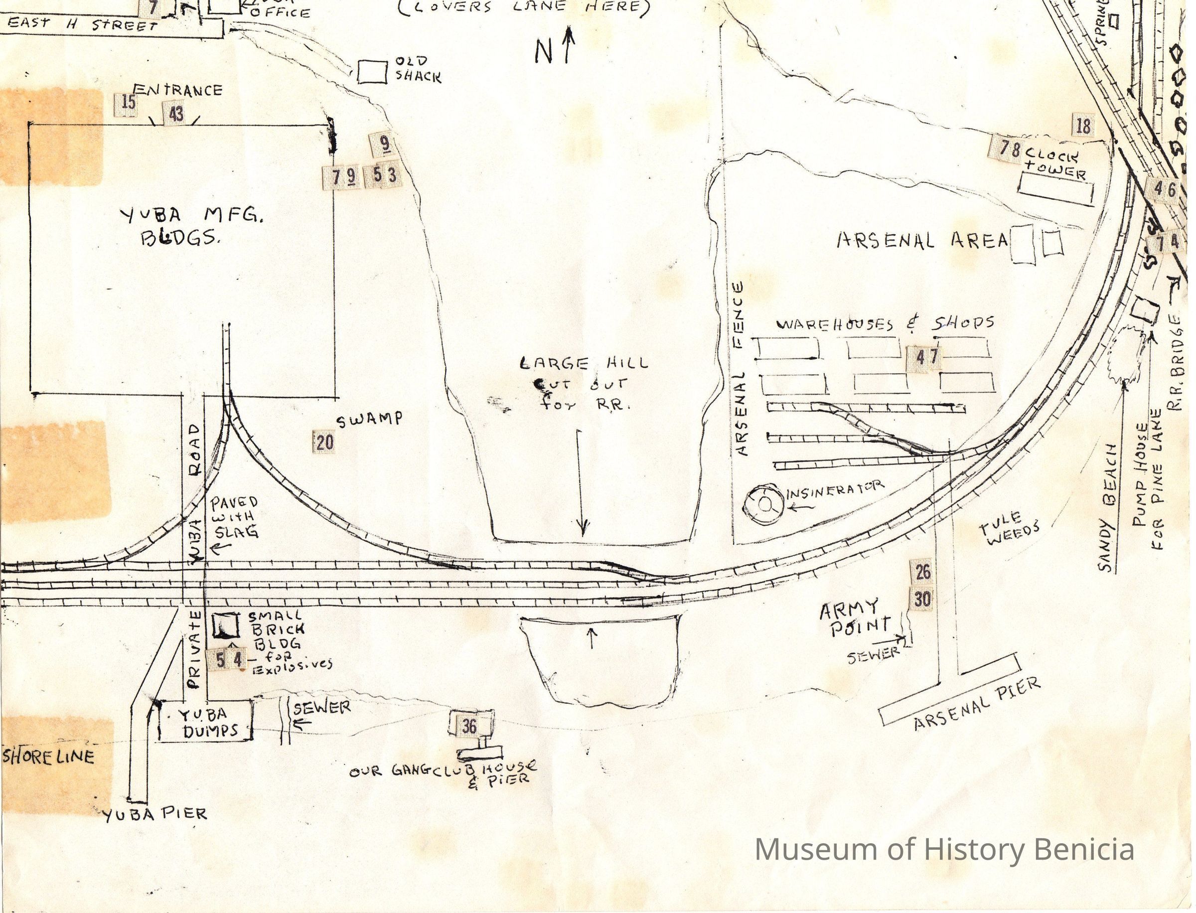
2011.023.0003Scope and Content
Hand drawn map (not to scale) by Bill Freitas, Benicia Resident, from memory of the 1930's era Benicia
Covers east side of Benicia from just west of East Seventh Street into the Arsenal area curved water front, south of East H Street; shows water front, industrial areas, hill areas, Yuba area and wharf and train tracks along the water's edge.
there are many numbers all over the map but their significance is unknown;
size: 8-1/2" x 11"Collection
Benicia Historical Museum Collection