Name/Title
MapEntry/Object ID
2015.020.0001Scope and Content
This is the first of a new collection of artifacts pertaining to Robert Semple.
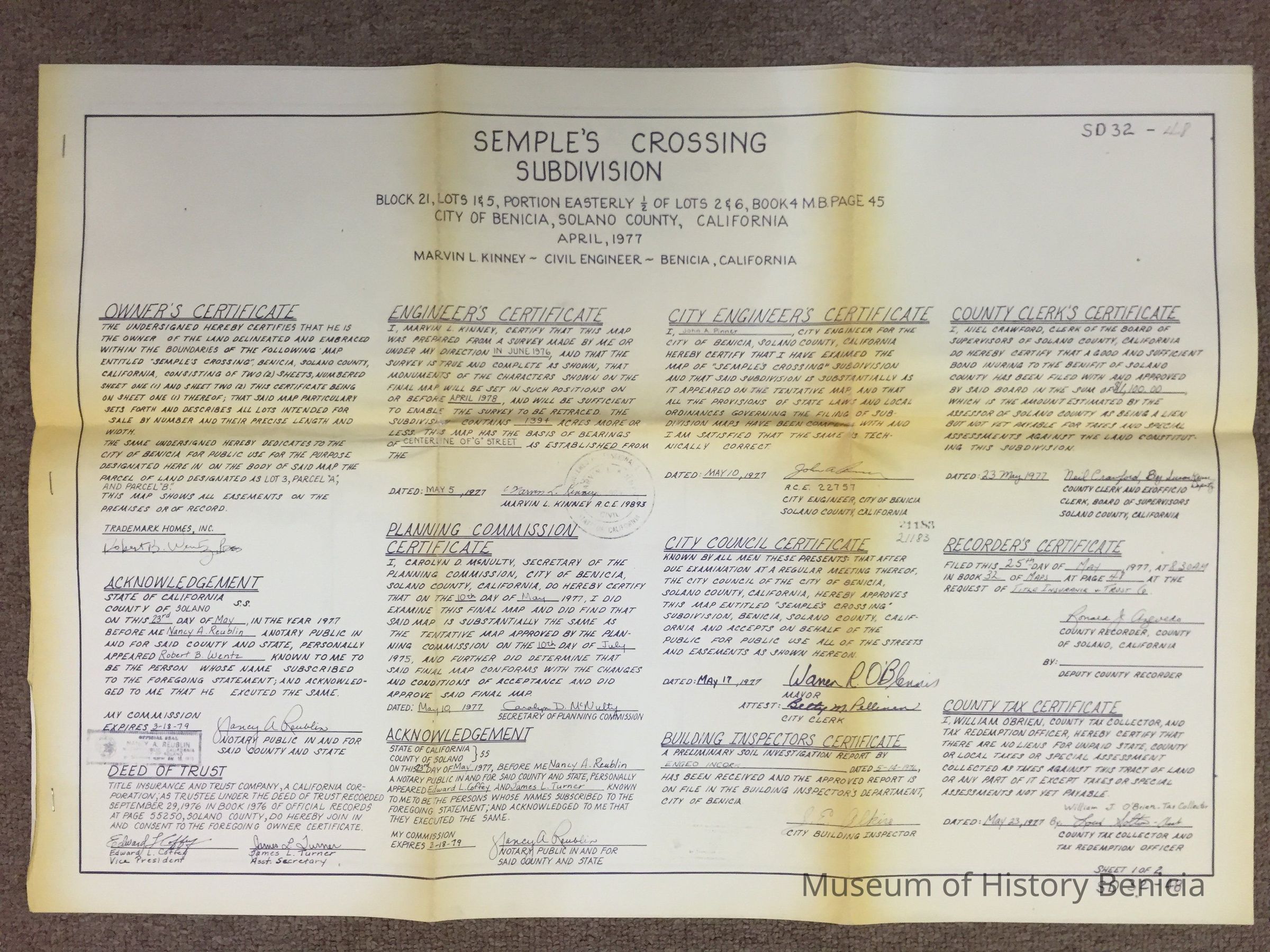
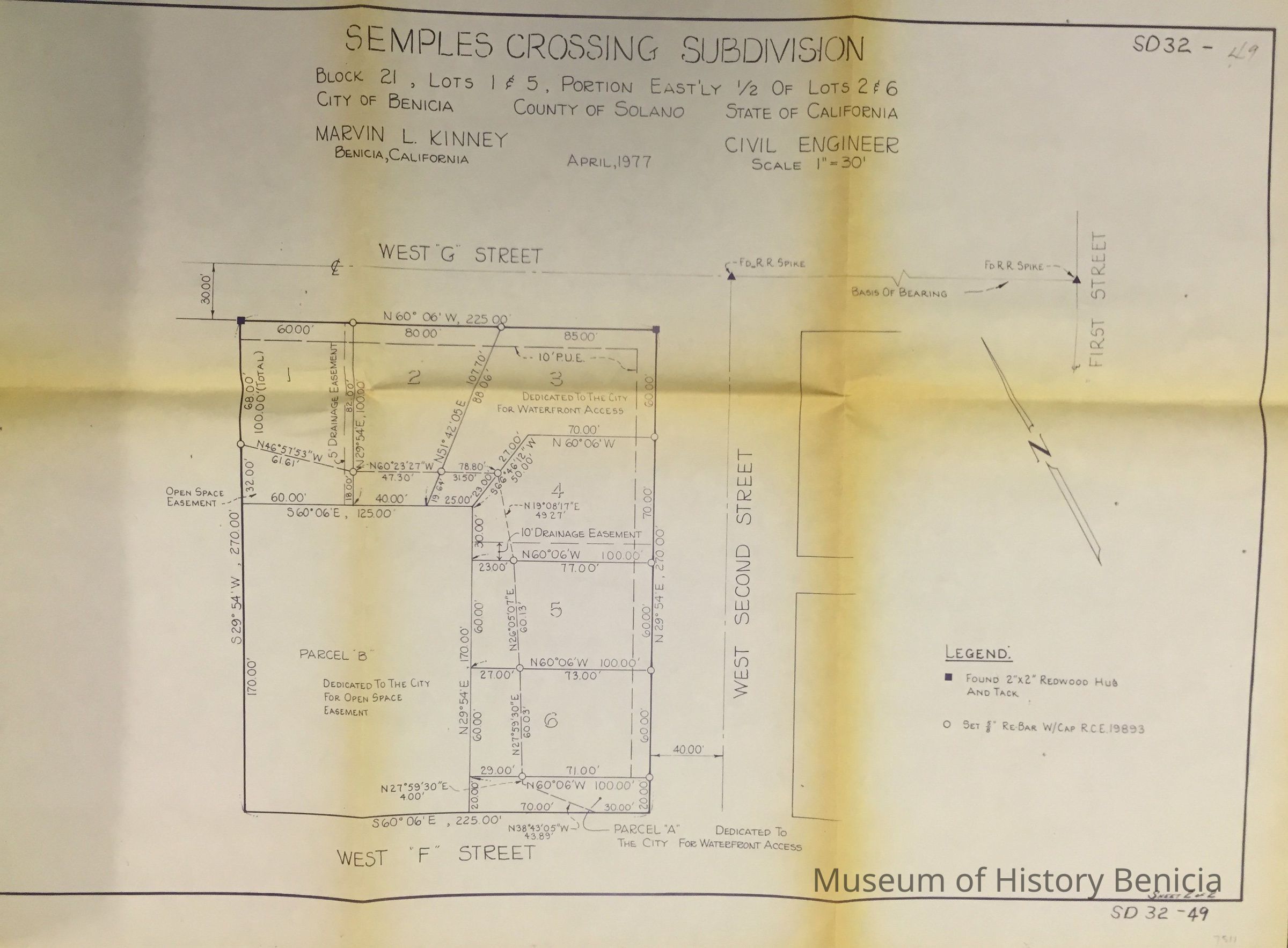
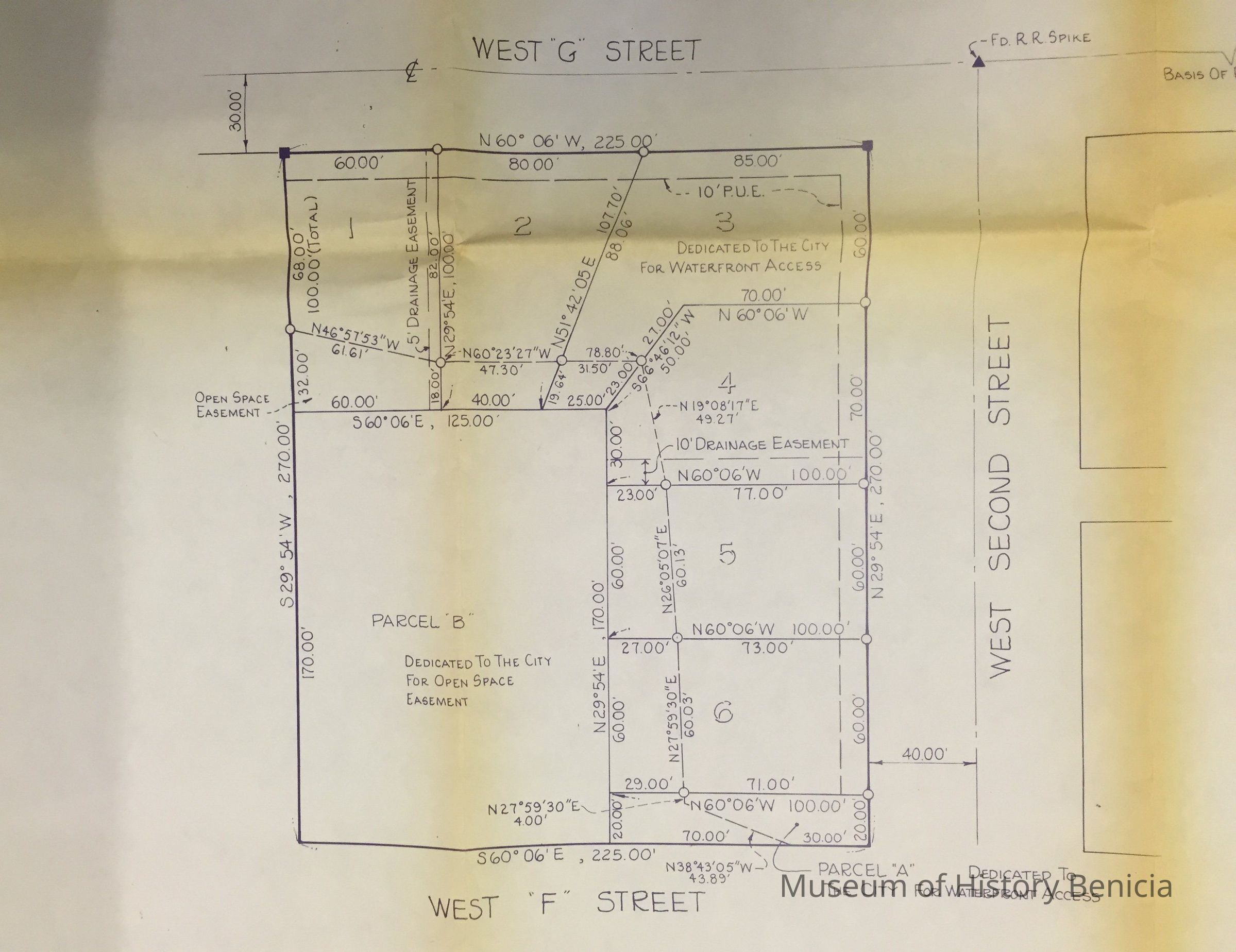
The first is a Property Plot Map of 'Semple's Crossing Subdivision produced in April 1977 and recorded on May 25th, 1977. The map includes the north east one fourth of a block in west Benicia between West Second Street (now Semple Court) and West Third Street and between West F Street and West G Street (now Semple Crossing). The south west corner, which involved over a fourth of the plot, was dedicated to the city for open space easement which is reasonable in that this area is under water. Five buildable lots were created; two on the north and three on the east, all with water frontage.
Doctor Robert Baylor Semple (1806–1854) was a 19th-century Californian newspaperman and politician and played a prominent role in the creation of Benicia.Collection
Special Collections