Name/Title
MapEntry/Object ID
2019.019.0002Scope and Content
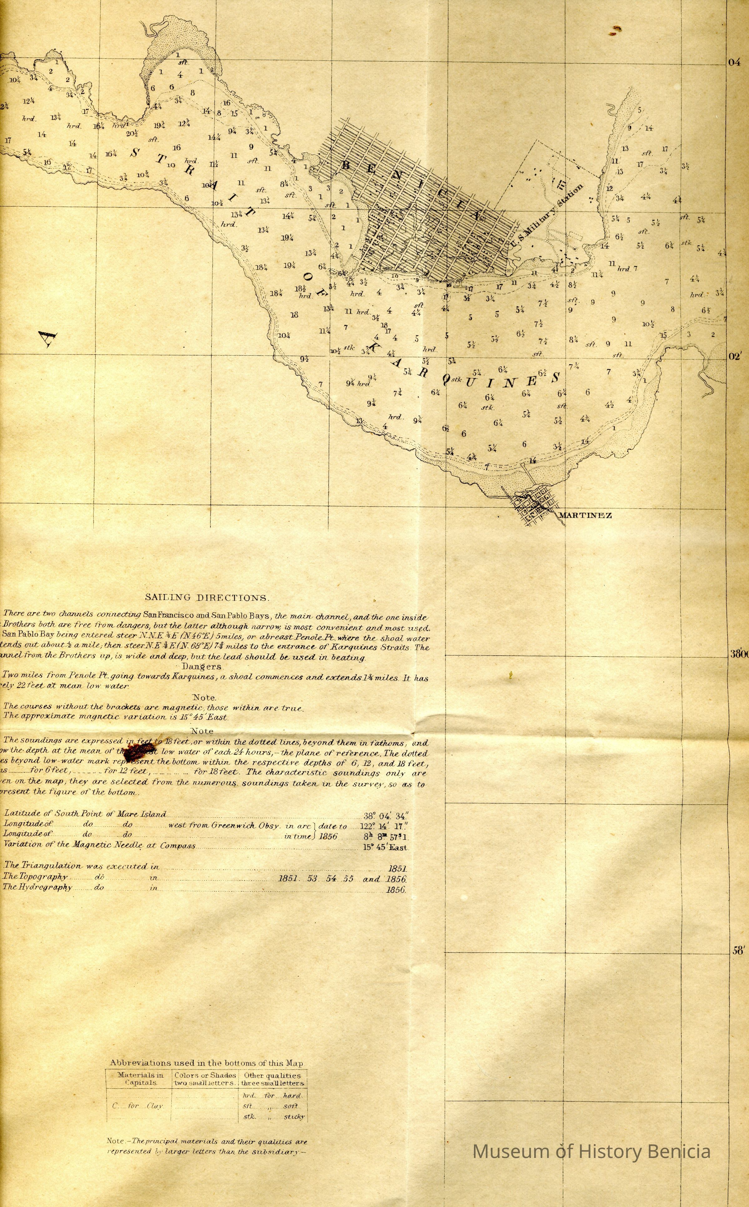
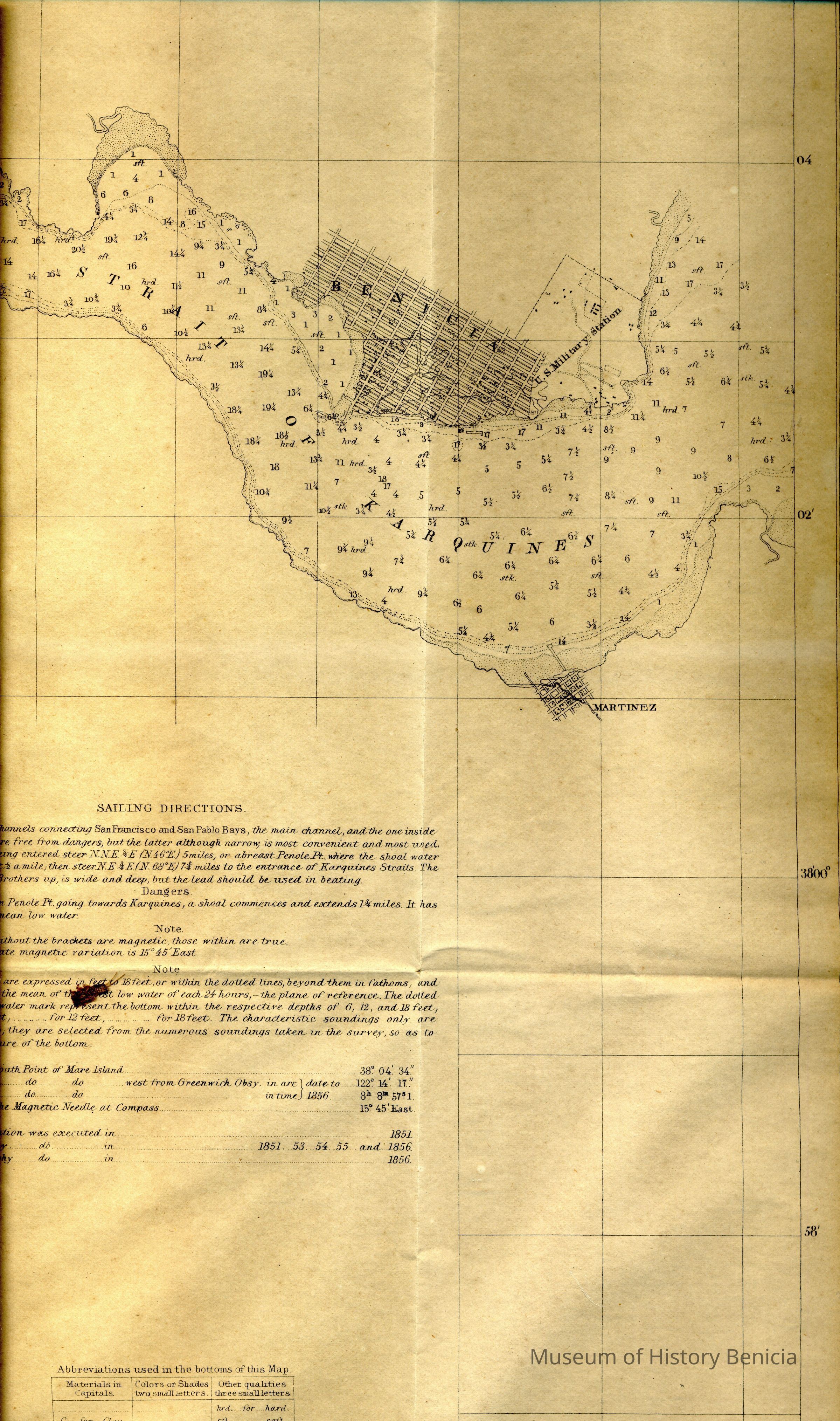
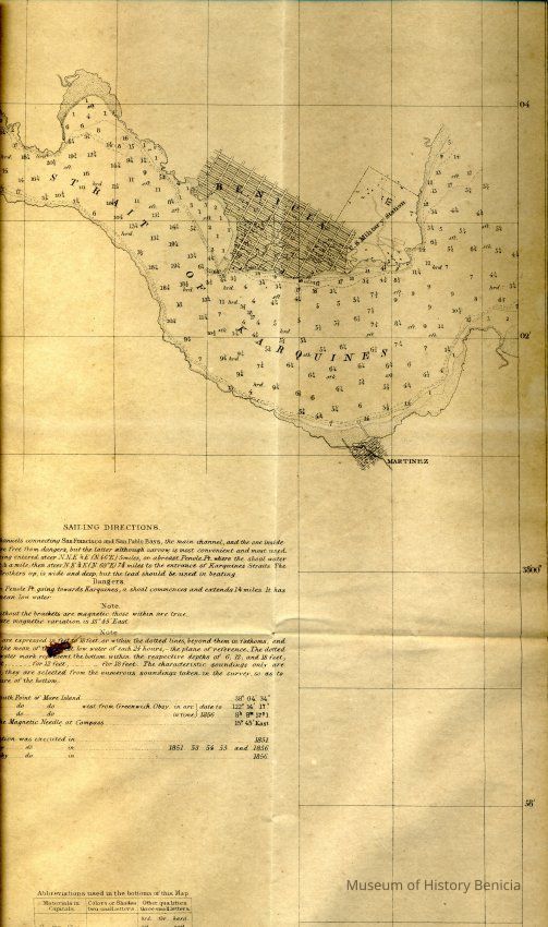
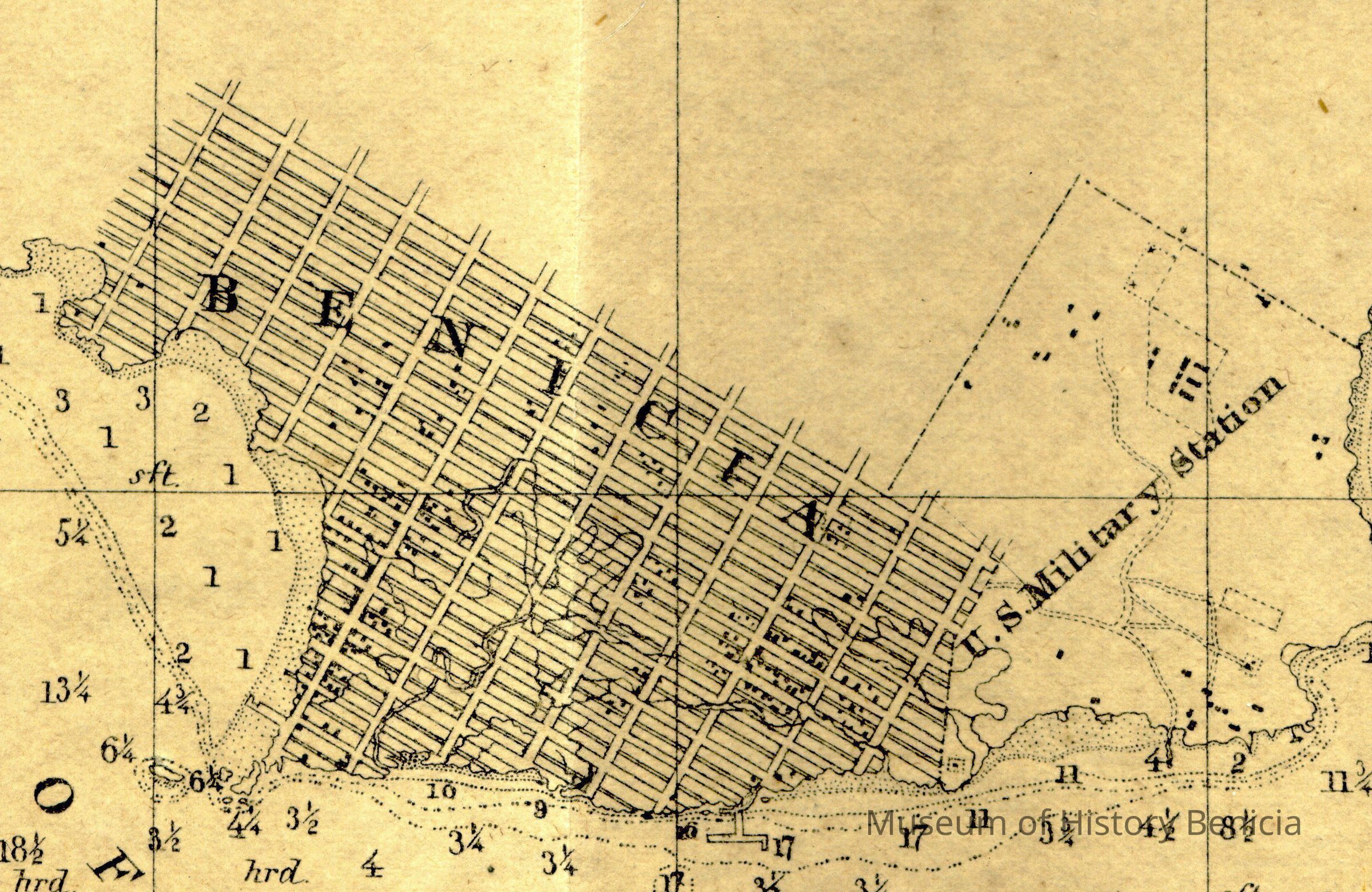
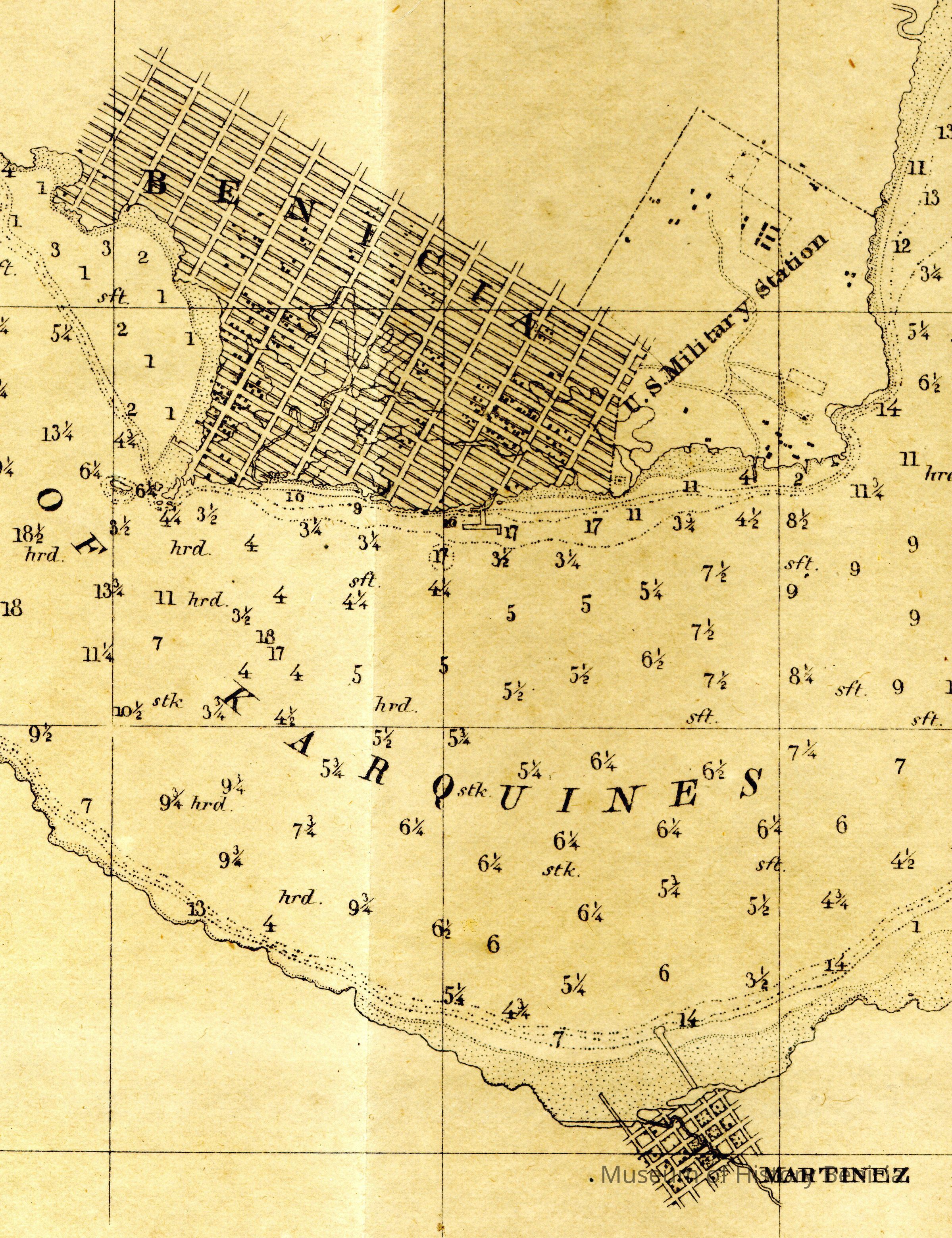
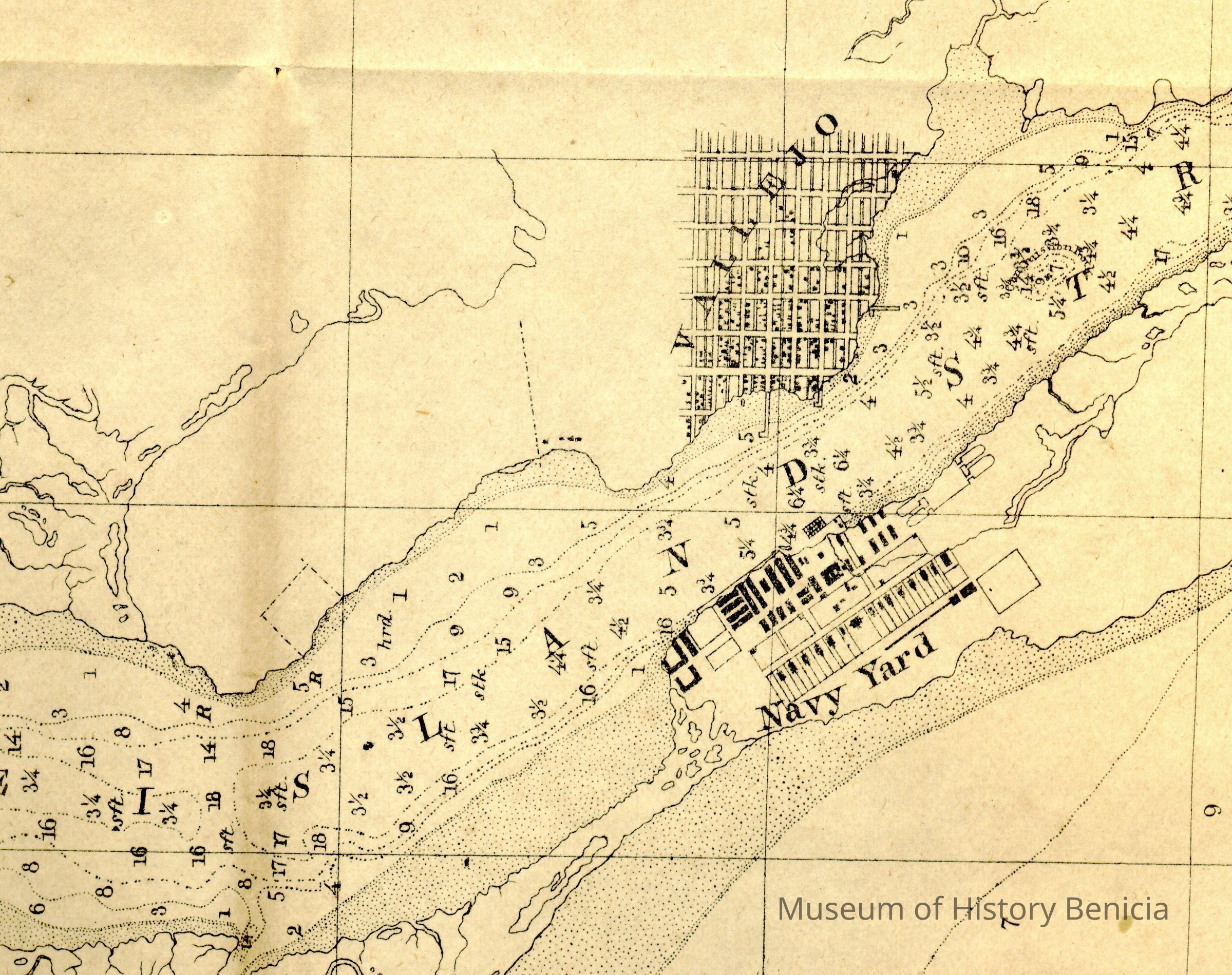
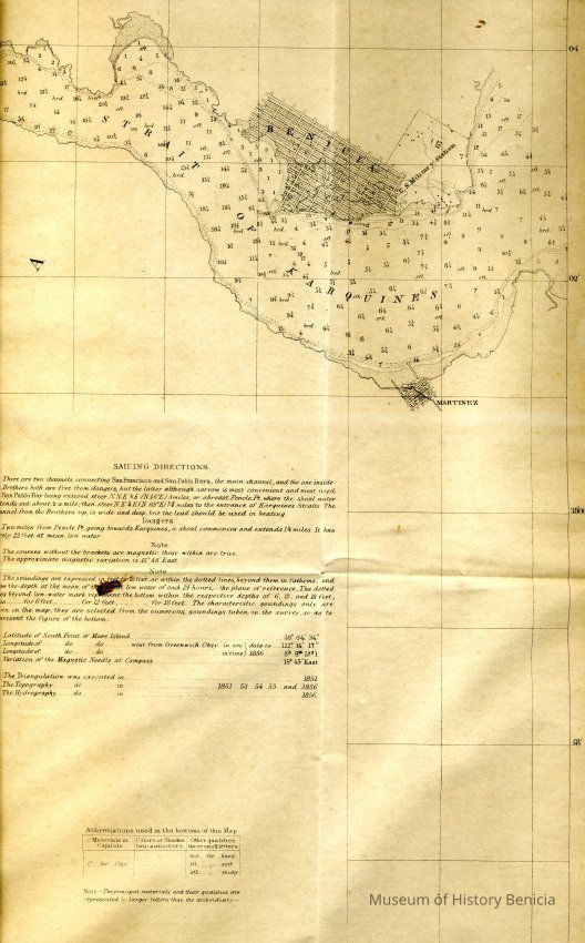
Map - Preliminary Chart of
San Pablo Bay California
From a Trigonometrical Survey
under the direction of A.D. Bache, Superintendent of the
Survey of the Coast of the United States
Triangulatin by R. D. Cutts, Asst.
Topography by R. D. Cutts, Asst. & A. F. Rodgers, Sub Assist.
Hydrography by the Party under the command of
Jamrs Alden, Lieut. U.S.N., Assist.
Scale 1/50,000 1856
includes saling directions
city street grids for Benicia, Martinez, Mare Isl and Vallejo
black squares in city grids represent houses or other structures
in a gold frame under glass;
brown ink on ecru background
frame 24" x 36" matted size 21" x 30"Collection
Benicia Historical Museum Collection