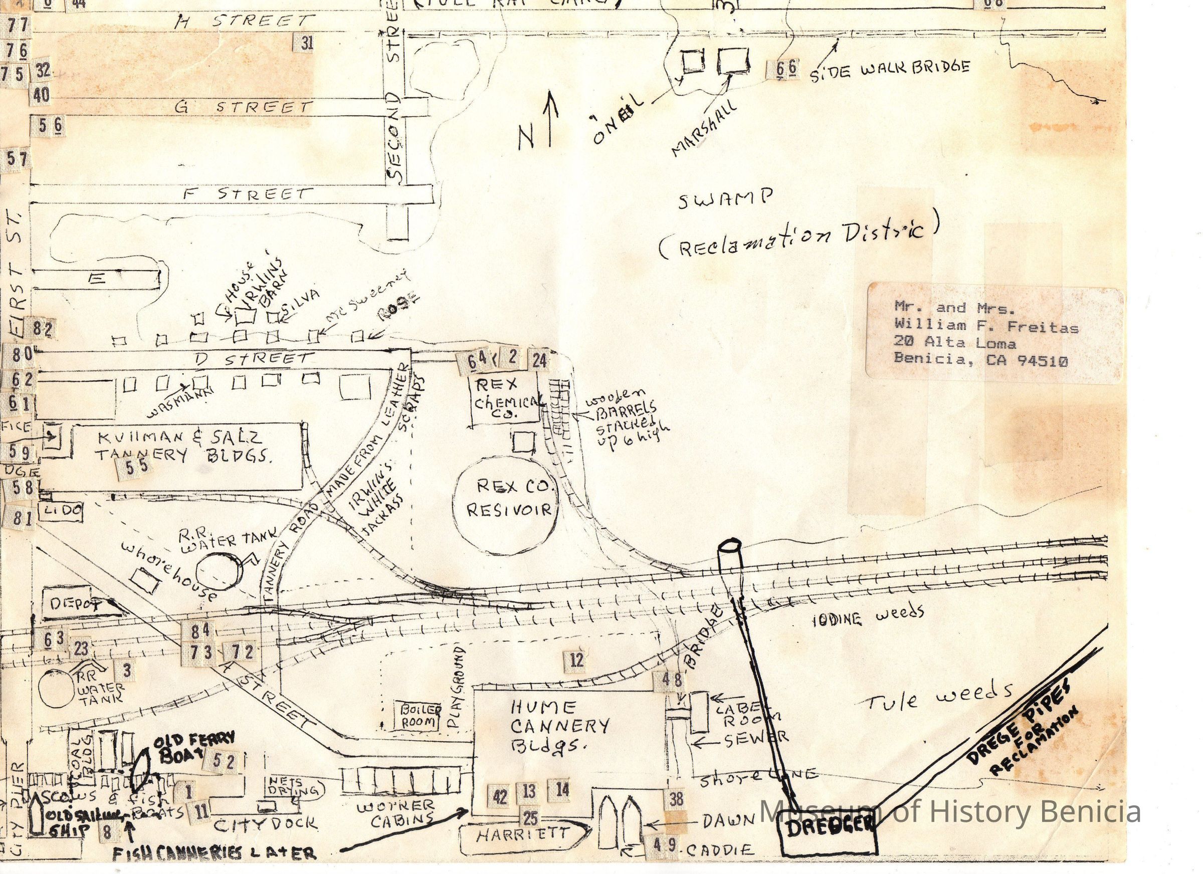
Name/Title
MapEntry/Object ID
2011.023.0001Scope and Content
Hand drawn map (not to scale) by Bill Freitas, Benicia Resident, from memory of the 1930's era Benicia
Covers east side of Benicia from First Street to about East Fourth Street south of East H Street; shows water front, raiload tracks, houses with some occupants' names, industrial areas, reclamation area;
there are many numbers all over the map but their significance is unknown;
size: 8-1/2" x 11"Collection
Benicia Historical Museum Collection