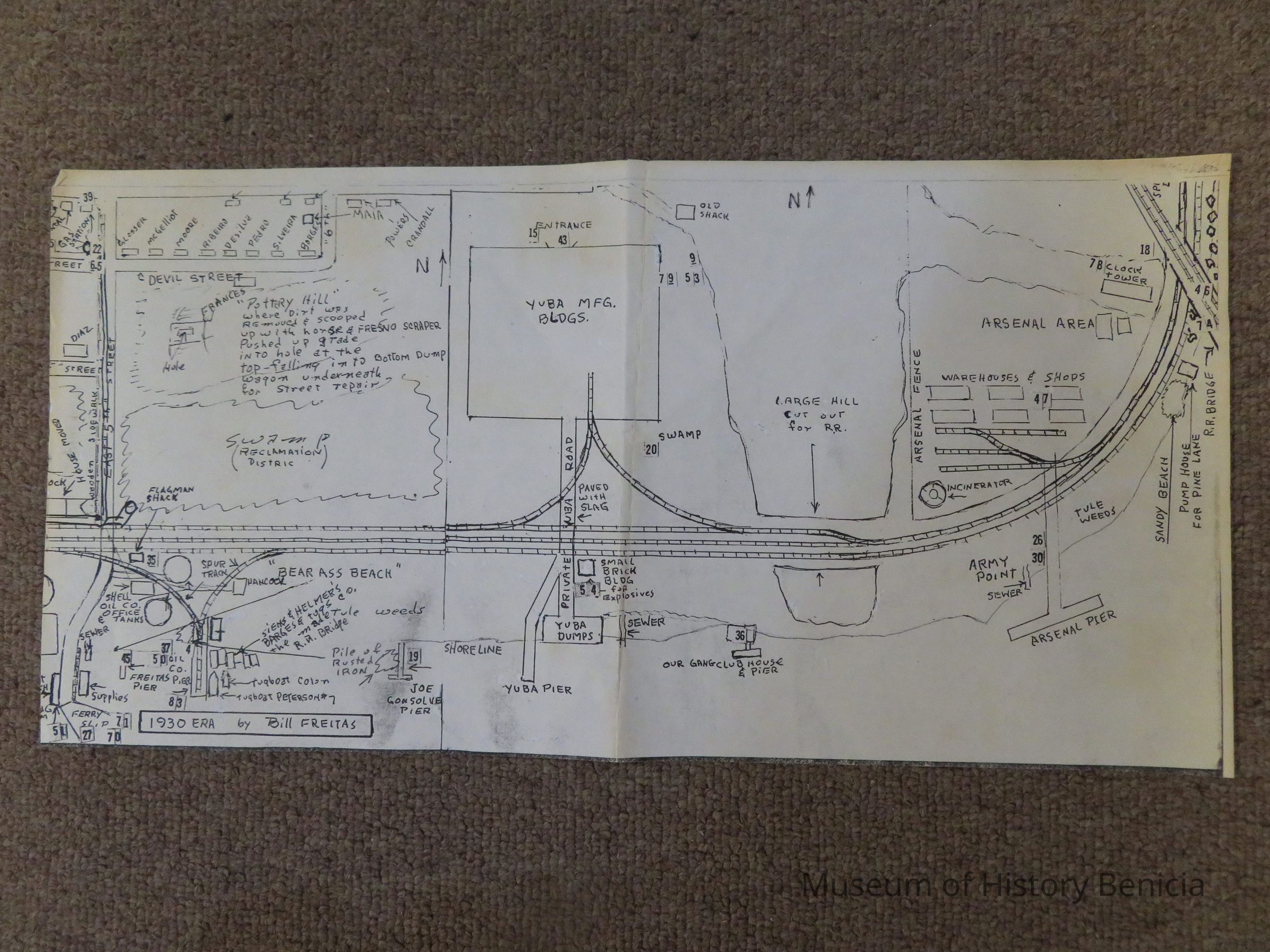
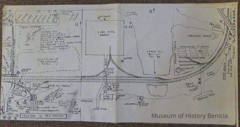
Name/Title
MapEntry/Object ID
2011.023.0005Scope and Content
A copy of parts of two hand drawn maps (not to scale) by Bill Freitas, Benicia Resident, from memory of the 1930's era Benicia
part of BHM2011.23.2 and all of BHM2011.23.3
(covers from East Fifth Street into the Arsenal area south of East H Street)
size: 8-1/2" x 17" - too large to scanCollection
Benicia Historical Museum Collection