Name/Title
MapEntry/Object ID
2008.004.0045Scope and Content
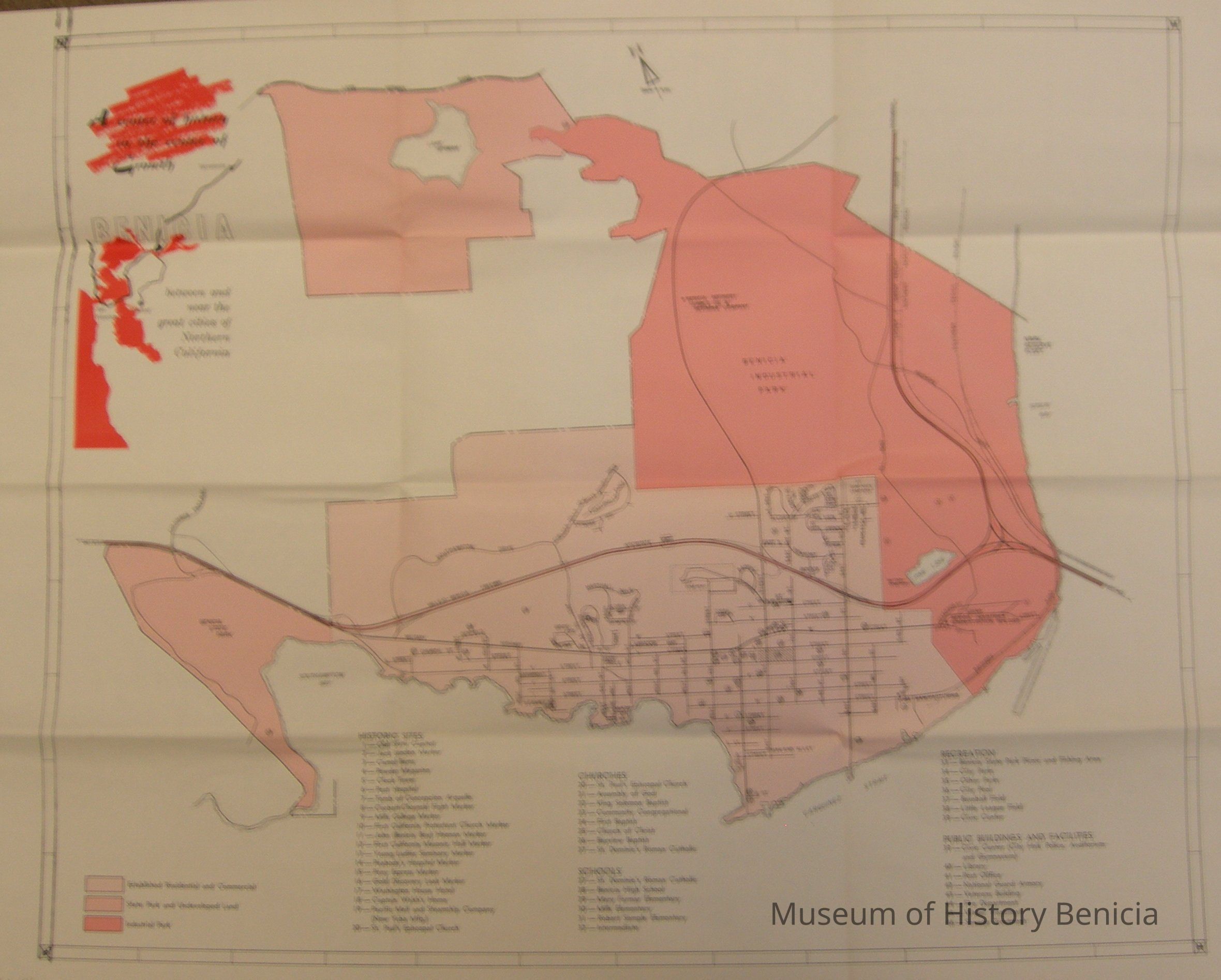
Map of Benicia: "A center of history in the center of growth...
between and near the great cities of Northern California."
Similar to BHM2008.004.0044 but only the inner portion:
Map with areas indicated in different shades of pink: Benicia State Park, established residential and commercial area, Benicia Industrial Park (including Pine Lake), and area around Lake Herman also listed are 20 Historic Sites, 8 Chrches, 6 Schools, 7 Recreation/Park Areas, 8 Public Buildings and Facilities.
size: 28-1/2" x 22"Collection
Benicia Historical Museum Collection