Name/Title
MapEntry/Object ID
2018.028.0002Scope and Content
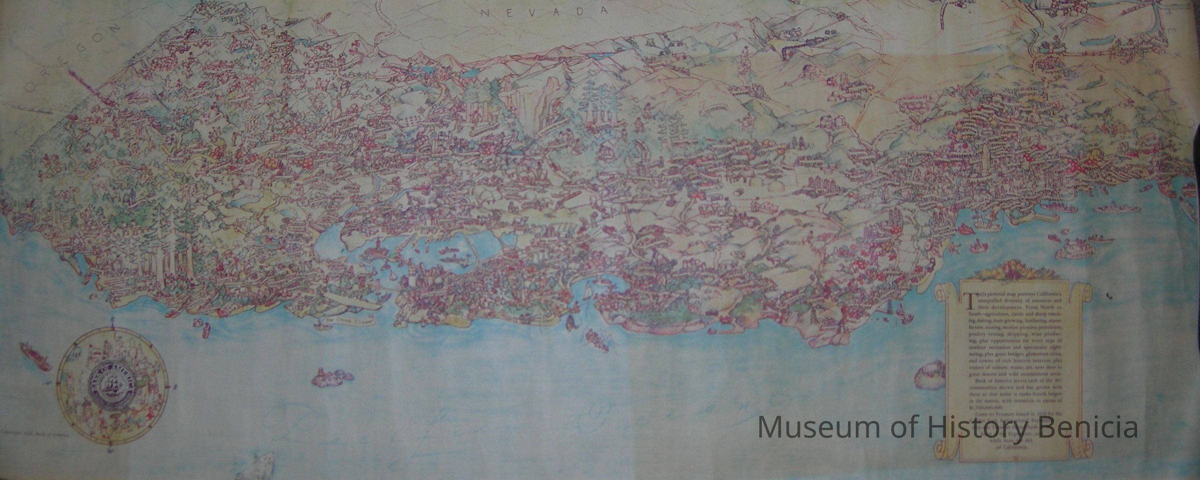
Map - Pictorial/Drawing of Calfornia in color
Copyright 1938 Bank of America
Portrays cities and landmarks;
Inset: "This pictorial map portrays California's unequalled diversity of resources and their development. From North to South -- agriculture, cattle and sheep ranching, fishing, fruit growing, lumbering, manufacture, mining, motion pictures, petroleum, poultry raising, shipping, wine production; plus opportunities for every type of outdoor recreation and spectacular sightseeing; plus great bridges, glamorous cities, and towns of rich historic interest; plus centers of culture, music, art, next door to great deserts and wild mountainous areas.
Bank of America serves each of the 307 communities shown and has grown with them so that today it ranks fourth largest in the nation, with resources in excess of $1,500,000,000.
Come to Treasure Island in 1939 for the Golden Gate International Exposition. . . visit our Treasure Island bank in the heart of the Exposition and while here see ALL of California."
size: 14" x 35"Collection
Benicia Historical Museum Collection