Name/Title
Print, PhotographicEntry/Object ID
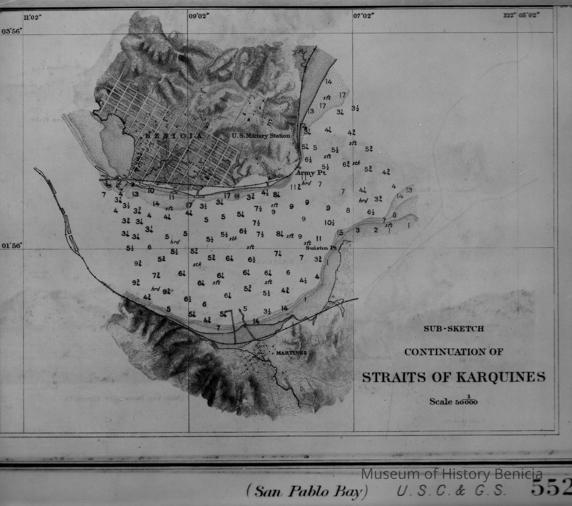
2001.009.0015Description
B/W photo of nautical chart of Carquinez Strait (here labeled "Straits of Karquines") between Benicia and Martinez. Copy is a portion of a larger map, "San Pablo Bay" published 1898 (date of first publication 1863).
Soundings are expressed in feet to 18 feet, or within the dotted surfaces, beyond them in fantoms, and show the depth at the mean of the lowest low water at each 24 hours - the plane of reference.
Abbrivations: hrd = hard, sft = soft, stk = sticky.
Reproduced from the collection of the Library of CongressCollection
Benicia Historical Museum Collection