Name/Title
State of California, Division of Parks and Recreation, Benicia Arsenal MapEntry/Object ID
2021.099.0067Scope and Content
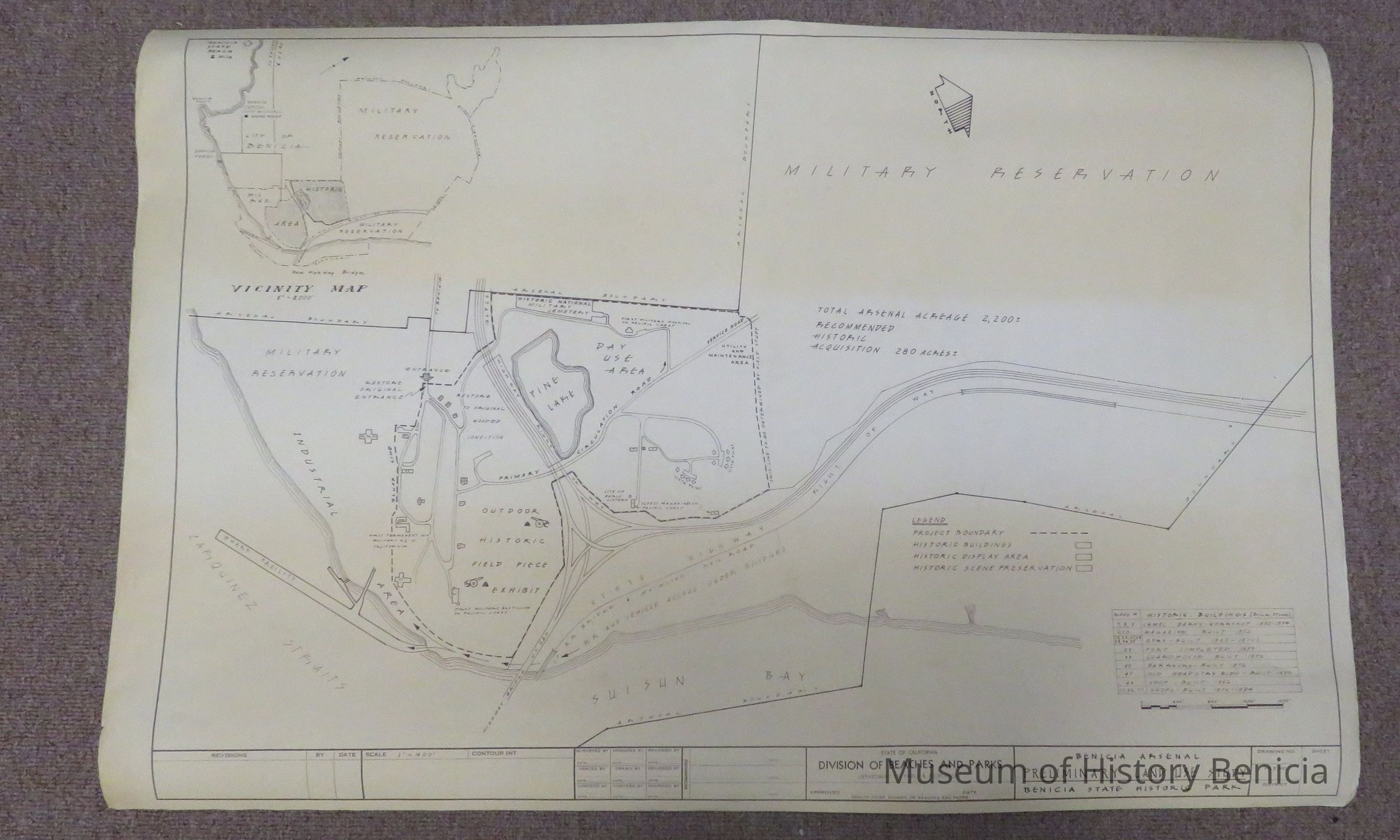
This map is labeled as "Benicia Arsenal, Preliminary Land Use Study". It is 36" wide by 24" high. The map was designed in the time period after the arsenal was closed (1964) and the new Benicia-Martinez bridge was constructed (1962). It shows the vicinity map of Benicia alongside the Arsenal boundary and the state highway.
The map was designed by the State of California, Department of Parks and Recreation.Collection
Benicia Arsenal Collection