Name/Title
"Bible Lands" National Geographic Map (1938)Entry/Object ID
2021.010Tags
On View, MapDescription
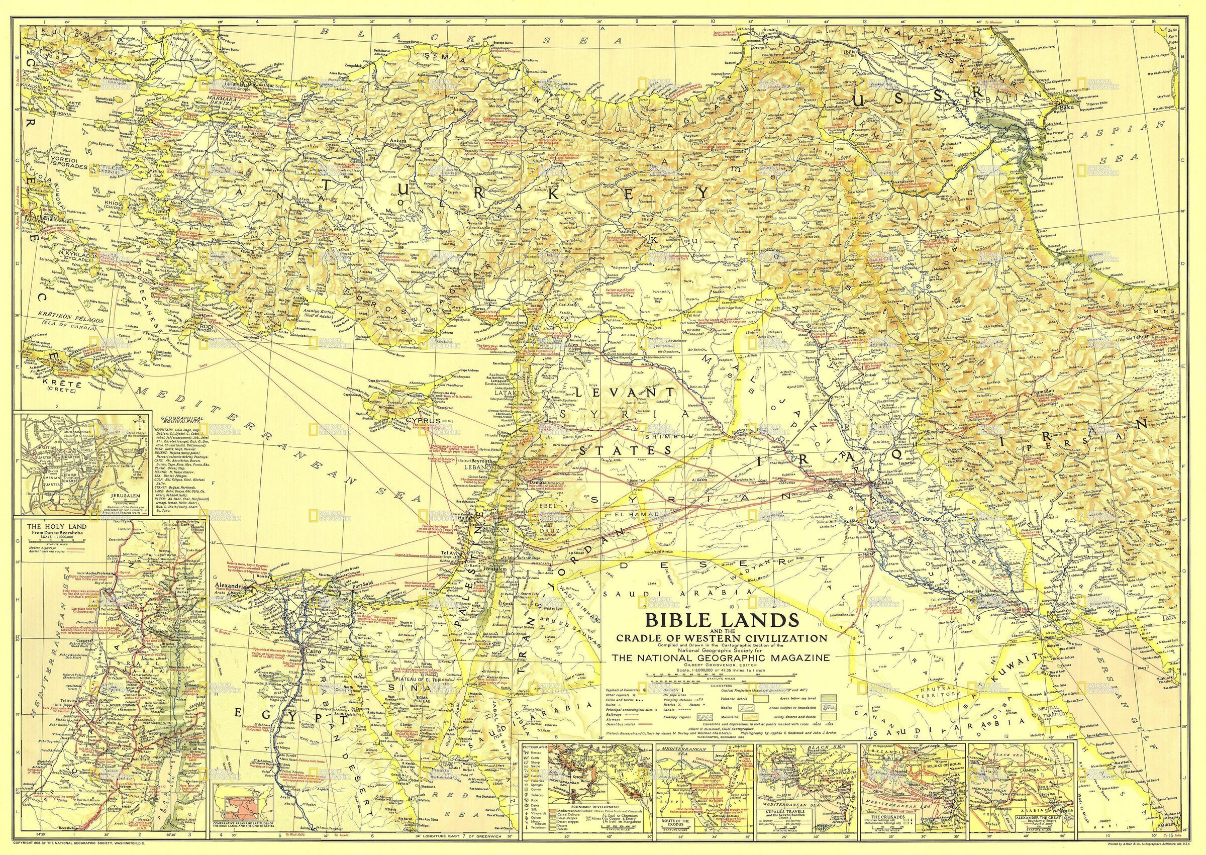
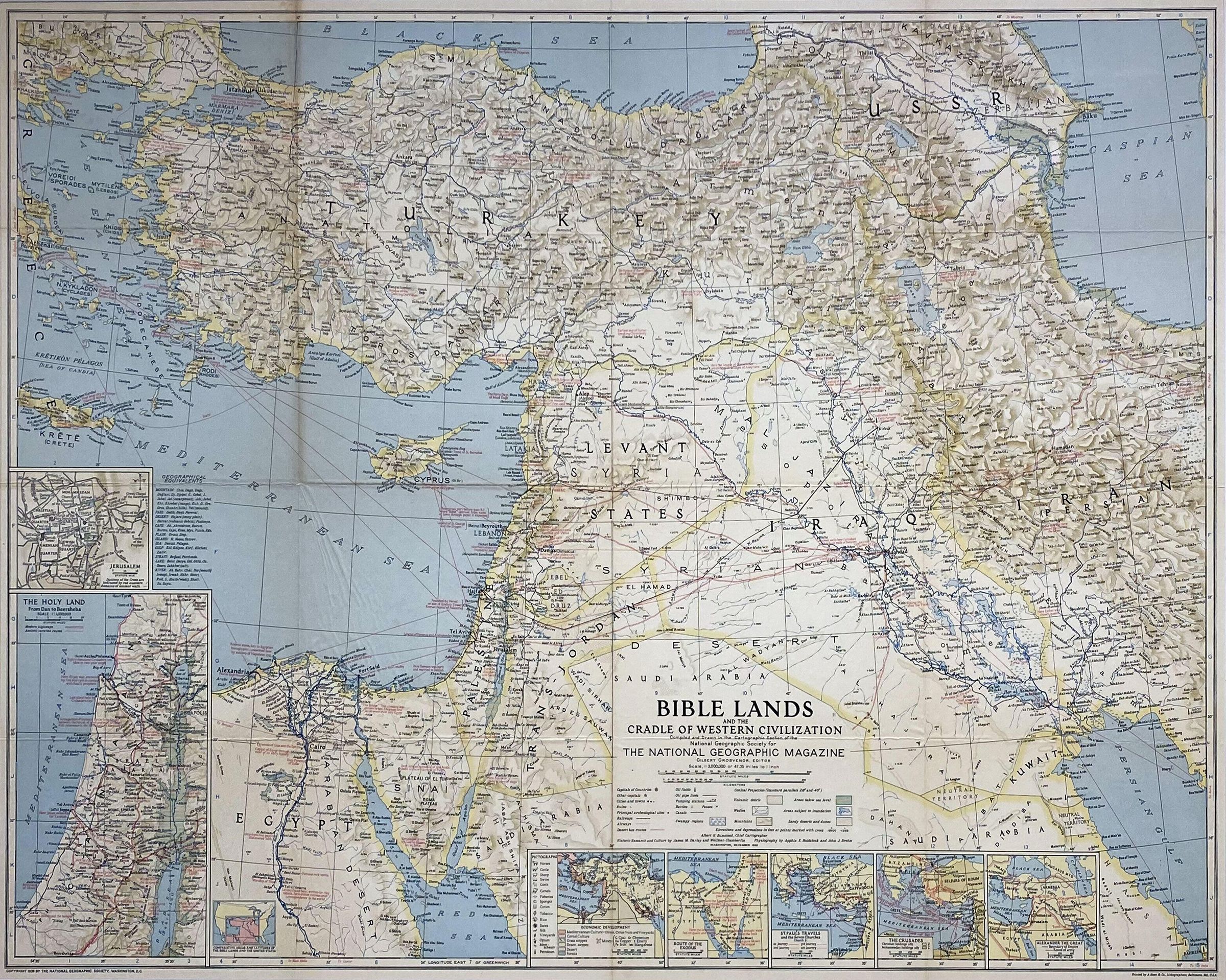
Throughout the centuries, maps of Palestine were produced within a colonialist and Biblical perspective often labelled with Biblical place names, rather than those used at the time that the map was produced. It is true, that the geography of Palestine has changed with every ruler and invader for centuries, however the Biblical maps produced and circulated no doubt have added a unique layer of complexity to the archive and study of place names than of any other part of the world.
Printed by A. Hoen & Co. Lithographers in Baltimore, Maryland (USA), this map was produced in 1938 and sold by National Geographic Society in Washington, DC. The full description of the map that is printed in the lower right portion is;
"Bible Lands and the Cradle of Western Civilization
Compiled and Drawn in the Cartographic Section of the National Geographic Society for The National Geographic Magazine
Gilbert Grosvenor, Editor
Scale, 1:3,000,000 or 47.35 miles to 1 inch"Collection
Permanent CollectionGeneral Notes
Note
Museum of the Palestinian People Collection