Name/Title
"Palestine or the Holy Land" (1861)Entry/Object ID
2022.013Tags
On View, MapDescription
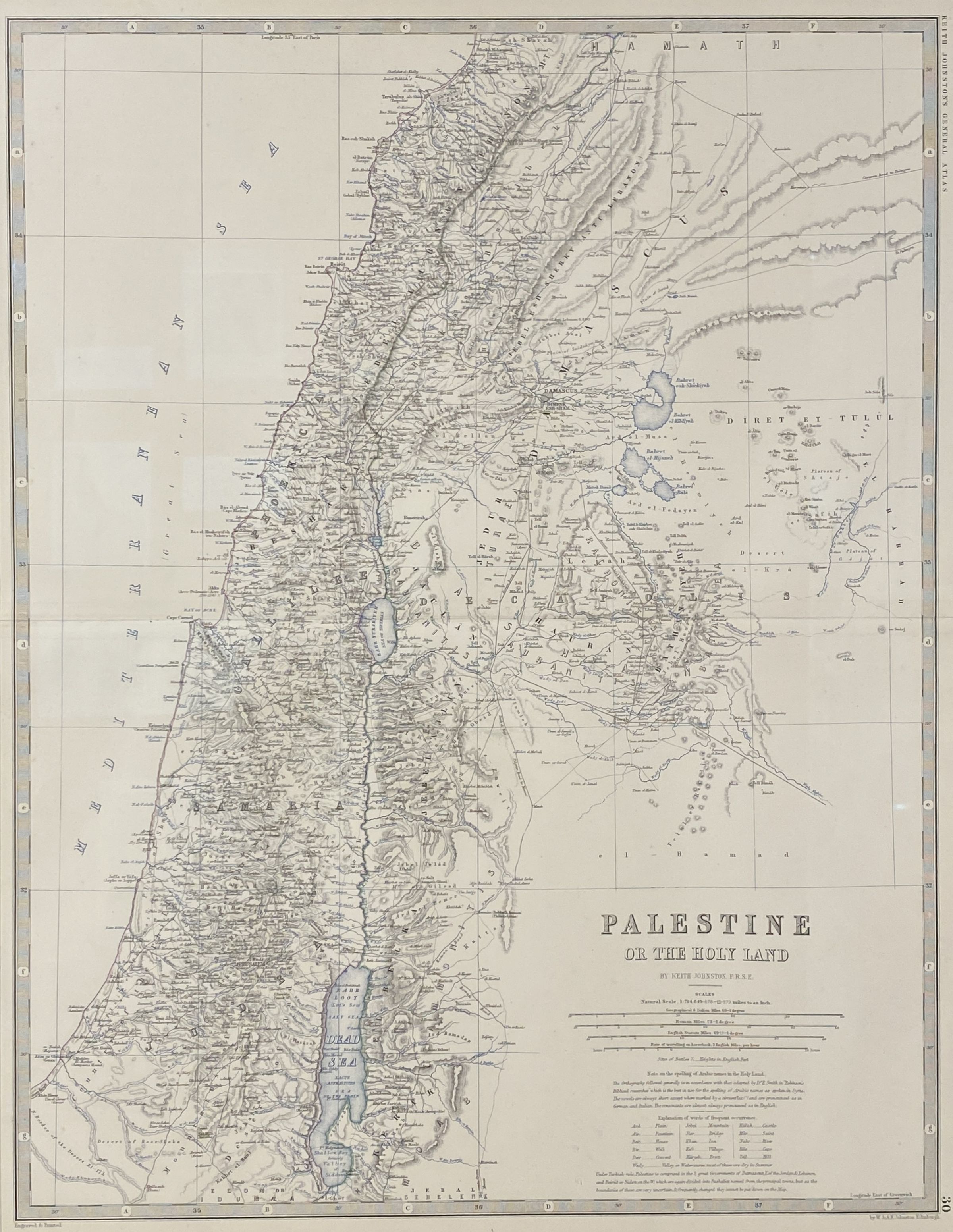
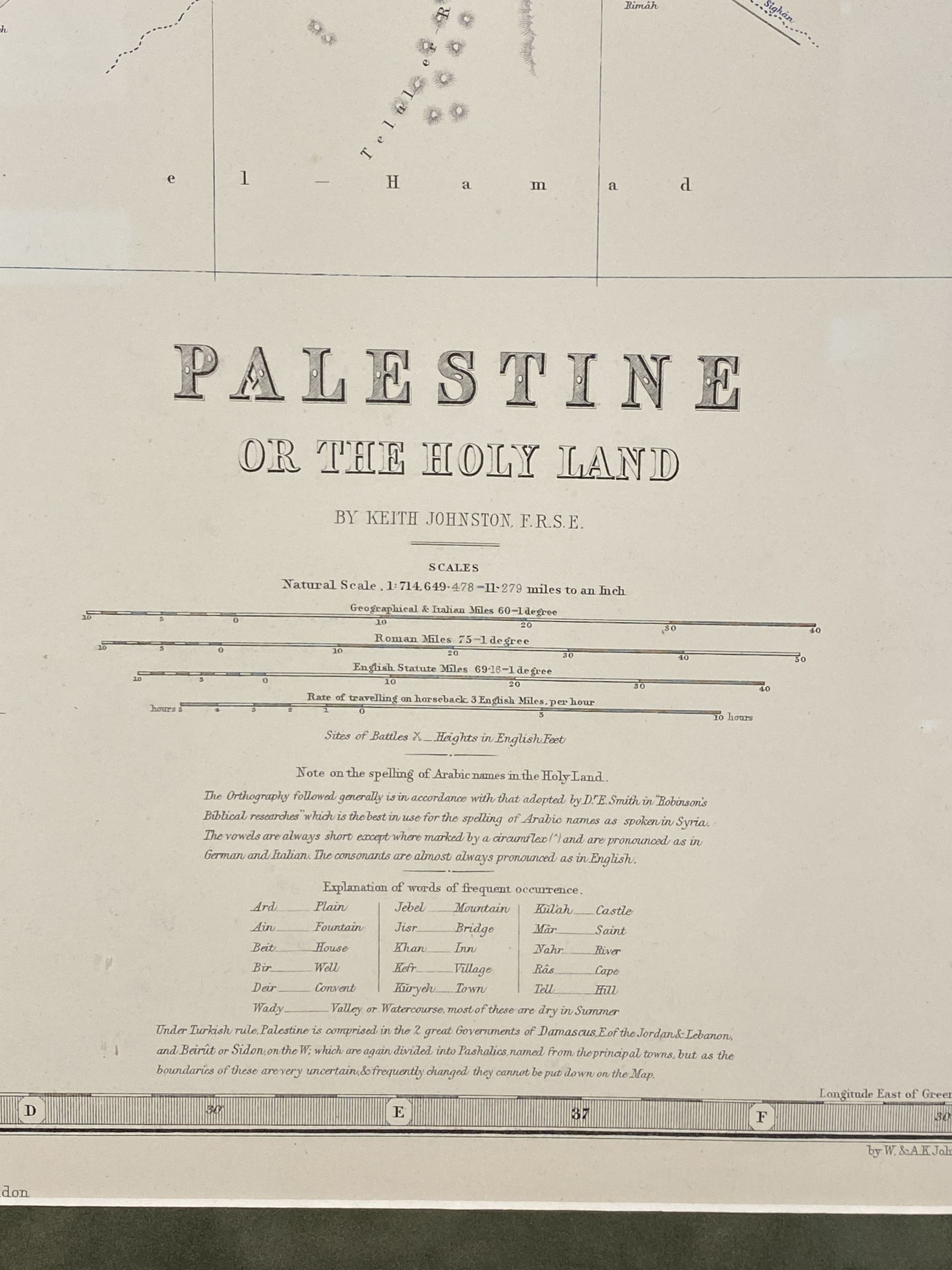
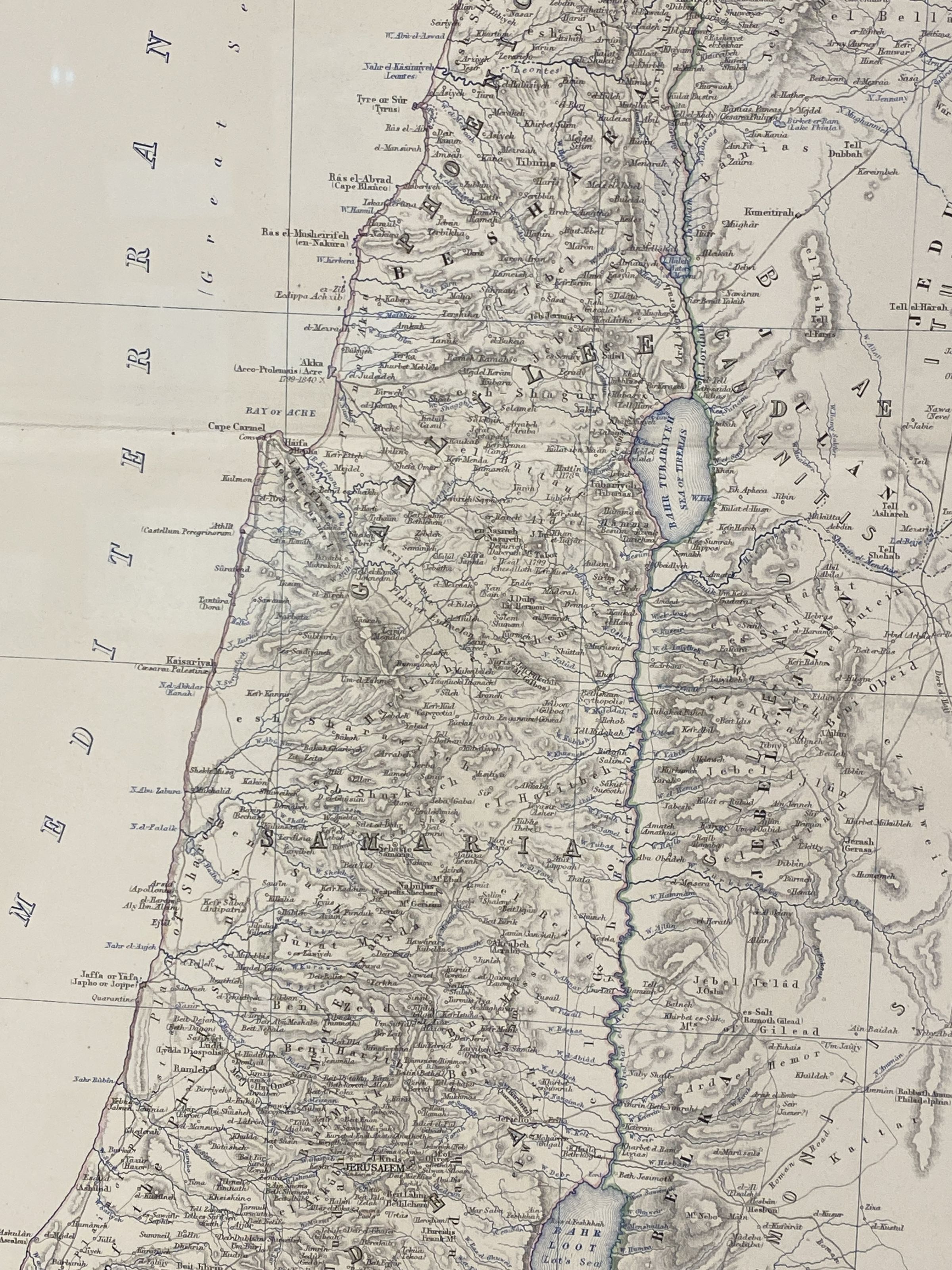
This large-scale map was produced by Geographer to the Queen of Scotland, Alexander Keith Johnston for the "Royal Atlas of Modern Geography." The outlines on this map of Palestine are hand colored. There are numerous Biblical maps produced throughout the centuries, depicting Palestine through the Holy Land lens. In Johnston’s map, one can see the original Arabic transliterated place names, as well as the Twelve Tribes of Israel.Collection
Permanent CollectionMap Details
Maker or Creator
Keith JohnstonDate Published
1861Dimensions
Height
22-1/2 inWidth
17 in