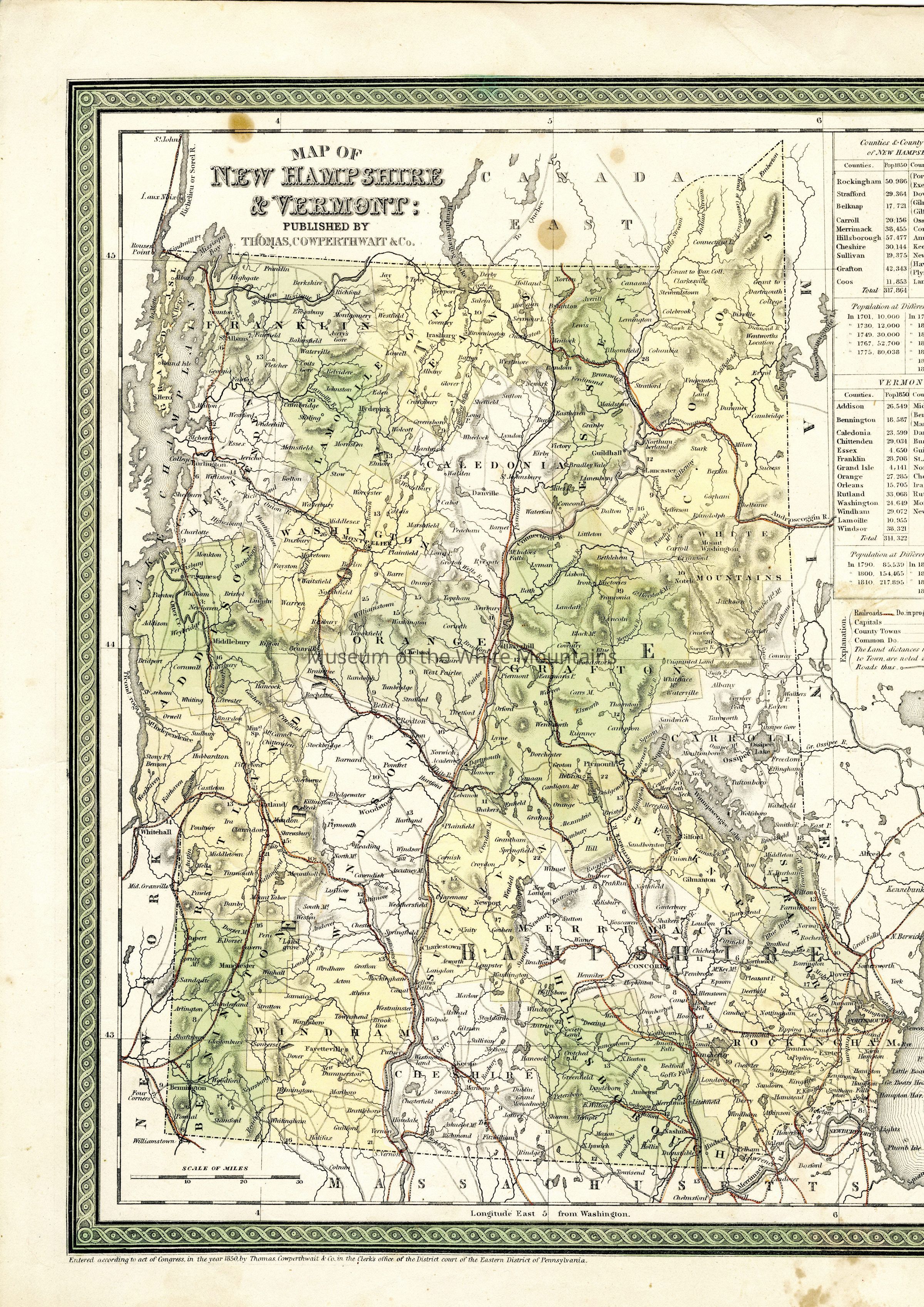
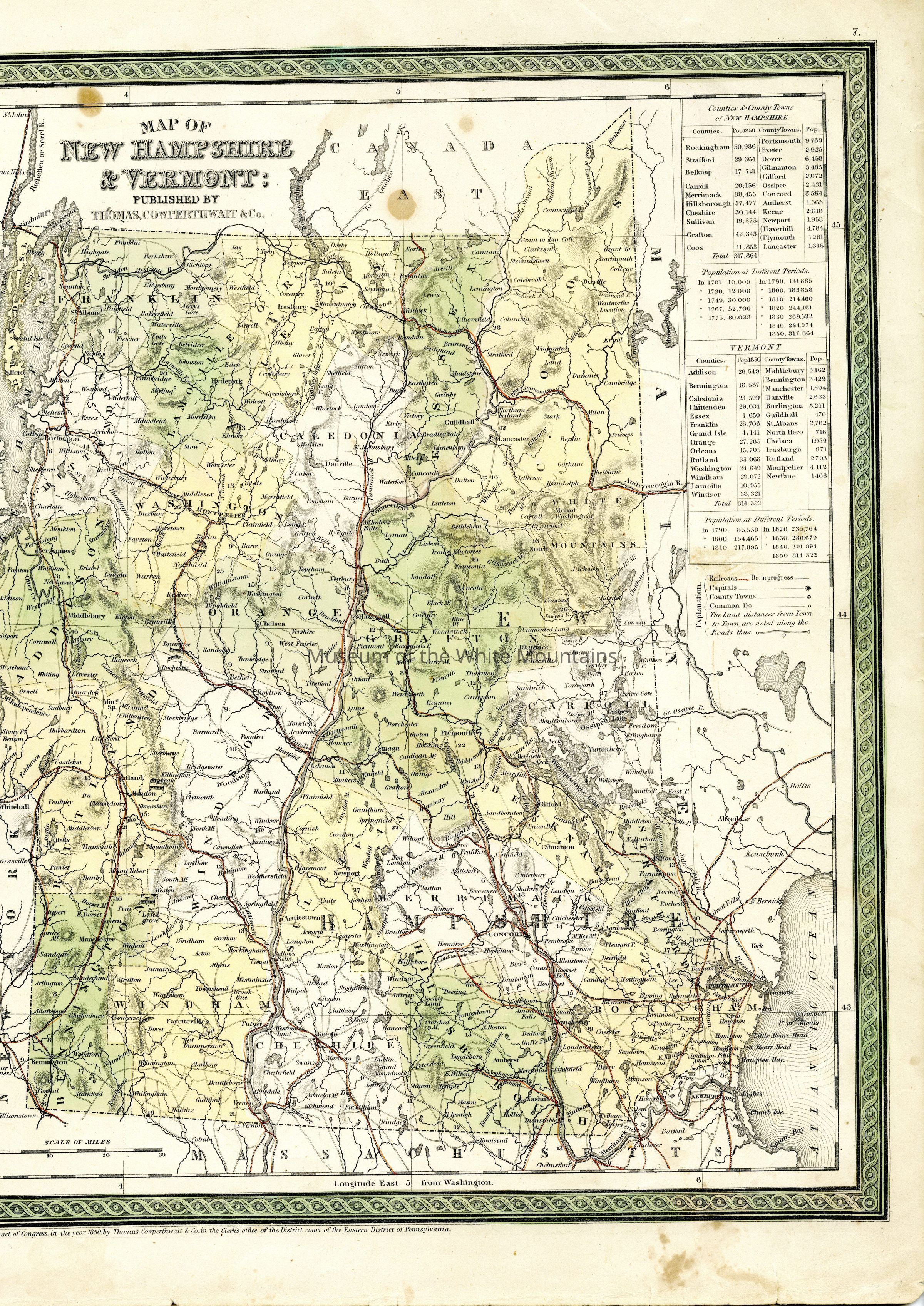
MAP OF NEW HAMPSHIRE & VERMONT: PUBLISHED BY THOMAS, COWPERTHWAIT & Co.
Entry/Object ID
MWM2025.0002.0020
Description
A map depicting New Hampshire and Vermont with an eastern limit of the New York state border, a western limit of Hollis, ME, a northern limit of St. John Canada, and a southern limit of Chelmsford, MA.
Along the upper right edge of the map there are several charts listing populations of counties and towns within each state and overall population change over time.
Currently two scans to fit all information.